North Acomita Village is a census-designated place (CDP) in Cibola County, New Mexico, United States. The population was 303 at the 2010 census.
| Name: | North Acomita Village CDP |
|---|---|
| LSAD Code: | 57 |
| LSAD Description: | CDP (suffix) |
| State: | New Mexico |
| County: | Cibola County |
| Elevation: | 6,047 ft (1,843 m) |
| Total Area: | 3.87 sq mi (10.03 km²) |
| Land Area: | 3.87 sq mi (10.03 km²) |
| Water Area: | 0.00 sq mi (0.00 km²) |
| Total Population: | 357 |
| Population Density: | 92.22/sq mi (35.61/km²) |
| Area code: | 505 |
| FIPS code: | 3552300 |
| GNISfeature ID: | 1867385 |
Online Interactive Map
Click on ![]() to view map in "full screen" mode.
to view map in "full screen" mode.
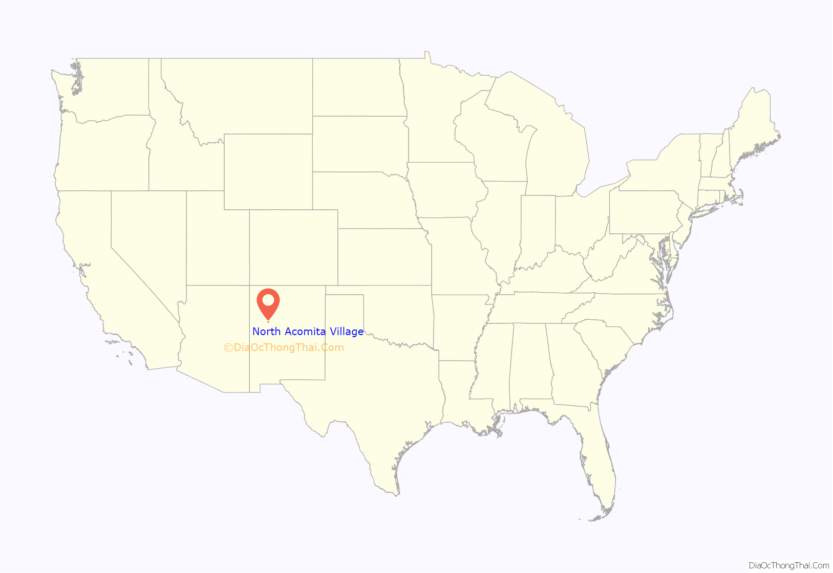
North Acomita Village location map. Where is North Acomita Village CDP?
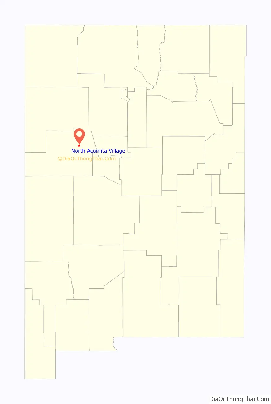
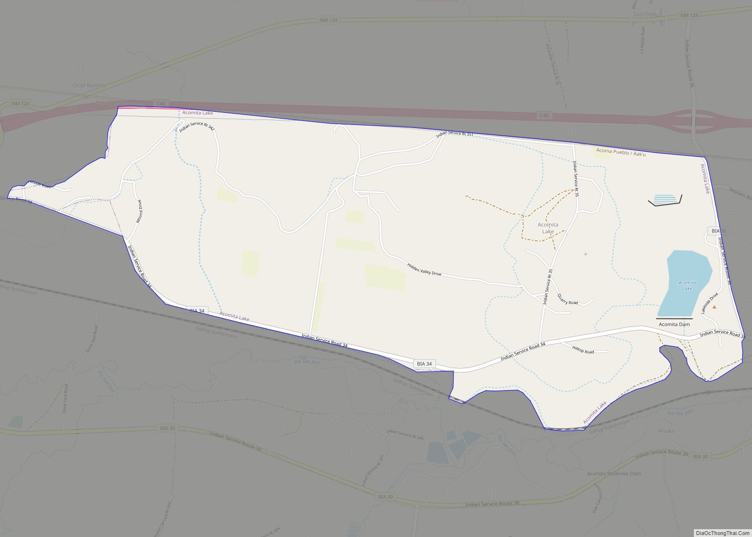
North Acomita Village Road Map
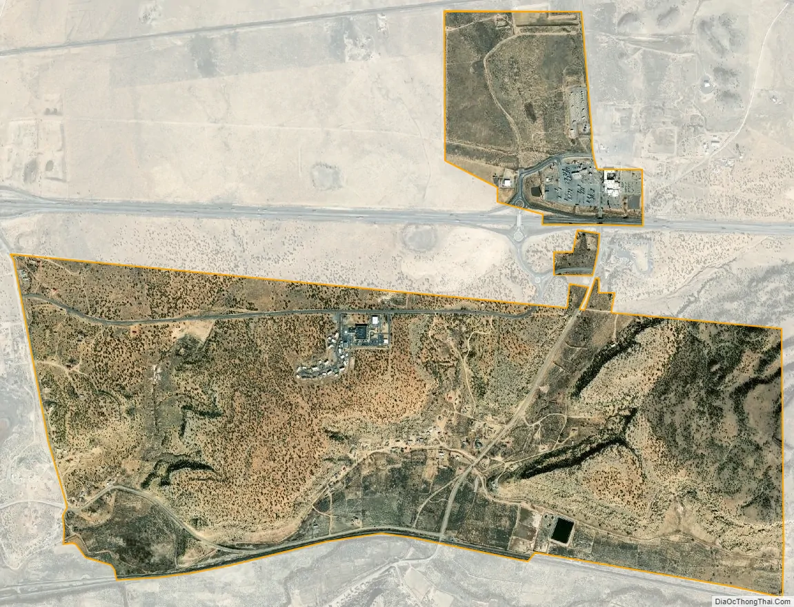
North Acomita Village city Satellite Map
Geography
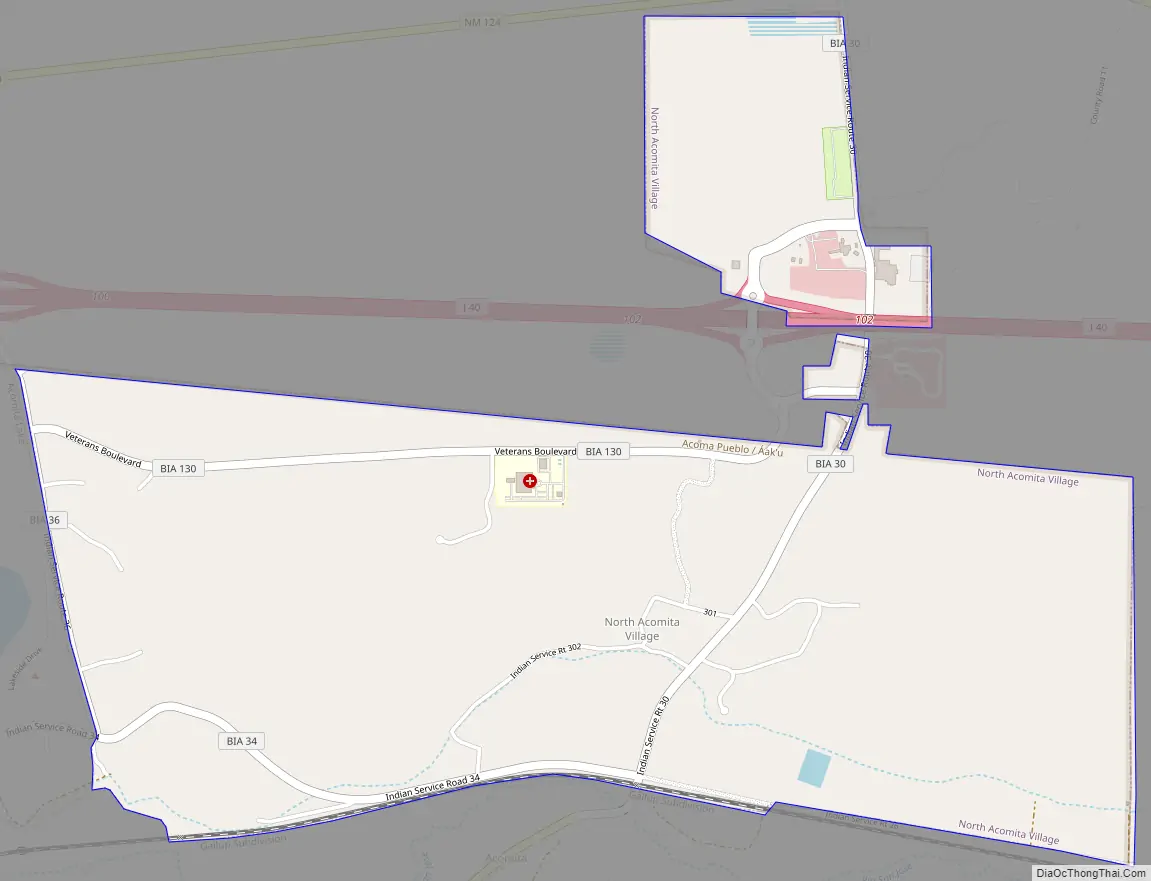
North Acomita Village is located in northeastern Cibola County at 35°4′4″N 107°33′55″W / 35.06778°N 107.56528°W / 35.06778; -107.56528 (35.067768, -107.565233). It occupies the northeastern corner of the Acoma Pueblo land and is situated on the north side of the Rio San Jose and south of Interstate 40. Two I-40 exits (100 and 102) serve the North Acomita area. South Acomita Village is directly to the south, across the Rio San Jose.
According to the United States Census Bureau, the CDP has a total area of 2.9 square miles (7.4 km), all land.
See also
Map of New Mexico State and its subdivision: Map of other states:- Alabama
- Alaska
- Arizona
- Arkansas
- California
- Colorado
- Connecticut
- Delaware
- District of Columbia
- Florida
- Georgia
- Hawaii
- Idaho
- Illinois
- Indiana
- Iowa
- Kansas
- Kentucky
- Louisiana
- Maine
- Maryland
- Massachusetts
- Michigan
- Minnesota
- Mississippi
- Missouri
- Montana
- Nebraska
- Nevada
- New Hampshire
- New Jersey
- New Mexico
- New York
- North Carolina
- North Dakota
- Ohio
- Oklahoma
- Oregon
- Pennsylvania
- Rhode Island
- South Carolina
- South Dakota
- Tennessee
- Texas
- Utah
- Vermont
- Virginia
- Washington
- West Virginia
- Wisconsin
- Wyoming