Providence is the capital and most populous city of the U.S. state of Rhode Island. Located near the Massachusetts state line, it is the county seat of Providence County, the most populous county in the state. One of the oldest cities in New England, it was founded in 1636 by Roger Williams, a Reformed Baptist theologian and religious exile from the Massachusetts Bay Colony. He named the area in honor of “God’s merciful Providence” which he believed was responsible for revealing such a haven for him and his followers. The city developed as a busy port as it is situated at the mouth of the Providence River, at the head of Narragansett Bay.
Providence was one of the first cities in the country to industrialize and became noted for its textile manufacturing and subsequent machine tool, jewelry, and silverware industries. Today, the city of Providence is home to eight hospitals and eight institutions of higher learning which have shifted the city’s economy into service industries, though it still retains some manufacturing activity.
At the 2020 census, Providence had a population of 190,934, making it the third-most-populous city in New England after Boston and Worcester, Massachusetts. Metro Providence, however, is the second largest metropolitan area in New England by a large margin with over 1.6 million residents, nearly 30% larger than the region’s third largest metro, Hartford.
| Name: | Providence city |
|---|---|
| LSAD Code: | 25 |
| LSAD Description: | city (suffix) |
| State: | Rhode Island |
| County: | Providence County |
| Elevation: | 10 ft (3 m) |
| Land Area: | 18.41 sq mi (47.67 km²) |
| Water Area: | 2.18 sq mi (5.64 km²) |
| Population Density: | 10,373.47/sq mi (4,005.25/km²) |
| Area code: | 401 |
| FIPS code: | 4459000 |
| Website: | www.providenceri.gov |
Online Interactive Map
Click on ![]() to view map in "full screen" mode.
to view map in "full screen" mode.
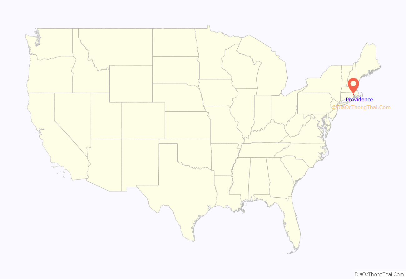
Providence location map. Where is Providence city?
History
Providence was settled in June 1636 by Puritan theologian Roger Williams and grew into one of the original Thirteen Colonies. As a minister in the Massachusetts Bay Colony, Williams had advocated the separation of church and state and condemned colonists’ confiscation of land from the Indians. For these and other “diverse, new, and dangerous opinions,” he was convicted of sedition and heresy and banished from the colony. Williams and others established a settlement in Rumford, Rhode Island. The group later moved down the Seekonk River, around Fox Point and up the Providence River to the confluence of the Moshassuck and Woonasquatucket Rivers. The settlement was named after “God’s merciful Providence.”
Providence lacked a royal charter, unlike Salem and Boston. The settlers thus organized themselves, allotting tracts on the eastern side of the Providence River in 1638 allowing roughly six acres each. These home lots extended from Towne Street (now South Main Street) to Hope Street. Over the following two decades, Providence Plantations grew into a self-sufficient agricultural and fishing settlement, though its lands were difficult to farm and its borders were disputed with Connecticut and Massachusetts. In 1652, Providence prohibited indentured servitude for periods of longer than 10 years. This statute constituted the first anti-slavery law in the United States, though there is no evidence the prohibition was ever enforced.
In March 1676, Providence Plantations was burned to the ground by the Narragansetts during King Philip’s War. Later in the year, the Rhode Island legislature formally rebuked the other colonies for provoking the war. In 1770, Brown University moved to Providence from nearby Warren. At the time, the college was known as Rhode Island College and occupied a single building on College Hill. The college’s choice to relocate to Providence as opposed to Newport symbolized a larger shift away from Newport’s commercial and political dominance over the colony.
In 1772, a group from Providence burned a British customs schooner south of Providence in the event known as the Gaspee Affair. This was the first act of armed resistance to British rule in America, predating the more famous Boston Tea Party by more than a year. Rhode Island was the first of the Thirteen Colonies to renounce its allegiance to the British Crown on May 4, 1776. It was also the last of the Thirteen States to ratify the United States Constitution on May 29, 1790, once assurances were made that a Bill of Rights would become part of the Constitution.
Following the war, Providence was the nation’s ninth-largest city with 7,614 people. The economy shifted from maritime endeavors to manufacturing, in particular machinery, tools, silverware, jewelry, and textiles. By the start of the 20th century, Providence hosted some of the largest manufacturing plants in the country, including Brown & Sharpe, Nicholson File, and Gorham Manufacturing Company. The city’s industries attracted many immigrants from Ireland, Germany, Sweden, England, Italy, Portugal, Cape Verde, and French Canada. These economic and demographic shifts caused social strife. Hard Scrabble and Snow Town were the sites of race riots in 1824 and 1831.
Providence residents ratified a city charter in 1831 as the population passed 17,000. The seat of city government was located in the Market House in Market Square from 1832 to 1878, which was the geographic and social center of the city. The city offices soon outgrew this building, and the City Council resolved to create a permanent municipal building in 1845. The city offices moved into Providence City Hall in 1878.
Local politics split over slavery during the American Civil War, as many had ties to Southern cotton and the slave trade. Despite ambivalence concerning the war, the number of military volunteers routinely exceeded quota, and the city’s manufacturing proved invaluable to the Union. Providence thrived after the war, and waves of immigrants brought the population from 54,595 in 1865 to 175,597 by 1900.
By the early 1900s, Providence was one of the wealthiest cities in the United States. Immigrant labor powered one of the nation’s largest industrial manufacturing centers. Providence was a major manufacturer of industrial products, from steam engines to precision tools to silverware, screws, and textiles. Giant companies were based in or near Providence, such as Brown & Sharpe, the Corliss Steam Engine Company, Babcock & Wilcox, the Grinnell Corporation, the Gorham Manufacturing Company, Nicholson File, and the Fruit of the Loom textile company. The manufacturing of jewelry and costume jewelry emerged as a dominant local industry. In the 1960s, jewelry trade magazines referred to Providence as “the jewelry capital of the world.”
The city began to see a decline by the mid-1920s as manufacturing industries began to shut down. It was deeply affected by the Great Depression, which left more than a third of the city’s labor force unemployed. The subsequent Recession of 1937–1938 was immediately followed by the New England Hurricane of 1938, which flooded downtown. The hurricane was particularly destructive to the struggling textile industry, with many mills never reopening following the storm. Providence’s population declined from a peak of 253,504 in 1940 to only 179,213 in 1970, as the white middle class moved to the suburbs. From the 1940s to 1970s, white middle class residents vacated Providence faster than any other American city other than Detroit. The remainder of these residents were disproportionately poor and elderly. From the 1950s to the 1980s, Providence was a notorious bastion of organized crime.
From 1975 until 1982, $606 million of local and national community development funds were invested throughout the city. In the 1990s, the city pushed for revitalization, completing a number of major development projects. Among these were the realignment of railroad tracks; the relocation of rivers, creation of Waterplace Park, and development of a riverwalk; the construction of a Downtown ice rink; and the development of Providence Place Mall. In 1980, Providence’s previously declining population began to grow once again.
In the early 2000s, Providence developed an economic development plan that outlined a shift to a knowledge-based economy. These efforts involved the rebranding of the formerly industrial Jewelry District as a new “Knowledge District”. Despite new investment, approximately 21.5-percent of the city population lives below the poverty line. Recent increases in real estate values have further exacerbated problems for those at marginal income levels, mirroring a statewide housing affordability crisis. From 2004 to 2005, Providence saw the highest rise in median housing price of any city in the United States.
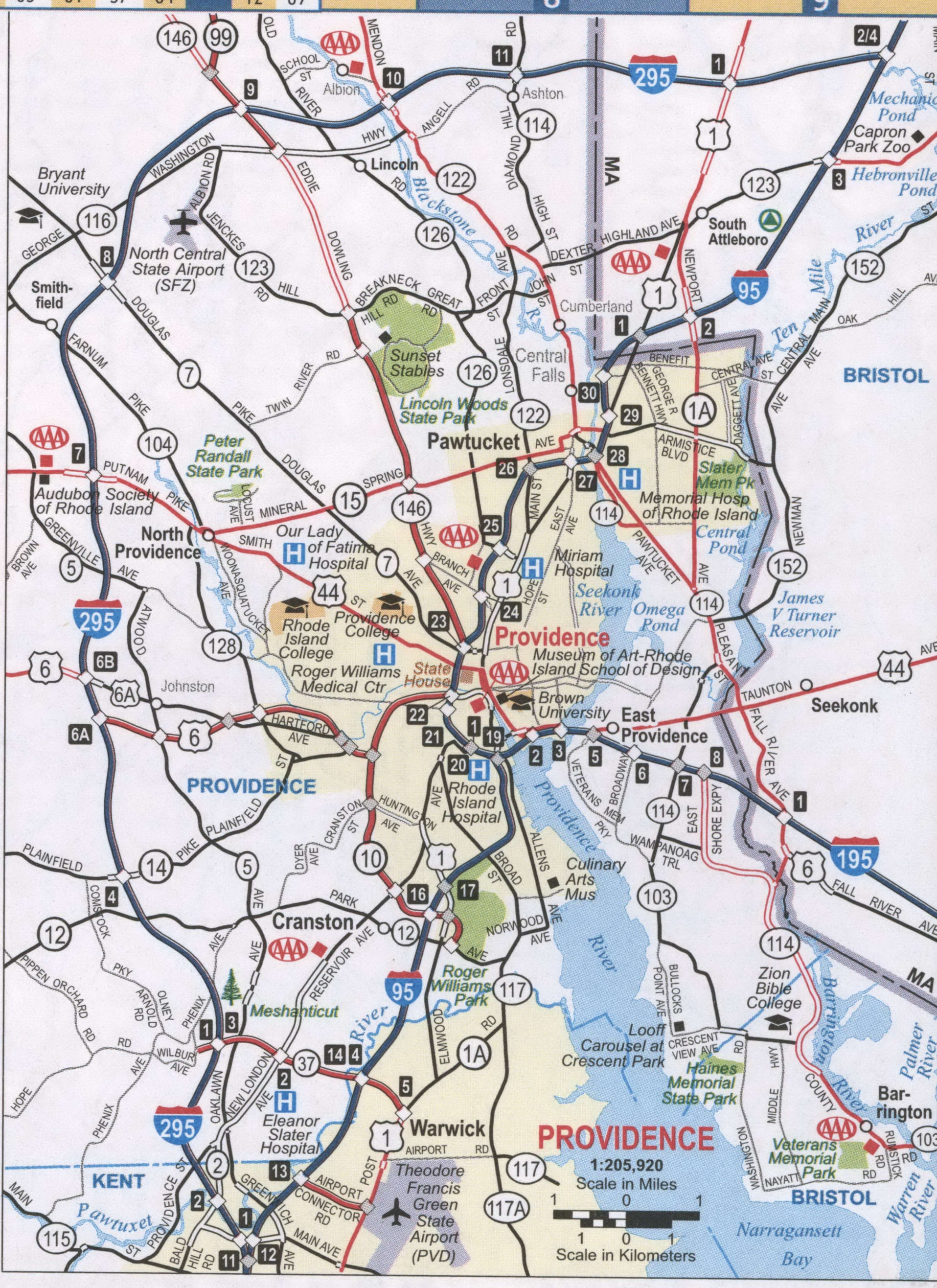
Providence Road Map
Providence city Satellite Map
Geography
The Providence city limits enclose a small geographical region with a total area of 20.5 square miles (53 km); 18.5 square miles (48 km) of it is land and the remaining 2.1 square miles (5.4 km) is water (roughly 10%). Providence is located at the head of Narragansett Bay, with the Providence River running into the bay through the center of the city, formed by the confluence of the Moshassuck and Woonasquatucket Rivers. The Waterplace Park amphitheater and riverwalks line the river’s banks through Downtown. Providence is one of many cities claimed to be founded on seven hills like Rome.
As with many cities worldwide, the Northeastern megacity has a large population of feral pigeons (Columba livia). Although expecting Providence’s population genetics to be continuous with the larger megacity, Carlen & Munshi-South 2020 find Providence and Boston share one population and the rest of the region shares another. This is likely due to the intervening low urbanization zone in western Connecticut.
Neighborhoods
Providence has 25 official neighborhoods, though these neighborhoods are often grouped together and referred to collectively:
- The East Side is a region comprising the neighborhoods of Blackstone, Hope (aka Summit), Mount Hope, College Hill, Wayland, and Fox Point.
- The Jewelry District describes the area enclosed by I-95, the old I-195, and the Providence River. The city has made efforts to rename this area the Knowledge District to reflect the area’s newly developing life sciences and technology-based economy.
- The North End is formed by the concatenation of the neighborhoods of Charles, Wanskuck, Smith Hill, Elmhurst, and Mount Pleasant.
- The South Side (or South Providence) consists of the neighborhoods of Elmwood, Lower South Providence, Upper South Providence, Washington Park, and the West End.
- West Broadway is an officially recognized neighborhood with its own association. It overlaps with the southern half of Federal Hill and the northern part of the West End.
Cityscape
Geographically, Providence is compact—characteristic of eastern seaboard cities that developed prior to use of the automobile. The street layout of the city is irregular; more than one thousand streets run haphazardly, connecting and radiating from traditionally bustling places such as Market Square.
Downtown Providence has numerous 19th-century mercantile buildings in the Federal and Victorian architectural styles, as well as several postmodern and modernist buildings. In particular, a fairly clear spatial separation appears between the areas of pre-1980s development and post-1980s development; West Exchange Street and Exchange Terrace serve as rough boundaries between the two. The newer area, sometimes called “Capitol Center”, includes the Providence Place Mall (1999), Omni Providence Hotel (1993) and Residences Providence (2007), GTECH Corporation (2006), Waterplace Towers condominiums (2007), and Waterplace Park (1994). The area tends toward newer development, since much of it is land reclaimed in the 1970s from a mass of railroad tracks referred to colloquially as the “Chinese Wall”. This part of Downtown is characterized by open spaces, wide roads, and landscaping.
The streetscape of much of historic downtown has retained a similar appearance since the early 20th century. Many of the state’s tallest buildings are found here. At 426 feet (130 m), the city’s largest structure is the art deco Industrial National Bank Building. The building contrasts with the city’s second tallest structure—One Financial Plaza—which is designed in the modernist style. Other core buildings of the Providence skyline are the postmodern 50 Kennedy Plaza and late modern Textron Tower. Downtown is also the home of the historic Providence Biltmore hotel and Westminster Arcade—the oldest enclosed shopping mall in the U.S.
The city’s southern waterfront, away from the downtown core, is the location of oil tanks, ferry and sailing docks, power plants, and nightclubs. The Russian Submarine Museum was located here until 2008, when the submarine sank. The Fox Point Hurricane Barrier is also found here, built to protect Providence from storm surge like those endured by the city during the 1938 New England Hurricane and 1954 Hurricane Carol.
The Shepard Company Building in Downtown Providence’s compact urban center
Burnside Park in Downtown Providence facing the city’s primary row of high rises
The Providence Riverwalk, at the edge of downtown
Climate
Providence has a humid continental climate (Köppen climate classification Dfa) bordering a humid subtropical climate with hot summers, cold winters, and high humidity year-round. The USDA places the city in hardiness zone 6b, with the suburbs in zones 6a–7b. The influence of the Atlantic Ocean keeps the state of Rhode Island warmer than many inland locales in New England.
January is the coldest month with a daily mean of 29.2 °F (−1.6 °C) and low temperatures dropping to 10 °F (−12 °C) or lower an average of 11 days per winter, while July is the warmest month with a daily mean of 73.5 °F (23.1 °C) and highs rising to 90 °F (32 °C) or higher an average of 10 days per summer. Extremes range from −17 °F or −27.2 °C on February 9, 1934 to 104 °F or 40 °C on August 2, 1975; the record cold daily maximum is 1 °F (−17.2 °C) on February 5, 1918, while the record warm daily minimum is 80 °F (26.7 °C) on June 6, 1925. Temperature readings of 0 °F or −17.8 °C or lower are uncommon in Providence and generally occur once every several years. The year which had the most days with a temperature reading of zero degrees or lower was 2015 with eight days total—one day in January and seven days in February. Conversely, temperature readings of 100 °F or 37.8 °C or higher are even rarer, and the year with the most days in this category was 1944 with three days, all of which were in August.
Monthly precipitation in Providence ranges from a high of 4.43 inches (112.5 mm) in March to a low of 3.17 inches (80.5 mm) in July. In general, precipitation levels are slightly less in the summer months than the winter months, when nor’easters can cause significant snowfall and blizzard conditions. Hurricanes are not frequent in coastal New England, although Providence’s location at the head of Narragansett Bay makes it vulnerable to them.
See also
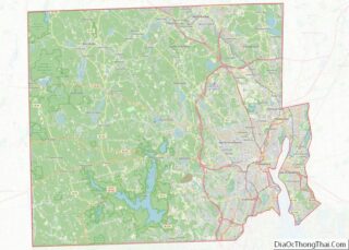
Map of Rhode Island State and its subdivision: Map of other states:- Alabama
- Alaska
- Arizona
- Arkansas
- California
- Colorado
- Connecticut
- Delaware
- District of Columbia
- Florida
- Georgia
- Hawaii
- Idaho
- Illinois
- Indiana
- Iowa
- Kansas
- Kentucky
- Louisiana
- Maine
- Maryland
- Massachusetts
- Michigan
- Minnesota
- Mississippi
- Missouri
- Montana
- Nebraska
- Nevada
- New Hampshire
- New Jersey
- New Mexico
- New York
- North Carolina
- North Dakota
- Ohio
- Oklahoma
- Oregon
- Pennsylvania
- Rhode Island
- South Carolina
- South Dakota
- Tennessee
- Texas
- Utah
- Vermont
- Virginia
- Washington
- West Virginia
- Wisconsin
- Wyoming
