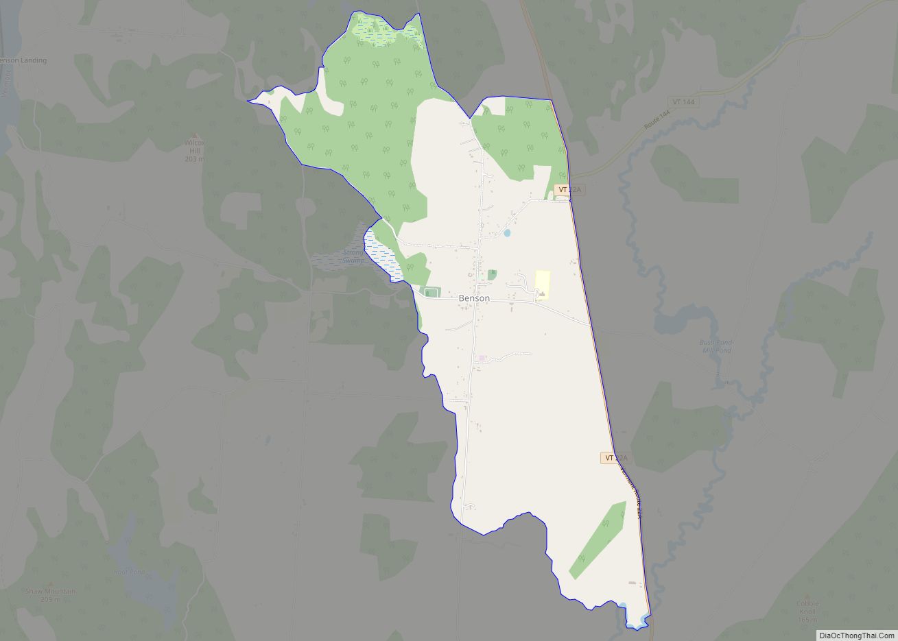
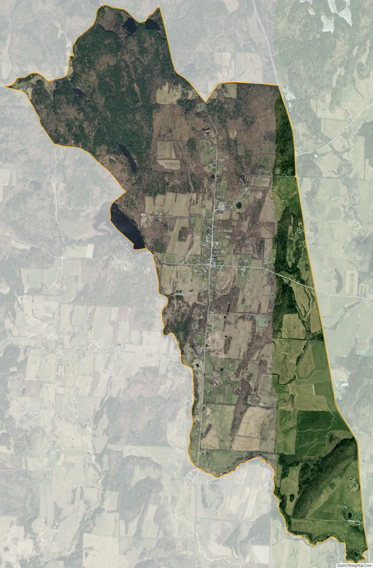
Benson is the primary village and a census-designated place (CDP) in the town of Benson, Rutland County, Vermont, United States. As of the 2020 census, it had a population of 269, out of 974 in the entire town.
The CDP is in northwestern Rutland County, at the geographic center of the town. Vermont Route 22A runs along the eastern edge of the village, leading north 6 miles (10 km) to Orwell and south 8 miles (13 km) to Fair Haven. Vermont Route 144 has its western terminus at Benson and leads northeast 4 miles (6 km) to Hortonia.
| Name: | Benson CDP |
|---|---|
| LSAD Code: | 57 |
| LSAD Description: | CDP (suffix) |
| State: | Vermont |
| County: | Rutland County |
| Elevation: | 390 ft (120 m) |
| Total Area: | 3.93 sq mi (10.19 km²) |
| Land Area: | 3.87 sq mi (10.03 km²) |
| Water Area: | 0.06 sq mi (0.16 km²) |
| ZIP code: | 05743 |
| Area code: | 802 |
| FIPS code: | 5005125 |
| GNISfeature ID: | 2586619 |
Online Interactive Map
Click on ![]() to view map in "full screen" mode.
to view map in "full screen" mode.
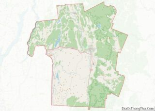
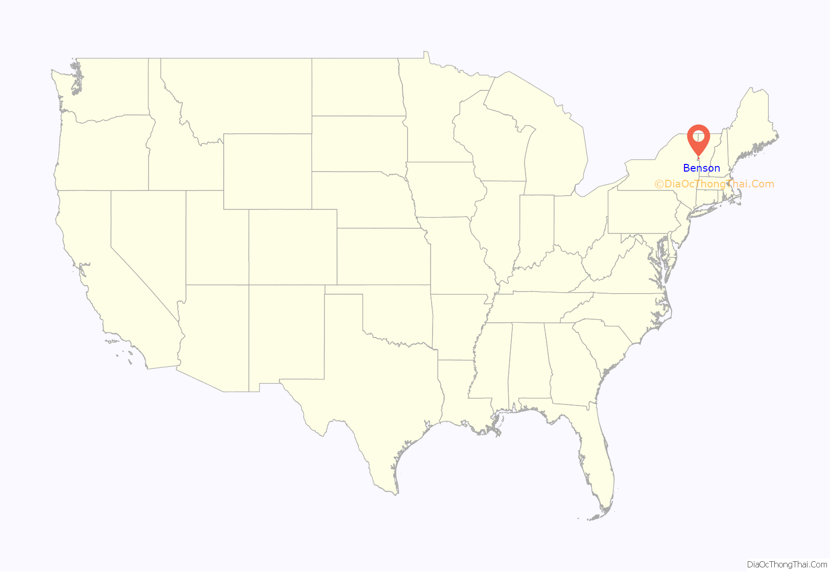
Benson location map. Where is Benson CDP?

Benson Road Map

Benson city Satellite Map
See also
Map of Vermont State and its subdivision: Map of other states:- Alabama
- Alaska
- Arizona
- Arkansas
- California
- Colorado
- Connecticut
- Delaware
- District of Columbia
- Florida
- Georgia
- Hawaii
- Idaho
- Illinois
- Indiana
- Iowa
- Kansas
- Kentucky
- Louisiana
- Maine
- Maryland
- Massachusetts
- Michigan
- Minnesota
- Mississippi
- Missouri
- Montana
- Nebraska
- Nevada
- New Hampshire
- New Jersey
- New Mexico
- New York
- North Carolina
- North Dakota
- Ohio
- Oklahoma
- Oregon
- Pennsylvania
- Rhode Island
- South Carolina
- South Dakota
- Tennessee
- Texas
- Utah
- Vermont
- Virginia
- Washington
- West Virginia
- Wisconsin
- Wyoming