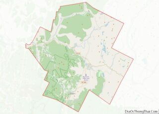
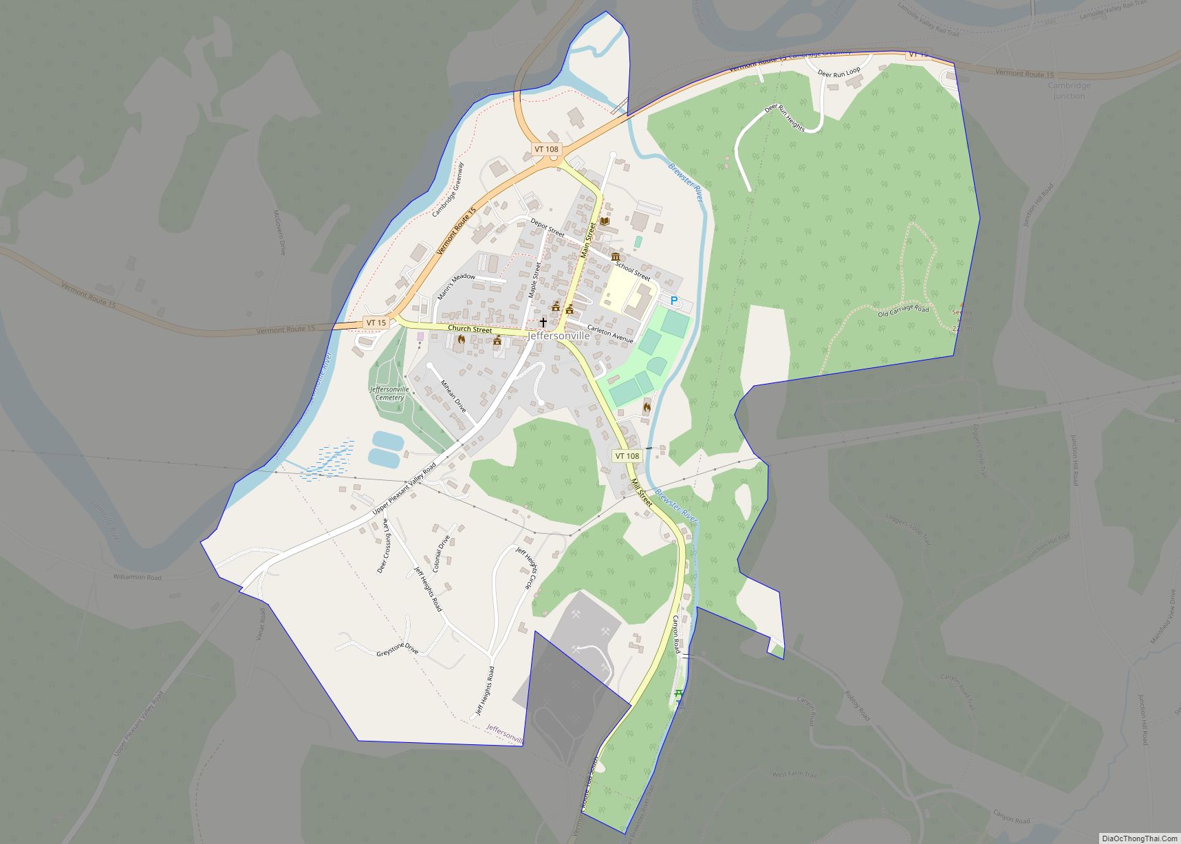
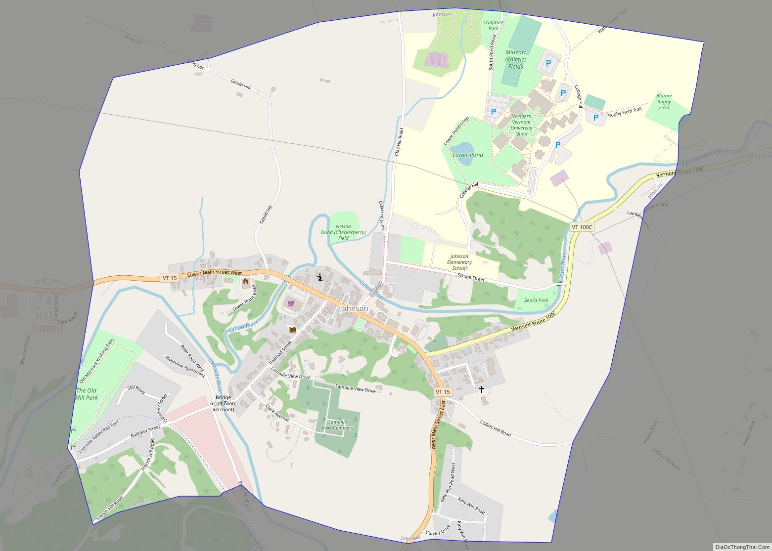
Cambridge is a town in Lamoille County, Vermont, United States. The population was 3,839 at the 2020 United States Census. Cambridge includes the villages of Jeffersonville and Cambridge.
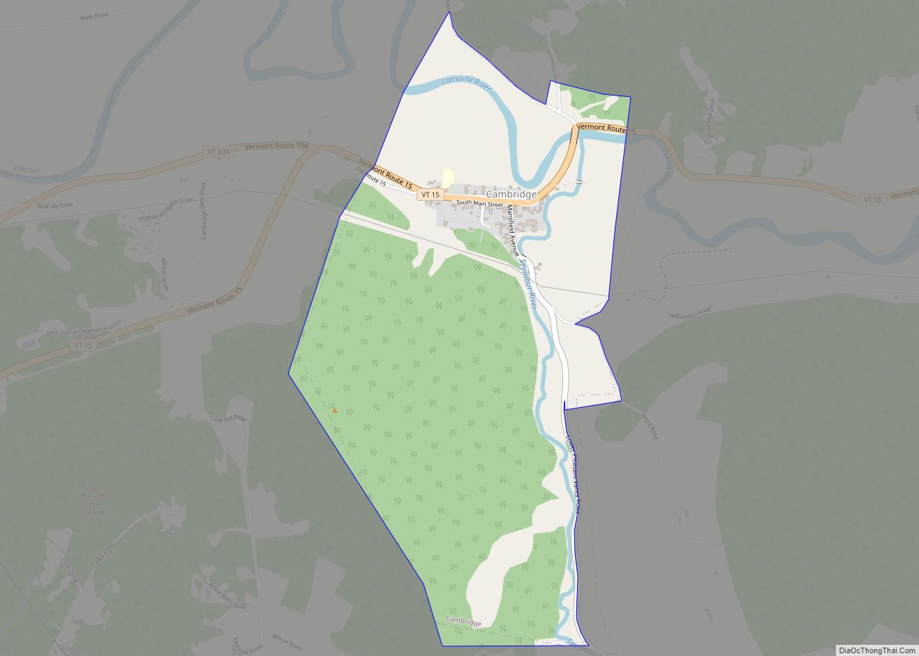
| Name: | Cambridge village |
|---|---|
| LSAD Code: | 47 |
| LSAD Description: | village (suffix) |
| State: | Vermont |
| County: | Lamoille County |
| Elevation: | 758 ft (231 m) |
| Total Area: | 63.69 sq mi (164.95 km²) |
| Land Area: | 63.19 sq mi (163.66 km²) |
| Water Area: | 0.50 sq mi (1.29 km²) |
| Total Population: | 3,839 |
| Population Density: | 61/sq mi (23.5/km²) |
| ZIP code: | 05444 |
| Area code: | 802 |
| FIPS code: | 5011425 |
| GNISfeature ID: | 1462063 |
| Website: | www.cambridge.vermont.gov |
Online Interactive Map
Click on ![]() to view map in "full screen" mode.
to view map in "full screen" mode.
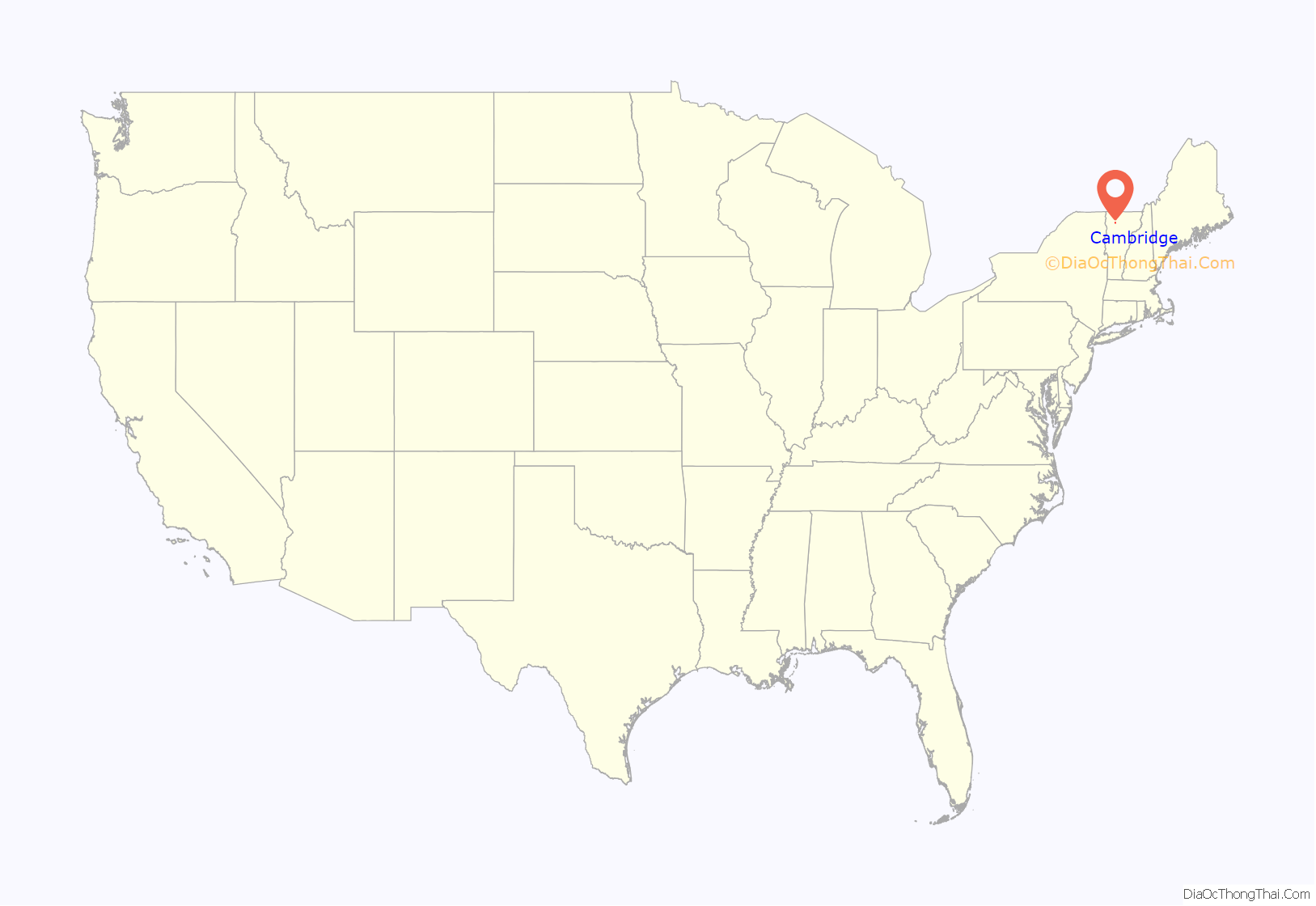
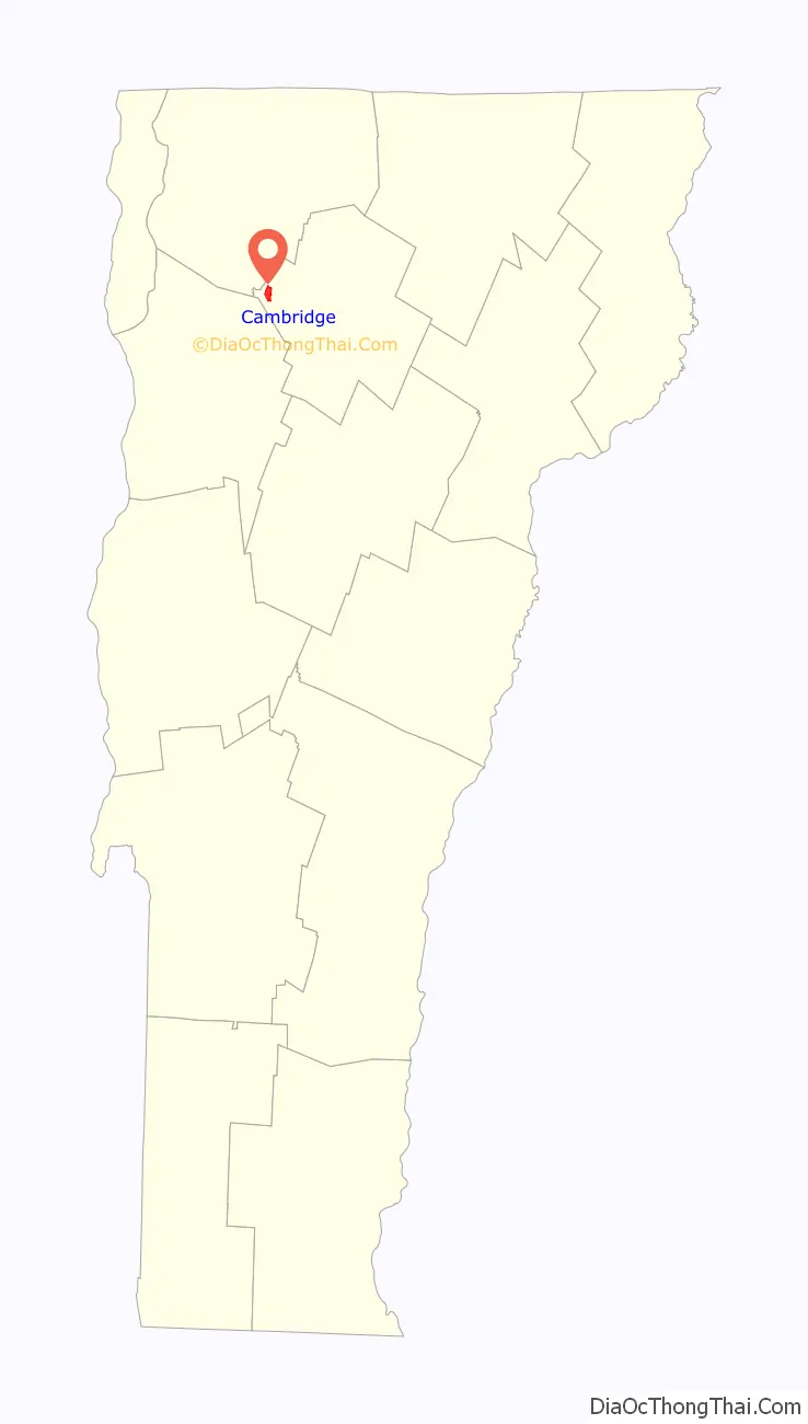
Cambridge location map. Where is Cambridge village?
History
Granted on November 7, 1780, Cambridge was chartered on August 13, 1781, to Samuel Robinson, John Fassett Jr., Jonathan Frost and 64 others. It was first settled in 1783 by John Safford from Piermont, New Hampshire. The valleys proved good but rough, best for grazing livestock. By 1839, the town had about 7,000 sheep. The Lamoille River offered water power for watermills. Industries included one woolen factory, one tannery, and one gristmill, plus several sawmills and cabinet shops.
Cambridge and neighboring Johnson were together known as the King’s College Tract, being created by Lieutenant Governor Cadwallader Colden by authority of King George III in 1764. The King’s College Tract was reserved for the eventual establishment of a university on the site. The place name “Cambridge” suggests the University of Cambridge in England. Johnson, the other town in the King’s College Grant, was named for William Samuel Johnson.
Both the St. Johnsbury & Lake Champlain Railroad and the Burlington & Lamoille Railroad passed through the town. The former is now the Lamoille Valley Rail Trail.
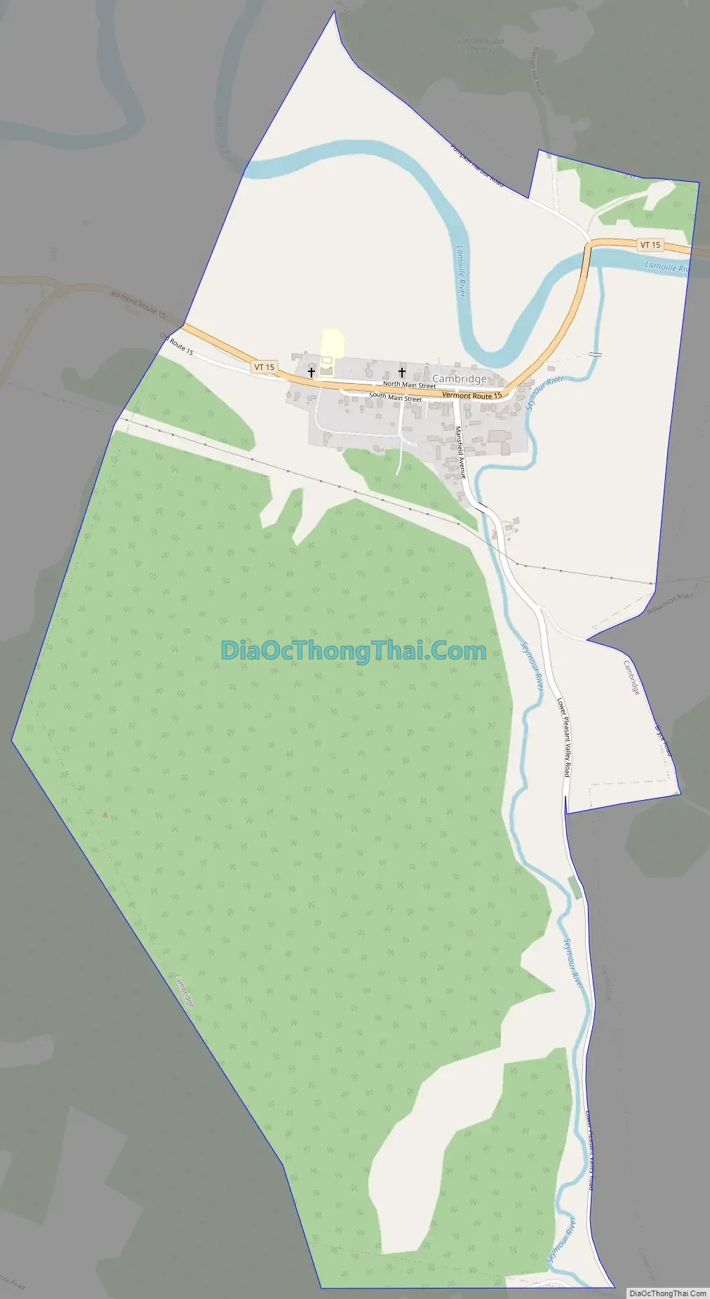
Cambridge Road Map
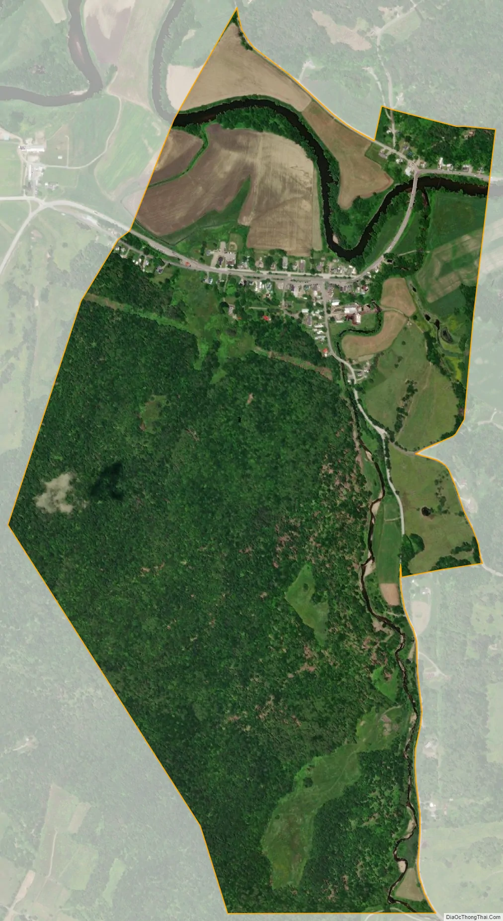
Cambridge city Satellite Map
Geography
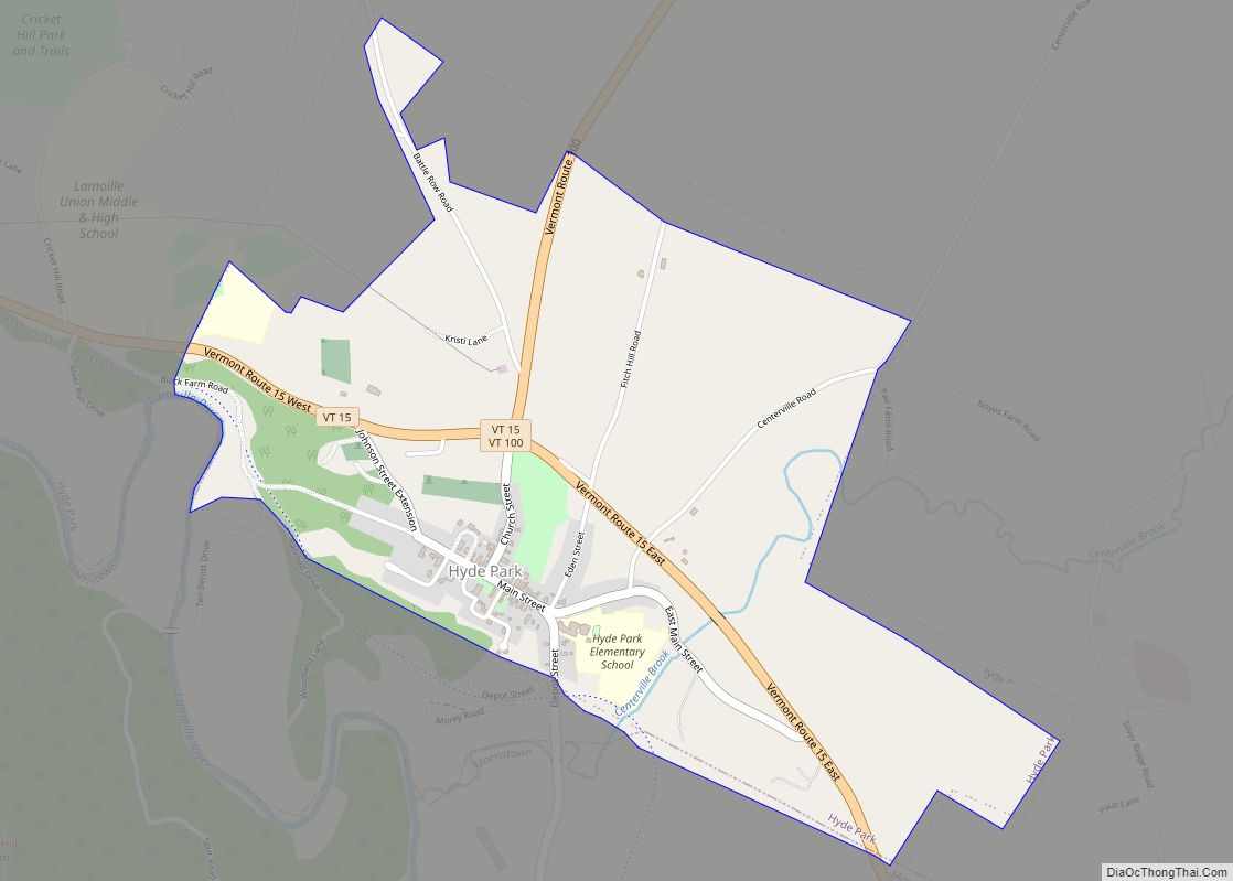
Cambridge is in western Lamoille County, bordered to the northwest by Franklin County and to the southwest by Chittenden County. The village of Jeffersonville is in the center of the town, and the village of Cambridge is in the west. According to the United States Census Bureau, the town has a total area of 63.7 square miles (164.9 km), of which 63.2 square miles (163.7 km) are land and 0.50 square miles (1.3 km), or 0.78%, are water. Cambridge is drained by the Lamoille River, which flows from east to west across the center of the town, passing through the north sides of Jeffersonville and Cambridge villages. Two main tributaries of the Lamoille drain the southern part of the town: the Brewster River originates in Smugglers Notch at the crest of the Green Mountains in the southernmost part of the town and flows north to Jeffersonville, while the Seymour River originates in Underhill and flows north to Cambridge village.
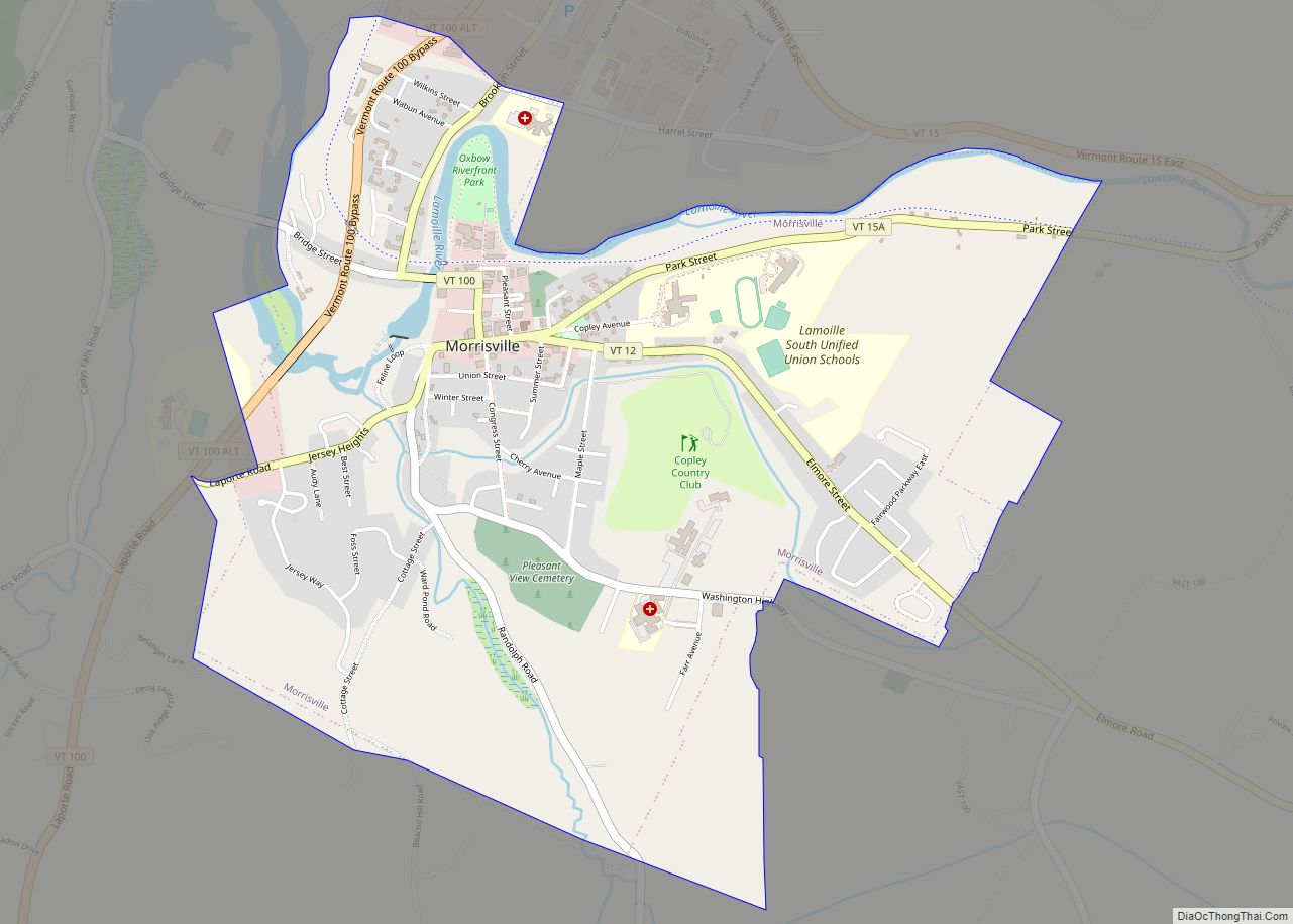
The town is crossed by Vermont Route 15, Vermont Route 104, Vermont Route 108 and Vermont Route 109. VT-15 leads southwest 27 miles (43 km) to Winooski, next to Burlington, and southeast 16 miles (26 km) to Morrisville. VT-104 leads northwest 22 miles (35 km) to St. Albans, while VT-108 leads north 20 miles (32 km) to Enosburg Falls and south through Smugglers Notch 17 miles (27 km) to Stowe. VT-109 leads northeast 11 miles (18 km) to Belvidere. (All distances are measured from Jeffersonville.)
See also
Map of Vermont State and its subdivision: Map of other states:- Alabama
- Alaska
- Arizona
- Arkansas
- California
- Colorado
- Connecticut
- Delaware
- District of Columbia
- Florida
- Georgia
- Hawaii
- Idaho
- Illinois
- Indiana
- Iowa
- Kansas
- Kentucky
- Louisiana
- Maine
- Maryland
- Massachusetts
- Michigan
- Minnesota
- Mississippi
- Missouri
- Montana
- Nebraska
- Nevada
- New Hampshire
- New Jersey
- New Mexico
- New York
- North Carolina
- North Dakota
- Ohio
- Oklahoma
- Oregon
- Pennsylvania
- Rhode Island
- South Carolina
- South Dakota
- Tennessee
- Texas
- Utah
- Vermont
- Virginia
- Washington
- West Virginia
- Wisconsin
- Wyoming