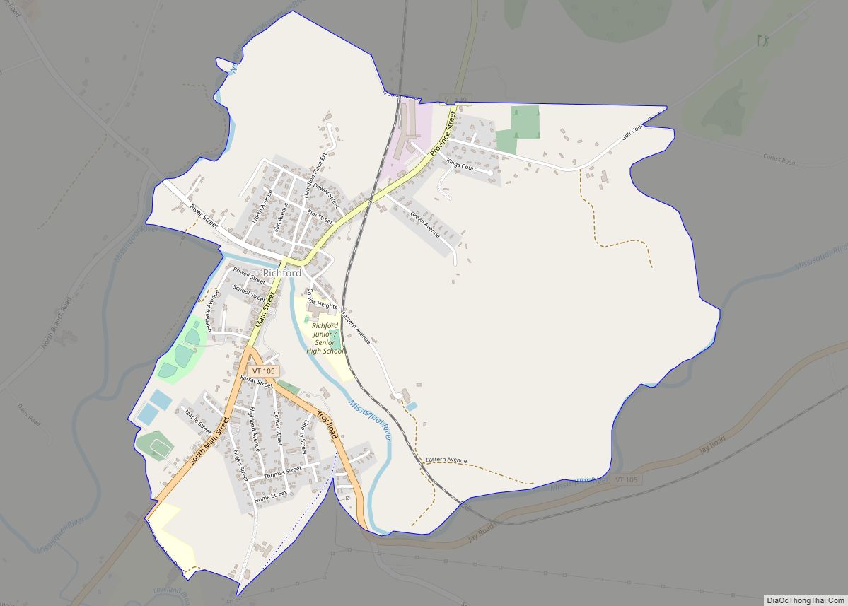
Richford is a census-designated place comprising the main settlement in the town of Richford, Franklin County, Vermont, United States. Its population was 1,361 as of the 2010 census, out of 2,308 people in the entire town of Richford.
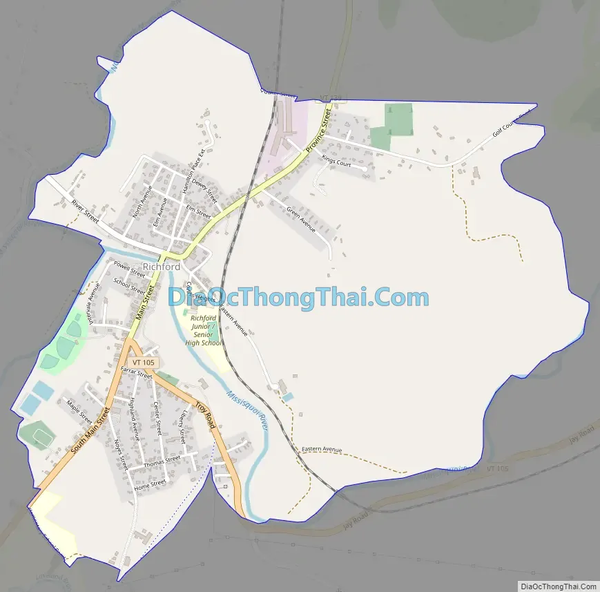
The Richford CDP is located in the northwest part of the town of Richford, along the Missisquoi River. Vermont Route 105 passes through the community, staying on the south side of the river; it leads east 18 miles (29 km) over the Green Mountains to North Troy and southwest down the Missisquoi River valley 10 miles (16 km) to Enosburg Falls. Vermont Route 139 (Main Street) intersects VT 105 in the south part of town, crosses the Missisquoi, becomes Province Street, and leads north 1.5 miles (2.4 km) to the Canada–United States border. Quebec Route 139 continues north from the border 7 miles (11 km) to Sutton, Quebec.
According to the United States Census Bureau, the Richford CDP has a total area of 1.9 square miles (4.9 km), of which 1.9 square miles (4.8 km) is land and 0.04 square miles (0.1 km), or 2.05%, is water.
| Name: | Richford CDP |
|---|---|
| LSAD Code: | 57 |
| LSAD Description: | CDP (suffix) |
| State: | Vermont |
| County: | Franklin County |
| Elevation: | 443 ft (135 m) |
| Total Area: | 4.9 sq mi (13 km²) |
| Land Area: | 4.8 sq mi (12 km²) |
| Water Area: | 0.1 sq mi (0.3 km²) |
| Total Population: | 1,361 |
| Population Density: | 734/sq mi (283.4/km²) |
| ZIP code: | 05476 |
| Area code: | 802 |
| FIPS code: | 5059050 |
| GNISfeature ID: | 2378132 |
Online Interactive Map
Click on ![]() to view map in "full screen" mode.
to view map in "full screen" mode.
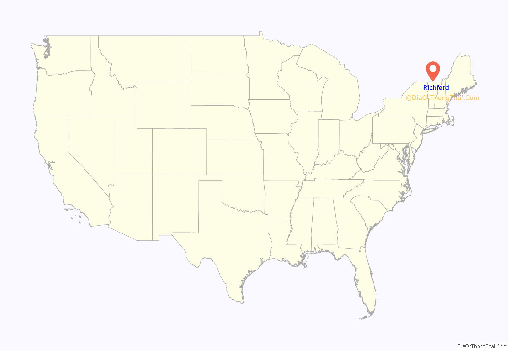
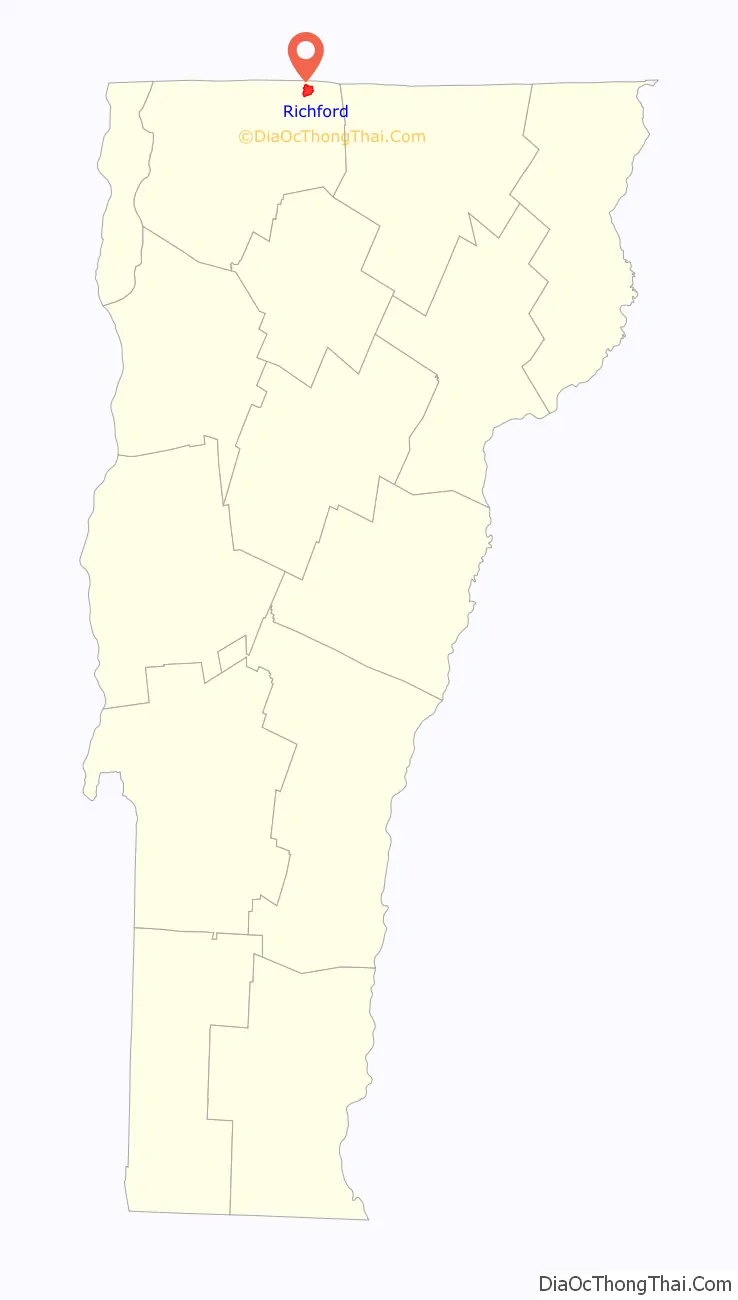
Richford location map. Where is Richford CDP?
Richford Road Map
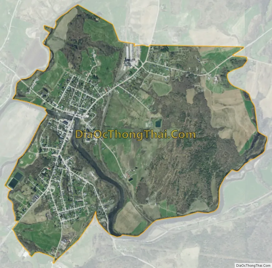
Richford city Satellite Map
See also
Map of Vermont State and its subdivision: Map of other states:- Alabama
- Alaska
- Arizona
- Arkansas
- California
- Colorado
- Connecticut
- Delaware
- District of Columbia
- Florida
- Georgia
- Hawaii
- Idaho
- Illinois
- Indiana
- Iowa
- Kansas
- Kentucky
- Louisiana
- Maine
- Maryland
- Massachusetts
- Michigan
- Minnesota
- Mississippi
- Missouri
- Montana
- Nebraska
- Nevada
- New Hampshire
- New Jersey
- New Mexico
- New York
- North Carolina
- North Dakota
- Ohio
- Oklahoma
- Oregon
- Pennsylvania
- Rhode Island
- South Carolina
- South Dakota
- Tennessee
- Texas
- Utah
- Vermont
- Virginia
- Washington
- West Virginia
- Wisconsin
- Wyoming