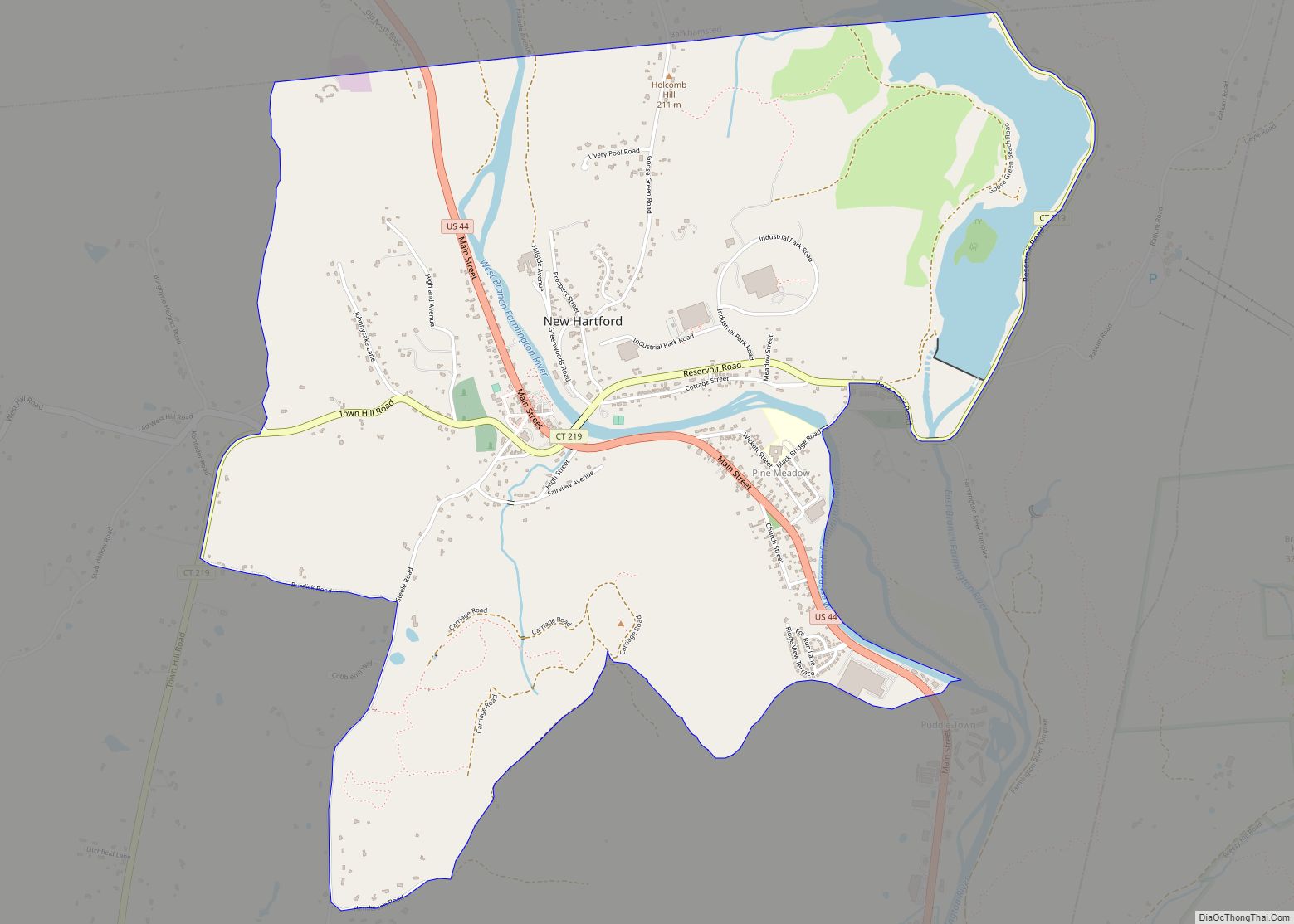
New Hartford Center is a census-designated place (CDP) in Litchfield County, Connecticut, United States. It comprises the village of New Hartford, the adjacent Pine Meadow Historic District, and some surrounding forest land, all within the town of New Hartford. As of the 2010 census, the population of New Hartford Center was 1,385, out of 6,970 in the entire town of New Hartford.
| Name: | New Hartford Center CDP |
|---|---|
| LSAD Code: | 57 |
| LSAD Description: | CDP (suffix) |
| State: | Connecticut |
| County: | Litchfield County |
| Elevation: | 400 ft (100 m) |
| Total Area: | 3.38 sq mi (8.76 km²) |
| Land Area: | 3.18 sq mi (8.23 km²) |
| Water Area: | 0.20 sq mi (0.53 km²) |
| Total Population: | 1,385 |
| Population Density: | 436/sq mi (168.3/km²) |
| ZIP code: | 06057 |
| FIPS code: | 0951420 |
| GNISfeature ID: | 2377835 |
Online Interactive Map
Click on ![]() to view map in "full screen" mode.
to view map in "full screen" mode.
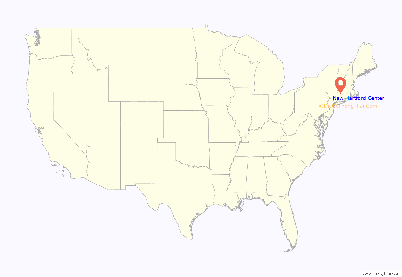
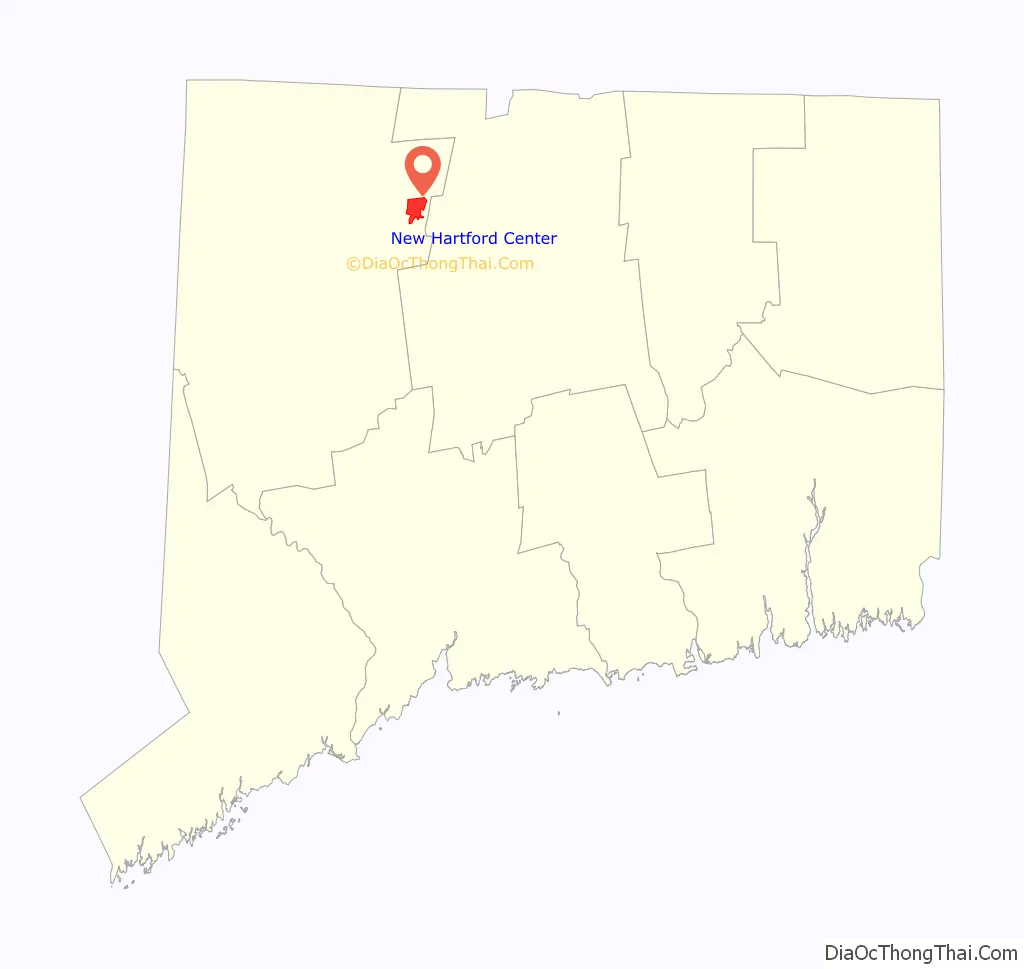
New Hartford Center location map. Where is New Hartford Center CDP?
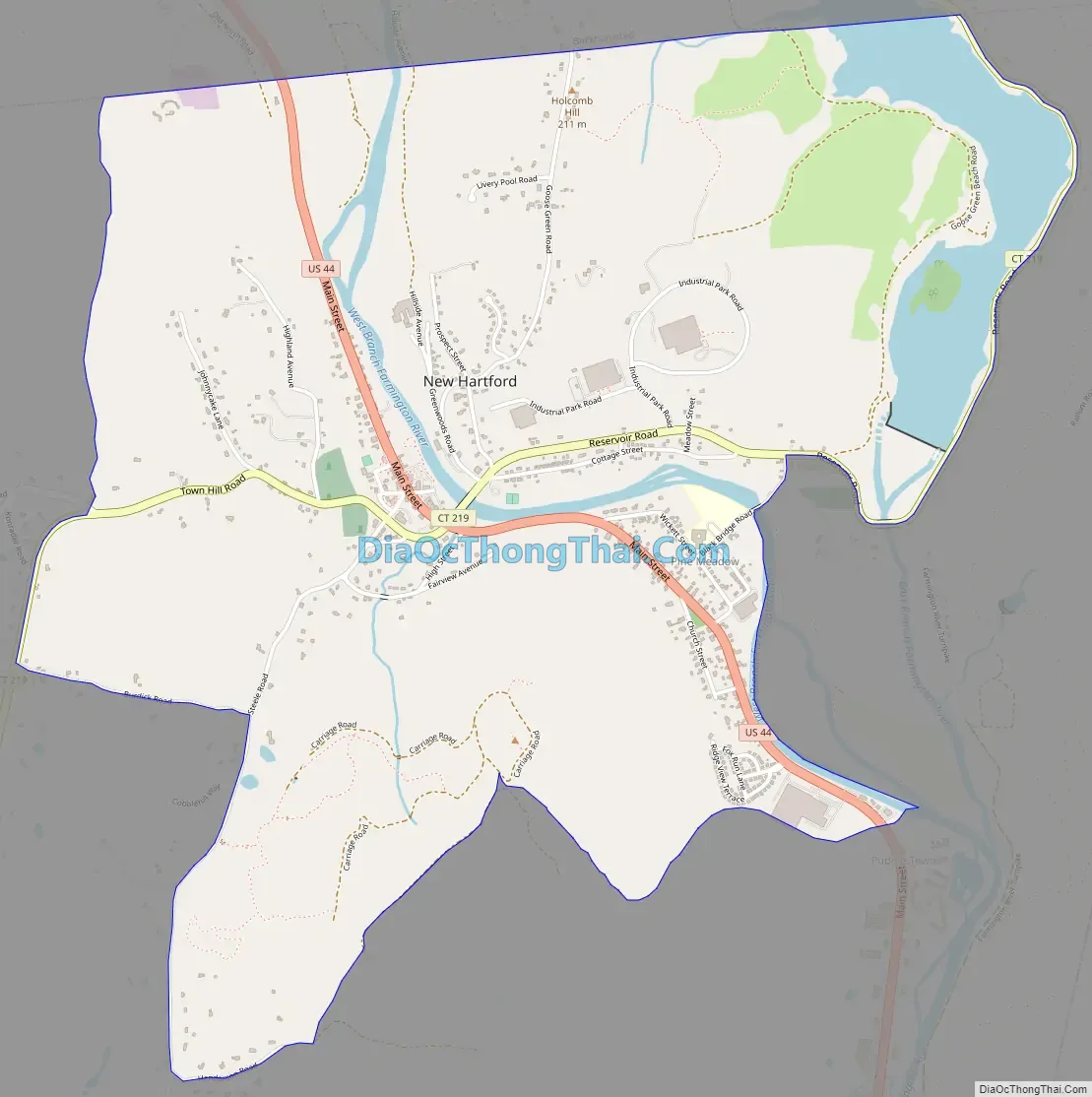
New Hartford Center Road Map
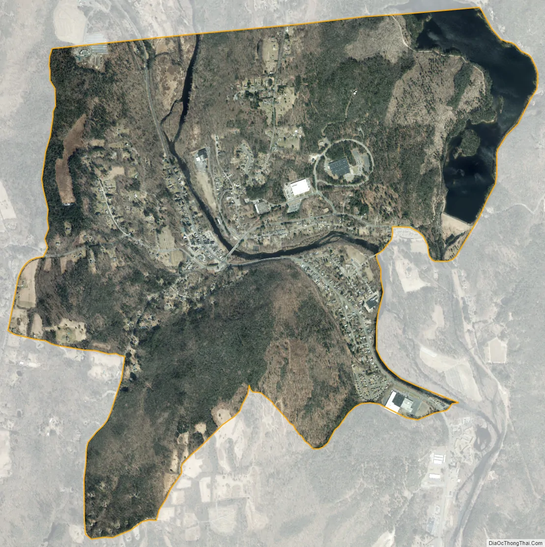
New Hartford Center city Satellite Map
Geography
New Hartford Center is in the northeast part of the town of New Hartford, in the valley of the West Branch of the Farmington River. The northern edge of the CDP follows the New Hartford–Barkhamsted town line. The CDP extends east to Connecticut Route 219 on the east side of Lake McDonough, a reservoir on the East Branch of the Farmington River. The CDP extends south nearly to the confluence of the East and West Branches of the Farmington, then runs west along Henderson Road to Steele Road and Burdick Road. The western edge of the CDP follows an unnamed brook about 0.5 miles (0.80 km) west of the village, north to the Barkhamsted town line.
U.S. Route 44 passes through the community as Main Street, leading northwest 6 miles (10 km) to Winsted and southeast 19 miles (31 km) to Hartford, the state capital. Connecticut Route 219 leads southwest through the town of New Hartford 4 miles (6 km) to U.S. Route 202, and northeast 6 miles (10 km) to Barkhamsted.
According to the U.S. Census Bureau, the New Hartford Center CDP has a total area of 3.4 square miles (8.8 km), of which 3.2 square miles (8.2 km) are land and 0.19 square miles (0.5 km), or 6.09%, are water.
See also
Map of Connecticut State and its subdivision: Map of other states:- Alabama
- Alaska
- Arizona
- Arkansas
- California
- Colorado
- Connecticut
- Delaware
- District of Columbia
- Florida
- Georgia
- Hawaii
- Idaho
- Illinois
- Indiana
- Iowa
- Kansas
- Kentucky
- Louisiana
- Maine
- Maryland
- Massachusetts
- Michigan
- Minnesota
- Mississippi
- Missouri
- Montana
- Nebraska
- Nevada
- New Hampshire
- New Jersey
- New Mexico
- New York
- North Carolina
- North Dakota
- Ohio
- Oklahoma
- Oregon
- Pennsylvania
- Rhode Island
- South Carolina
- South Dakota
- Tennessee
- Texas
- Utah
- Vermont
- Virginia
- Washington
- West Virginia
- Wisconsin
- Wyoming