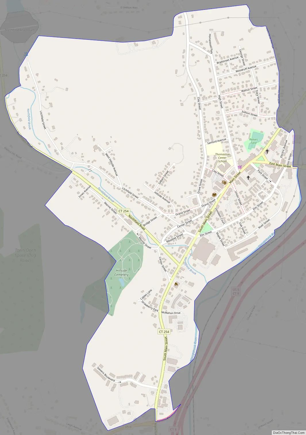
Thomaston is a census-designated place (CDP) in Litchfield County, Connecticut, United States. It comprises the downtown portion of the town of Thomaston. As of the 2010 census, the population of the CDP was 1,910, out of 7,887 in the entire town.
| Name: | Thomaston CDP |
|---|---|
| LSAD Code: | 57 |
| LSAD Description: | CDP (suffix) |
| State: | Connecticut |
| County: | Litchfield County |
| Elevation: | 393 ft (120 m) |
| Total Area: | 1.03 sq mi (2.66 km²) |
| Land Area: | 1.02 sq mi (2.64 km²) |
| Water Area: | 0.01 sq mi (0.03 km²) |
| Total Population: | 1,910 |
| Population Density: | 1,876/sq mi (724.5/km²) |
| ZIP code: | 06787 |
| FIPS code: | 0975660 |
| GNISfeature ID: | 2631577 |
Online Interactive Map
Click on ![]() to view map in "full screen" mode.
to view map in "full screen" mode.
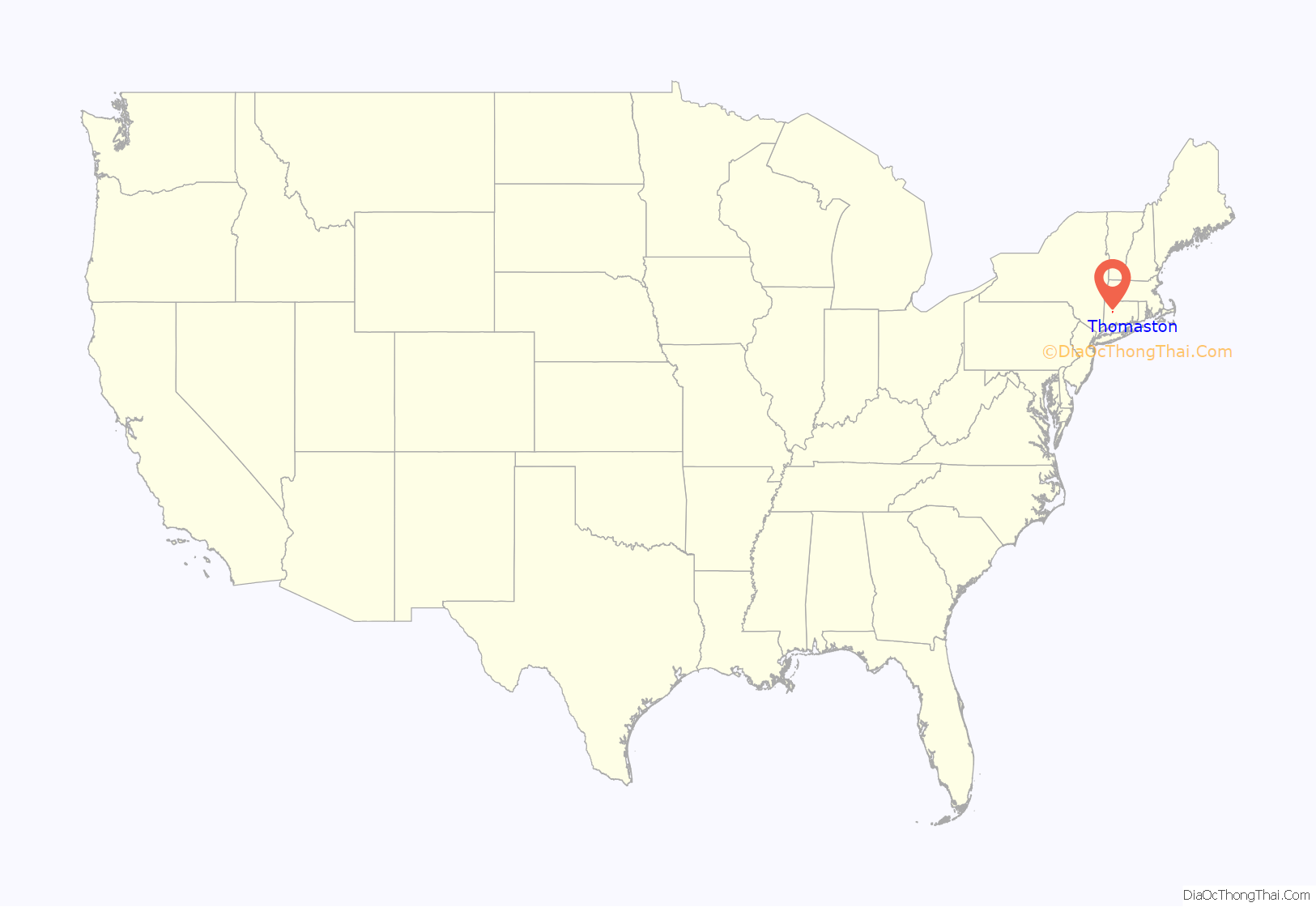
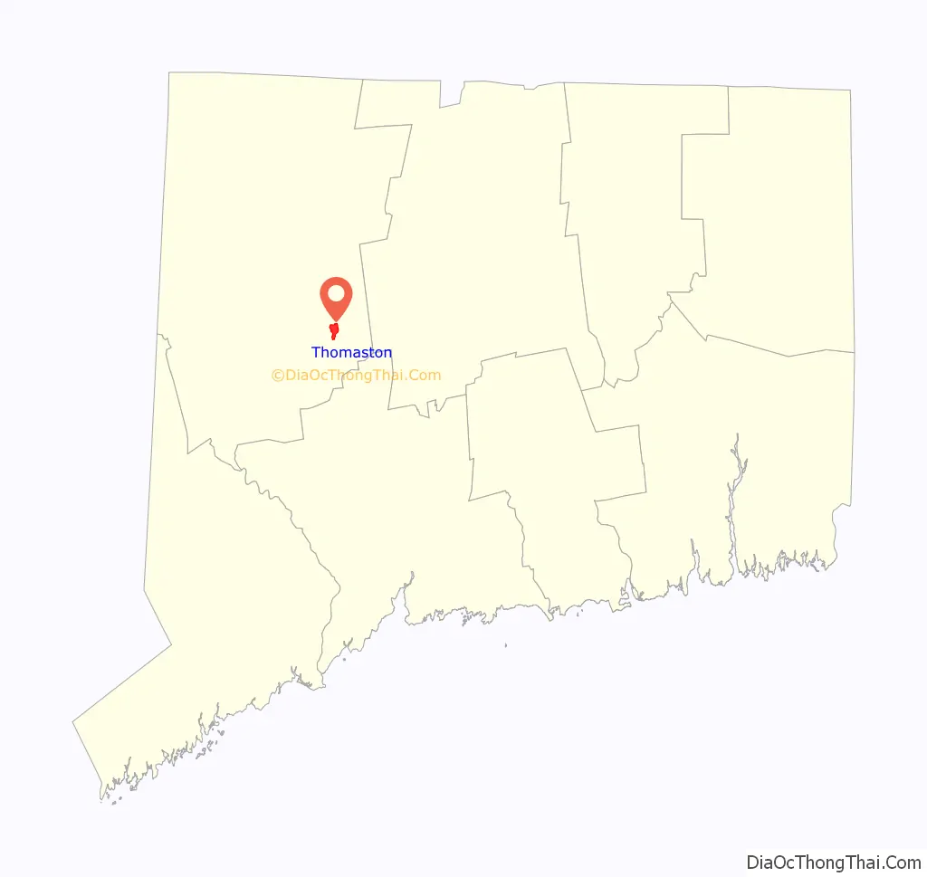
Thomaston location map. Where is Thomaston CDP?
Thomaston Road Map
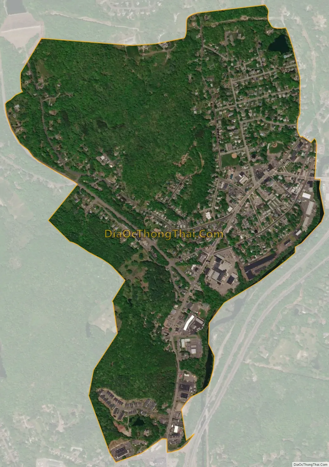
Thomaston city Satellite Map
Geography
The Thomaston CDP is slightly east of the geographic center of the town of Thomaston, on the west side of the Naugatuck River and its valley. It extends to the south as far as Watertown Road, to the west beyond Hillside Cemetery and to Northfield Brook, to the north to a powerline south of D. Welton Way, and to the east to Williams Street, Electric Avenue, and the Naugatuck River.
U.S. Route 6 follows Main Street through Thomaston; it leads east to Bristol and southwest to Watertown. The Connecticut Route 8 freeway passes east of the CDP, leading south 9 miles (14 km) to Waterbury.
According to the U.S. Census Bureau, the Thomaston CDP has a total area of 1.0 square mile (2.7 km), of which 0.01 square miles (0.03 km), or 0.95%, are water.
See also
Map of Connecticut State and its subdivision: Map of other states:- Alabama
- Alaska
- Arizona
- Arkansas
- California
- Colorado
- Connecticut
- Delaware
- District of Columbia
- Florida
- Georgia
- Hawaii
- Idaho
- Illinois
- Indiana
- Iowa
- Kansas
- Kentucky
- Louisiana
- Maine
- Maryland
- Massachusetts
- Michigan
- Minnesota
- Mississippi
- Missouri
- Montana
- Nebraska
- Nevada
- New Hampshire
- New Jersey
- New Mexico
- New York
- North Carolina
- North Dakota
- Ohio
- Oklahoma
- Oregon
- Pennsylvania
- Rhode Island
- South Carolina
- South Dakota
- Tennessee
- Texas
- Utah
- Vermont
- Virginia
- Washington
- West Virginia
- Wisconsin
- Wyoming