Abington is a town in Plymouth County, Massachusetts, United States, 20 miles (32 km) southeast of Boston. The population was 17,062 at the 2020 census.
| Name: | Abington CDP |
|---|---|
| LSAD Code: | 57 |
| LSAD Description: | CDP (suffix) |
| State: | Massachusetts |
| County: | Plymouth County |
| Incorporated: | 1712 |
| Elevation: | 108 ft (33 m) |
| Total Area: | 10.19 sq mi (26.39 km²) |
| Land Area: | 9.96 sq mi (25.80 km²) |
| Water Area: | 0.23 sq mi (0.59 km²) |
| Total Population: | 17,062 |
| Population Density: | 1,713.05/sq mi (661.42/km²) |
| ZIP code: | 02351 |
| Area code: | 339/781 |
| FIPS code: | 2500135 |
| GNISfeature ID: | 0618336 |
| Website: | www.abingtonma.gov |
Online Interactive Map
Click on ![]() to view map in "full screen" mode.
to view map in "full screen" mode.
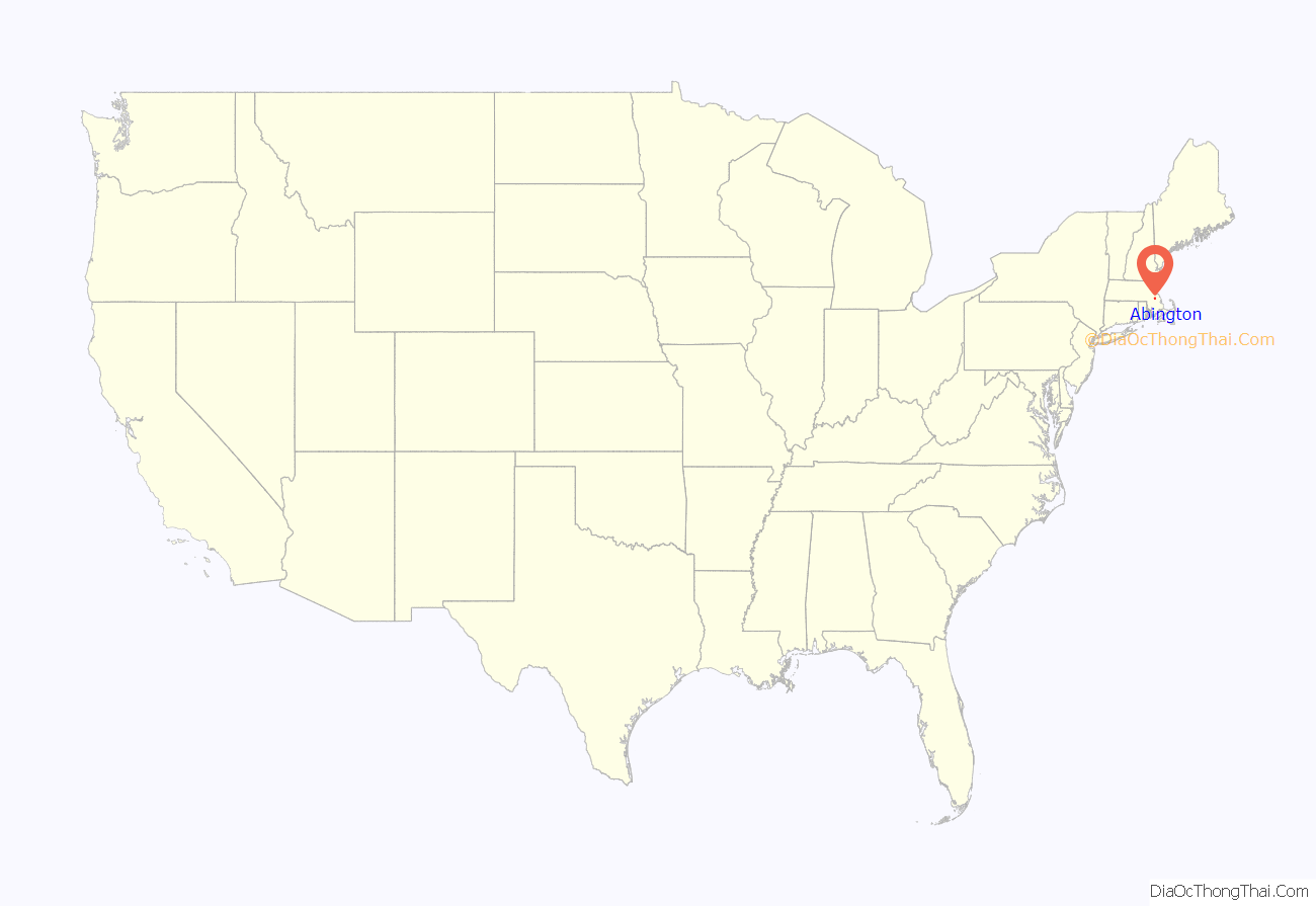
Abington location map. Where is Abington CDP?
History
Before the Europeans made their claim to the area, the local Native Americans referred to the area as Manamooskeagin, meaning “great green place of shaking grass”. Two streams in the area were named for the large beaver population: Schumacastacut or “upper beaver brook” and Schumacastuscacant or “lower beaver brook”.
Abington was first settled by European settlers in 1668. The lands included the current towns of Bridgewater, Rockland, Whitman, and parts of Hanover. The town was officially incorporated in 1712, having been named six years earlier by Governor Joseph Dudley as a tribute to Anne Venables-Bertie, Countess of Abingdon, wife of the second Earl of Abingdon, who helped him secure the governorship of the colony from Queen Anne. The Earl of Abingdon is named from Abingdon-on-Thames in Oxfordshire (then Berkshire), UK. Indeed, the original petition from Governor Dudley ordered that “the Town be named Abingdon”. A marginal note on the document gave the spelling as “Abington” as it has been known ever since.
In 1769, an iron foundry was established within the town. In 1815, Jesse Reed invented a machine that mass-produced tacks, which in turn led to the shoe industry becoming established in the town. During the nineteenth and early twentieth century, the manufacture of boots and shoes was its primary industry, with nearly half of the footwear provided for the Union Army during the Civil War being provided by Abington factories. From 1846 to 1865, Abington was a center of the abolitionist movement. In 1874 and 1875, the towns of Rockland and Whitman, respectively, separated and incorporated as towns.
In 1893, the town was the site of a riot between town constables and workers from the New York, New Haven & Hartford Railroad, over the town’s rights to build a streetcar line that crossed the railroad’s tracks. The town eventually built the line, and as a “peace offering”, the railroad built the North Abington Depot building, which was built in the style of H. H. Richardson.
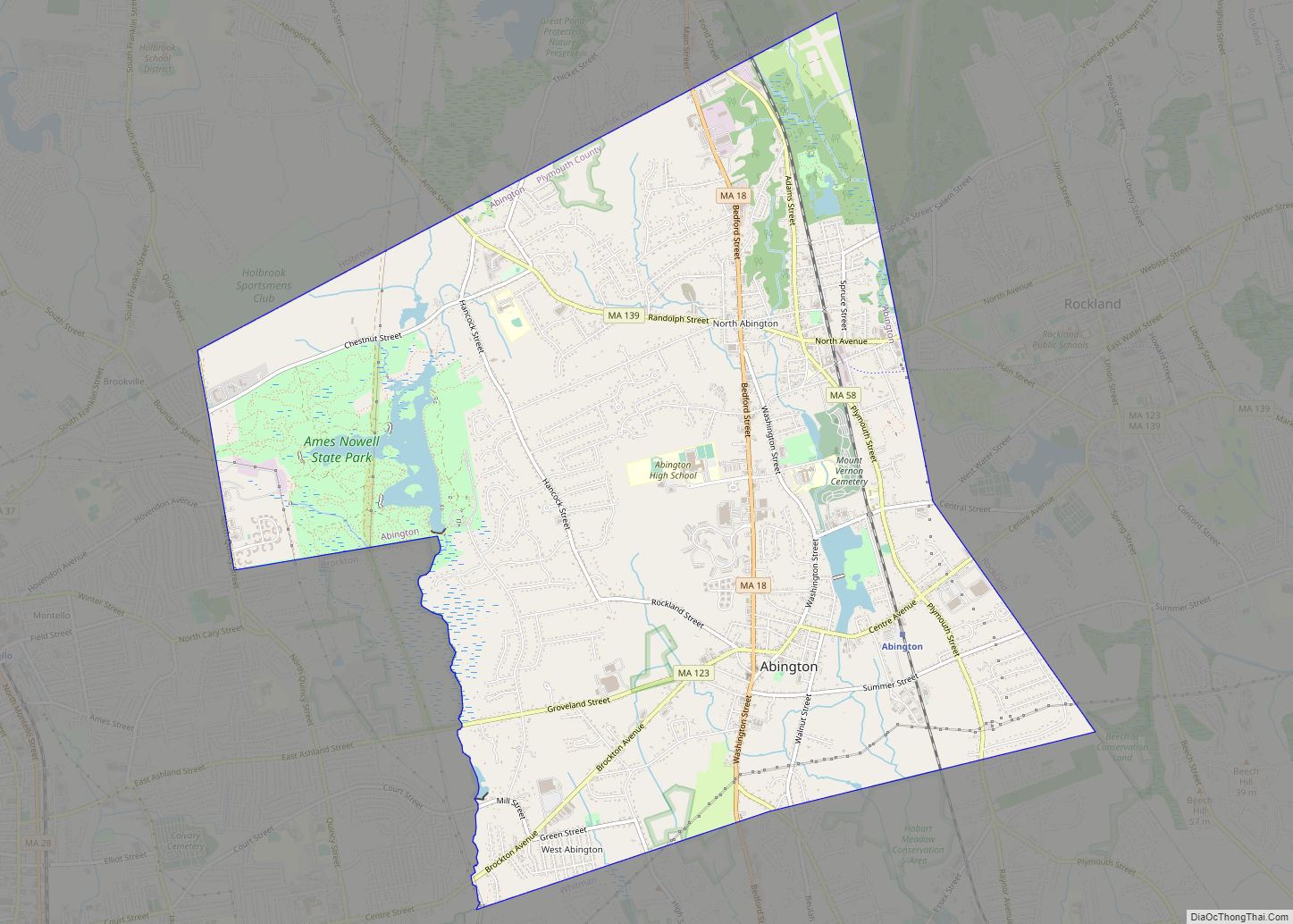
Abington Road Map
Abington city Satellite Map
Geography
Abington is located at 42°7′10″N 70°56′52″W / 42.11944°N 70.94778°W / 42.11944; -70.94778 (42.119534, –70.947876).
According to the United States Census Bureau, the town has a total area of 9.9 square miles (25.6 km), of which 9.7 square miles (25.0 km) is land and 0.23 square miles (0.6 km), or 2.41%, is water.
Abington ranks 308th of 351 communities in the Commonwealth, and is the fourth-smallest town (behind Hull, Whitman and Rockland) in Plymouth County. Abington is bordered by Holbrook to the northwest, Weymouth to the northeast, Rockland to the east, Whitman to the south, and Brockton to the west. Abington is considered to be an inland town of the South Shore, and is located approximately 20 miles (32 km) south of Boston.
Abington has two major waterways; the Shumatuscacant River to the west provides the town’s border with Brockton, and Beaver Brook runs through the eastern part of town; it was the source of much of the water power used by the shoe factories. In the northwestern corner of town lies Ames Nowell State Park, a large forested area around Cleveland Pond. Island Grove Pond was created in the 1700s, when a dam was built on the Shumatuscacant River. Much of the town’s population is centered on the eastern side of town, closer to the former town geographic center. The northeast corner of town is also the site of portions of the runways of the South Weymouth Naval Air Station, which was closed in 1997 as a part of the fourth round of BRAC base closures.
Climate
The climate in this area is characterized by hot, humid summers and generally mild to cool winters. According to the Köppen climate classification system, Abington has a humid subtropical climate, abbreviated “Cfa” on climate maps.
See also
Map of Massachusetts State and its subdivision: Map of other states:- Alabama
- Alaska
- Arizona
- Arkansas
- California
- Colorado
- Connecticut
- Delaware
- District of Columbia
- Florida
- Georgia
- Hawaii
- Idaho
- Illinois
- Indiana
- Iowa
- Kansas
- Kentucky
- Louisiana
- Maine
- Maryland
- Massachusetts
- Michigan
- Minnesota
- Mississippi
- Missouri
- Montana
- Nebraska
- Nevada
- New Hampshire
- New Jersey
- New Mexico
- New York
- North Carolina
- North Dakota
- Ohio
- Oklahoma
- Oregon
- Pennsylvania
- Rhode Island
- South Carolina
- South Dakota
- Tennessee
- Texas
- Utah
- Vermont
- Virginia
- Washington
- West Virginia
- Wisconsin
- Wyoming
