White Island Shores is a census-designated place (CDP) in the town of Wareham in Plymouth County, Massachusetts, United States, along the shores of White Island Pond. The population was 2,106 at the 2010 census.
| Name: | White Island Shores CDP |
|---|---|
| LSAD Code: | 57 |
| LSAD Description: | CDP (suffix) |
| State: | Massachusetts |
| County: | Plymouth County |
| Elevation: | 82 ft (25 m) |
| Total Area: | 1.30 sq mi (3.37 km²) |
| Land Area: | 1.16 sq mi (3.00 km²) |
| Water Area: | 0.14 sq mi (0.37 km²) |
| Total Population: | 2,180 |
| Population Density: | 1,882.56/sq mi (726.98/km²) |
| FIPS code: | 2579390 |
| GNISfeature ID: | 0615470 |
Online Interactive Map
Click on ![]() to view map in "full screen" mode.
to view map in "full screen" mode.
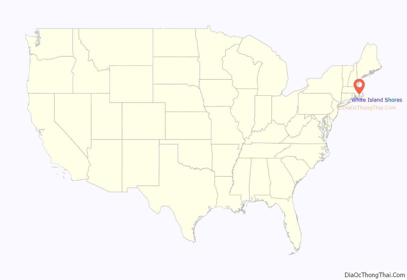
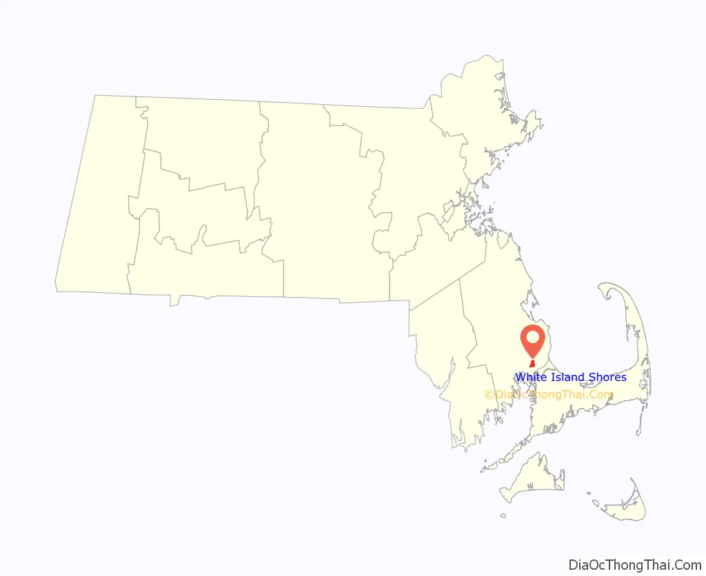
White Island Shores location map. Where is White Island Shores CDP?
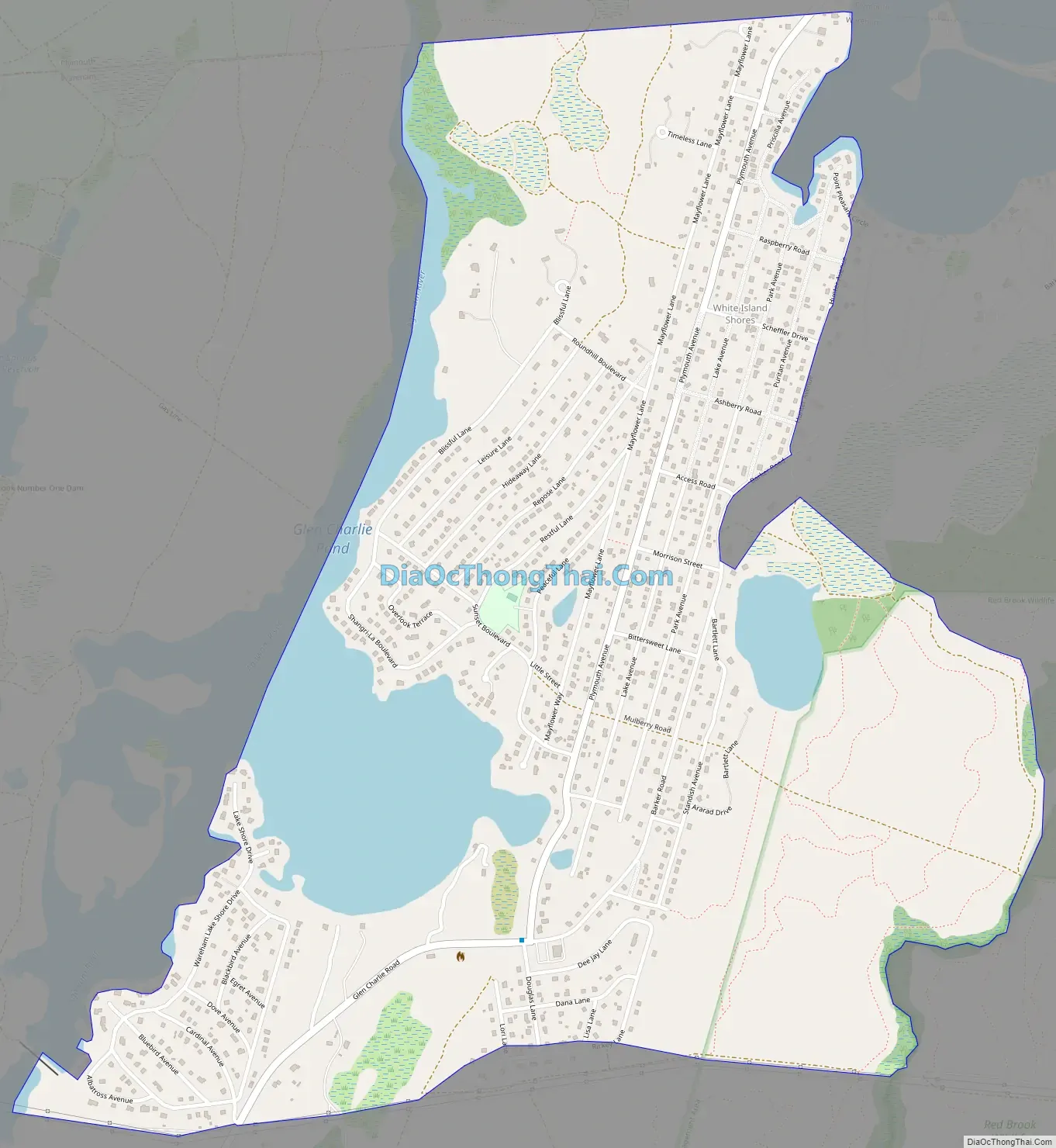
White Island Shores Road Map
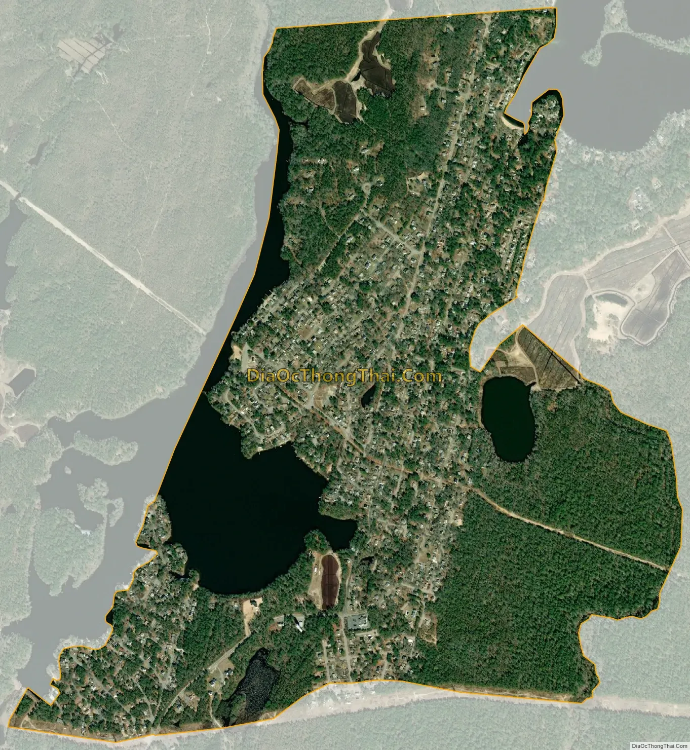
White Island Shores city Satellite Map
Geography
White Island Shores is located at 41°47′38″N 70°38′19″W / 41.79389°N 70.63861°W / 41.79389; -70.63861 (41.793928, -70.638531).
According to the United States Census Bureau, the CDP has a total area of 3.4 km (1.3 mi), of which 3.0 km (1.2 mi) is land and 0.4 km (0.2 mi) (11.36%) is water.
White Island Shores is also home to a new, A.D Makepeace, development, Redbrook. Redbrook is home to multiple restaurants, the Old Colony YMCA, retail spaces, healthcare buildings, apartments, and many single family homes.
See also
Map of Massachusetts State and its subdivision: Map of other states:- Alabama
- Alaska
- Arizona
- Arkansas
- California
- Colorado
- Connecticut
- Delaware
- District of Columbia
- Florida
- Georgia
- Hawaii
- Idaho
- Illinois
- Indiana
- Iowa
- Kansas
- Kentucky
- Louisiana
- Maine
- Maryland
- Massachusetts
- Michigan
- Minnesota
- Mississippi
- Missouri
- Montana
- Nebraska
- Nevada
- New Hampshire
- New Jersey
- New Mexico
- New York
- North Carolina
- North Dakota
- Ohio
- Oklahoma
- Oregon
- Pennsylvania
- Rhode Island
- South Carolina
- South Dakota
- Tennessee
- Texas
- Utah
- Vermont
- Virginia
- Washington
- West Virginia
- Wisconsin
- Wyoming