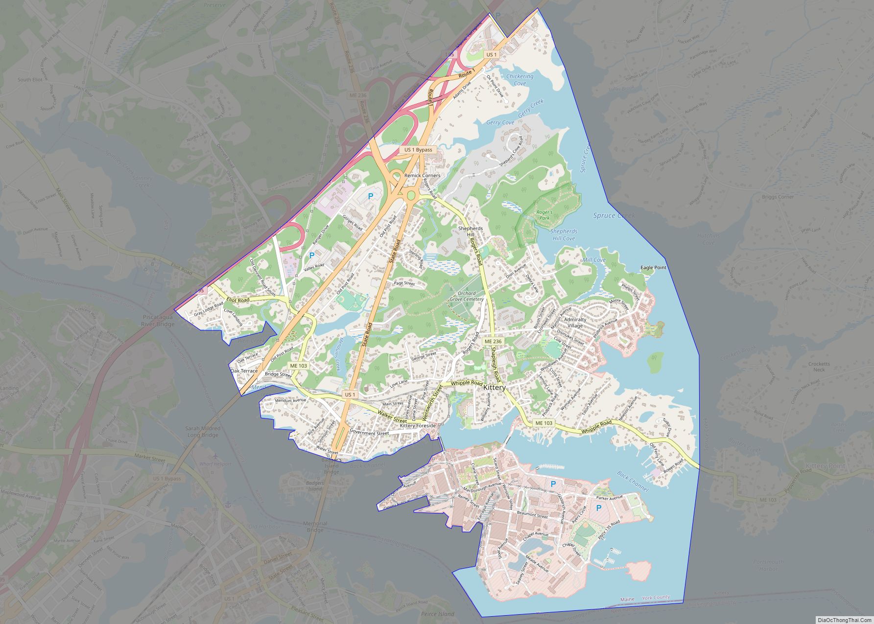
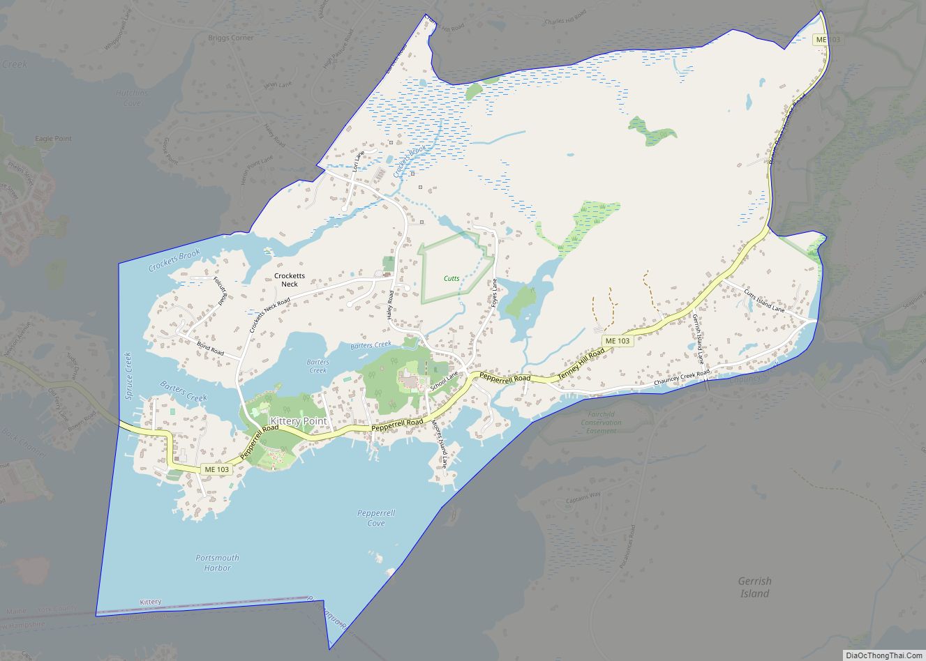
Kittery Point is a census-designated place (CDP) in the town of Kittery, York County, Maine, United States. First settled in 1623, Kittery Point traces its history to the first seafarers who colonized the shore of what became Massachusetts Bay Colony and later the State of Maine. Located beside the Atlantic Ocean, it is home to Fort McClary State Historic Site, and Fort Foster Park on Gerrish Island. Cutts Island is home to Seapoint Beach and the Brave Boat Harbor Division of the Rachel Carson National Wildlife Refuge.
Kittery Point is part of the Portland–South Portland–Biddeford, Maine Metropolitan Statistical Area. The population was 1,012 at the 2010 census.
| Name: | Kittery Point CDP |
|---|---|
| LSAD Code: | 57 |
| LSAD Description: | CDP (suffix) |
| State: | Maine |
| County: | York County |
| Elevation: | 43 ft (13 m) |
| Total Area: | 2.57 sq mi (6.66 km²) |
| Land Area: | 1.91 sq mi (4.94 km²) |
| Water Area: | 0.66 sq mi (1.72 km²) |
| Total Population: | 1,009 |
| Population Density: | 528.83/sq mi (204.18/km²) |
| ZIP code: | 03905 |
| Area code: | 207 |
| FIPS code: | 2337375 |
| GNISfeature ID: | 0569232 |
Online Interactive Map
Click on ![]() to view map in "full screen" mode.
to view map in "full screen" mode.
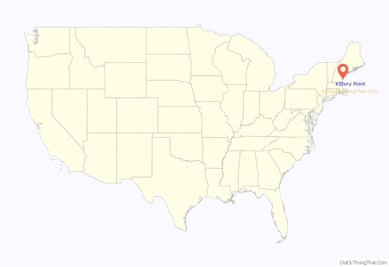
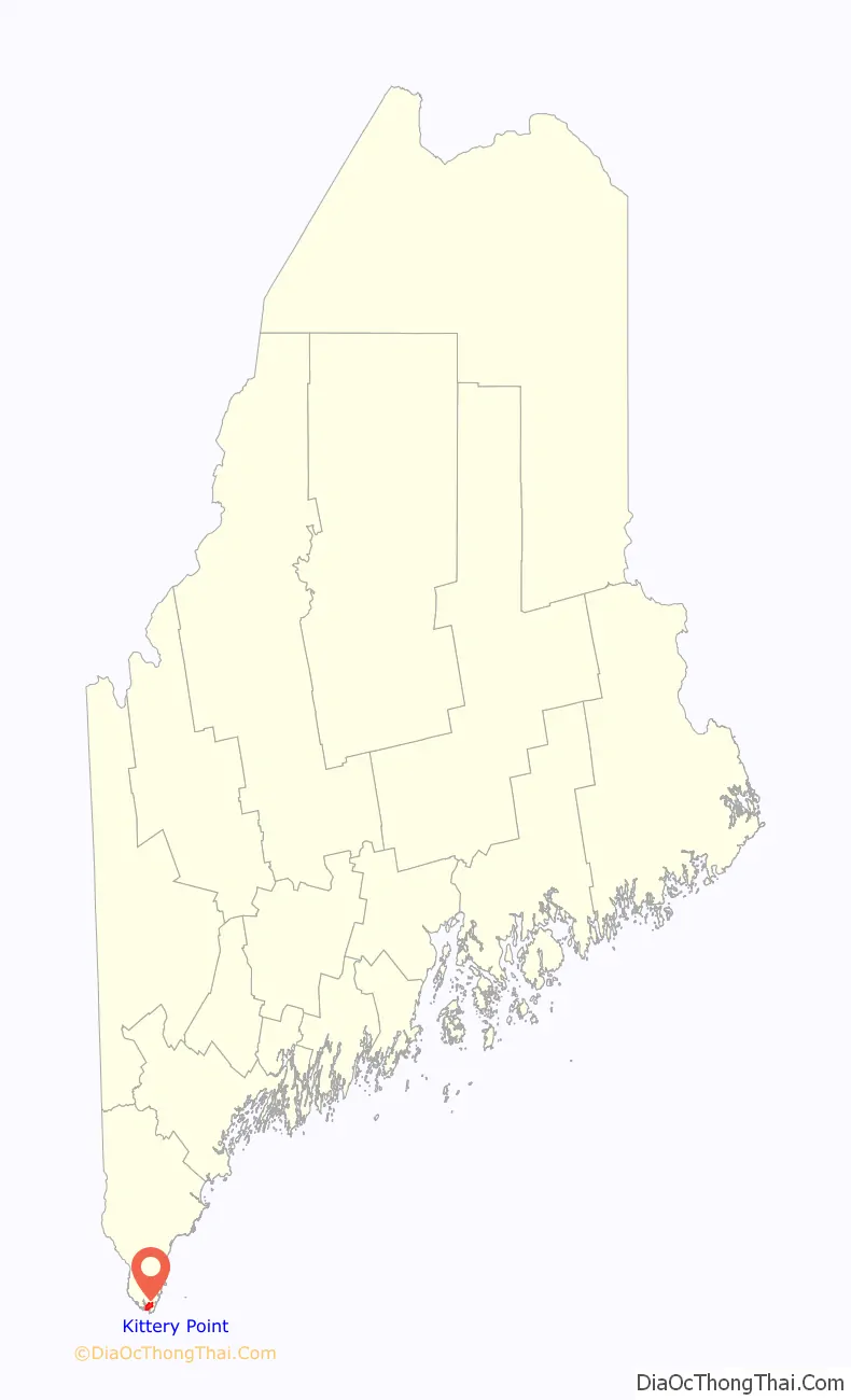
Kittery Point location map. Where is Kittery Point CDP?
History
Settled as early as 1623, the southern part of Kittery was once called Champernowne’s after Sir Francis Champernowne, a prominent merchant adventurer and cousin of Sir Ferdinando Gorges, the prime mover behind settlement north of the Massachusetts Bay Colony. Nicholas Shapleigh built the first house in the area, and Edward Godfrey established a trading post in 1632. Early professions included fishermen, hunters and trappers. Others harvested the region’s abundant timber, which was shipped to England or the West Indies. The town of Kittery was incorporated in 1652 when Maine became part of the Massachusetts Bay Colony.
The Pepperrells were a distinguished Kittery Point family who established fisheries to supply the London market. William Pepperrell Sr. had arrived from Devonshire as a lowly fisherman’s apprentice at the Isles of Shoals in New Hampshire. He went on to build a mercantile empire, which his son Sir William Pepperrell inherited and expanded. Sir William became the first baronet in New England for commanding a militia which defeated the French in 1745 at the Siege of Louisbourg. His gambrel mansion of 1733 remains a landmark at Pepperrell Cove on the Piscataqua River. In 1760, his widow built the Lady Pepperrell House, a noted Georgian building formerly owned by Historic New England.
Pepperrell himself built an elaborate wooden house called the Sparhawk Mansion at Kittery Point as a gift to his daughter on her marriage to Nathaniel Sparhawk in 1750. Crowned with an elegant cupola, the house contained finely carved panelling in its 19 rooms. Sadly, over two centuries later, in 1967 the Sparhawk Mansion was demolished, just as preservation efforts in the area were emerging. More fortunate is the John Bray House, built by a shipwright in 1662 and considered the oldest surviving house in Maine. Recently threatened with redevelopment because of its desirable view of Pepperrell Cove and Portsmouth Harbor, the building has instead been restored. Some speculate that the Bray House was the birthplace of the mother of Sir William Pepperrell, whose father William Pepperrell Sr. married John Bray’s daughter Margery, but it is more likely that she was born in England.
On land once owned by Sir William Pepperrell is a Portsmouth Harbor defense called Fort McClary, built opposite Fort Constitution in New Castle, New Hampshire. It is today Fort McClary State Historic Site and features a blockhouse dating from 1844. In 1969, it was listed on the National Register of Historic Places. Fort Foster, a later coastal defense, was built by the federal government on 92 acres (370,000 m) at Gerrish Island. Now owned by the town of Kittery, Fort Foster Park provides superb views of Portsmouth Harbor, Whaleback Lighthouse and the Isles of Shoals, part of which belongs to Kittery. Near Seapoint Beach in the mid-20th century, the Newcomen Society built a cluster of Tudor cottages at what was then its summer retreat.
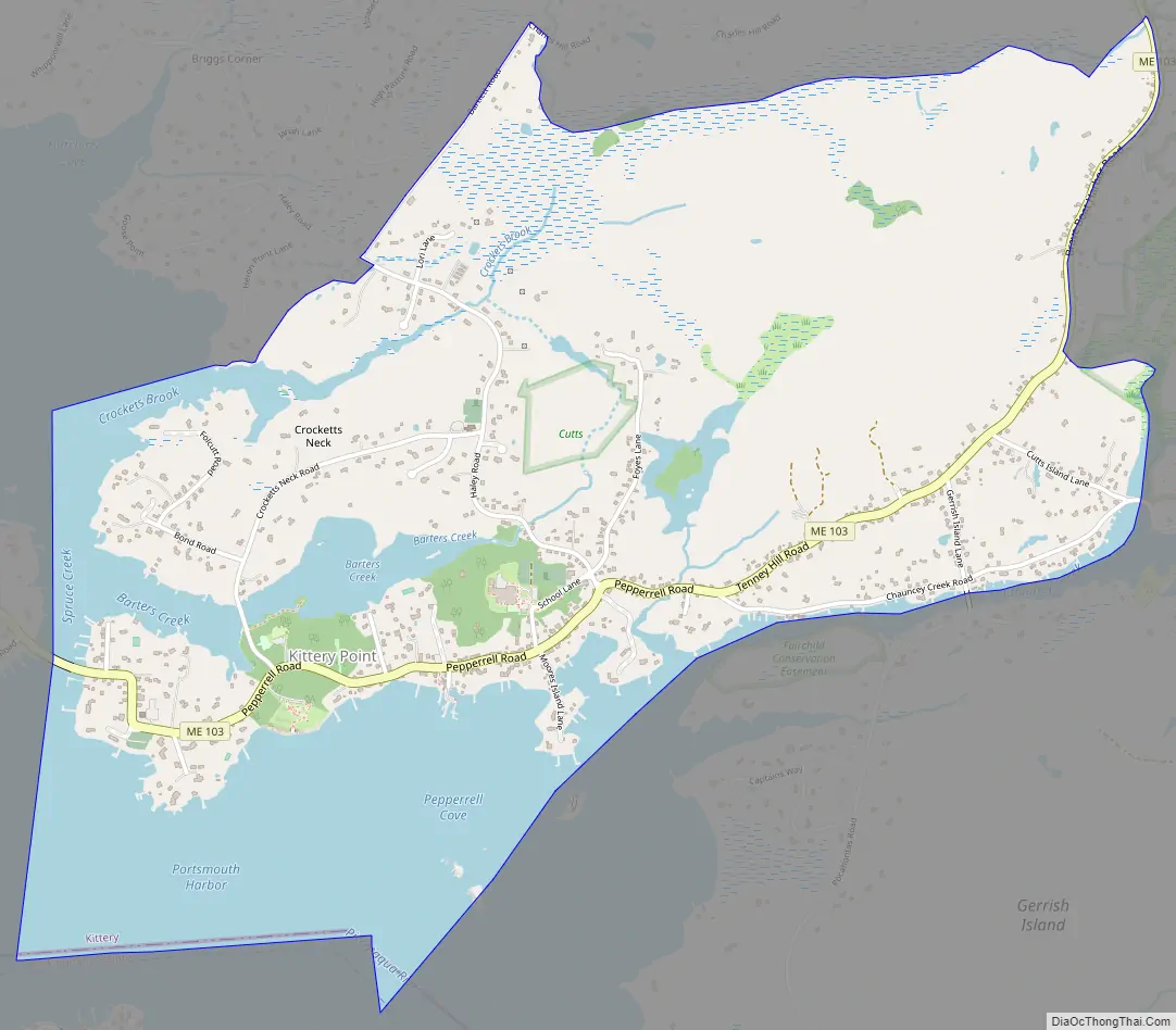
Kittery Point Road Map
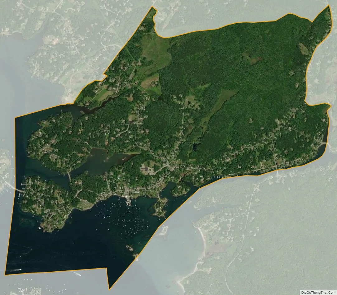
Kittery Point city Satellite Map
Geography
According to the United States Census Bureau, the CDP has a total area of 2.6 square miles (6.7 km), of which 1.9 square miles (4.9 km) is land and 1.7 square kilometres (0.66 sq mi) (25.83%) is water. Kittery Point is bounded by Spruce Creek, the Piscataqua River, the Atlantic Ocean and Brave Boat Harbor.
See also
Map of Maine State and its subdivision: Map of other states:- Alabama
- Alaska
- Arizona
- Arkansas
- California
- Colorado
- Connecticut
- Delaware
- District of Columbia
- Florida
- Georgia
- Hawaii
- Idaho
- Illinois
- Indiana
- Iowa
- Kansas
- Kentucky
- Louisiana
- Maine
- Maryland
- Massachusetts
- Michigan
- Minnesota
- Mississippi
- Missouri
- Montana
- Nebraska
- Nevada
- New Hampshire
- New Jersey
- New Mexico
- New York
- North Carolina
- North Dakota
- Ohio
- Oklahoma
- Oregon
- Pennsylvania
- Rhode Island
- South Carolina
- South Dakota
- Tennessee
- Texas
- Utah
- Vermont
- Virginia
- Washington
- West Virginia
- Wisconsin
- Wyoming