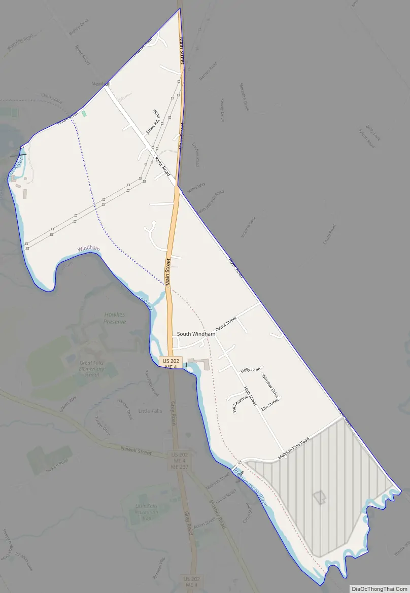
South Windham is a census-designated place (CDP) in the town of Windham in Cumberland County, Maine, United States. The population of the CDP was 1,374 at the 2010 census. Prior to 2010, South Windham was part of the Little Falls-South Windham census-designated place.
It is part of the Portland–South Portland–Biddeford, Maine Metropolitan Statistical Area.
| Name: | South Windham CDP |
|---|---|
| LSAD Code: | 57 |
| LSAD Description: | CDP (suffix) |
| State: | Maine |
| County: | Cumberland County |
| Elevation: | 154 ft (47 m) |
| Total Area: | 1.26 sq mi (3.27 km²) |
| Land Area: | 1.19 sq mi (3.09 km²) |
| Water Area: | 0.07 sq mi (0.17 km²) |
| Total Population: | 1,215 |
| Population Density: | 1,017.59/sq mi (392.87/km²) |
| Area code: | 207 |
| FIPS code: | 2372900 |
Online Interactive Map
Click on ![]() to view map in "full screen" mode.
to view map in "full screen" mode.
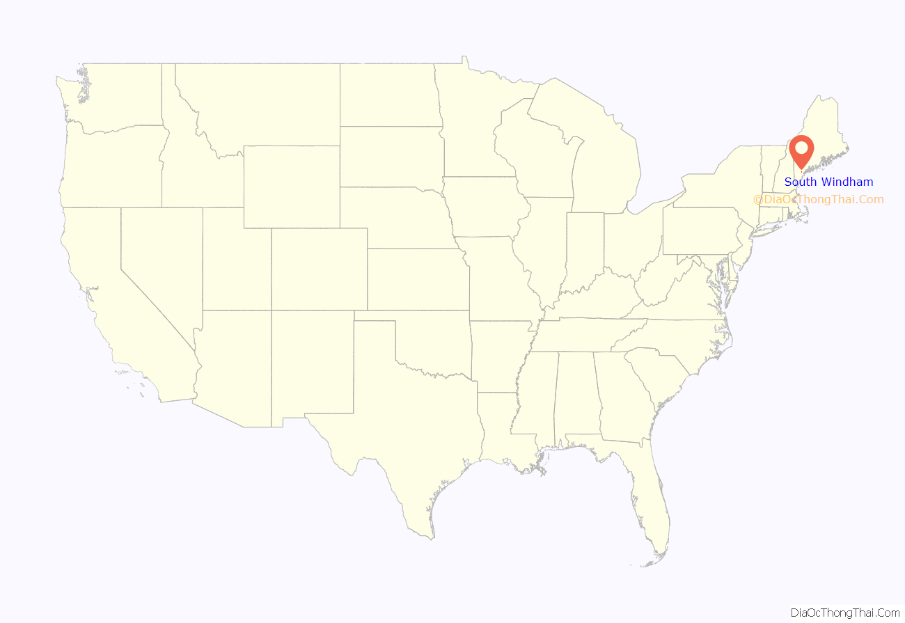
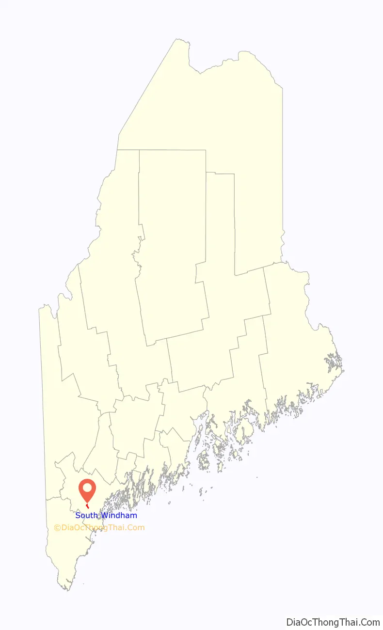
South Windham location map. Where is South Windham CDP?
History
The Presumpscot River was an early transportation corridor to interior Maine; and provided reliable water power at Little Falls. Major William Knight was operating a sawmill at the falls in 1756. As the local forests were cleared, the sawmill was replaced by William Johnson’s grist mill and a wool carding mill operated by Leonard Bacon and Lathrop Crockett. Locks were constructed around the falls to complete the Cumberland and Oxford Canal in 1832. The canal fell into disuse after the Portland and Ogdensburg Railway was completed through South Windham in 1875. Maine Central Railroad leased the railway as their Mountain Division in 1888. Availability of year-round transportation encouraged C.A. Brown and Company to build a large brick wood-paper board factory at South Windham in 1875. Androscoggin Pulp Company purchased the factory, and the industrial village of South Windham developed around the pulp mill. On April 4, 1919, the legislature passed an act creating the Reformatory for Men at South Windham. It is now the Maine Correctional Center, a minimum to medium security facility for men and women.
South Windham Road Map
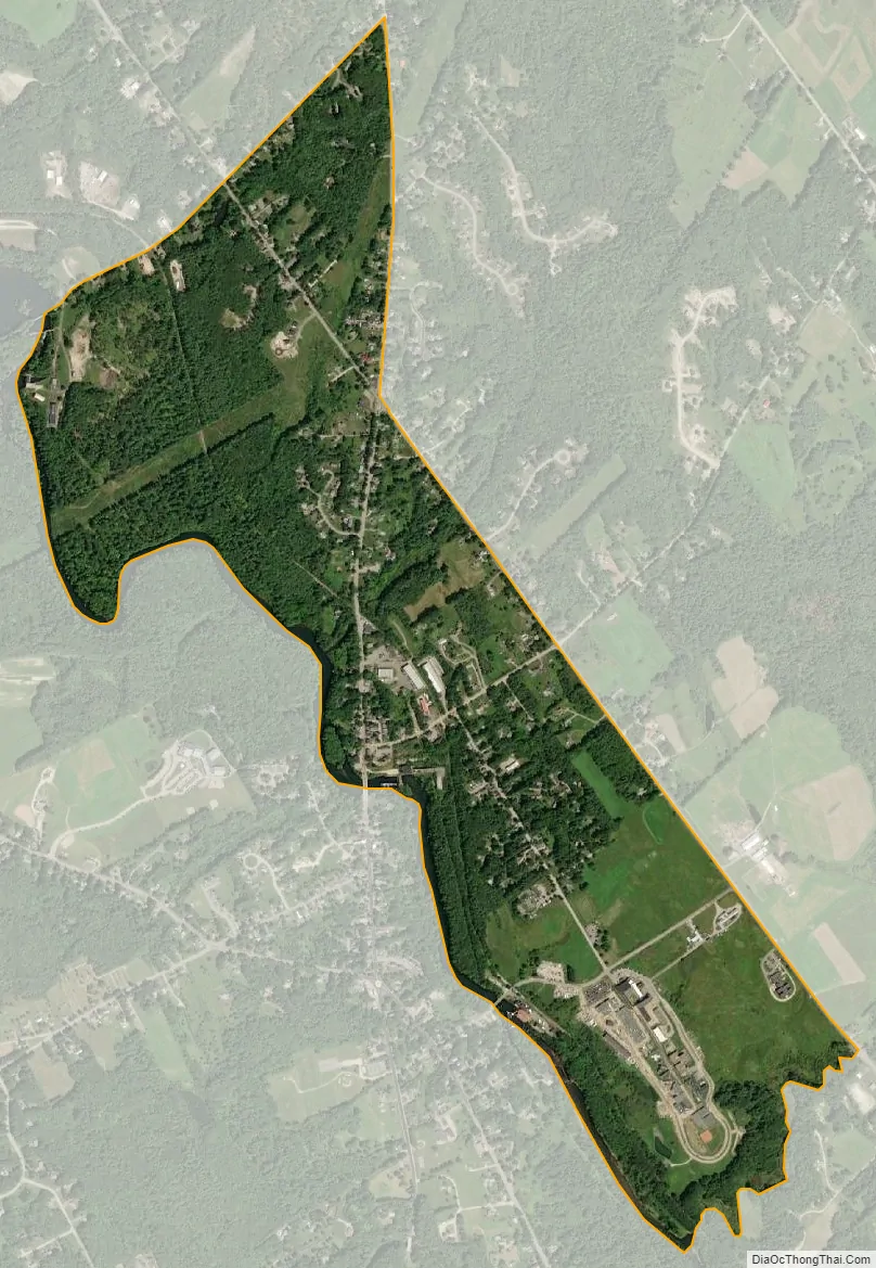
South Windham city Satellite Map
Geography
South Windham is located at 43°44′10″N 70°25′19″W / 43.73611°N 70.42194°W / 43.73611; -70.42194, along the Presumpscot River. According to the United States Census Bureau, the CDP has a total area of 1.3 square miles (3.3 km), of which 1.2 square miles (3.1 km) is land and 0.077 square miles (0.2 km), or 5.31%, is water.
The CDP of Little Falls is located directly across the Presumpscot River, in the town of Gorham. U.S. Route 202 and Maine State Route 4 run north-south in a concurrency through both communities.
See also
Map of Maine State and its subdivision: Map of other states:- Alabama
- Alaska
- Arizona
- Arkansas
- California
- Colorado
- Connecticut
- Delaware
- District of Columbia
- Florida
- Georgia
- Hawaii
- Idaho
- Illinois
- Indiana
- Iowa
- Kansas
- Kentucky
- Louisiana
- Maine
- Maryland
- Massachusetts
- Michigan
- Minnesota
- Mississippi
- Missouri
- Montana
- Nebraska
- Nevada
- New Hampshire
- New Jersey
- New Mexico
- New York
- North Carolina
- North Dakota
- Ohio
- Oklahoma
- Oregon
- Pennsylvania
- Rhode Island
- South Carolina
- South Dakota
- Tennessee
- Texas
- Utah
- Vermont
- Virginia
- Washington
- West Virginia
- Wisconsin
- Wyoming