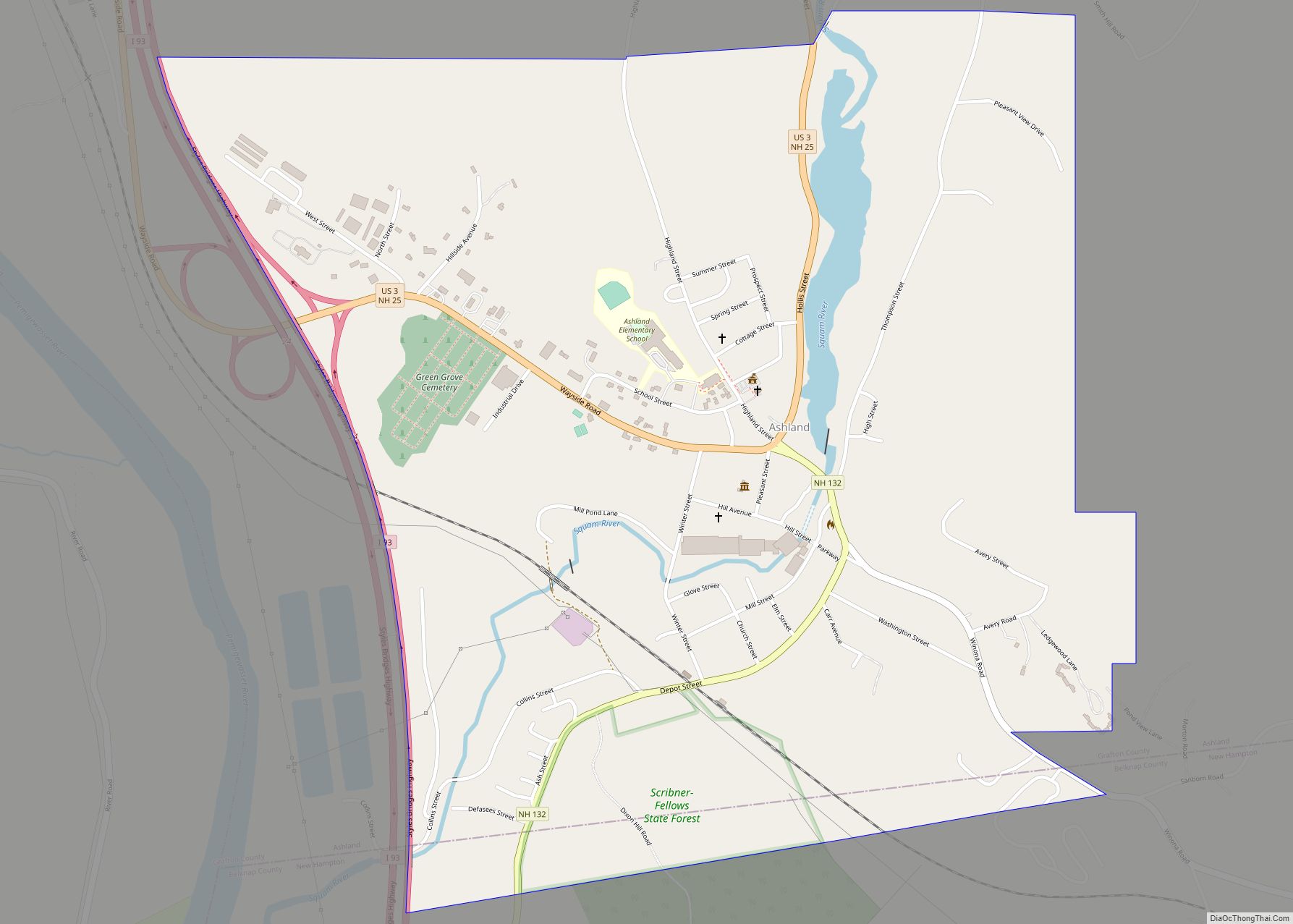
Ashland is a census-designated place (CDP) and the main village in the town of Ashland in Grafton County, New Hampshire, United States. The population of the CDP was 1,082 at the 2020 census, out of 1,938 in the entire town.
| Name: | Ashland CDP |
|---|---|
| LSAD Code: | 57 |
| LSAD Description: | CDP (suffix) |
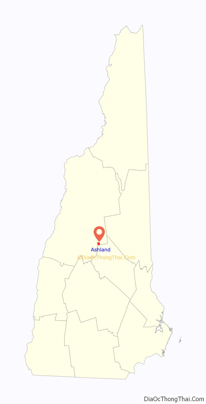
| State: | New Hampshire |
| County: | Grafton County |
| Elevation: | 560 ft (170 m) |
| Total Area: | 1.37 sq mi (3.54 km²) |
| Land Area: | 1.33 sq mi (3.45 km²) |
| Water Area: | 0.03 sq mi (0.09 km²) |
| Total Population: | 1,082 |
| Population Density: | 812.31/sq mi (313.64/km²) |
| ZIP code: | 03217 |
| Area code: | 603 |
| FIPS code: | 3301940 |
| GNISfeature ID: | 2629711 |
Online Interactive Map
Click on ![]() to view map in "full screen" mode.
to view map in "full screen" mode.
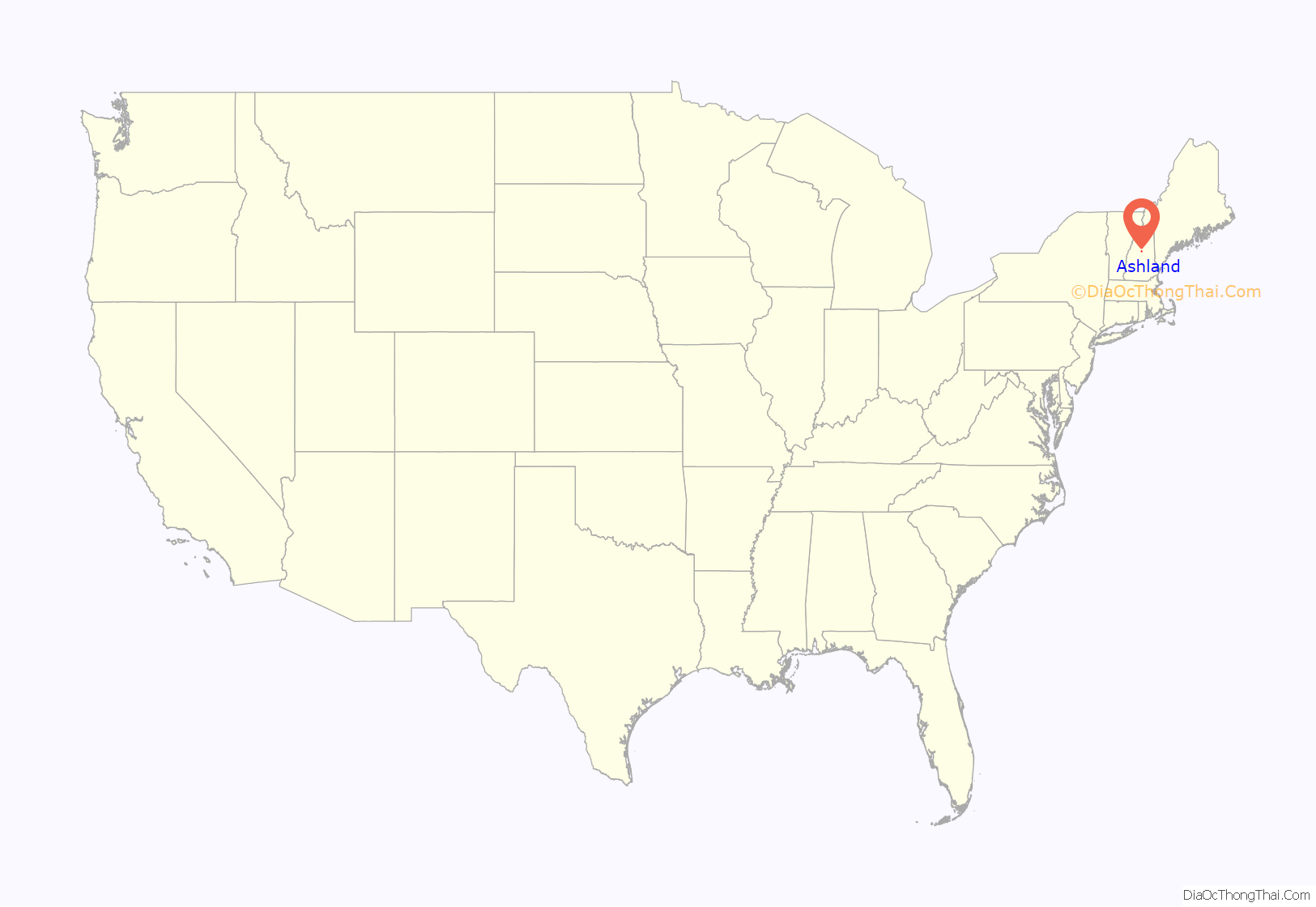
Ashland location map. Where is Ashland CDP?
Ashland Road Map
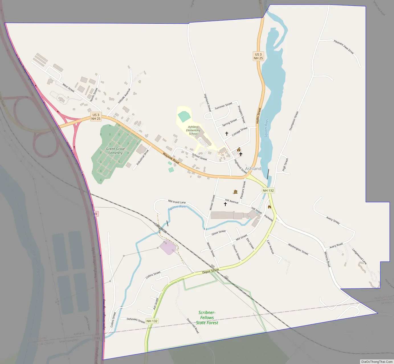
Ashland city Satellite Map
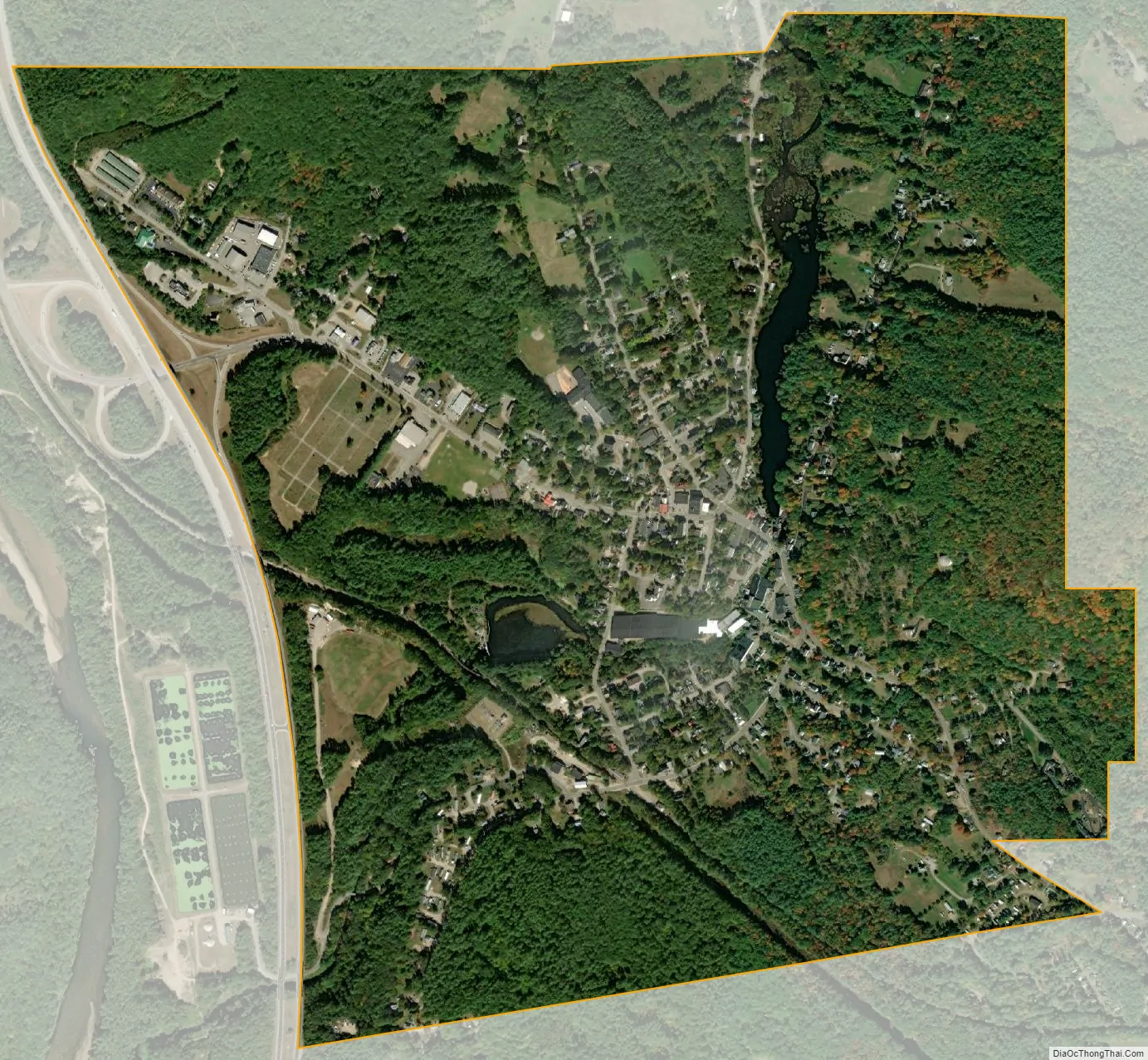
Geography
The CDP is in the southwestern part of the town of Ashland, on both sides of the Squam River, which descends 50 feet (15 m) through the center of town. The CDP is bordered to the south by the town of New Hampton and to the west by Interstate 93. The northern border of the CDP runs east and west from the junction of River Street with U.S. Route 3 just south of the dam on the Squam River that controls the elevations Little Squam Lake and Squam Lake, while the eastern edge of the CDP is east of Thompson Street and Ledgewood Lane.
U.S. Route 3 and New Hampshire Route 25 run through the center of Ashland, leading northeast (US 3 southbound and NH 25 eastbound) 4 miles (6 km) to Holderness and northwest (US 3 northbound and NH 25 westbound) 6 miles (10 km) to Plymouth. Interstate 93 crosses Routes 3 and 25 on the west side of the CDP at Exit 24; I-93 leads north 49 miles (79 km) to Littleton and south 37 miles (60 km) to Concord. New Hampshire Route 132 runs south from Routes 3 and 25 in the center of Ashland 7 miles (11 km) to New Hampton.
According to the U.S. Census Bureau, the Ashland CDP has a total area of 1.4 square miles (3.5 km), of which 1.3 square miles (3.4 km) are land and 0.04 square miles (0.1 km), or 2.59%, are water.
See also
Map of New Hampshire State and its subdivision: Map of other states:- Alabama
- Alaska
- Arizona
- Arkansas
- California
- Colorado
- Connecticut
- Delaware
- District of Columbia
- Florida
- Georgia
- Hawaii
- Idaho
- Illinois
- Indiana
- Iowa
- Kansas
- Kentucky
- Louisiana
- Maine
- Maryland
- Massachusetts
- Michigan
- Minnesota
- Mississippi
- Missouri
- Montana
- Nebraska
- Nevada
- New Hampshire
- New Jersey
- New Mexico
- New York
- North Carolina
- North Dakota
- Ohio
- Oklahoma
- Oregon
- Pennsylvania
- Rhode Island
- South Carolina
- South Dakota
- Tennessee
- Texas
- Utah
- Vermont
- Virginia
- Washington
- West Virginia
- Wisconsin
- Wyoming