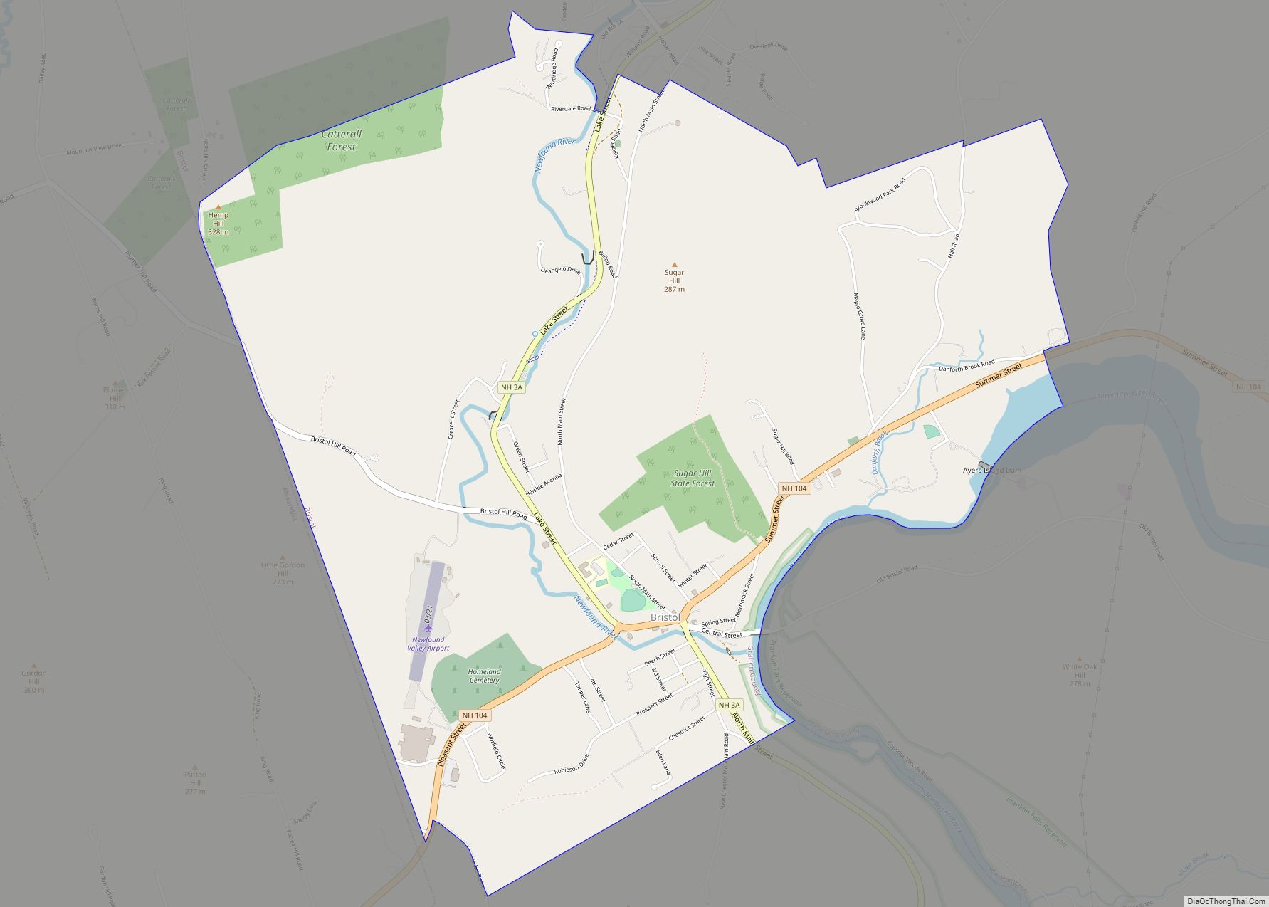
Bristol is a census-designated place (CDP) and the main village in the town of Bristol in Grafton County, New Hampshire, United States. The population of the CDP was 1,911 at the 2020 census, out of 3,244 in the entire town.
| Name: | Bristol CDP |
|---|---|
| LSAD Code: | 57 |
| LSAD Description: | CDP (suffix) |
| State: | New Hampshire |
| County: | Grafton County |
| Elevation: | 470 ft (140 m) |
| Total Area: | 4.07 sq mi (10.55 km²) |
| Land Area: | 4.01 sq mi (10.39 km²) |
| Water Area: | 0.06 sq mi (0.16 km²) |
| Total Population: | 1,911 |
| Population Density: | 476.56/sq mi (183.98/km²) |
| ZIP code: | 03222 |
| Area code: | 603 |
| FIPS code: | 3307620 |
| GNISfeature ID: | 2378054 |
Online Interactive Map
Click on ![]() to view map in "full screen" mode.
to view map in "full screen" mode.
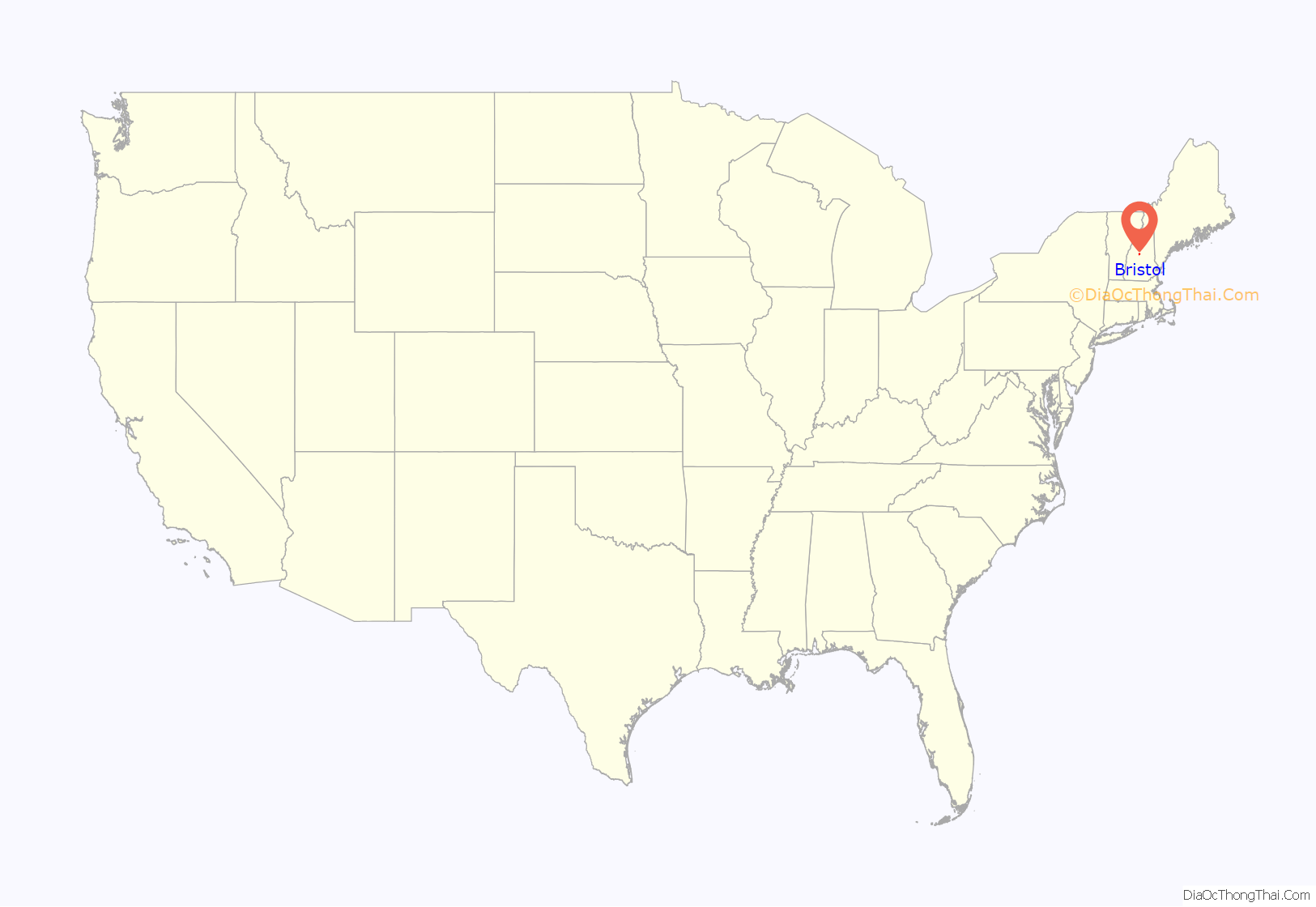
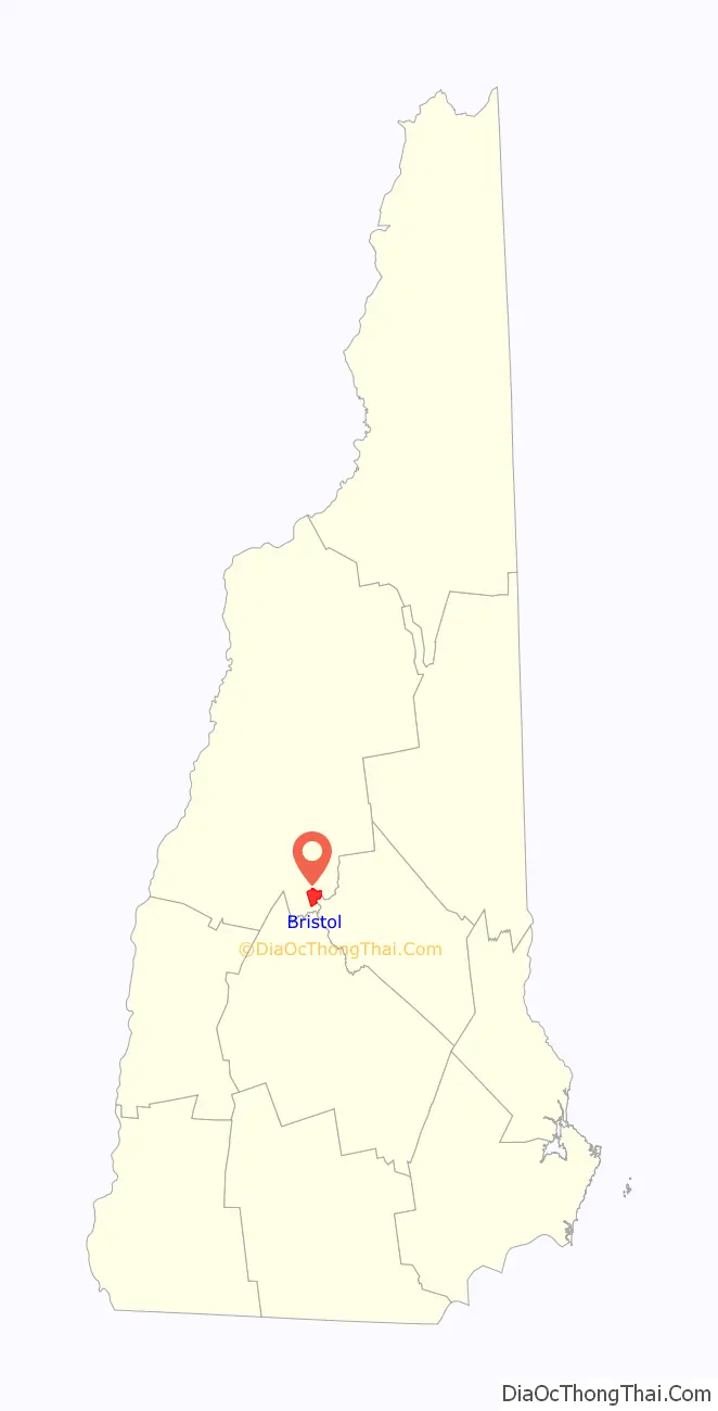
Bristol location map. Where is Bristol CDP?
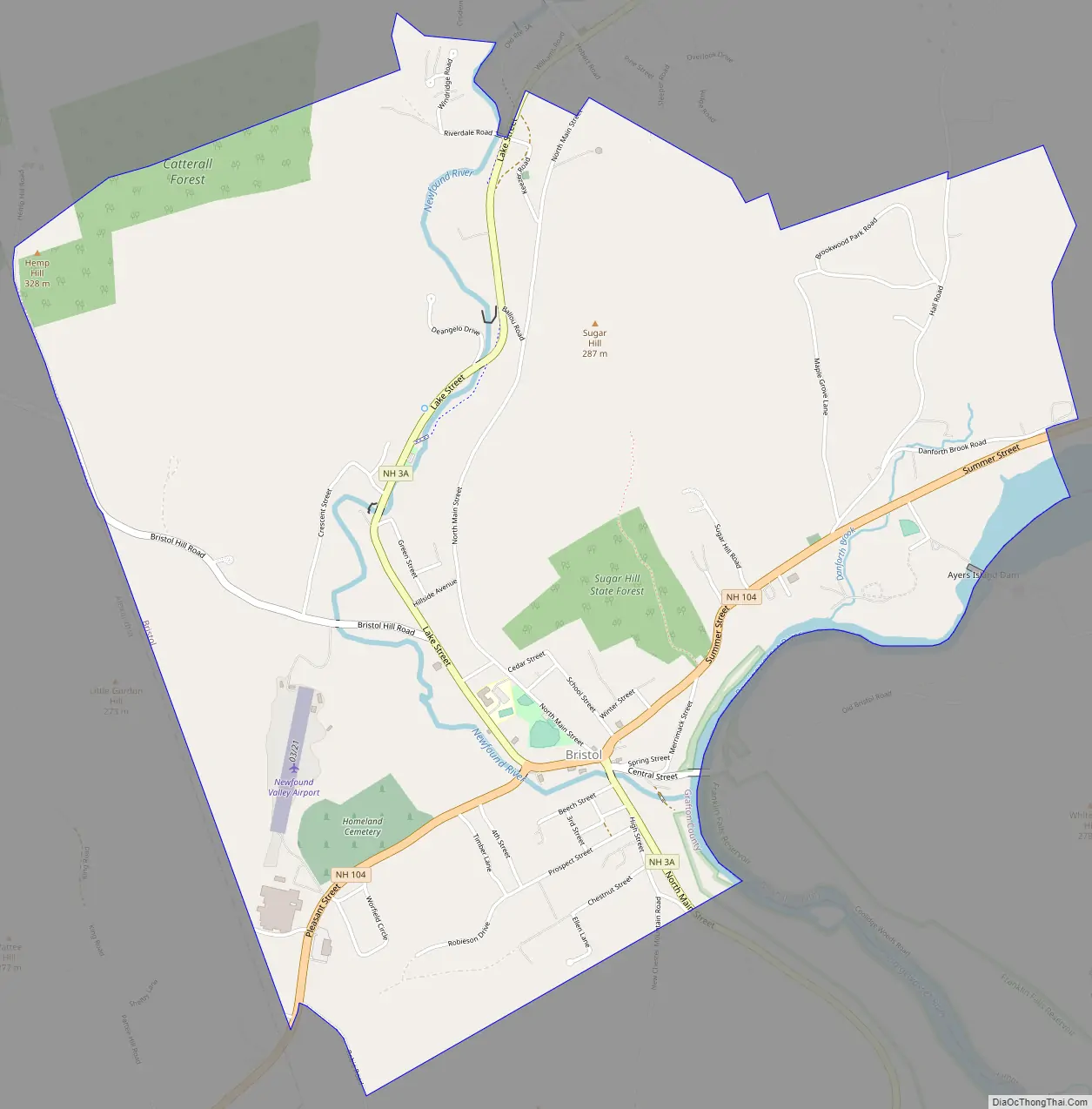
Bristol Road Map
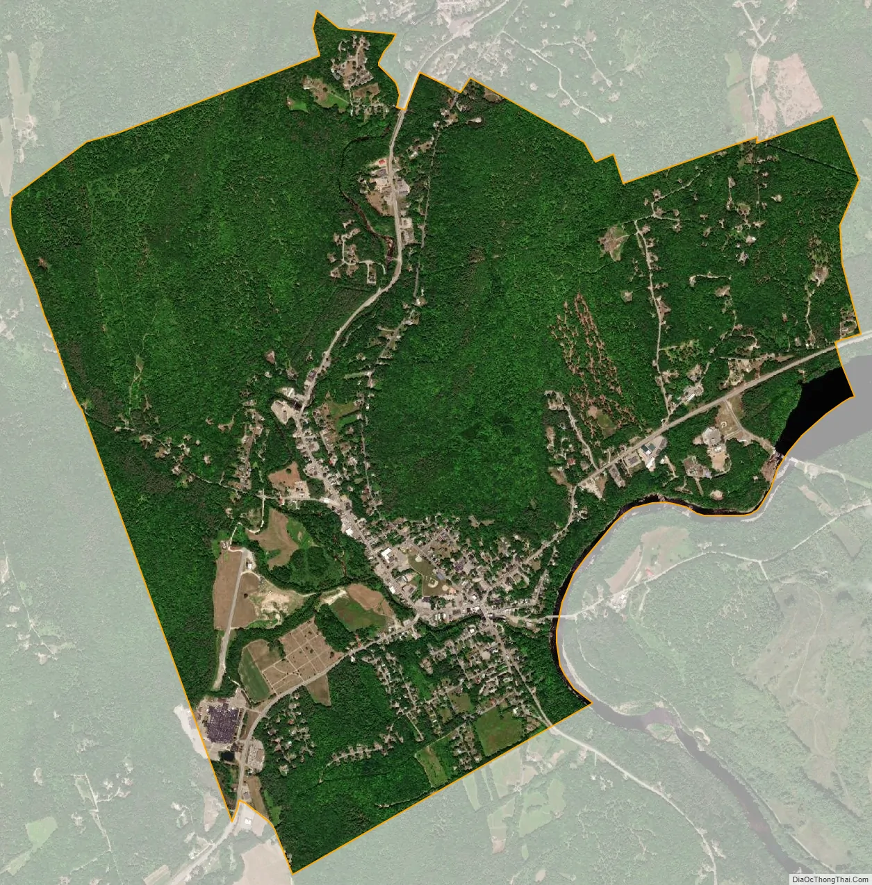
Bristol city Satellite Map
Geography
The CDP is in the southern part of the town of Bristol, along the Newfound River where it descends to the Pemigewasset River. The CDP is bordered to the west by the town of Alexandria and to the southeast by the Pemigewasset, which is the Belknap County line. The CDP extends south to include all of Chestnut Street. To the east it extends out New Hampshire Route 104 beyond Hall Road, and to the north it includes all of Brookwood Park Road, Keezer Road, Wind Ridge Road, Redbone Drive, and Blue Tick Drive.
New Hampshire Route 3A passes through the center of town, leading north past Newfound Lake 14 miles (23 km) to New Hampshire Route 25 in West Plymouth, while to the south it leads 13 miles (21 km) to Franklin. New Hampshire Route 104 crosses NH 3A in the center of town, leading east 5.5 miles (8.9 km) to Interstate 93 in New Hampton and southwest 9 miles (14 km) to Danbury.
According to the U.S. Census Bureau, the Bristol CDP has a total area of 4.1 square miles (10.6 km), of which 4.0 square miles (10.4 km) are land and 0.1 square miles (0.2 km), or 1.54%, are water.
See also
Map of New Hampshire State and its subdivision: Map of other states:- Alabama
- Alaska
- Arizona
- Arkansas
- California
- Colorado
- Connecticut
- Delaware
- District of Columbia
- Florida
- Georgia
- Hawaii
- Idaho
- Illinois
- Indiana
- Iowa
- Kansas
- Kentucky
- Louisiana
- Maine
- Maryland
- Massachusetts
- Michigan
- Minnesota
- Mississippi
- Missouri
- Montana
- Nebraska
- Nevada
- New Hampshire
- New Jersey
- New Mexico
- New York
- North Carolina
- North Dakota
- Ohio
- Oklahoma
- Oregon
- Pennsylvania
- Rhode Island
- South Carolina
- South Dakota
- Tennessee
- Texas
- Utah
- Vermont
- Virginia
- Washington
- West Virginia
- Wisconsin
- Wyoming