Franklin is a city in Merrimack County, New Hampshire, United States. At the 2020 census, the population was 8,741, the least of New Hampshire‘s 13 cities. Franklin includes the village of West Franklin.
| Name: | Franklin city |
|---|---|
| LSAD Code: | 25 |
| LSAD Description: | city (suffix) |
| State: | New Hampshire |
| County: | Merrimack County |
| Elevation: | 310 ft (90 m) |
| Total Area: | 29.17 sq mi (75.55 km²) |
| Land Area: | 27.43 sq mi (71.05 km²) |
| Water Area: | 1.74 sq mi (4.50 km²) 5.95% |
| Total Population: | 8,741 |
| Population Density: | 318.63/sq mi (123.03/km²) |
| ZIP code: | 03235 |
| Area code: | 603 |
| FIPS code: | 3327380 |
| GNISfeature ID: | 0873290 |
| Website: | www.franklinnh.org |
Online Interactive Map
Click on ![]() to view map in "full screen" mode.
to view map in "full screen" mode.
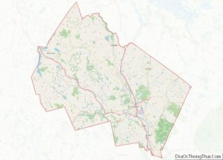
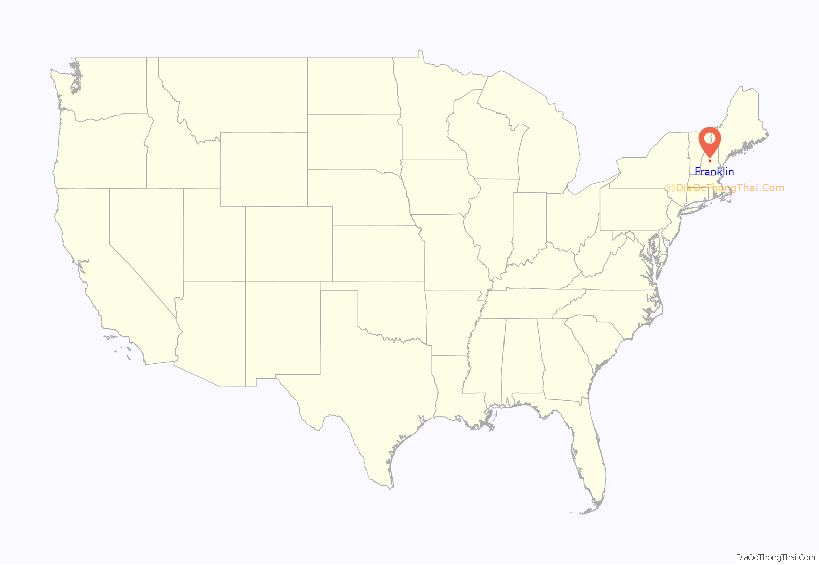
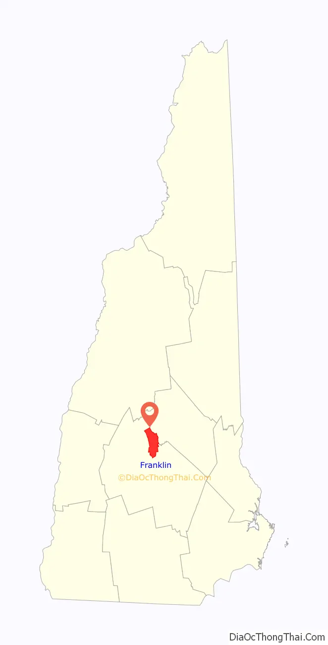
Franklin location map. Where is Franklin city?
History
Situated at the confluence of the Pemigewasset and Winnipesaukee rivers that form the Merrimack River, the town was settled by Anglo-European colonists in 1764 and originally known as “Pemigewasset Village”. It was taken from portions of Salisbury, Andover, Sanbornton and Northfield. The name “Franklin” was adopted in 1820 in honor of statesman and founding father Benjamin Franklin. Water power from the falls on the Winnipesaukee River helped it develop as a mill town. It incorporated as a town in 1828, and then as a city in 1895.
Daniel Webster was born in a section of Franklin that was then part of Salisbury. There is a state historic site located off Route 127 that preserves the famous orator’s childhood home. As an adult, Webster owned “The Elms”, a farm near the Merrimack River along present-day Route 3.
In 1943, the Army Corps of Engineers created the Franklin Falls Reservoir above Franklin by constructing the Franklin Falls Dam for flood control on the Pemigewasset River.
Image gallery
Bird’s eye view c. 1912
Merrimack River in 1905
Old High School in 1908
Central Street in 1909
Sulloway Mills c. 1910
Daniel Webster birthplace c. 1910
City Hall
The library
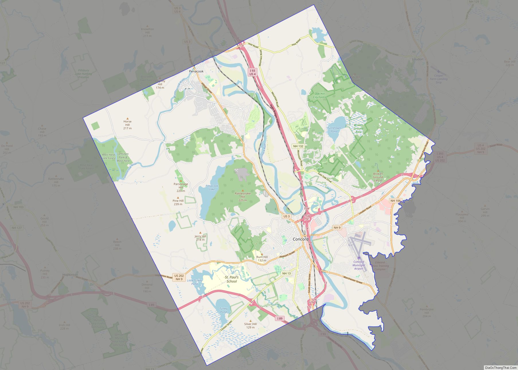
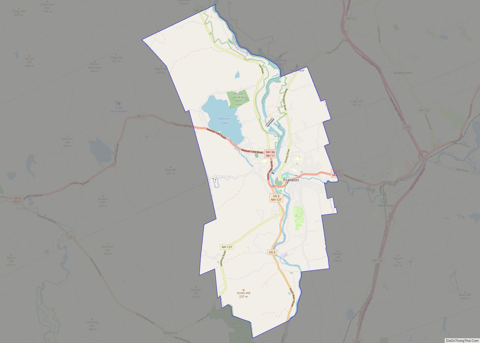
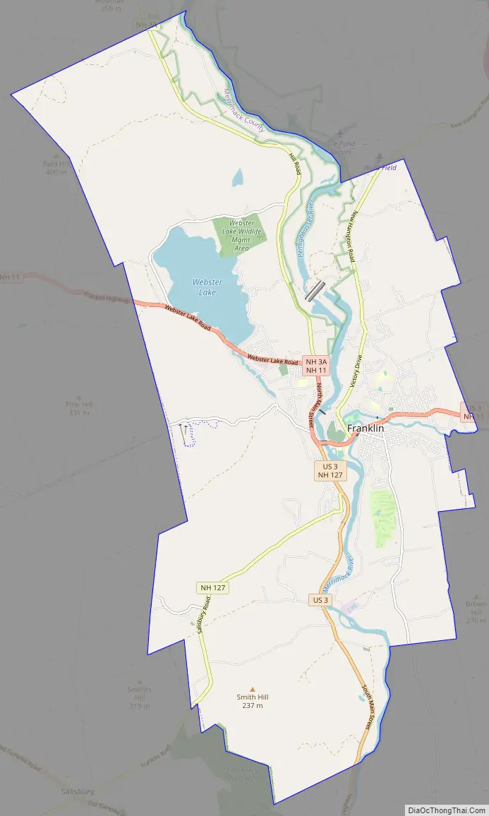
Franklin Road Map
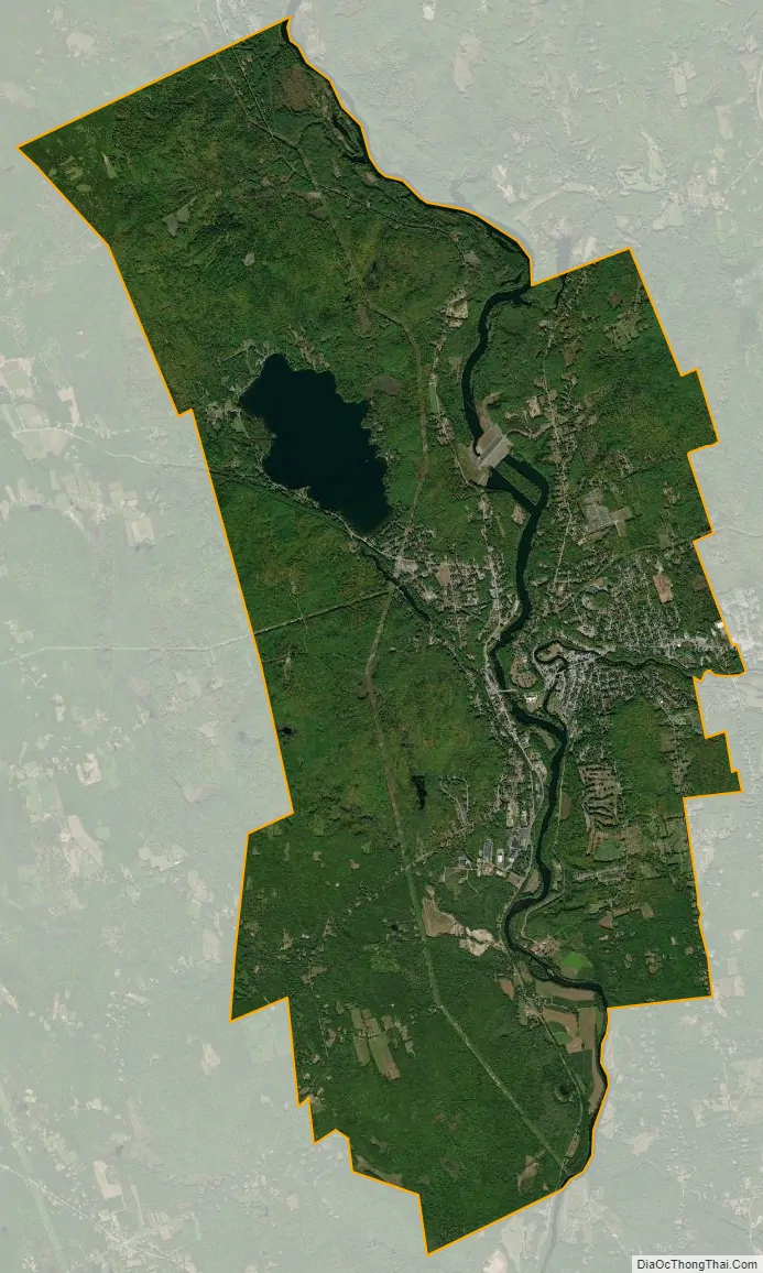
Franklin city Satellite Map
Geography
Franklin is located in northern Merrimack County at 43°26′49″N 71°39′25″W / 43.44694°N 71.65694°W / 43.44694; -71.65694 (43.446956, −71.656966).
According to the United States Census Bureau, the city has a total area of 29.2 square miles (75.5 km), of which 27.5 square miles (71.1 km) are land and 1.7 square miles (4.5 km) are water, comprising 5.95% of the town. It is drained by the Winnipesaukee, Pemigewasset and Merrimack rivers. Webster Lake is in the north. The highest point in Franklin is an unnamed summit near the northwestern corner of the city limits, where the elevation reaches approximately 1,370 feet (420 m) above sea level. Franklin lies fully within the Merrimack River watershed.
U.S. Route 3 and New Hampshire Route 11 form Central Street, the main street of Franklin. Heading east, the two routes lead to Tilton and Laconia. US 3 leads south to Boscawen and Concord, while NH 11 goes west to Andover and New London. New Hampshire Route 127 also passes through downtown Franklin, leading southwest to Salisbury and Contoocook, and north into Sanbornton. New Hampshire Route 3A leads north from West Franklin to Bristol.
Adjacent municipalities
- Sanbornton (northeast)
- Tilton (east)
- Northfield (southeast)
- Boscawen (south)
- Salisbury (southwest)
- Andover (west)
- Hill (northwest)
See also
Map of New Hampshire State and its subdivision: Map of other states:- Alabama
- Alaska
- Arizona
- Arkansas
- California
- Colorado
- Connecticut
- Delaware
- District of Columbia
- Florida
- Georgia
- Hawaii
- Idaho
- Illinois
- Indiana
- Iowa
- Kansas
- Kentucky
- Louisiana
- Maine
- Maryland
- Massachusetts
- Michigan
- Minnesota
- Mississippi
- Missouri
- Montana
- Nebraska
- Nevada
- New Hampshire
- New Jersey
- New Mexico
- New York
- North Carolina
- North Dakota
- Ohio
- Oklahoma
- Oregon
- Pennsylvania
- Rhode Island
- South Carolina
- South Dakota
- Tennessee
- Texas
- Utah
- Vermont
- Virginia
- Washington
- West Virginia
- Wisconsin
- Wyoming