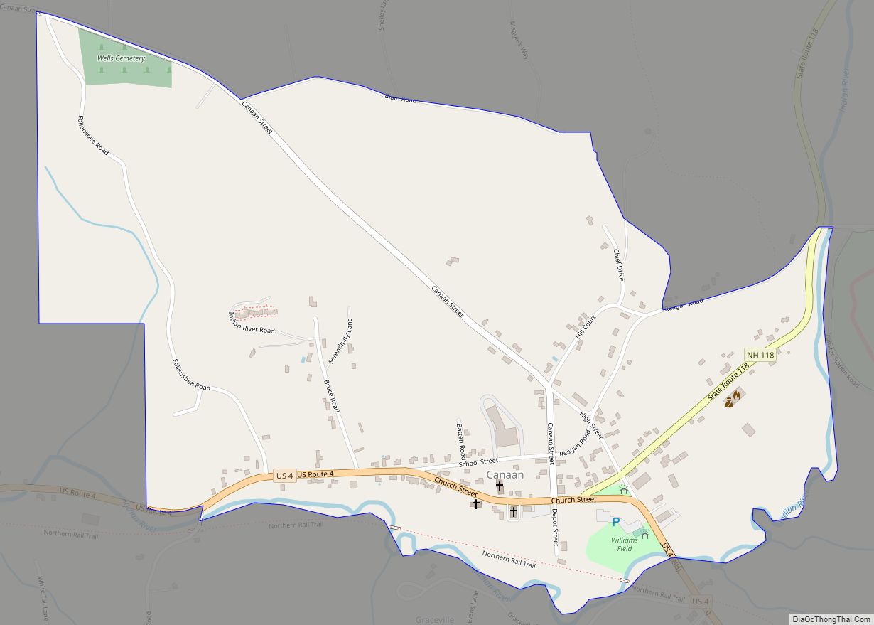
Canaan is a census-designated place (CDP) and the main village in the town of Canaan in Grafton County, New Hampshire, United States. The population of the CDP was 442 at the 2020 census, out of 3,794 in the entire town.
| Name: | Canaan CDP |
|---|---|
| LSAD Code: | 57 |
| LSAD Description: | CDP (suffix) |
| State: | New Hampshire |
| County: | Grafton County |
| Elevation: | 946.2 ft (288.4 m) |
| Total Area: | 0.68 sq mi (1.77 km²) |
| Land Area: | 0.68 sq mi (1.77 km²) |
| Water Area: | 0.00 sq mi (0.00 km²) |
| Total Population: | 442 |
| Population Density: | 646.20/sq mi (249.41/km²) |
| ZIP code: | 03741 |
| Area code: | 603 |
| FIPS code: | 3308900 |
| GNISfeature ID: | 2629718 |
Online Interactive Map
Click on ![]() to view map in "full screen" mode.
to view map in "full screen" mode.
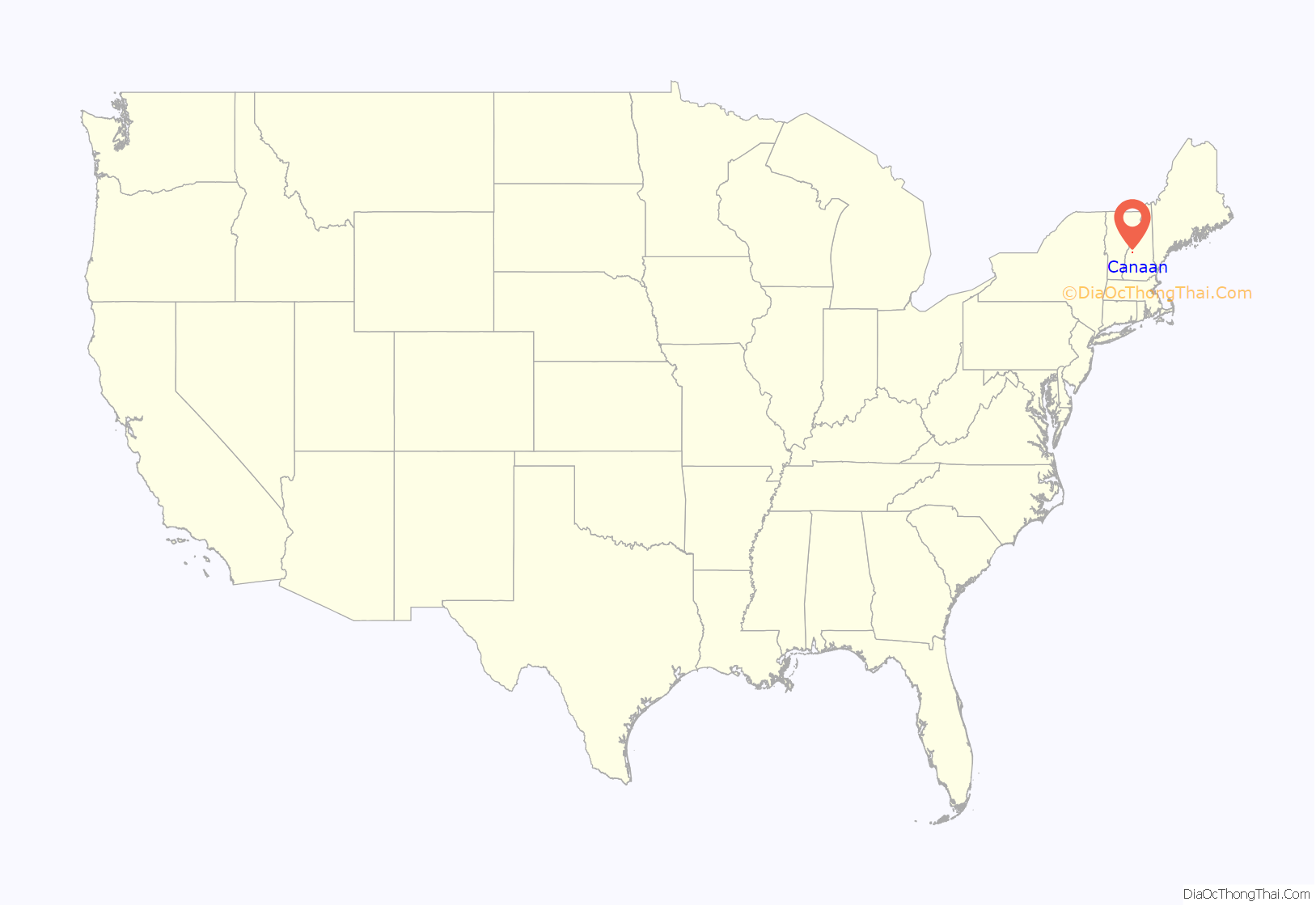
Canaan location map. Where is Canaan CDP?
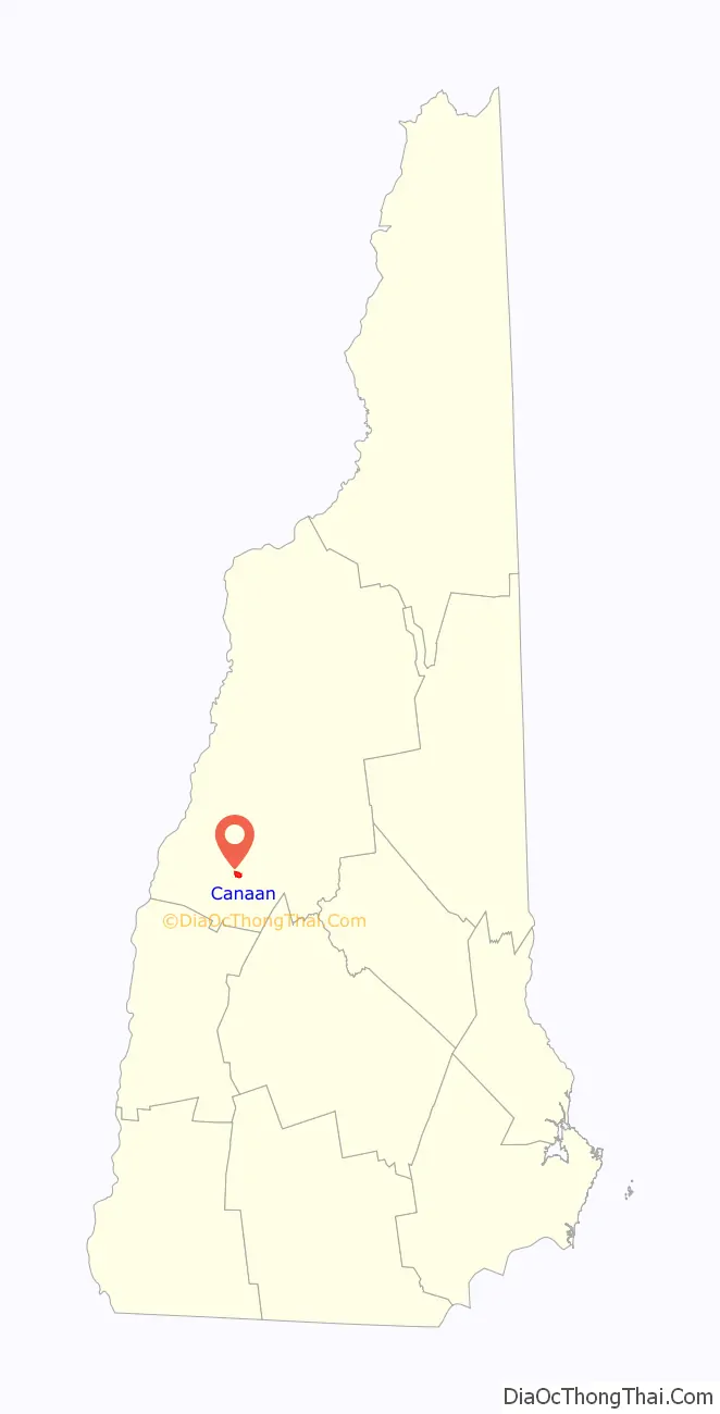
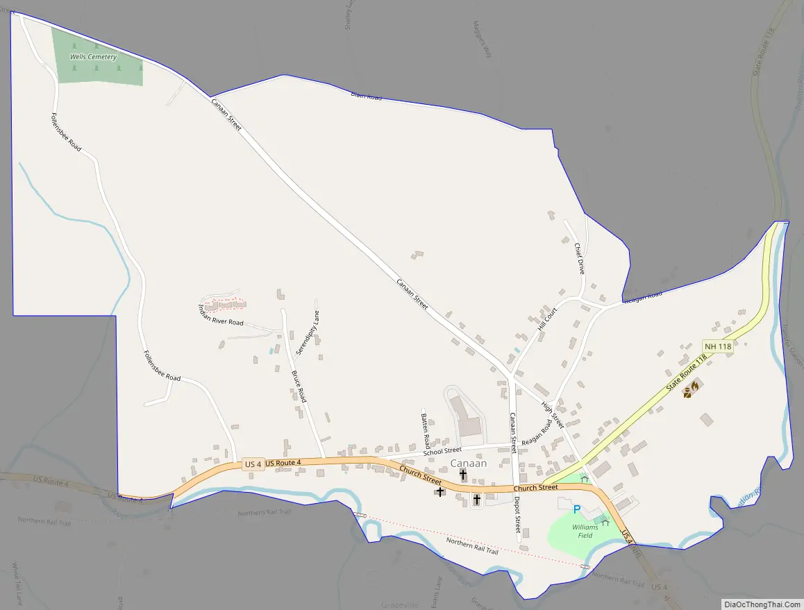
Canaan Road Map
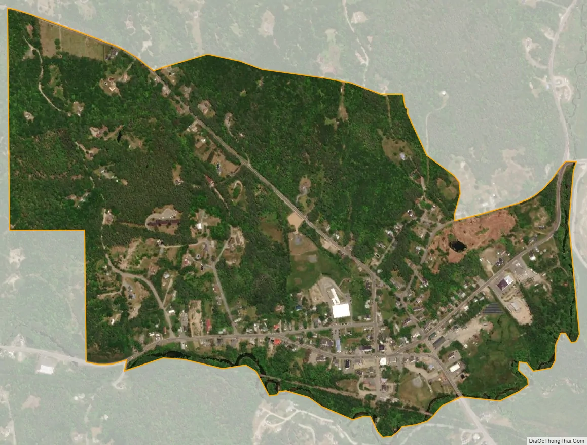
Canaan city Satellite Map
Geography
The CDP is in the southeastern part of the town of Canaan, along U.S. Route 4 in the valley of the Indian River, a tributary of the Mascoma River and part of the Connecticut River watershed. US 4 leads southeast 46 miles (74 km) to Concord, the state capital, and west 14 miles (23 km) to Lebanon. New Hampshire Route 118 runs north from Canaan 15 miles (24 km) to New Hampshire Route 25 at West Rumney.
The Canaan CDP is bordered to the south and east by the Indian River, and to the north by Reagan Road, Blain Road, and Canaan Street. The CDP extends to the west beyond Follansbee Road.
According to the U.S. Census Bureau, the Canaan CDP has a total area of 0.7 square miles (1.8 km), all of it recorded as land.
See also
Map of New Hampshire State and its subdivision: Map of other states:- Alabama
- Alaska
- Arizona
- Arkansas
- California
- Colorado
- Connecticut
- Delaware
- District of Columbia
- Florida
- Georgia
- Hawaii
- Idaho
- Illinois
- Indiana
- Iowa
- Kansas
- Kentucky
- Louisiana
- Maine
- Maryland
- Massachusetts
- Michigan
- Minnesota
- Mississippi
- Missouri
- Montana
- Nebraska
- Nevada
- New Hampshire
- New Jersey
- New Mexico
- New York
- North Carolina
- North Dakota
- Ohio
- Oklahoma
- Oregon
- Pennsylvania
- Rhode Island
- South Carolina
- South Dakota
- Tennessee
- Texas
- Utah
- Vermont
- Virginia
- Washington
- West Virginia
- Wisconsin
- Wyoming