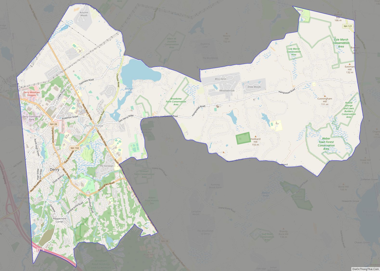
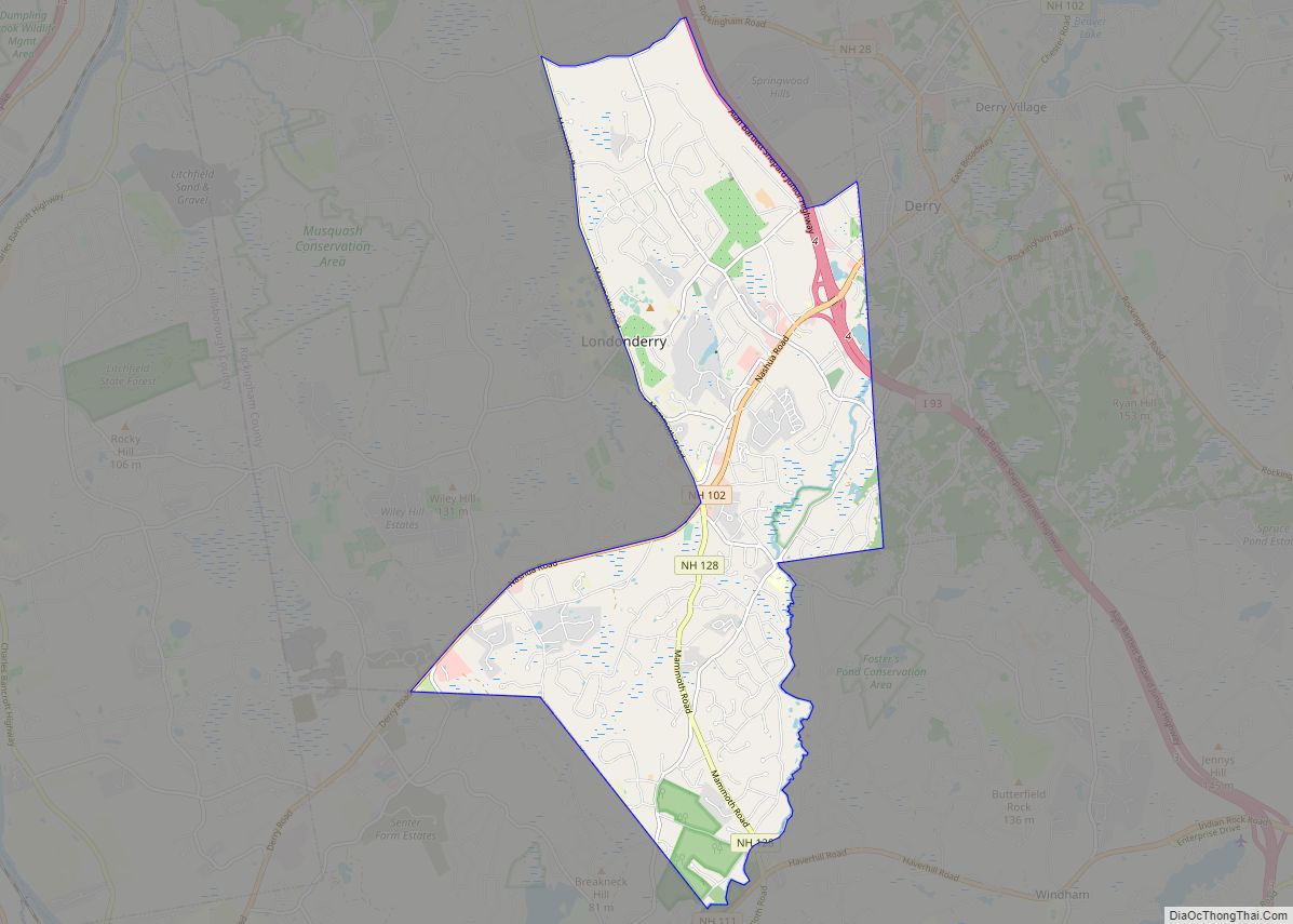
Derry is a census-designated place (CDP) in the town of Derry in Rockingham County, New Hampshire, United States. The CDP comprises the urban center of the town, as well as the village of East Derry and connected suburban areas. The population of the CDP was 22,879 at the 2020 census, out of 34,317 in the entire town.
| Name: | Derry CDP |
|---|---|
| LSAD Code: | 57 |
| LSAD Description: | CDP (suffix) |
| State: | New Hampshire |
| County: | Rockingham County |
| Elevation: | 280 ft (90 m) |
| Total Area: | 16.27 sq mi (42.14 km²) |
| Land Area: | 16.02 sq mi (41.50 km²) |
| Water Area: | 0.25 sq mi (0.64 km²) |
| Total Population: | 22,879 |
| Population Density: | 1,427.80/sq mi (551.27/km²) |
| ZIP code: | 03038 (Derry), 03041 (East Derry) |
| Area code: | 603 |
| FIPS code: | 3317860 |
| GNISfeature ID: | 2378058 |
Online Interactive Map
Click on ![]() to view map in "full screen" mode.
to view map in "full screen" mode.
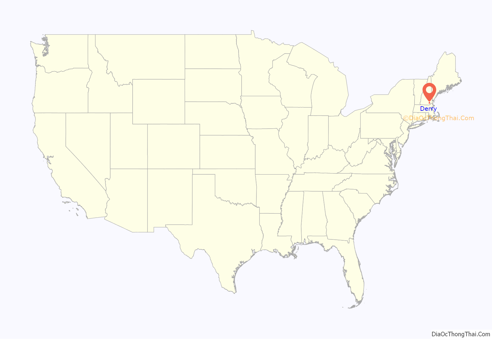
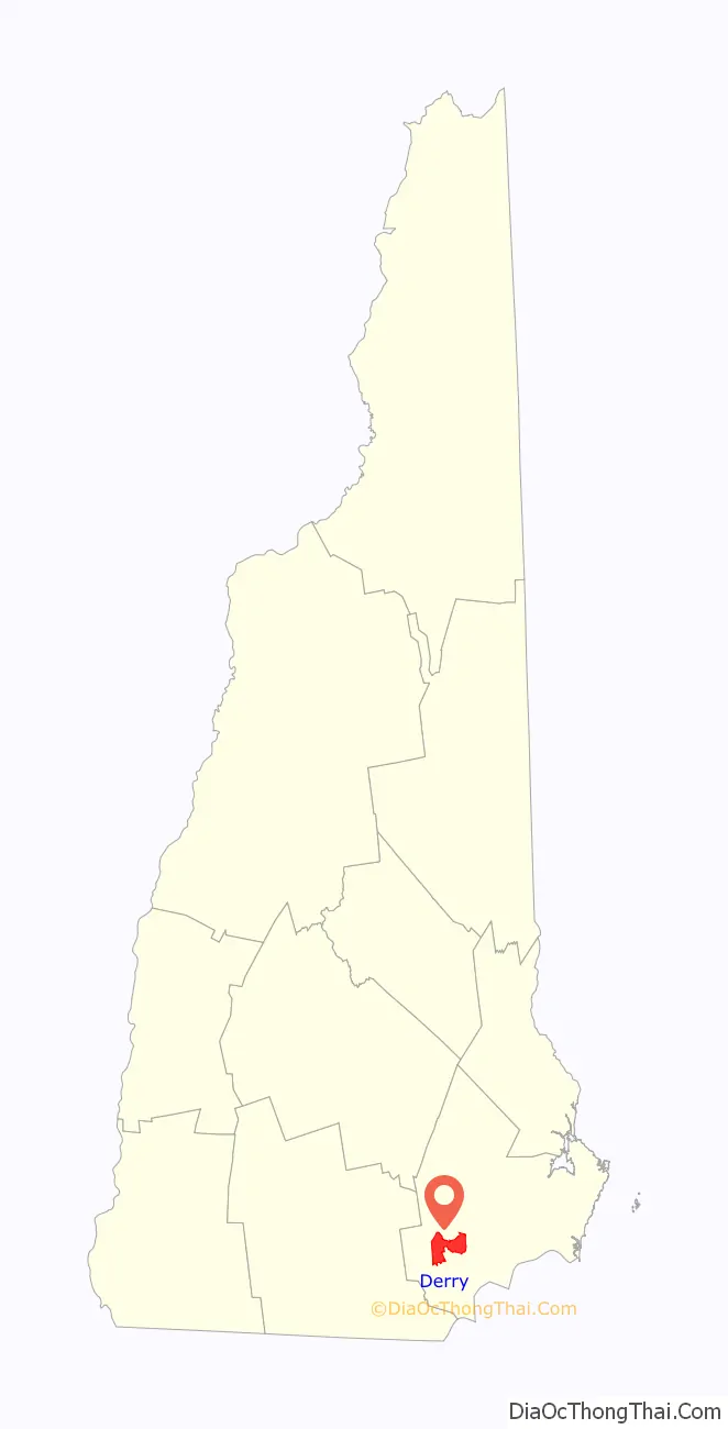
Derry location map. Where is Derry CDP?
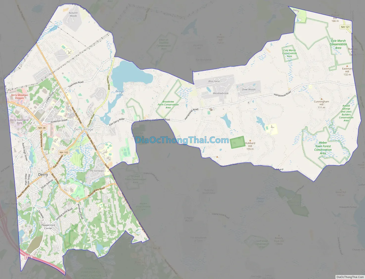
Derry Road Map
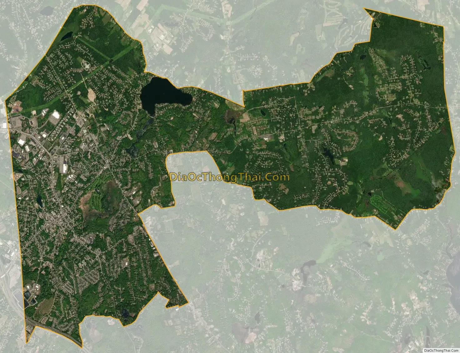
Derry city Satellite Map
Geography
The CDP occupies the central section of the town of Derry, extending from the western border of town to the eastern border. The main urban area of Derry, centered on the intersection of New Hampshire Routes 102 and 28, is in the western part of the CDP, and the village of East Derry is near the geographic center of the CDP. The town line with Londonderry forms the western border of the CDP, and the eastern border is the town line with Hampstead and Sandown. A portion of the northeastern edge of the CDP follows the town line with Chester.
Route 28 passes through the center of Derry, leading northwest 4 miles (6 km) to Interstate 93 Exit 5 in North Londonderry and 11 miles (18 km) to Manchester. Route 28 leads southeast 10 miles (16 km) to Salem. Route 102 crosses Route 28 in the center of Derry, leading southwest 1 mile (1.6 km) to Interstate 93 Exit 4 in Londonderry and 12 miles (19 km) to Nashua. To the northeast Route 102 leads 15 miles (24 km) to Raymond. New Hampshire Route 28 Bypass crosses the CDP east of Derry’s central urban area, leading northwest 8 miles (13 km) to New Hampshire Route 101 east of Manchester. Interstate 93 forms part of the southwest border of the CDP and leads northwest 11 miles (18 km) to Manchester and southeast 40 miles (64 km) to Boston, Massachusetts.
According to the U.S. Census Bureau, the Derry CDP has a total area of 16.3 square miles (42.1 km), of which 16.0 square miles (41.5 km) are land and 0.2 square miles (0.6 km), or 1.52%, are water. Beaver Lake is near the center of the CDP, northeast of Derry village and northwest of East Derry. Its outlet, Beaver Brook, flows southwest through Derry and eventually to the Merrimack River.
See also
Map of New Hampshire State and its subdivision: Map of other states:- Alabama
- Alaska
- Arizona
- Arkansas
- California
- Colorado
- Connecticut
- Delaware
- District of Columbia
- Florida
- Georgia
- Hawaii
- Idaho
- Illinois
- Indiana
- Iowa
- Kansas
- Kentucky
- Louisiana
- Maine
- Maryland
- Massachusetts
- Michigan
- Minnesota
- Mississippi
- Missouri
- Montana
- Nebraska
- Nevada
- New Hampshire
- New Jersey
- New Mexico
- New York
- North Carolina
- North Dakota
- Ohio
- Oklahoma
- Oregon
- Pennsylvania
- Rhode Island
- South Carolina
- South Dakota
- Tennessee
- Texas
- Utah
- Vermont
- Virginia
- Washington
- West Virginia
- Wisconsin
- Wyoming