Henniker is a census-designated place (CDP) and the main village in the town of Henniker in Merrimack County, New Hampshire, United States. The population of the CDP was 3,166 at the 2020 census, out of 6,185 in the entire town. The CDP is the home to New England College.
| Name: | Henniker CDP |
|---|---|
| LSAD Code: | 57 |
| LSAD Description: | CDP (suffix) |
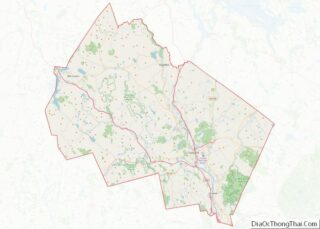
| State: | New Hampshire |
| County: | Merrimack County |
| Elevation: | 430 ft (130 m) |
| Total Area: | 1.42 sq mi (3.67 km²) |
| Land Area: | 1.42 sq mi (3.67 km²) |
| Water Area: | 0.00 sq mi (0.00 km²) |
| Total Population: | 3,166 |
| Population Density: | 2,235.88/sq mi (863.00/km²) |
| ZIP code: | 03242 |
| Area code: | 603 |
| FIPS code: | 3335460 |
| GNISfeature ID: | 2378070 |
Online Interactive Map
Click on ![]() to view map in "full screen" mode.
to view map in "full screen" mode.
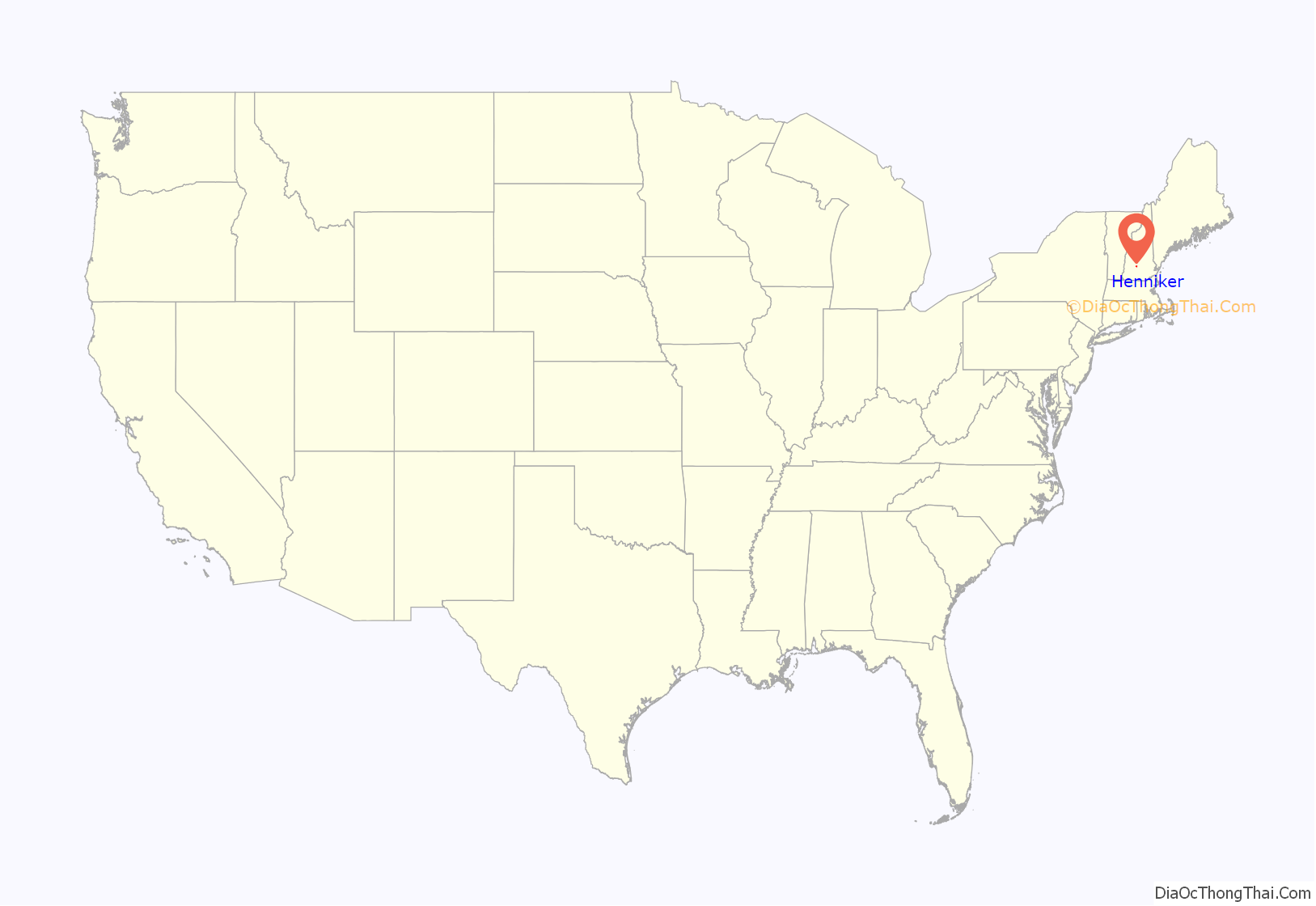
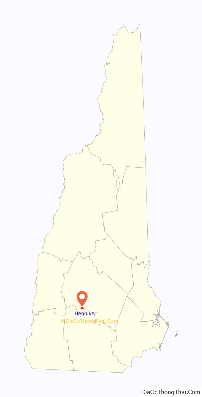
Henniker location map. Where is Henniker CDP?
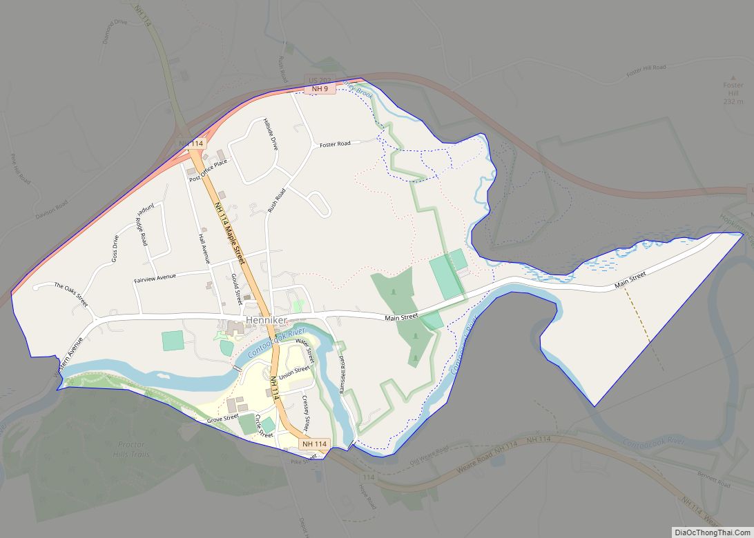
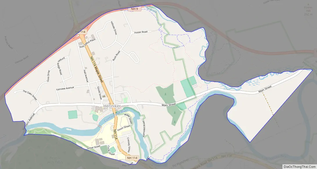
Henniker Road Map
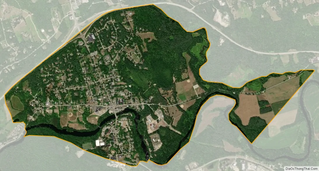
Henniker city Satellite Map
Geography
The CDP is in the center of the town of Henniker, primarily on the north side of the Contoocook River but with a small portion on the south side, comprising the campus of New England College. The CDP is bordered to the north by U.S. Route 202/New Hampshire Route 9 and by Amey Brook and to the south by the Contoocook River and an abandoned railroad grade. To the west the CDP extends past The Oaks road.
New Hampshire Route 114 passes through the center of the village, leading northwest 9 miles (14 km) to Bradford and southeast 18 miles (29 km) to Goffstown. Routes 202/9 lead east 16 miles (26 km) to Concord, the state capital, and southwest 6 miles (10 km) to Hillsborough.
According to the U.S. Census Bureau, the Henniker CDP has a total area of 1.4 square miles (3.7 km), all of it recorded as land. The Contoocook River, flowing through the southern part of the CDP, is part of the Merrimack River watershed.
See also
Map of New Hampshire State and its subdivision: Map of other states:- Alabama
- Alaska
- Arizona
- Arkansas
- California
- Colorado
- Connecticut
- Delaware
- District of Columbia
- Florida
- Georgia
- Hawaii
- Idaho
- Illinois
- Indiana
- Iowa
- Kansas
- Kentucky
- Louisiana
- Maine
- Maryland
- Massachusetts
- Michigan
- Minnesota
- Mississippi
- Missouri
- Montana
- Nebraska
- Nevada
- New Hampshire
- New Jersey
- New Mexico
- New York
- North Carolina
- North Dakota
- Ohio
- Oklahoma
- Oregon
- Pennsylvania
- Rhode Island
- South Carolina
- South Dakota
- Tennessee
- Texas
- Utah
- Vermont
- Virginia
- Washington
- West Virginia
- Wisconsin
- Wyoming