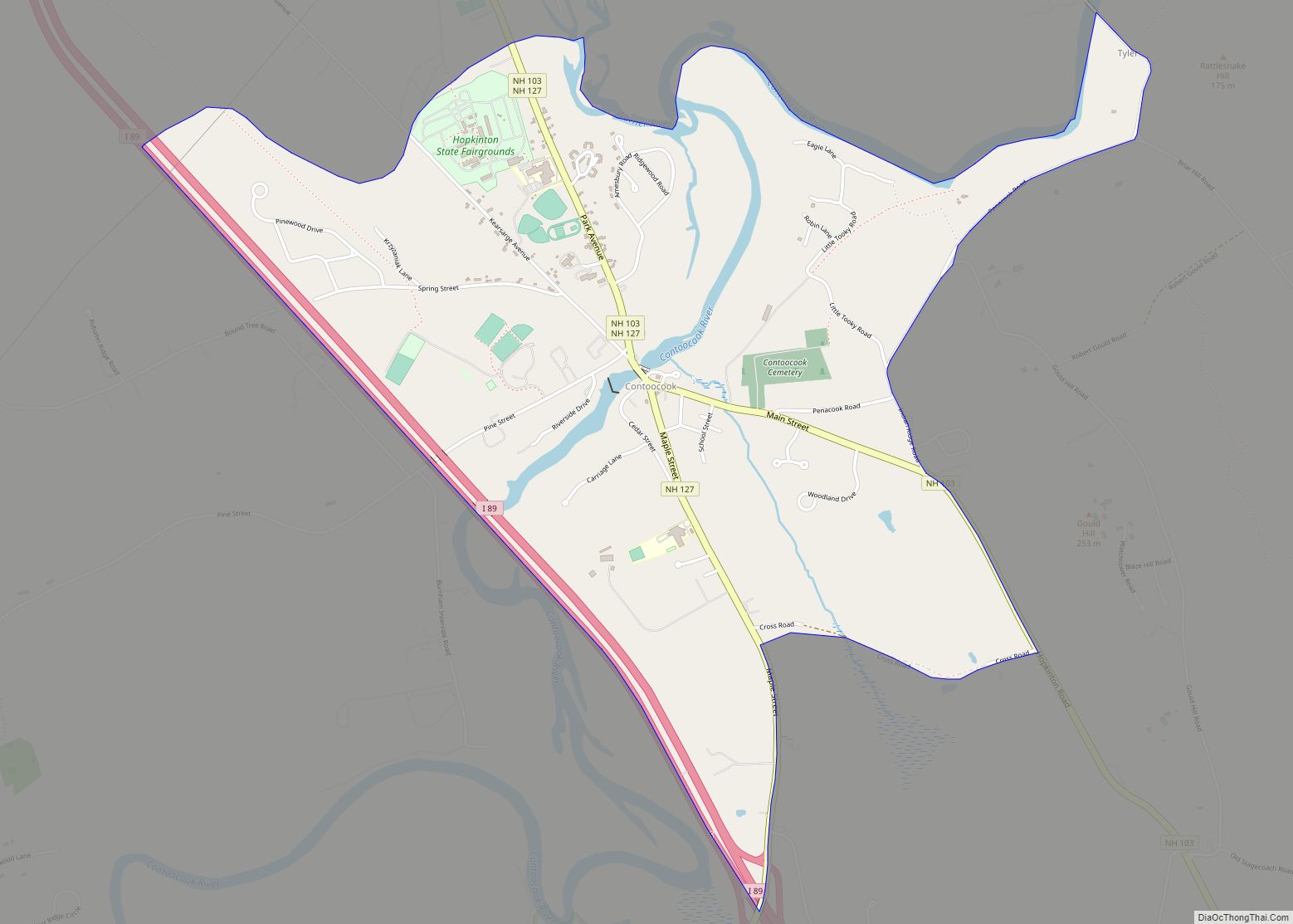
Contoocook (/kənˈtʊkək/ (listen)) is a village and census-designated place (CDP) within the town of Hopkinton in Merrimack County, New Hampshire, United States. The population was 1,427 at the 2020 census. Contoocook is well known for its growth of small businesses, preservation of historical landmarks, community involvement and recreational activities within the village.
| Name: | Contoocook CDP |
|---|---|
| LSAD Code: | 57 |
| LSAD Description: | CDP (suffix) |
| State: | New Hampshire |
| County: | Merrimack County |
| Elevation: | 364 ft (111 m) |
| Total Area: | 2.40 sq mi (6.22 km²) |
| Land Area: | 2.30 sq mi (5.96 km²) |
| Water Area: | 0.10 sq mi (0.27 km²) |
| Total Population: | 1,427 |
| Population Density: | 620.17/sq mi (239.48/km²) |
| ZIP code: | 03229 |
| Area code: | 603 |
| FIPS code: | 3314340 |
| GNISfeature ID: | 0866311 |
Online Interactive Map
Click on ![]() to view map in "full screen" mode.
to view map in "full screen" mode.
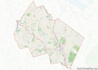
Contoocook location map. Where is Contoocook CDP?


History
The village is named after the Contoocook River that runs through it. The name Contoocook comes from the Pennacook tribe of Native Americans and perhaps means “place of the river near pines”. Other variations of the name include the Abenaki meaning “nut trees river” or Natick language meaning “small plantation at the river”. In previous centuries the area was known as “Contoocookville”. It is the birthplace of Civil War naval officer George H. Perkins. His daughter Isabel Weld Perkins and his son-in-law Larz Anderson maintained Perkins Manor as one of several summer homes.
In describing the approach to Perkins Manor one commentator writes:
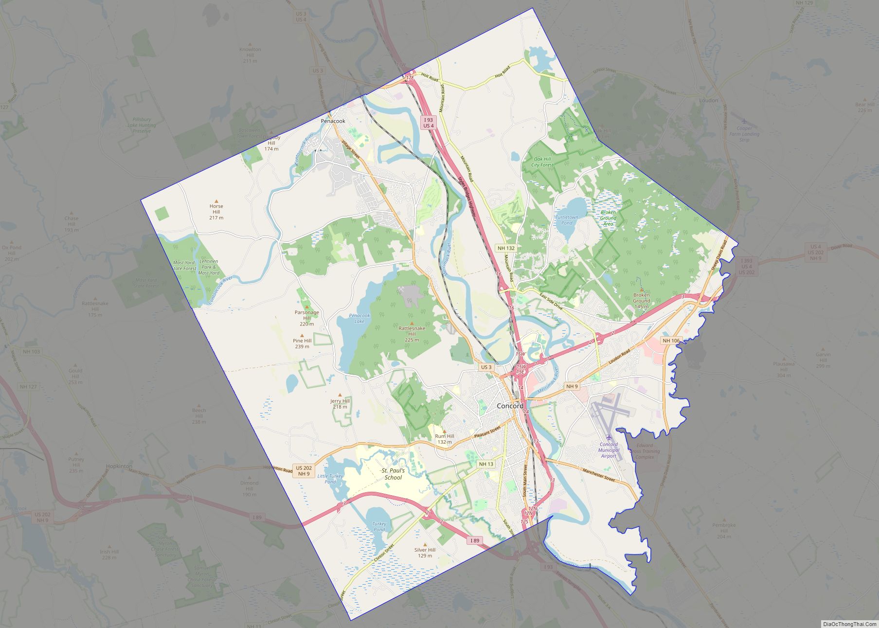
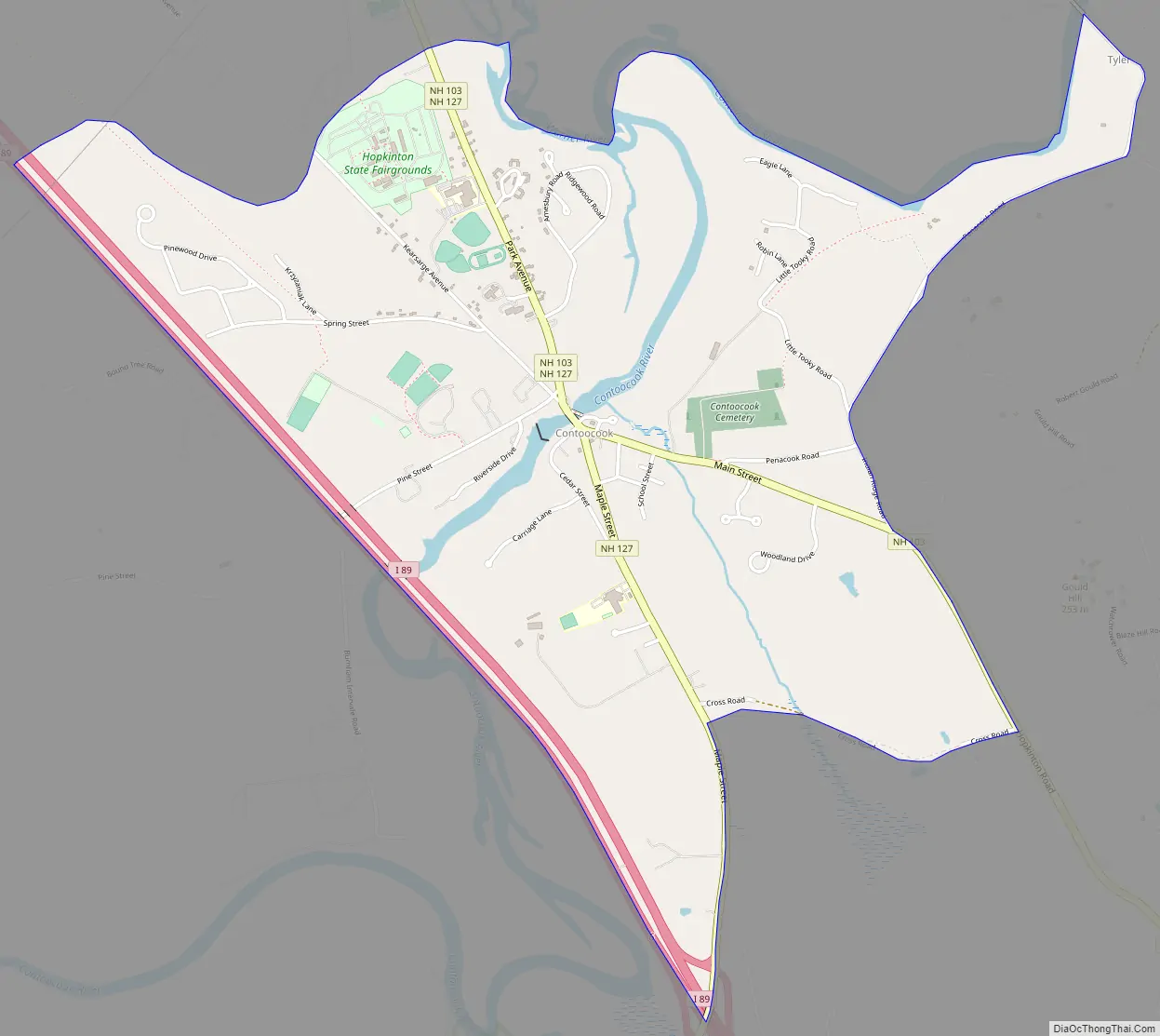
Contoocook Road Map
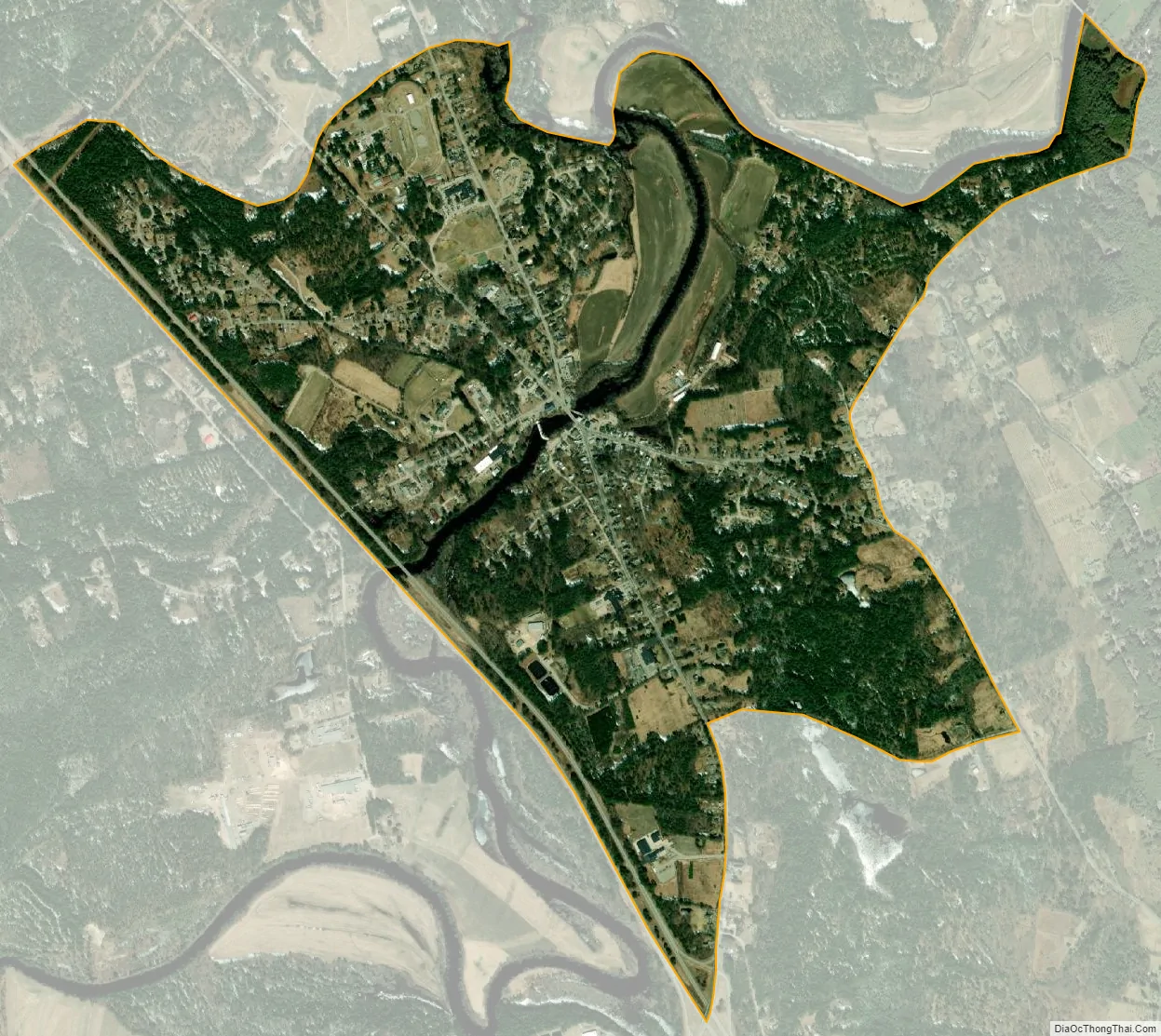
Contoocook city Satellite Map
Geography
Contoocook is located in the northern part of the town of Hopkinton. New Hampshire Route 103 passes through the center of the village as Main Street and Park Avenue. New Hampshire Route 127 enters the village from the south as Maple Street and joins NH 103 along Park Avenue departing to the north. Interstate 89 runs along the western edge of the community, with access from Exit 6 (NH 127). I-89 leads southeast 12 miles (19 km) to Interstate 93 in the town of Bow, just south of Concord, the state capital. I-89 leads northwest 45 miles (72 km) to Lebanon. NH 103 leads southeast 3 miles (5 km) to Hopkinton village and northwest 7 miles (11 km) to Warner. NH 127 leads southwest 4 miles (6 km) to West Hopkinton and north 19 miles (31 km) to Franklin.
According to the United States Census Bureau, the Contoocook CDP has a total area of 2.40 square miles (6.22 km), of which 2.30 square miles (5.96 km) are land and 0.10 square miles (0.27 km), or 4.26%, are water. The Contoocook River flows through the center of the village, and the Warner River forms the northern edge of the community, flowing into the Contoocook.
See also
Map of New Hampshire State and its subdivision: Map of other states:- Alabama
- Alaska
- Arizona
- Arkansas
- California
- Colorado
- Connecticut
- Delaware
- District of Columbia
- Florida
- Georgia
- Hawaii
- Idaho
- Illinois
- Indiana
- Iowa
- Kansas
- Kentucky
- Louisiana
- Maine
- Maryland
- Massachusetts
- Michigan
- Minnesota
- Mississippi
- Missouri
- Montana
- Nebraska
- Nevada
- New Hampshire
- New Jersey
- New Mexico
- New York
- North Carolina
- North Dakota
- Ohio
- Oklahoma
- Oregon
- Pennsylvania
- Rhode Island
- South Carolina
- South Dakota
- Tennessee
- Texas
- Utah
- Vermont
- Virginia
- Washington
- West Virginia
- Wisconsin
- Wyoming