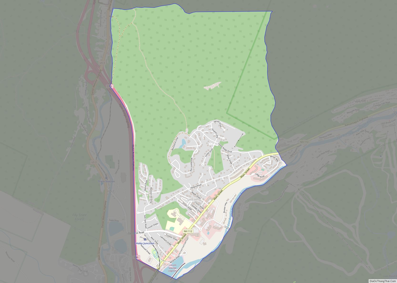
Lincoln is a census-designated place (CDP) and the main village in the town of Lincoln in Grafton County, New Hampshire, United States. The population of the CDP was 969 at the 2020 census, out of 1,631 in the entire town.
| Name: | Lincoln CDP |
|---|---|
| LSAD Code: | 57 |
| LSAD Description: | CDP (suffix) |
| State: | New Hampshire |
| County: | Grafton County |
| Elevation: | 811 ft (247 m) |
| Total Area: | 2.74 sq mi (7.09 km²) |
| Land Area: | 2.69 sq mi (6.97 km²) |
| Water Area: | 0.04 sq mi (0.11 km²) |
| Total Population: | 969 |
| Population Density: | 359.96/sq mi (139.00/km²) |
| ZIP code: | 03251 |
| Area code: | 603 |
| FIPS code: | 3341780 |
| GNISfeature ID: | 2629725 |
Online Interactive Map
Click on ![]() to view map in "full screen" mode.
to view map in "full screen" mode.
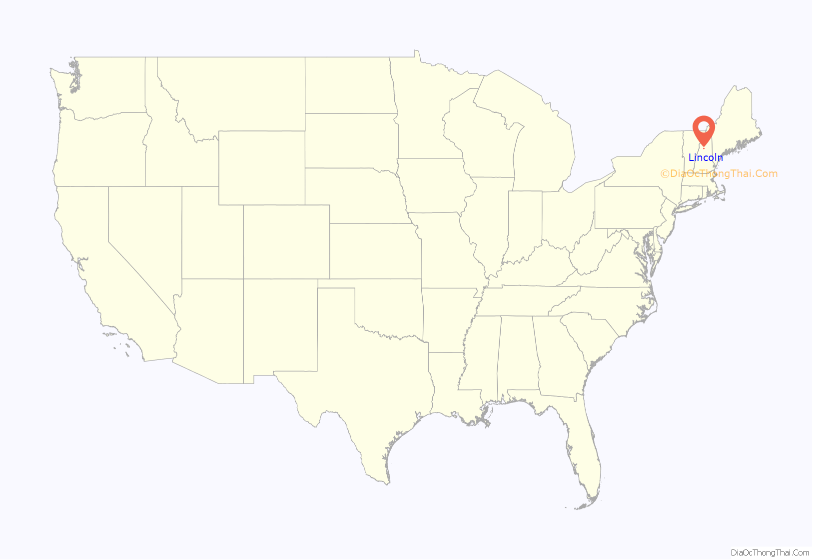
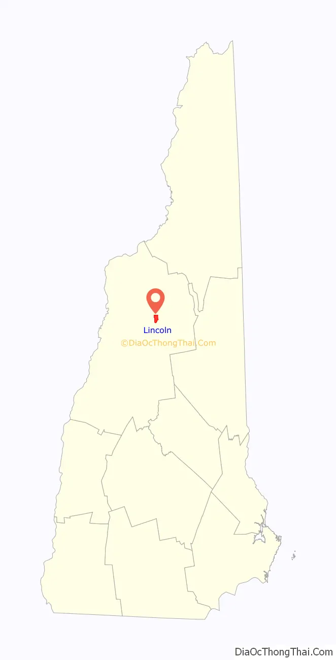
Lincoln location map. Where is Lincoln CDP?
Lincoln Road Map
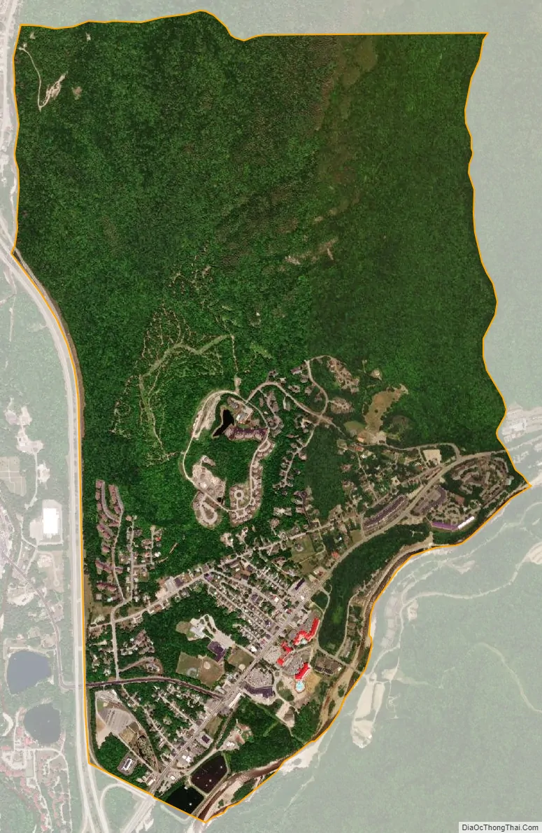
Lincoln city Satellite Map
Geography
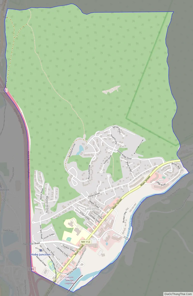
The CDP is in the southwestern part of the town of Lincoln, between the Pemigewasset River and its East Branch, on the southern side of the White Mountains. The CDP is bordered to the south by the town of Woodstock, to the southeast by the East Branch of the Pemigewasset, to the east by Pollard Brook, and to the north by Little Coolidge Mountain. To the west the CDP is bordered by the Pemigewasset River and by Interstate 93. The northern part of the CDP is within the White Mountain National Forest. The CDP is overlooked to the south by 3,065-foot (934 m) Loon Mountain.
New Hampshire Route 112 is the main road through Lincoln, becoming the Kancamagus Highway as it enters the national forest to the east. The highway leads east 36 miles (58 km) to Conway. Interstate 93 intersects Route 112 at Exit 32 just south of the Lincoln town line in North Woodstock. I-93 leads north through Franconia Notch 22 miles (35 km) to Littleton and south 62 miles (100 km) to Concord, the state capital.
According to the U.S. Census Bureau, the Lincoln CDP has a total area of 2.7 square miles (7.1 km), of which 2.7 square miles (7.0 km) are land and 0.04 square miles (0.1 km), or 1.62%, are water.
See also
Map of New Hampshire State and its subdivision: Map of other states:- Alabama
- Alaska
- Arizona
- Arkansas
- California
- Colorado
- Connecticut
- Delaware
- District of Columbia
- Florida
- Georgia
- Hawaii
- Idaho
- Illinois
- Indiana
- Iowa
- Kansas
- Kentucky
- Louisiana
- Maine
- Maryland
- Massachusetts
- Michigan
- Minnesota
- Mississippi
- Missouri
- Montana
- Nebraska
- Nevada
- New Hampshire
- New Jersey
- New Mexico
- New York
- North Carolina
- North Dakota
- Ohio
- Oklahoma
- Oregon
- Pennsylvania
- Rhode Island
- South Carolina
- South Dakota
- Tennessee
- Texas
- Utah
- Vermont
- Virginia
- Washington
- West Virginia
- Wisconsin
- Wyoming