New London is a census-designated place (CDP) and the primary village in the town of New London in Merrimack County, New Hampshire, United States. The population of the CDP was 1,266 at the 2020 census, out of 4,400 in the entire town. The CDP includes the campus of Colby–Sawyer College.
| Name: | New London CDP |
|---|---|
| LSAD Code: | 57 |
| LSAD Description: | CDP (suffix) |
| State: | New Hampshire |
| County: | Merrimack County |
| Elevation: | 1,291 ft (393 m) |
| Total Area: | 1.11 sq mi (2.88 km²) |
| Land Area: | 1.11 sq mi (2.88 km²) |
| Water Area: | 0.00 sq mi (0.00 km²) |
| Total Population: | 1,266 |
| Population Density: | 1,139.51/sq mi (440.11/km²) |
| ZIP code: | 03257 |
| Area code: | 603 |
| FIPS code: | 3352020 |
| GNISfeature ID: | 2629733 |
Online Interactive Map
Click on ![]() to view map in "full screen" mode.
to view map in "full screen" mode.
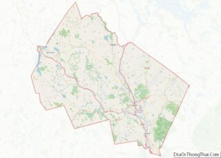
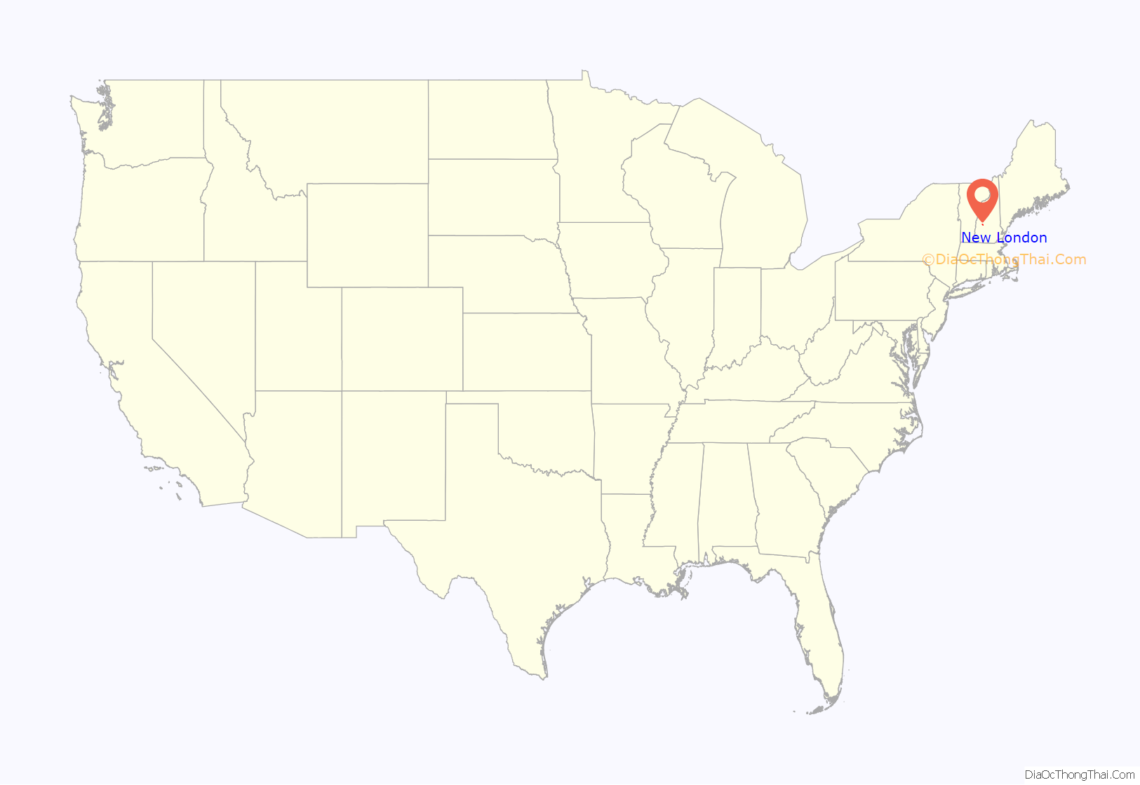
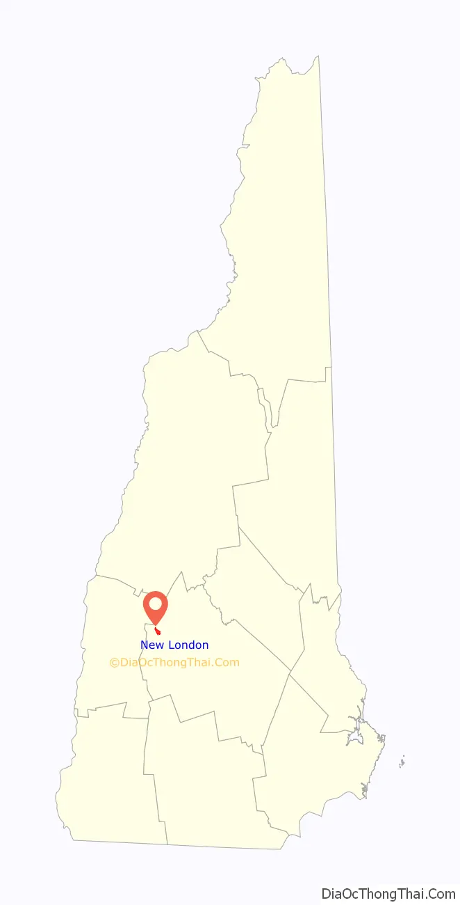
New London location map. Where is New London CDP?
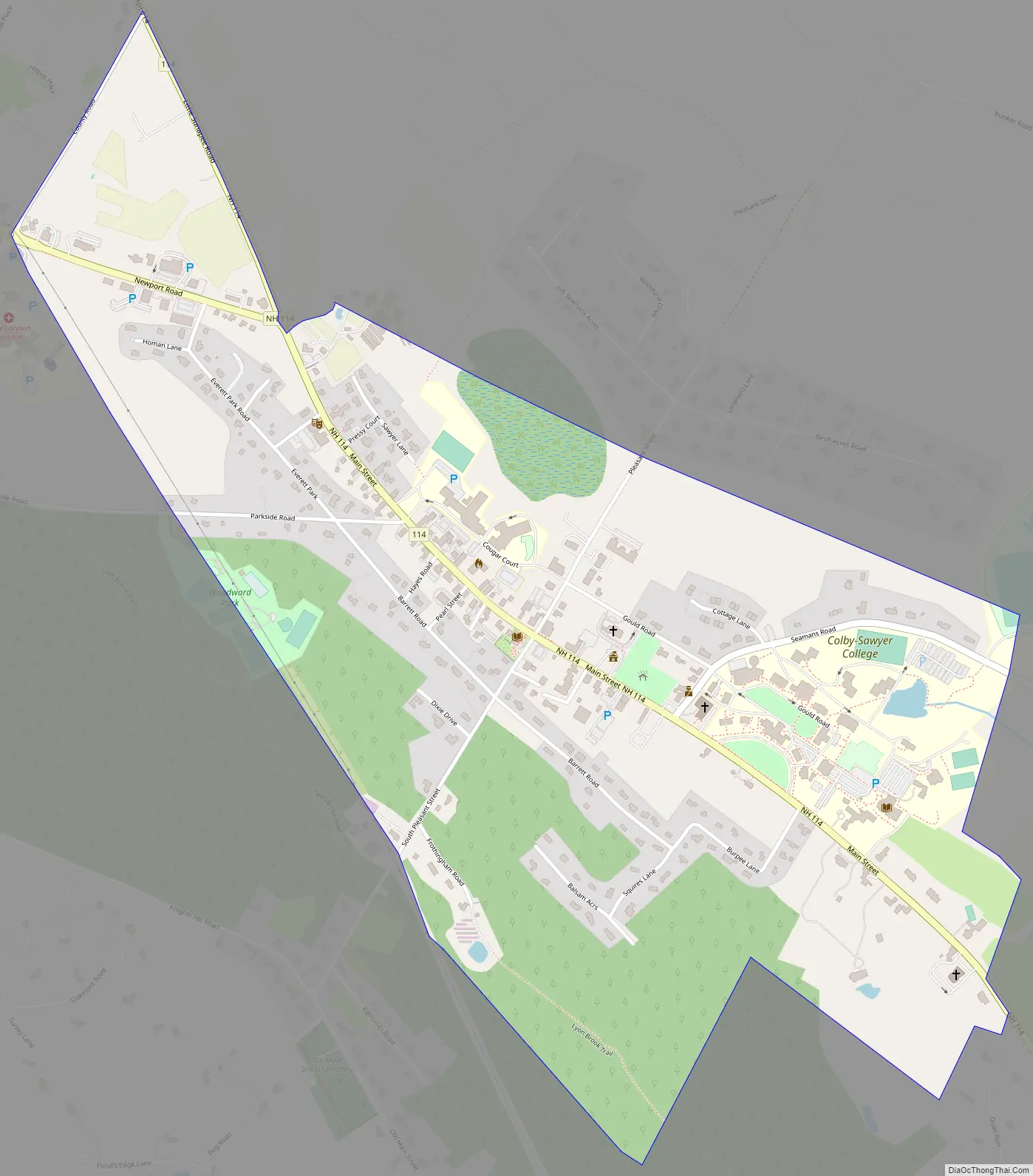
New London Road Map
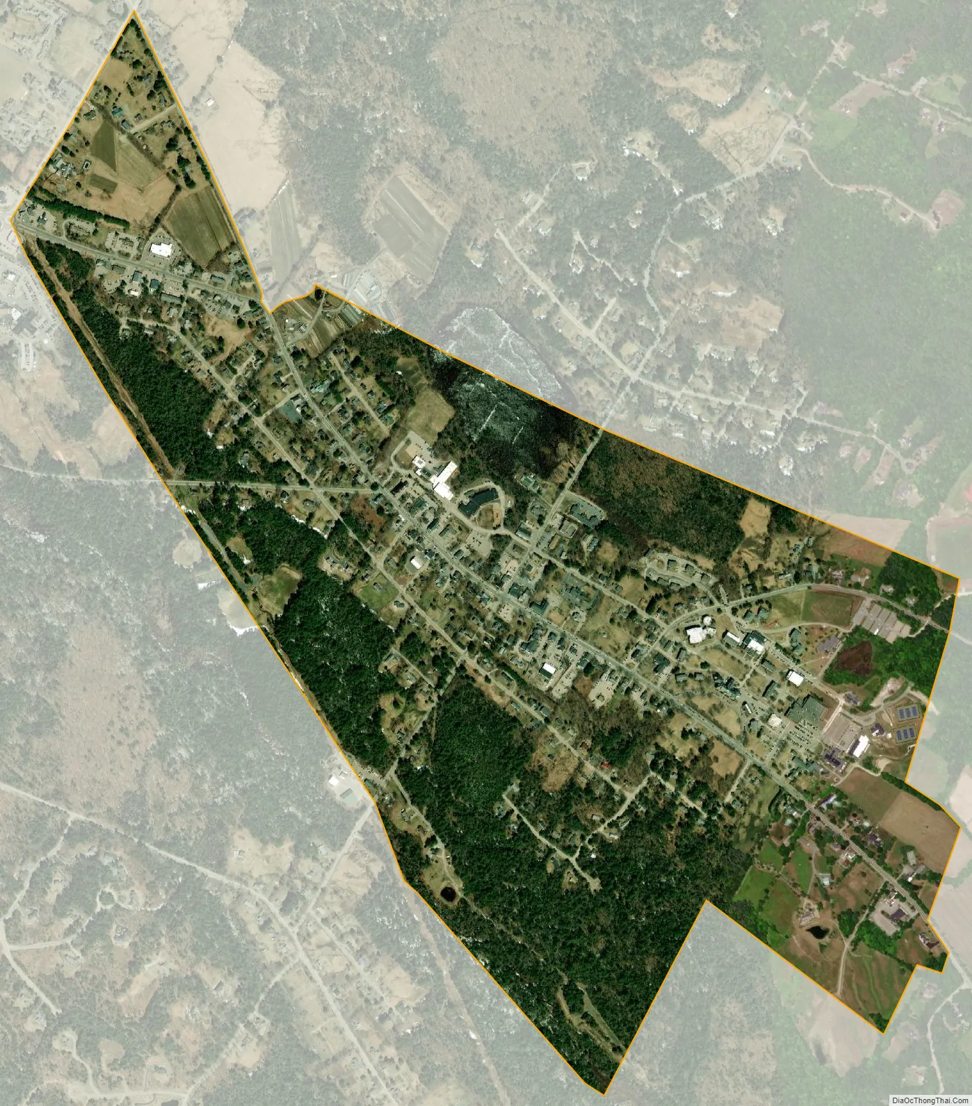
New London city Satellite Map
Geography
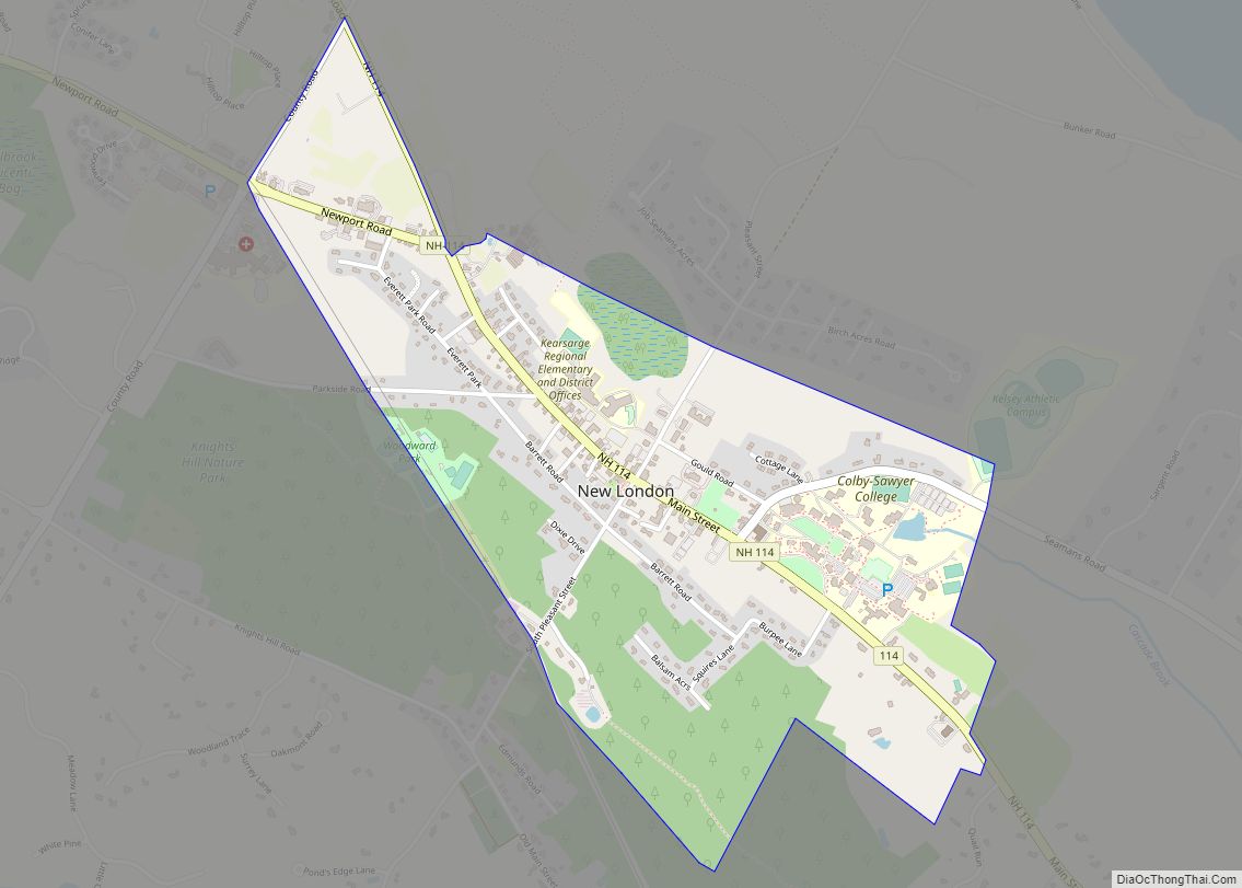
The CDP occupies the central part of the town of New London, extending northwest to County Road and southeast past Squires Lane but not as far as Ridgeview Road/Quail Run. To the north the CDP extends beyond Seamans Road but not as far as Birch Acres Road, while to the south the CDP reaches to Lion Brook, south of Balsam Acres.
New Hampshire Route 114 is Main Street through the village, leading northwest 13 miles (21 km) to Grantham and south 12 miles (19 km) to Bradford. Interstate 89 passes 2 miles (3 km) southwest of the CDP, with access from Exits 11 and 12.
According to the U.S. Census Bureau, the New London CDP has a total area of 1.1 square miles (2.9 km), of which 1.2 acres (4,986 m), or 0.17%, are water. The CDP occupies a wide ridgetop which forms a watershed divide. The southwest side of the CDP drains toward Lion Brook, a headwaters of the Lane River in neighboring Sutton, which is part of the Warner River watershed, while the northeast side drains to Pleasant Lake, the outlet of which is a tributary of the Blackwater River. Both the Warner and the Blackwater River are part of the Contoocook River watershed, leading east to the Merrimack River.
See also
Map of New Hampshire State and its subdivision: Map of other states:- Alabama
- Alaska
- Arizona
- Arkansas
- California
- Colorado
- Connecticut
- Delaware
- District of Columbia
- Florida
- Georgia
- Hawaii
- Idaho
- Illinois
- Indiana
- Iowa
- Kansas
- Kentucky
- Louisiana
- Maine
- Maryland
- Massachusetts
- Michigan
- Minnesota
- Mississippi
- Missouri
- Montana
- Nebraska
- Nevada
- New Hampshire
- New Jersey
- New Mexico
- New York
- North Carolina
- North Dakota
- Ohio
- Oklahoma
- Oregon
- Pennsylvania
- Rhode Island
- South Carolina
- South Dakota
- Tennessee
- Texas
- Utah
- Vermont
- Virginia
- Washington
- West Virginia
- Wisconsin
- Wyoming