Audubon is a borough in Camden County, in the U.S. state of New Jersey. As of the 2020 United States census, the borough’s population was 8,707, a decrease of 112 (−1.3%) from the 2010 census count of 8,819, which in turn reflected a decline of 363 (−4.0%) from the 9,182 counted in the 2000 census.
| Name: | Audubon borough |
|---|---|
| LSAD Code: | 21 |
| LSAD Description: | borough (suffix) |
| State: | New Jersey |
| County: | Camden County |
| Incorporated: | March 13, 1905 |
| Elevation: | 56 ft (17 m) |
| Total Area: | 1.50 sq mi (3.87 km²) |
| Land Area: | 1.48 sq mi (3.84 km²) |
| Water Area: | 0.01 sq mi (0.04 km²) 0.93% |
| Total Population: | 8,707 |
| Population Density: | 58,752/sq mi (22,684/km²) |
| ZIP code: | 08106 |
| FIPS code: | 3402200 |
| GNISfeature ID: | 0885144 |
| Website: | www.audubonnj.com |
Online Interactive Map
Click on ![]() to view map in "full screen" mode.
to view map in "full screen" mode.
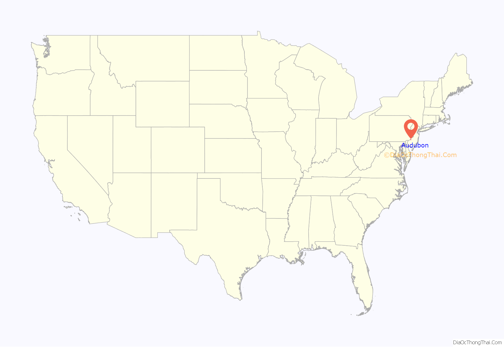
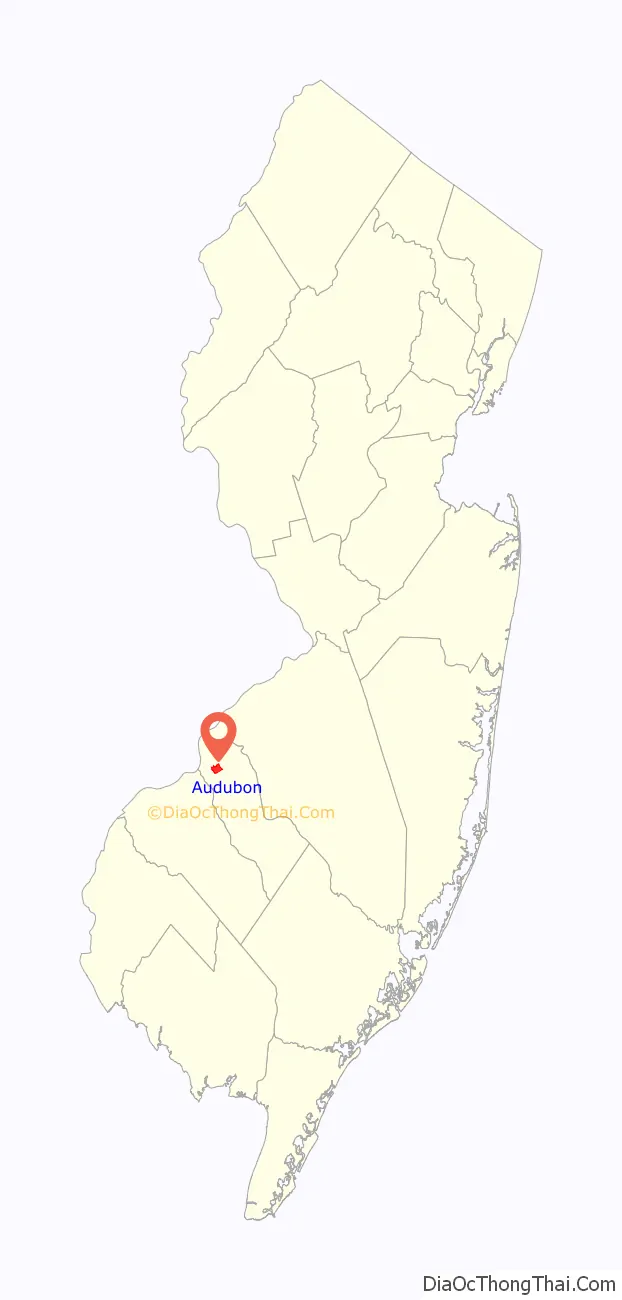
Audubon location map. Where is Audubon borough?
History
The area that was to become Audubon was initially settled in the late 17th Century by various land owners and was primarily used for farms and mills. In 1695 the land now known as the Borough of Audubon was part of Newton Township. By the early 1700s, the area’s first families were building their homesteads. Today, two of these original farmhouses remain in Audubon. The Low-Stokes-Nicholson house was built c. 1732 by John Low. Simon Breach built his home, known locally as “The Mansion House”, in about 1740. A large addition was built by shipbuilder John Dialogue in c. 1853. Samuel Nicholson Rhodes, a local naturalist and author, owned this farm, which he named “Cedarcroft”, from 1898–1912. It was Mrs. Rhodes who came up with the name for the town. When the Atlantic City Railroad arrived in the 1880s the local farms were subdivided into the smaller communities of Audubon, Cedarcroft and Orston. Residential development began when both Audubon and Orston had train stations built in the 1890s.
On March 13, 1905, through an act of the New Jersey Legislature, Audubon was created as a borough from portions of Haddon Township. It was named for John James Audubon, the naturalist. After a referendum on October 28, 1947, portions of Audubon were taken to form the borough of Audubon Park.
Audubon is the home of three Medal of Honor recipients, the most awarded per capita of any town in the United States: Samuel M. Sampler (World War I), Edward Clyde Benfold (Korean War) and Nelson V. Brittin (Korean War). The three are honored by a memorial at Audubon High School.
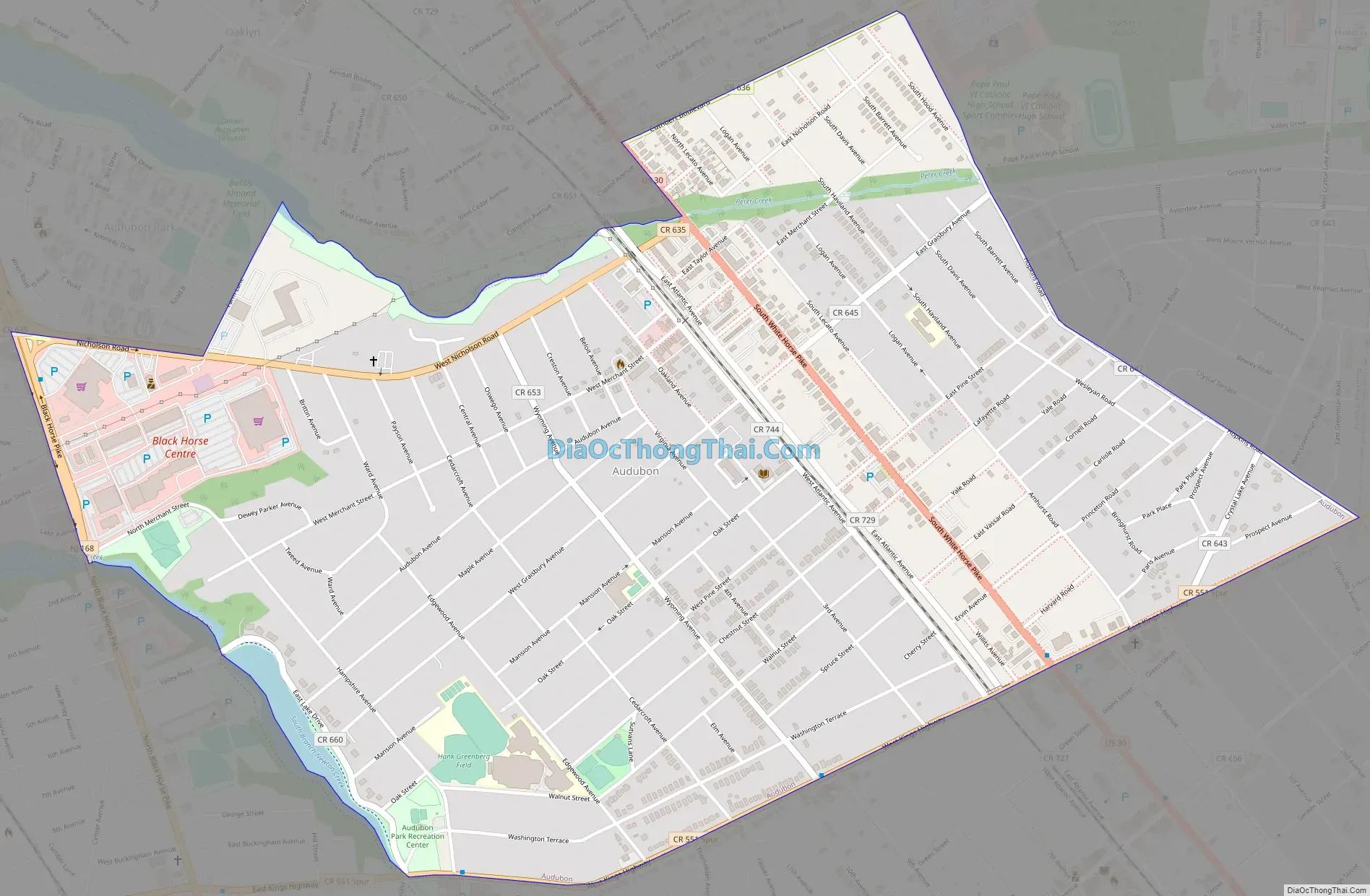
Audubon Road Map
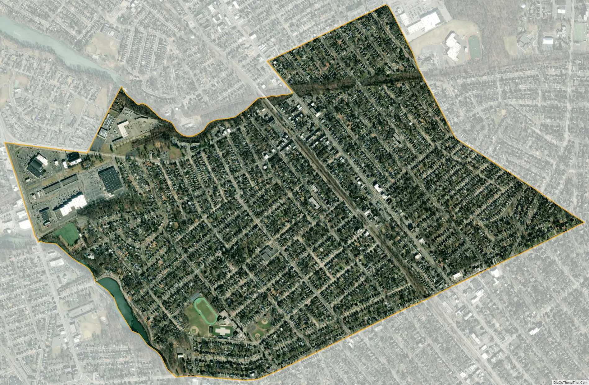
Audubon city Satellite Map
Geography
According to the United States Census Bureau, the borough had a total area of 1.50 square miles (3.87 km), including 1.48 square miles (3.84 km) of land and 0.01 square miles (0.04 km) of water (0.93%).
Unincorporated communities, localities and place names located partially or completely within the borough include Orston.
Audubon borders Audubon Park, Haddon Heights, Haddon Township, Haddonfield, Mount Ephraim and Oaklyn.
Climate
The climate in the area is characterized by hot, humid summers and generally mild to cool winters. According to the Köppen Climate Classification system, Audubon has a humid subtropical climate, abbreviated “Cfa” on climate maps.
See also
Map of New Jersey State and its subdivision: Map of other states:- Alabama
- Alaska
- Arizona
- Arkansas
- California
- Colorado
- Connecticut
- Delaware
- District of Columbia
- Florida
- Georgia
- Hawaii
- Idaho
- Illinois
- Indiana
- Iowa
- Kansas
- Kentucky
- Louisiana
- Maine
- Maryland
- Massachusetts
- Michigan
- Minnesota
- Mississippi
- Missouri
- Montana
- Nebraska
- Nevada
- New Hampshire
- New Jersey
- New Mexico
- New York
- North Carolina
- North Dakota
- Ohio
- Oklahoma
- Oregon
- Pennsylvania
- Rhode Island
- South Carolina
- South Dakota
- Tennessee
- Texas
- Utah
- Vermont
- Virginia
- Washington
- West Virginia
- Wisconsin
- Wyoming


