Bellmawr is a borough in Camden County, in the U.S. state of New Jersey. As of the 2020 United States census, the borough’s population was 11,707, an increase of 124 (+1.1%) from the 2010 census count of 11,583, which in turn reflected an increase of 321 (+2.9%) from the 11,262 counted in the 2000 census.
Bellmawr is home to the main post office for the area, one of the largest in the state of New Jersey, handling an average of 4.5 million pieces of mail daily.
Bellmawr joins Cranbury, Egg Harbor Township, Montclair and Woodbridge Township as one of the first five municipalities in the state that have authorized dispensaries to sell medical cannabis.
| Name: | Bellmawr borough |
|---|---|
| LSAD Code: | 21 |
| LSAD Description: | borough (suffix) |
| State: | New Jersey |
| County: | Camden County |
| Incorporated: | April 21, 1926 |
| Elevation: | 66 ft (20 m) |
| Total Area: | 3.11 sq mi (8.05 km²) |
| Land Area: | 2.98 sq mi (7.73 km²) |
| Water Area: | 0.12 sq mi (0.32 km²) 3.92% |
| Total Population: | 11,707 |
| Population Density: | 3,923.3/sq mi (1,514.8/km²) |
| Area code: | 856 |
| FIPS code: | 3404750 |
| GNISfeature ID: | 0885154 |
| Website: | www.bellmawr.com |
Online Interactive Map
Click on ![]() to view map in "full screen" mode.
to view map in "full screen" mode.
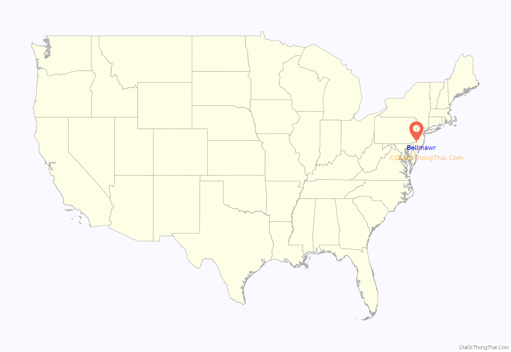
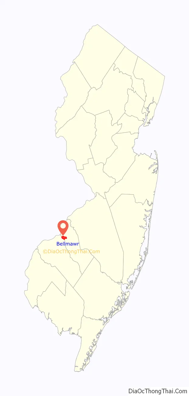
Bellmawr location map. Where is Bellmawr borough?
History
Bellmawr was incorporated as a borough on March 23, 1926, from portions of the now-defunct Centre Township, based on the results of a referendum held on April 21, 1926. The boroughs of Mount Ephraim, Runnemede and Lawnside were also created in the same two-day period. The borough was named for Ernest C. Bell, who owned a farm in the area.
In 1966, the Bellmawr Police Department investigated several officers for ticket fixing. The officers were ordered to cooperate with internal investigators and give statements and told that they would be fired if they refused to do so; upon answering the investigators’ questions, the officers were criminally charged. In 1967, the Supreme Court of the United States ruled that the officers’ self-incriminating statements violated the Fifth Amendment and Fourteenth Amendment, and that it was therefore unconstitutional to use their statements in a prosecution; the officers’ convictions were overturned. The case, Garrity v. New Jersey, led to the creation of the Garrity warning, which advises government employees of their rights during internal investigations.
In late October 2001, the Bellmawr post office was closed due to possible anthrax contamination in the wake of the 2001 anthrax attacks. The office was re-opened several days later, in early November, after testing negative for anthrax.
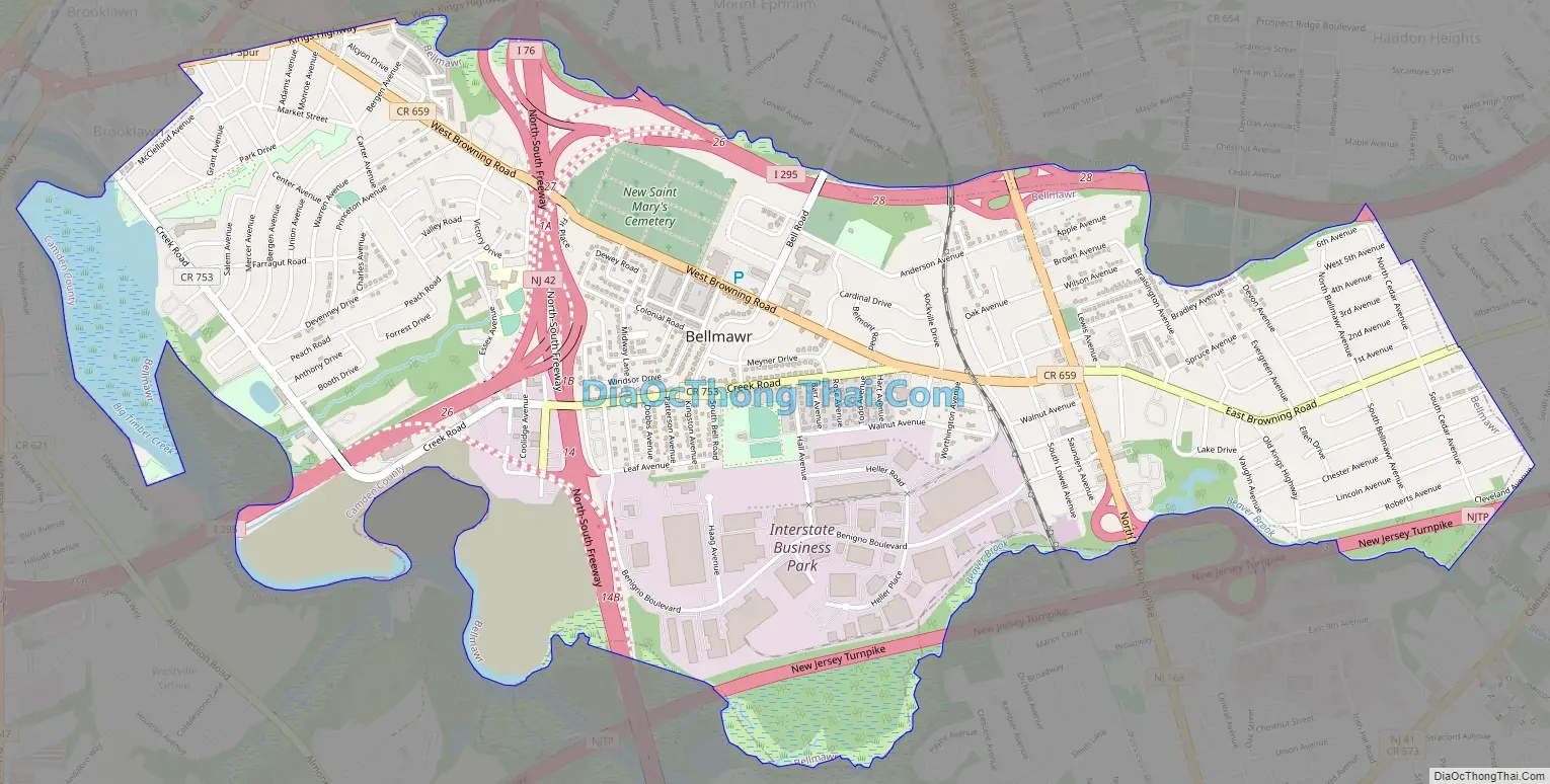
Bellmawr Road Map
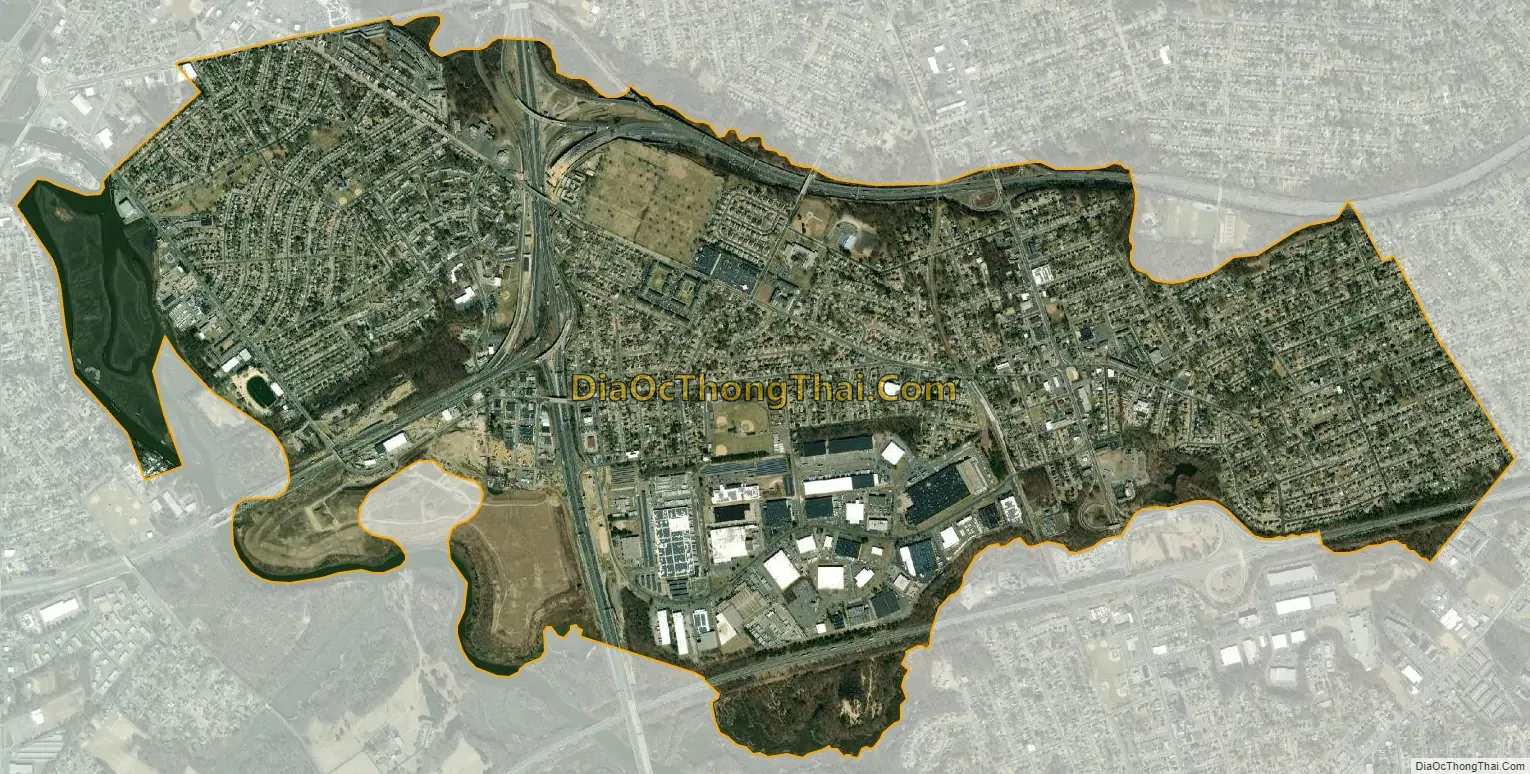
Bellmawr city Satellite Map
Geography
According to the United States Census Bureau, the borough had a total area of 3.11 square miles (8.05 km), including 2.98 square miles (7.73 km) of land and 0.12 square miles (0.32 km) of water (3.92%).
The borough borders the municipalities of Barrington, Brooklawn, Gloucester City, Haddon Heights, Mount Ephraim, and Runnemede in Camden County; and Deptford Township and Westville, both in Gloucester County.
See also
Map of New Jersey State and its subdivision: Map of other states:- Alabama
- Alaska
- Arizona
- Arkansas
- California
- Colorado
- Connecticut
- Delaware
- District of Columbia
- Florida
- Georgia
- Hawaii
- Idaho
- Illinois
- Indiana
- Iowa
- Kansas
- Kentucky
- Louisiana
- Maine
- Maryland
- Massachusetts
- Michigan
- Minnesota
- Mississippi
- Missouri
- Montana
- Nebraska
- Nevada
- New Hampshire
- New Jersey
- New Mexico
- New York
- North Carolina
- North Dakota
- Ohio
- Oklahoma
- Oregon
- Pennsylvania
- Rhode Island
- South Carolina
- South Dakota
- Tennessee
- Texas
- Utah
- Vermont
- Virginia
- Washington
- West Virginia
- Wisconsin
- Wyoming


