Brooklawn is a borough in Camden County, in the U.S. state of New Jersey. As of the 2020 United States census, the borough’s population was 1,815, a decrease of 140 (−7.2%) from the 2010 census count of 1,955, which in turn reflected a decline of 399 (-16.9%) from the 2,354 counted in the 2000 Census, which had in turn increased by 549 (+30.4%) from the 1,805 counted in the 1990 Census.
Brooklawn was incorporated as a borough on March 11, 1924, from portions of the now-defunct Centre Township, based on the results of a referendum held on April 5, 1924. The borough was reincorporated on March 23, 1926. The borough’s name is derived from its location and setting.
| Name: | Brooklawn borough |
|---|---|
| LSAD Code: | 21 |
| LSAD Description: | borough (suffix) |
| State: | New Jersey |
| County: | Camden County |
| Incorporated: | March 11, 1924 |
| Elevation: | 20 ft (6 m) |
| Total Area: | 0.53 sq mi (1.37 km²) |
| Land Area: | 0.49 sq mi (1.27 km²) |
| Water Area: | 0.04 sq mi (0.11 km²) 7.74% |
| Total Population: | 1,815 |
| Population Density: | 3,715.7/sq mi (1,434.6/km²) |
| ZIP code: | 08030 |
| Area code: | 856 exchanges: 456, 742, 931, 933 |
| FIPS code: | 3408170 |
| GNISfeature ID: | 0885172 |
| Website: | brooklawn-nj.com |
Online Interactive Map
Click on ![]() to view map in "full screen" mode.
to view map in "full screen" mode.
Brooklawn location map. Where is Brooklawn borough?

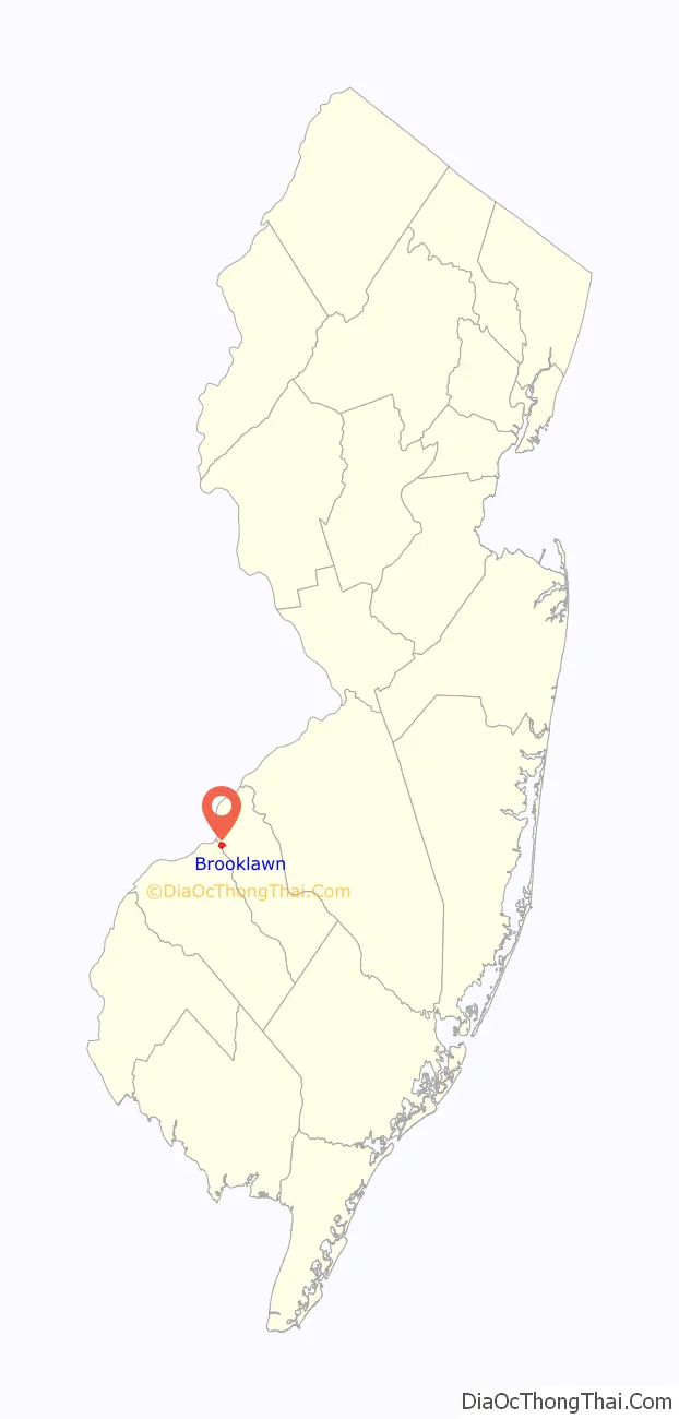
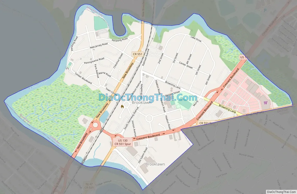
Brooklawn Road Map
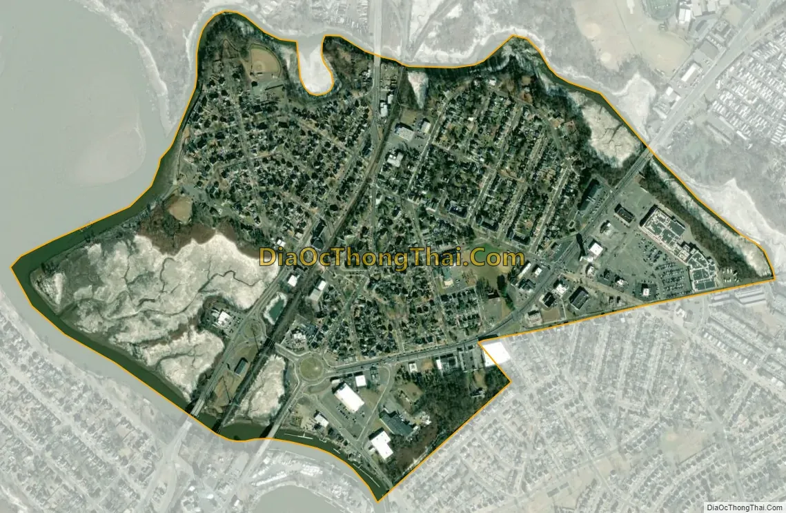
Brooklawn city Satellite Map
Geography
According to the U.S. Census Bureau, the borough had a total area of 0.53 square miles (1.37 km), including 0.49 square miles (1.27 km) of land and 0.04 square miles (0.11 km) of water (7.74%).
The borough borders the municipalities of Bellmawr, Gloucester City, and Mount Ephraim in Camden County and Westville in Gloucester County.
See also
Map of New Jersey State and its subdivision: Map of other states:- Alabama
- Alaska
- Arizona
- Arkansas
- California
- Colorado
- Connecticut
- Delaware
- District of Columbia
- Florida
- Georgia
- Hawaii
- Idaho
- Illinois
- Indiana
- Iowa
- Kansas
- Kentucky
- Louisiana
- Maine
- Maryland
- Massachusetts
- Michigan
- Minnesota
- Mississippi
- Missouri
- Montana
- Nebraska
- Nevada
- New Hampshire
- New Jersey
- New Mexico
- New York
- North Carolina
- North Dakota
- Ohio
- Oklahoma
- Oregon
- Pennsylvania
- Rhode Island
- South Carolina
- South Dakota
- Tennessee
- Texas
- Utah
- Vermont
- Virginia
- Washington
- West Virginia
- Wisconsin
- Wyoming


