Clayton is a borough in Gloucester County in the U.S. state of New Jersey. As of the 2020 United States census, the borough’s population was 8,807, an increase of 628 (+7.7%) from the 2010 census count of 8,179, which in turn reflected an increase of 1,040 (+14.6%) from the 7,139 counted in the 2000 census.
Jacob Fisler purchased much of the area that is now Clayton, acquiring 6,500 acres (2,600 ha) of land after the American Revolutionary War. A settlement named Fislertown developed and grew to 36 families by 1812. A glass factory was established in Clayton in the 1850s by one of Fisler’s descendants, which contributed to Fislertown’s growth.
What is now Clayton was formed as Clayton Township on February 5, 1858, from portions of Franklin Township. Portions of the township were later taken on March 11, 1878, to form Glassboro Township. Clayton was formed as a borough by the New Jersey Legislature on May 9, 1887, from portions of Clayton Township. The remainder of Clayton Township was absorbed by the Clayton on April 14, 1908, and the township was dissolved. Clayton is part of the South Jersey region of the state.
| Name: | Clayton borough |
|---|---|
| LSAD Code: | 21 |
| LSAD Description: | borough (suffix) |
| State: | New Jersey |
| County: | Gloucester County |
| Incorporated: | February 5, 1858 (as township) |
| Elevation: | 121 ft (37 m) |
| Total Area: | 7.26 sq mi (18.80 km²) |
| Land Area: | 7.08 sq mi (18.32 km²) |
| Water Area: | 0.18 sq mi (0.48 km²) 2.53% |
| Total Population: | 8,807 |
| Population Density: | 1,244.8/sq mi (480.6/km²) |
| ZIP code: | 08312 |
| Area code: | 856 exchanges: 307, 442, 863, 881 |
| FIPS code: | 3413360 |
| GNISfeature ID: | 0885185 |
| Website: | www.claytonnj.com |
Online Interactive Map
Click on ![]() to view map in "full screen" mode.
to view map in "full screen" mode.
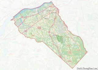
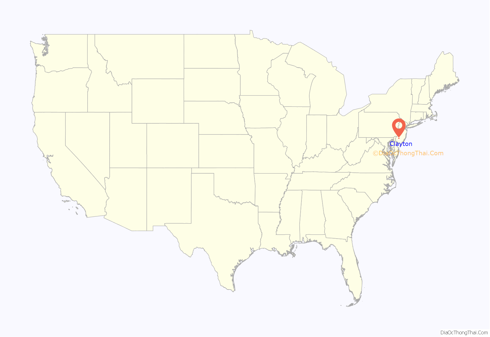
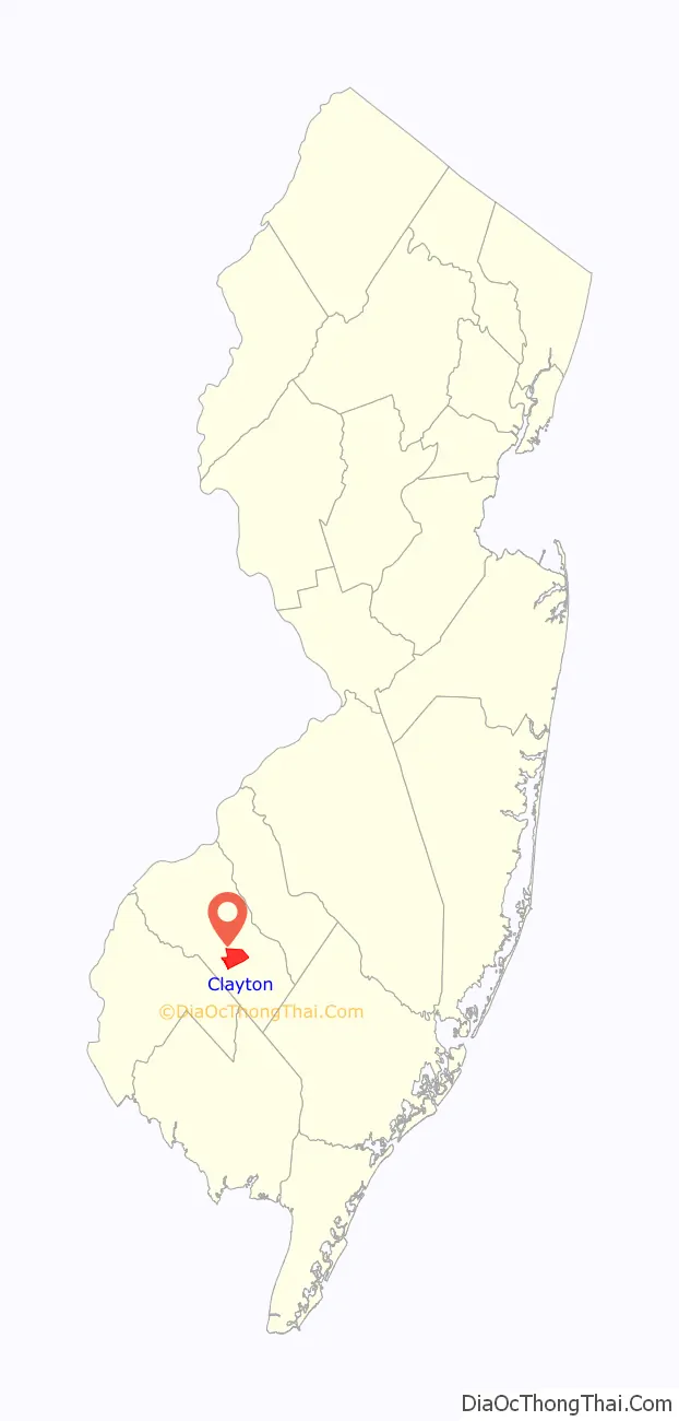
Clayton location map. Where is Clayton borough?
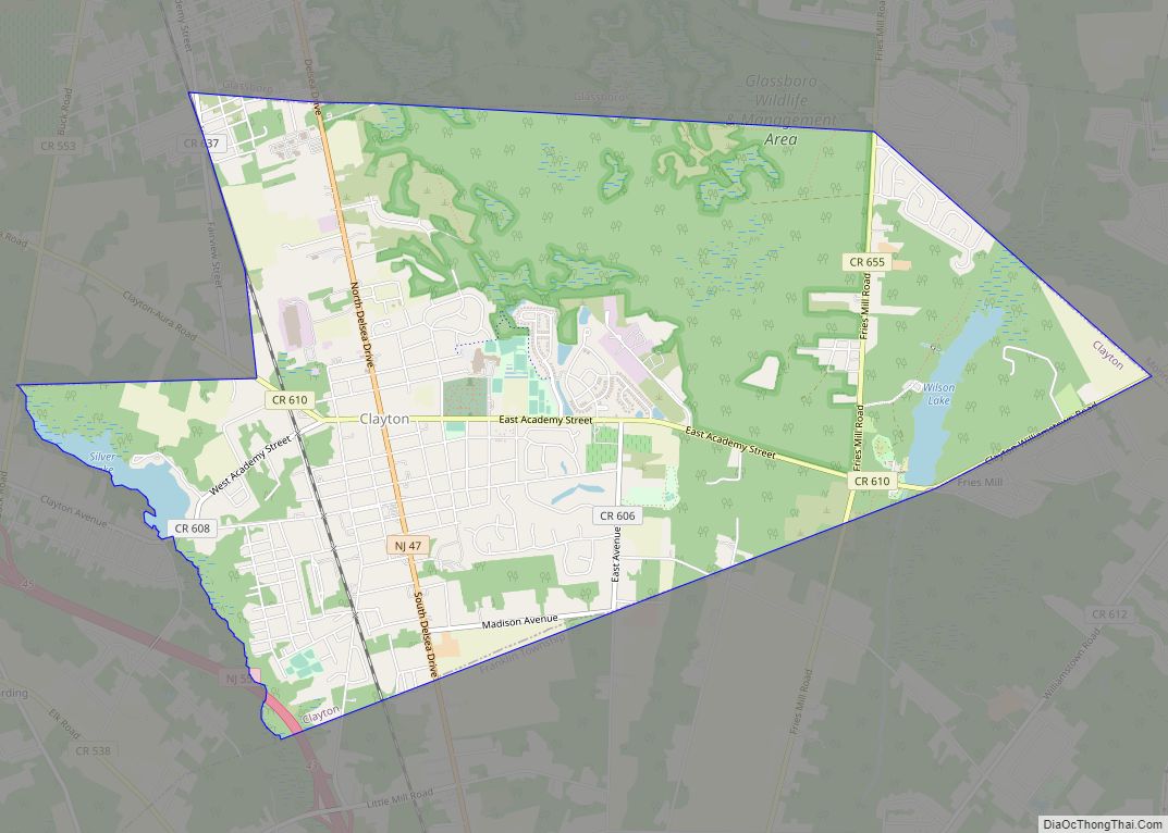
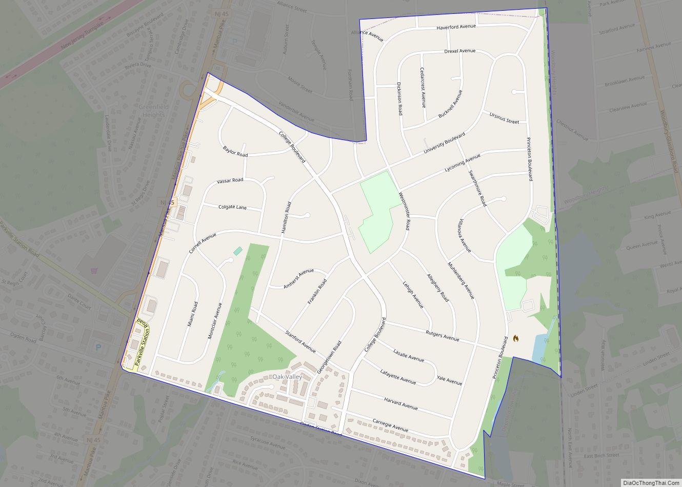
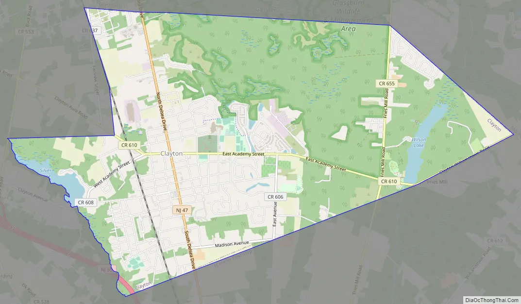
Clayton Road Map
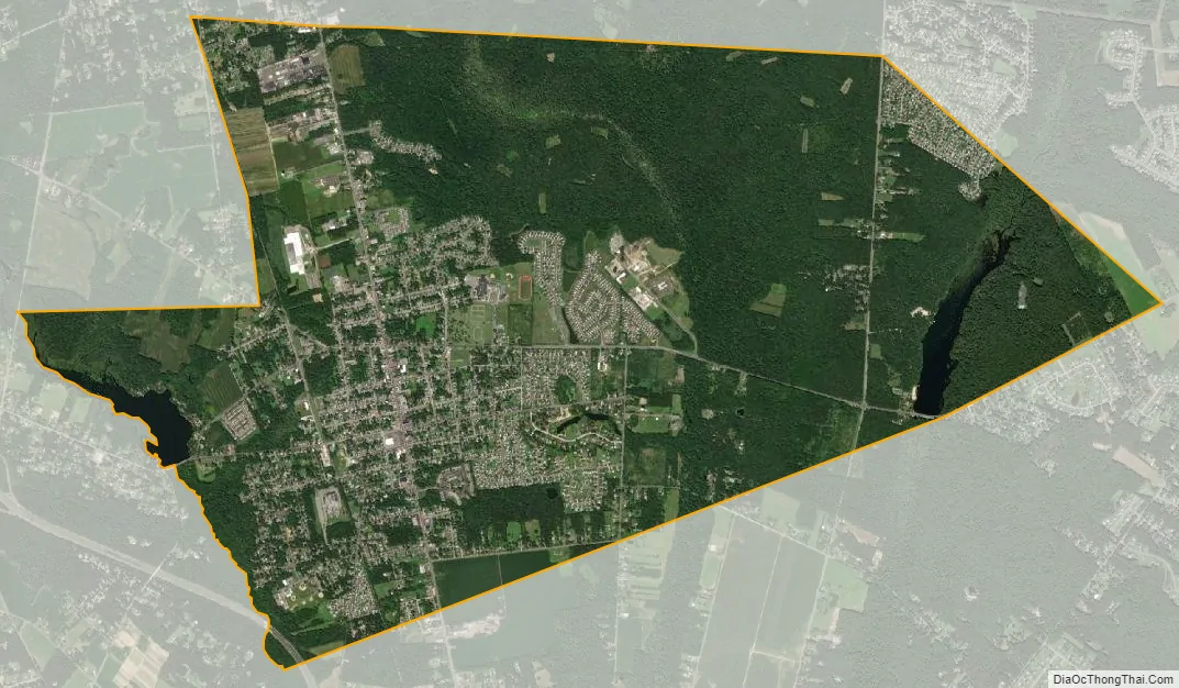
Clayton city Satellite Map
Geography
According to the U.S. Census Bureau, the borough had a total area of 7.26 square miles (18.80 km), including 7.08 square miles (18.32 km) of land and 0.18 square miles (0.48 km) of water (2.53%). Unincorporated communities, localities and place names located partially or completely within the borough include Silver Lake. Clayton borders Elk Township, Franklin Township, Glassboro, and Monroe Township.
See also
Map of New Jersey State and its subdivision: Map of other states:- Alabama
- Alaska
- Arizona
- Arkansas
- California
- Colorado
- Connecticut
- Delaware
- District of Columbia
- Florida
- Georgia
- Hawaii
- Idaho
- Illinois
- Indiana
- Iowa
- Kansas
- Kentucky
- Louisiana
- Maine
- Maryland
- Massachusetts
- Michigan
- Minnesota
- Mississippi
- Missouri
- Montana
- Nebraska
- Nevada
- New Hampshire
- New Jersey
- New Mexico
- New York
- North Carolina
- North Dakota
- Ohio
- Oklahoma
- Oregon
- Pennsylvania
- Rhode Island
- South Carolina
- South Dakota
- Tennessee
- Texas
- Utah
- Vermont
- Virginia
- Washington
- West Virginia
- Wisconsin
- Wyoming