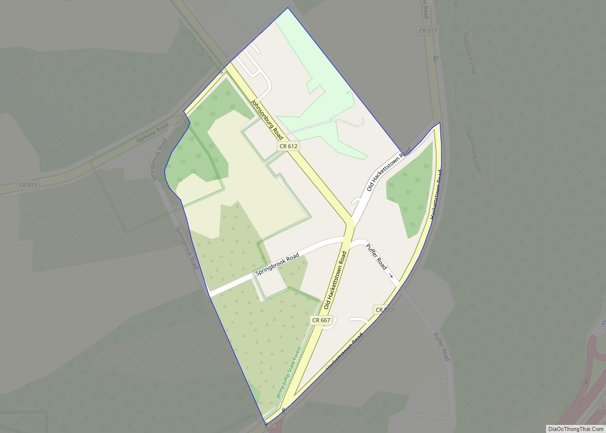
Columbia is an unincorporated community and census-designated place (CDP) located within Knowlton Township in Warren County, New Jersey, United States. While the community has existed for over a century, the CDP was created as part of the 2010 United States Census. As of the 2010 Census, the CDP’s population was 229. The area is served as United States Postal Service ZIP Code 07832.
| Name: | Columbia CDP |
|---|---|
| LSAD Code: | 57 |
| LSAD Description: | CDP (suffix) |
| State: | New Jersey |
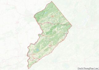
| County: | Warren County |
| Elevation: | 305 ft (93 m) |
| Total Area: | 0.13 sq mi (0.33 km²) |
| Land Area: | 0.10 sq mi (0.26 km²) |
| Water Area: | 0.03 sq mi (0.07 km²) 20.94% |
| Total Population: | 215 |
| Population Density: | 2,150.00/sq mi (829.28/km²) |
| ZIP code: | 07832 |
| Area code: | 908 |
| FIPS code: | 3414590 |
| GNISfeature ID: | 02583981 |
Online Interactive Map
Click on ![]() to view map in "full screen" mode.
to view map in "full screen" mode.
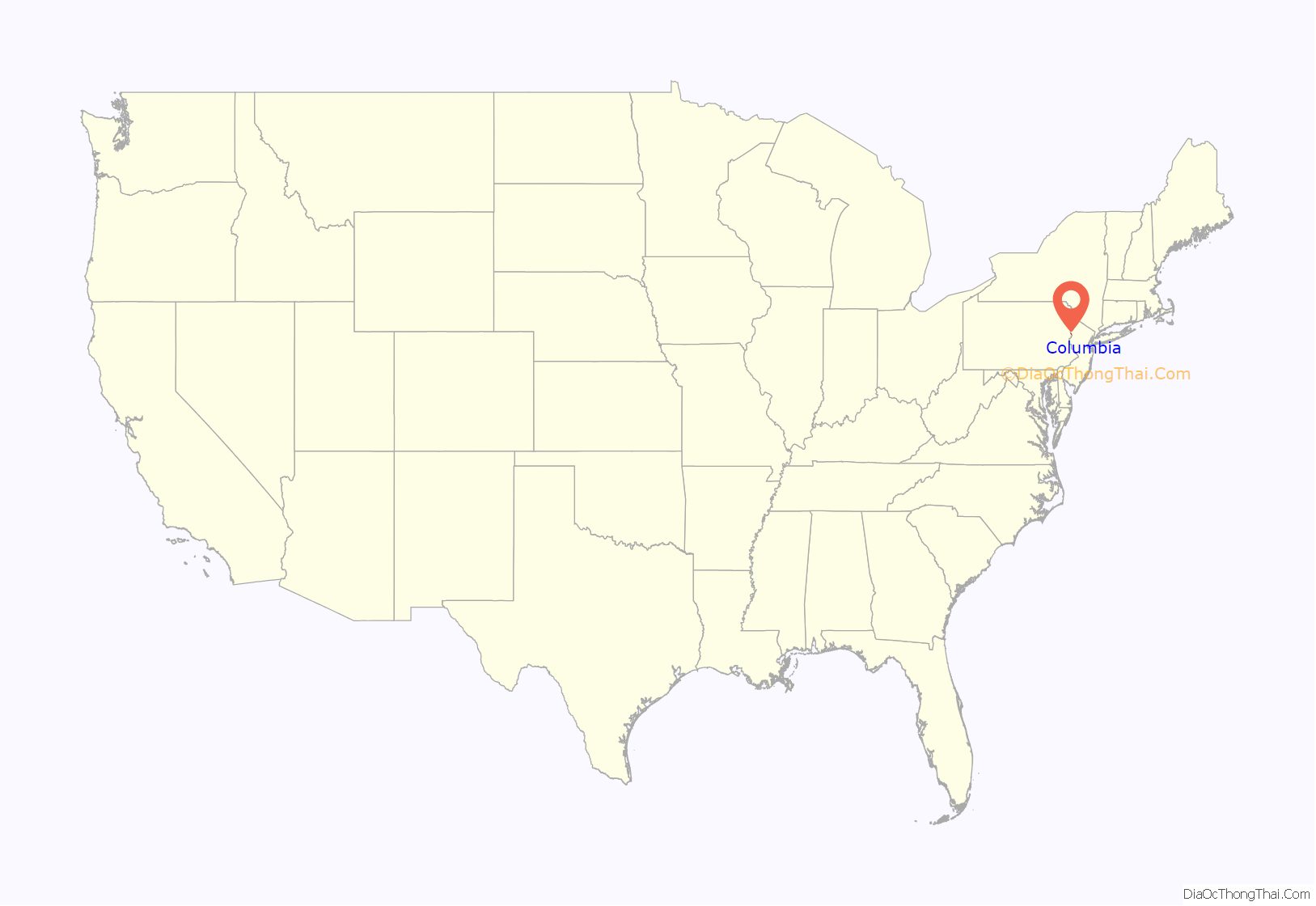
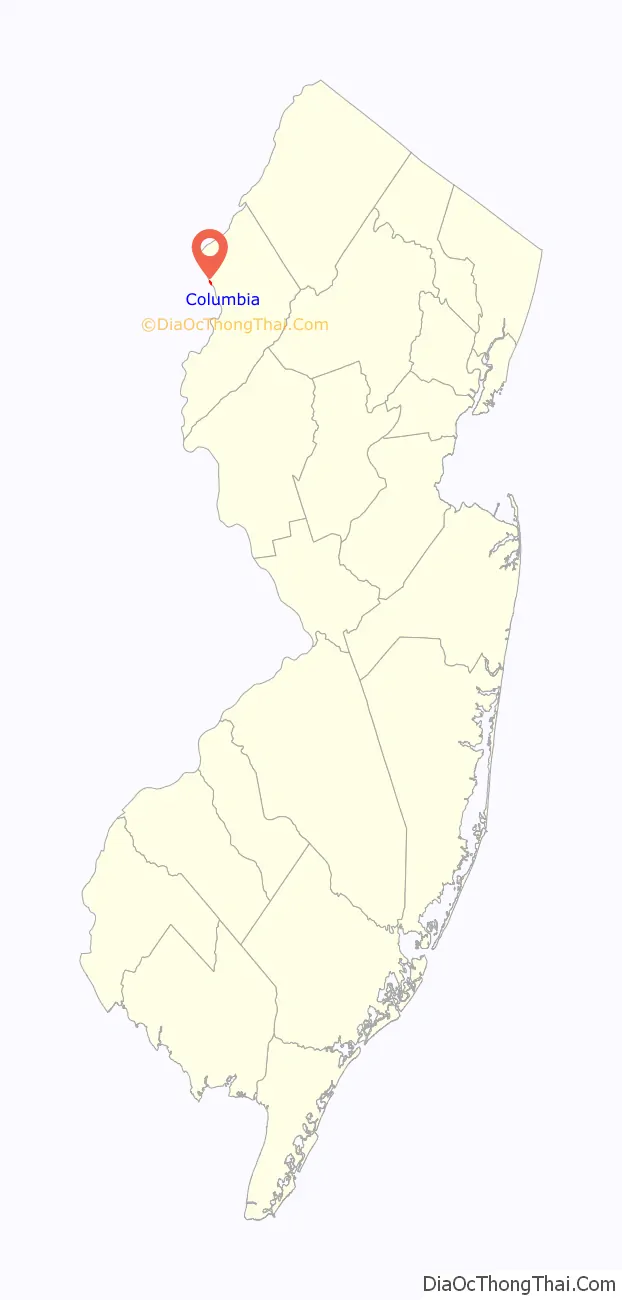
Columbia location map. Where is Columbia CDP?
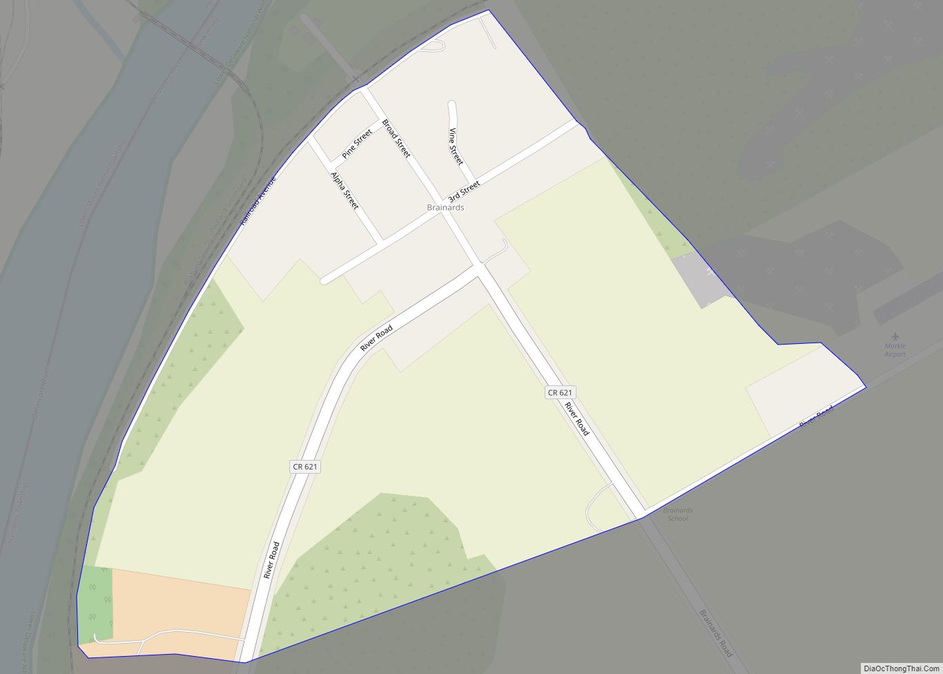
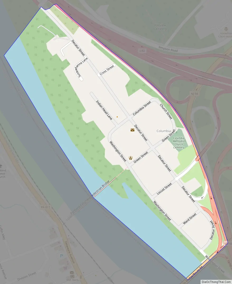
Columbia Road Map
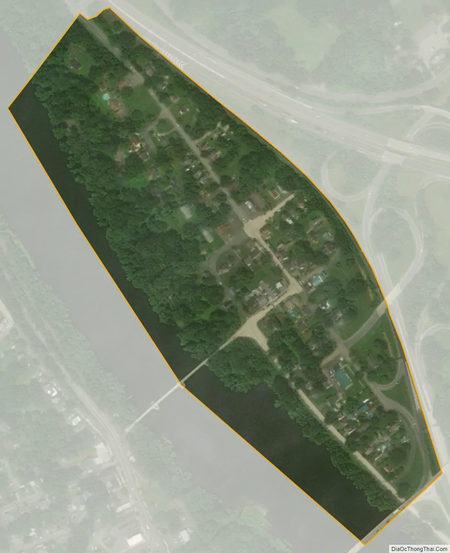
Columbia city Satellite Map
Geography
According to the United States Census Bureau, the CDP had a total area of 0.126 square miles (0.327 km), including 0.100 square miles (0.258 km) of land and 0.026 square miles (0.068 km) of water (20.94%).
See also
Map of New Jersey State and its subdivision: Map of other states:- Alabama
- Alaska
- Arizona
- Arkansas
- California
- Colorado
- Connecticut
- Delaware
- District of Columbia
- Florida
- Georgia
- Hawaii
- Idaho
- Illinois
- Indiana
- Iowa
- Kansas
- Kentucky
- Louisiana
- Maine
- Maryland
- Massachusetts
- Michigan
- Minnesota
- Mississippi
- Missouri
- Montana
- Nebraska
- Nevada
- New Hampshire
- New Jersey
- New Mexico
- New York
- North Carolina
- North Dakota
- Ohio
- Oklahoma
- Oregon
- Pennsylvania
- Rhode Island
- South Carolina
- South Dakota
- Tennessee
- Texas
- Utah
- Vermont
- Virginia
- Washington
- West Virginia
- Wisconsin
- Wyoming