Frenchtown is a borough in Hunterdon County, in the U.S. state of New Jersey. Frenchtown is located along the banks of the Delaware River on the Hunterdon Plateau, 32 miles (51 km) northwest of the state capital of Trenton. As of the 2020 United States census, the borough’s population was 1,370, a decrease of three people (−0.2%) from the 2010 census count of 1,373, which in turn reflected a decline of 115 (−7.7%) from the 1,488 counted in the 2000 census.
| Name: | Frenchtown borough |
|---|---|
| LSAD Code: | 21 |
| LSAD Description: | borough (suffix) |
| State: | New Jersey |
| County: | Hunterdon County |
| Incorporated: | April 4, 1867 |
| Elevation: | 220 ft (70 m) |
| Total Area: | 1.23 sq mi (3.18 km²) |
| Land Area: | 1.13 sq mi (2.92 km²) |
| Water Area: | 0.10 sq mi (0.26 km²) 8.05% |
| Total Population: | 1,370 |
| Population Density: | 1,214.2/sq mi (468.8/km²) |
| ZIP code: | 08825 |
| Area code: | 908 |
| FIPS code: | 3425350 |
| GNISfeature ID: | 0885227 |
| Website: | www.frenchtownboro.com |
Online Interactive Map
Click on ![]() to view map in "full screen" mode.
to view map in "full screen" mode.
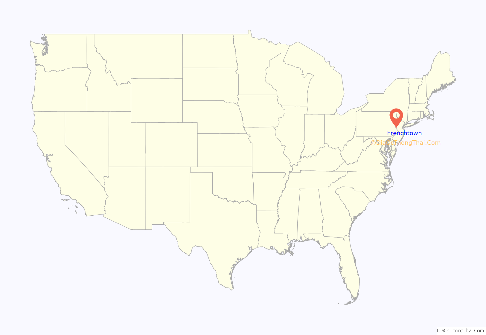
Frenchtown location map. Where is Frenchtown borough?
History
Naming Frenchtown
Various names have been applied to this settlement after the many ferry operators residing on both sides of the river. The community had variously been known as Alexandriaville, Sunbeam and Frenchtown over the years. The borough was formed by an Incorporation act of the New Jersey Legislature on April 4, 1867, from portions of Alexandria Township. Additional territory was acquired from Kingwood Township in 1876.
Bridges
The first bridge across the Delaware at Frenchtown was a six-span covered wooden bridge built in 1841 on the five piers that still stand today, and the community became a gateway to Pennsylvania. The present day steel truss Uhlerstown-Frenchtown Bridge is a free Delaware River Joint Toll Bridge Commission bridge over the Delaware River connecting Frenchtown to Uhlerstown, Bucks County, Pennsylvania.
Lenape and early European settlers
The Lenape Native Americans had populated the area until they were fully supplanted by European settlement around 1750. About 1725, a group of French Huguenot refugees settled in Hunterdon County. Originally from the Picardy region of France, they had fled after the revocation of the Edict of Nantes in 1685 when the King began persecution of non Catholics in France. One notable settler was Luther Calvin, a landowner and ferry operator who also bought a Hotel on Everittstown Road. Calvin also served as a 1st Lieutenant of the Associated Companies in 1756 during the French and Indian War. In 1757, three joint owners of a tract purchased from the West Jersey Land Society began laying out streets and building lots at what was then known as Calvin’s Ferry. The developing town was to be called “Alexandria” in honor of William Alexander, Lord Stirling, one of the three owners. In 1776, the three sold the settlement to Thomas Lowrey, a Flemington speculator. In 1794, Lowrey sold the tract to Paul Henri Mallet-Prevost, a Swiss fugitive from the French Revolution. He and other early settlers were French speaking, leading some to begin calling the settlement “Frenchtown.”
The canal, railroad, and industry
Lambertville grew substantially in the next four decades. A trade in grain and other farm products brought into town developed. Boatmen and river men helped fuel Frenchtown’s growth through their buying of cargo and food, and hiring of pilots. In the years after Henri Mallet-Prevost’s death, his sons sold off portions of their property and no longer was the town privately owned.
The arrival of the Belvidere Delaware Railroad in 1853 sparked continued growth in Frenchtown. Steam-powered industry became widely developed, and by the 1860s, water powered mills were being converted into larger factories. Around the same time, the town had three major hotels: The Lower Hotel (Present day Frenchtown Inn), The Middle Hotel (no longer existing), and the Upper Hotel (The National Hotel). In 1889, Britton Brothers Big Brick Store, which sold a variety of goods, opened on Bridge Street. The railroad eventually became a branch of the Pennsylvania Railroad. It no longer operates but its tracks are still evident. The Delaware and Raritan Canal had been constructed adjacent to the Delaware River in the 1800s. It was quickly abandoned upon the arrival of the paralleling railroad. Its extant towpaths are now a popular biking and hiking trail from Trenton through Lambertville to Frenchtown and beyond. It is maintained by the State of New Jersey as the Delaware and Raritan State Park Trail.
In the early 20th century, growth was spurred by the arrival of Frenchtown Porcelain Works, the establishment of the Milford plant of the Warren Paper Company, and the rise of the poultry industry.
Floods
Hurricane Diane in 1955 raised the level of the Delaware River dramatically and flooded the streets of Frenchtown as well as other riverbank towns and caused serious damage to buildings and residences. Frenchtown streets have flooded on occasion due to other hurricanes since 1955.
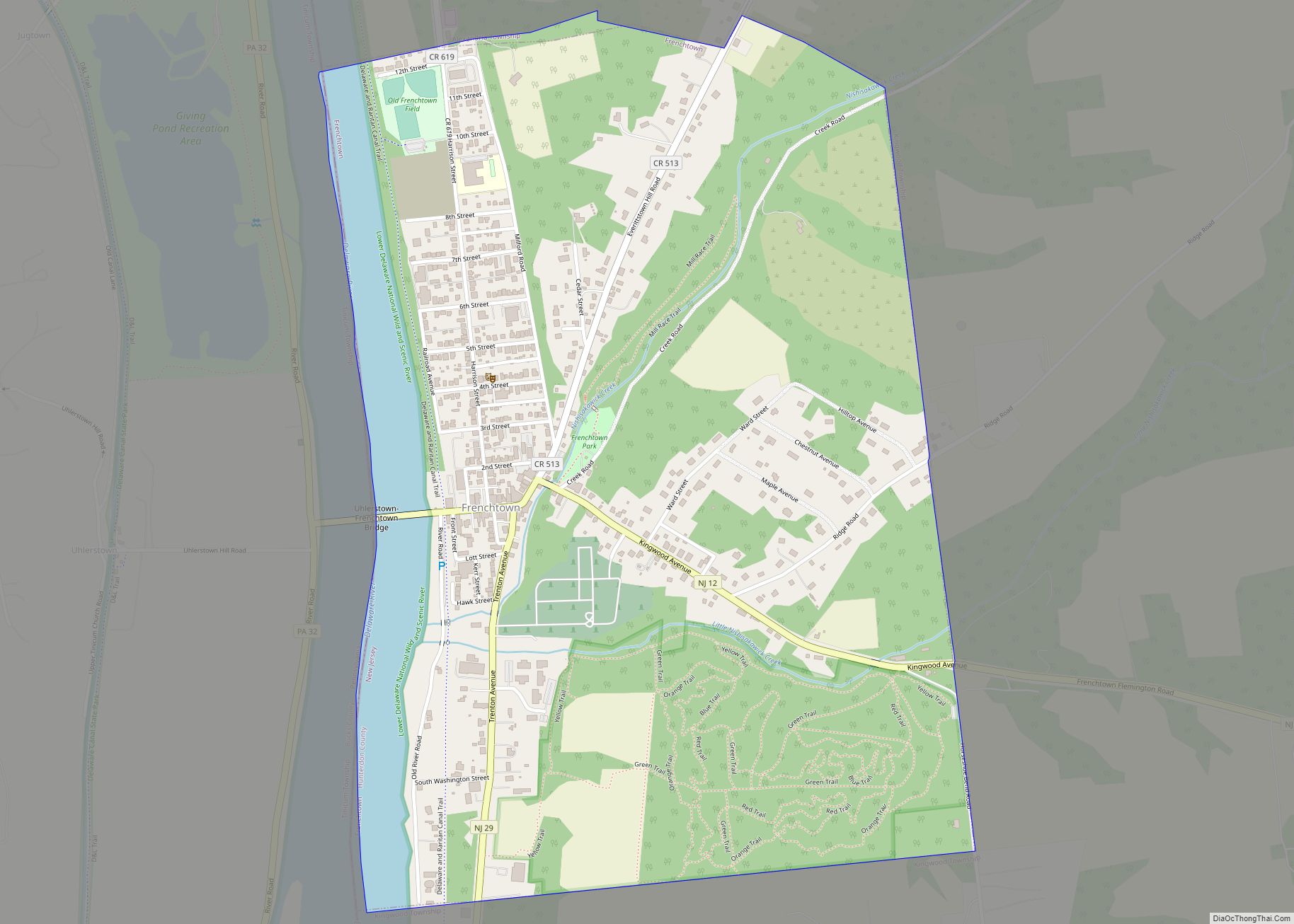
Frenchtown Road Map
Frenchtown city Satellite Map
Geography
According to the United States Census Bureau, the borough had a total area of 1.23 square miles (3.18 km), including 1.13 square miles (2.92 km) of land and 0.10 square miles (0.26 km) of water (8.05%).
Frenchtown borders the municipalities of Alexandria Township and Kingwood Township in Hunterdon County; and Tinicum Township in Bucks County, across the Delaware River in the Commonwealth of Pennsylvania.
Frenchtown Solar is a group of three photovoltaic arrays forming one of the largest solar farms in the state covering 110 acres (44.5 ha) with 68,500 solar panels and 20.1 megawatt capacity.
See also
Map of New Jersey State and its subdivision: Map of other states:- Alabama
- Alaska
- Arizona
- Arkansas
- California
- Colorado
- Connecticut
- Delaware
- District of Columbia
- Florida
- Georgia
- Hawaii
- Idaho
- Illinois
- Indiana
- Iowa
- Kansas
- Kentucky
- Louisiana
- Maine
- Maryland
- Massachusetts
- Michigan
- Minnesota
- Mississippi
- Missouri
- Montana
- Nebraska
- Nevada
- New Hampshire
- New Jersey
- New Mexico
- New York
- North Carolina
- North Dakota
- Ohio
- Oklahoma
- Oregon
- Pennsylvania
- Rhode Island
- South Carolina
- South Dakota
- Tennessee
- Texas
- Utah
- Vermont
- Virginia
- Washington
- West Virginia
- Wisconsin
- Wyoming
