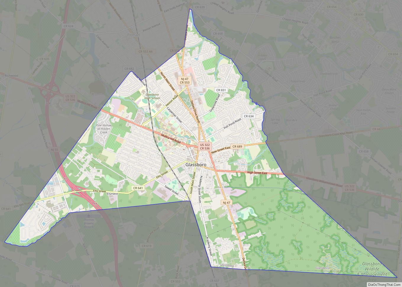
Glassboro is a borough in Gloucester County, in the U.S. state of New Jersey. As of the 2020 United States census, the borough’s population was 23,149, an increase of 4,570 (+24.6%) from the 2010 census count of 18,579, which in turn reflected a decline of 489 (−2.6%) from the 19,068 counted in the 2000 census.
What is now Glassboro was originally formed as a township by an act of the New Jersey Legislature on March 11, 1878, from portions of Clayton Township. Portions of the township were taken to form Elk Township (April 17, 1891) and Pitman (May 24, 1905). Glassboro was incorporated as a borough on March 18, 1920, replacing Glassboro Township. The borough was named for its glass industry.
Glassboro is home to Rowan University, founded in 1923 and formerly known as Glassboro State College, which was the site of the Glassboro Summit Conference in 1967 between U.S. President Lyndon B. Johnson and Soviet Premier Alexei Kosygin.
Glassboro is part of the South Jersey region of the state.
| Name: | Glassboro borough |
|---|---|
| LSAD Code: | 21 |
| LSAD Description: | borough (suffix) |
| State: | New Jersey |
| County: | Gloucester County |
| Incorporated: | March 11, 1878 |
| Elevation: | 148 ft (45 m) |
| Total Area: | 9.36 sq mi (24.24 km²) |
| Land Area: | 9.32 sq mi (24.14 km²) |
| Water Area: | 0.04 sq mi (0.10 km²) 0.41% |
| Total Population: | 23,149 |
| Population Density: | 2,483.8/sq mi (959.0/km²) |
| ZIP code: | 08028 |
| FIPS code: | 3426340 |
| GNISfeature ID: | 0885231 |
| Website: | www.glassboro.org |
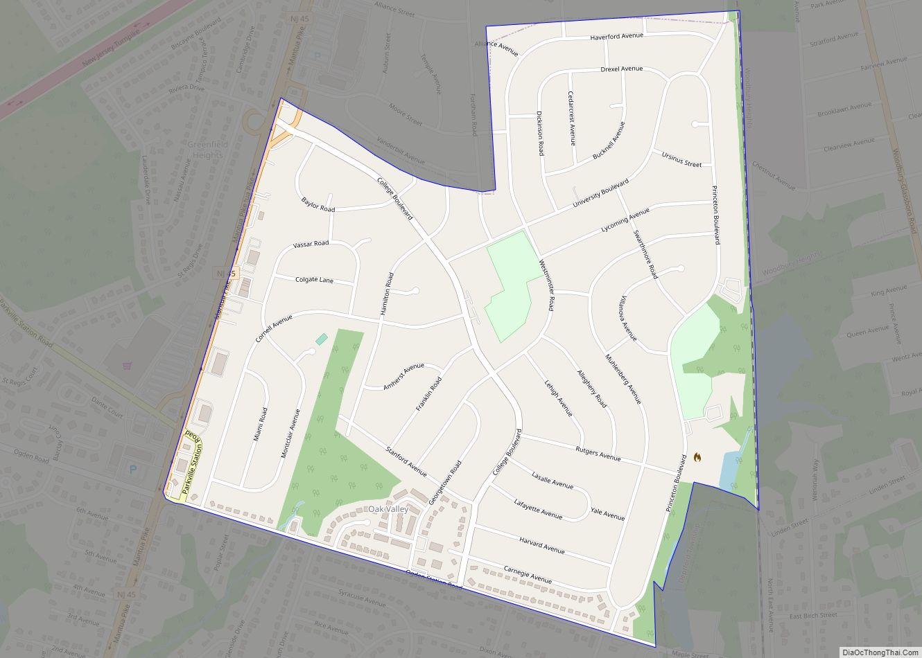
Online Interactive Map
Click on ![]() to view map in "full screen" mode.
to view map in "full screen" mode.
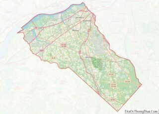
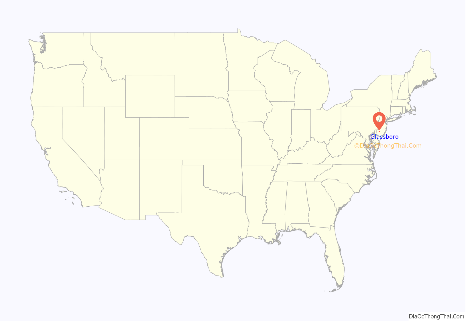
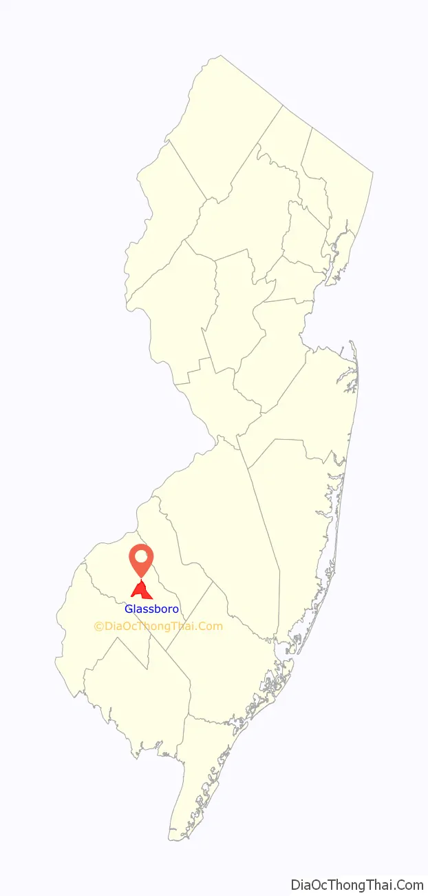
Glassboro location map. Where is Glassboro borough?
History
Glassboro’s early industrial history was built on the manufacturing of glass. The town was first established in 1779 by Solomon Stanger as Glass Works in the Woods. Glass manufacturers over the years since include Heston-Carpenter Glass Works, Olive Glass Works, Harmony Glass Works, Temperanceville Glass Works, Whitney Brothers Glass Works, Owens Bottle Company, Owens Illinois Glass Company, and Anchor Hocking.
In 1958, a typhoid fever epidemic broke out in the predominantly African-American neighborhoods of Elsmere and Lawns, which was attributed to 20 years of municipal neglect of the sanitary infrastructure in these neighborhoods.
The Glassboro Summit Conference between U.S. President Lyndon B. Johnson and Soviet Premier Alexei Kosygin took place in Glassboro. Johnson and Kosygin met for three days from June 23 to June 25, 1967, at Glassboro State College (later renamed Rowan University). The location was chosen as a compromise. Kosygin, having agreed to address the United Nations in New York City, wanted to meet in New York City. Johnson, wary of encountering protests against the Vietnam War, preferred to meet in Washington, D.C. They agreed in Glassboro because it was equidistant between the two cities. The summit’s generally amicable atmosphere was referred to as the “Spirit of Glassboro,” although the leaders failed to reach agreement on limiting anti-ballistic missile systems.
On June 19, 1986, Ronald Reagan became the first sitting president to speak at a high school graduation when he spoke at the Glassboro High School commencement ceremonies.
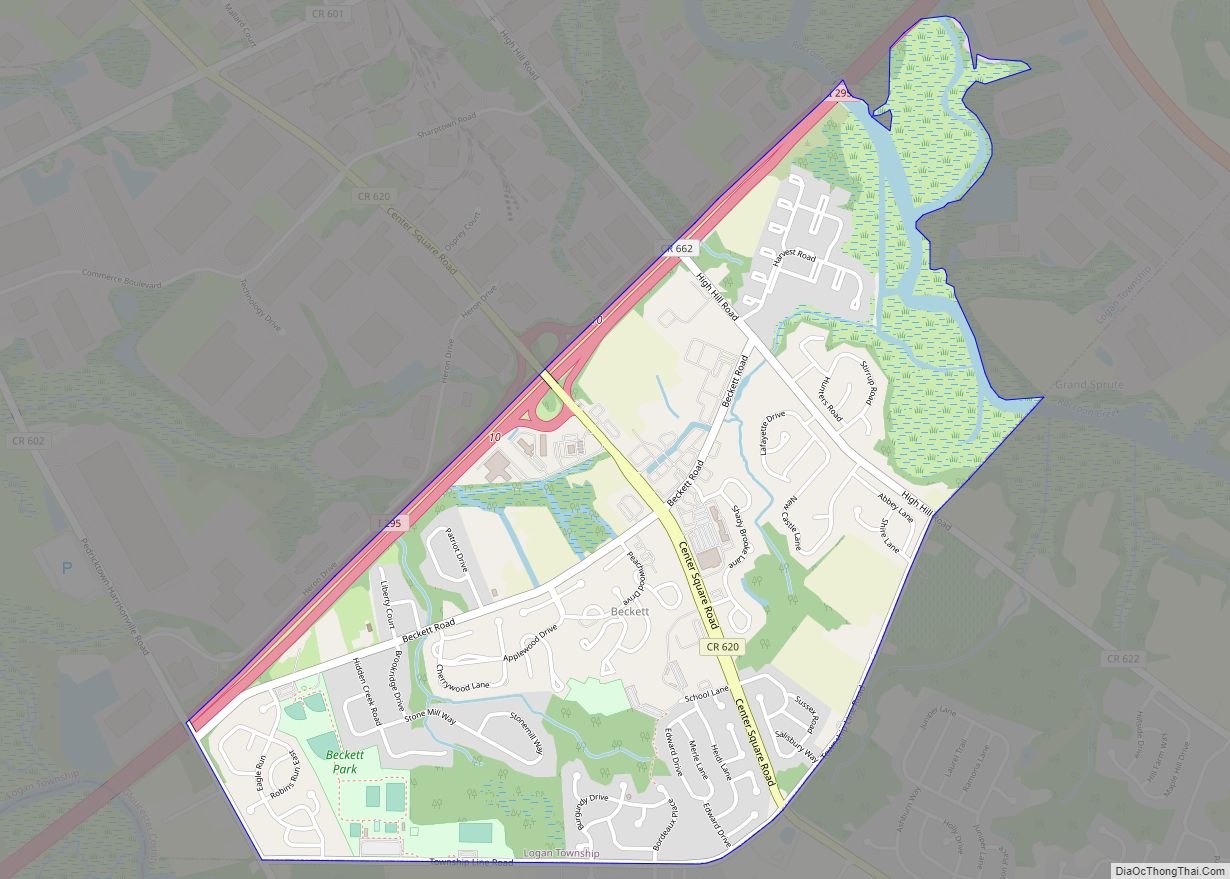
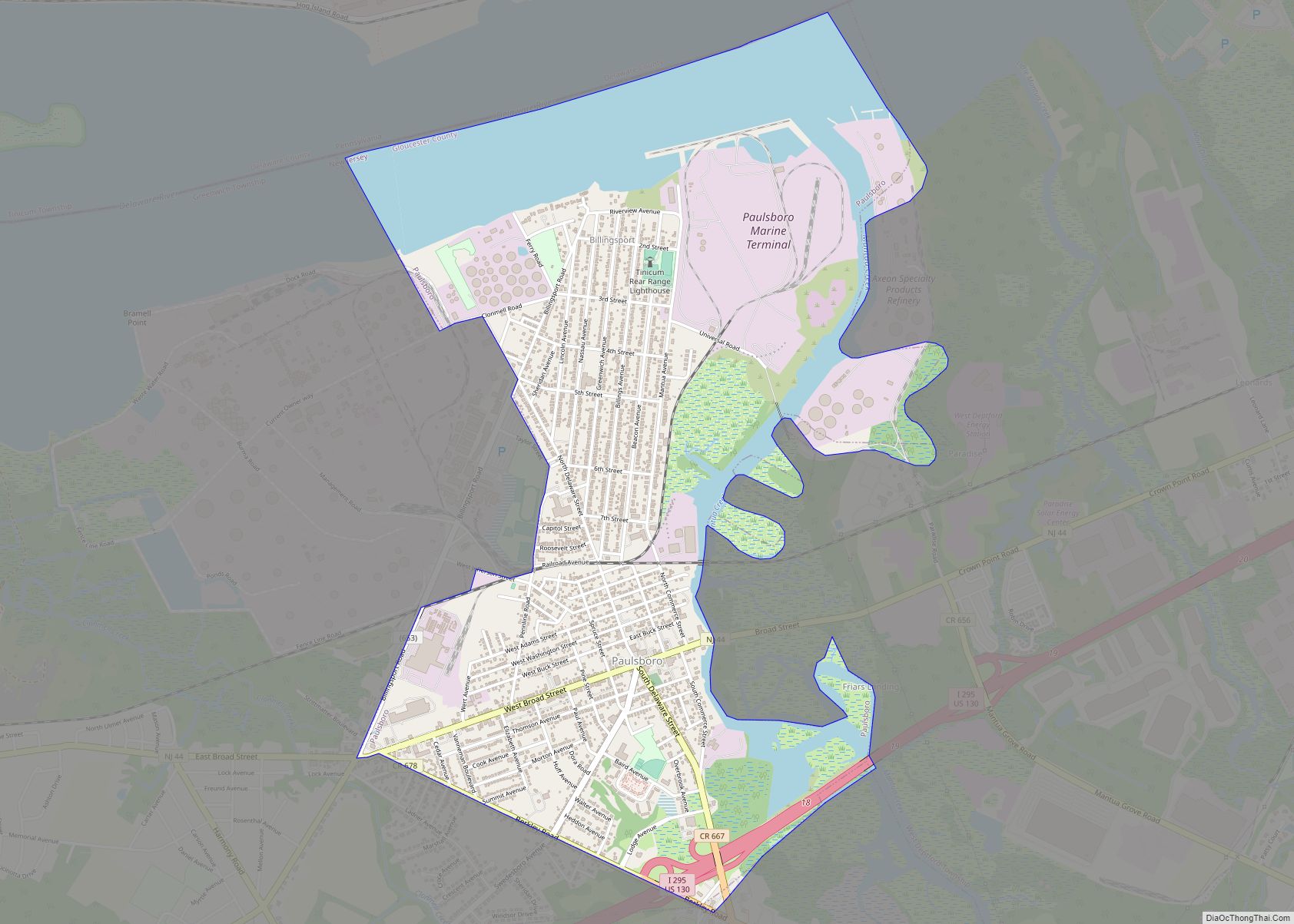
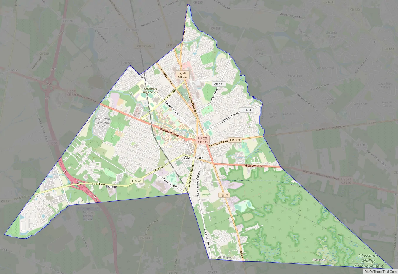
Glassboro Road Map
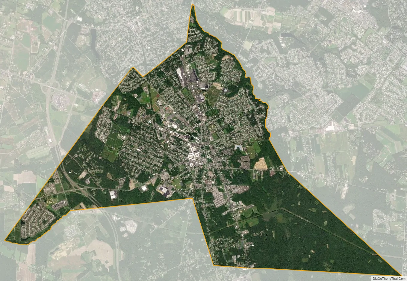
Glassboro city Satellite Map
Geography
According to the U.S. Census Bureau, the borough had a total area of 9.36 square miles (24.24 km), including 9.32 square miles (24.14 km) of land and 0.04 square miles (0.10 km) of water (0.41%). Unincorporated communities, localities and place names located partially or completely within the borough include Elsemere.
Glassboro borders the Gloucester County municipalities of Clayton Borough, Elk Township, Harrison Township, Mantua Township, Monroe Township, Pitman, and Washington Township.
Climate
The area is characterized by hot, humid summers and generally mild to cool winters. According to the Köppen Climate Classification system, Glassboro has a humid subtropical climate, abbreviated “Cfa” on climate maps.
See also
Map of New Jersey State and its subdivision: Map of other states:- Alabama
- Alaska
- Arizona
- Arkansas
- California
- Colorado
- Connecticut
- Delaware
- District of Columbia
- Florida
- Georgia
- Hawaii
- Idaho
- Illinois
- Indiana
- Iowa
- Kansas
- Kentucky
- Louisiana
- Maine
- Maryland
- Massachusetts
- Michigan
- Minnesota
- Mississippi
- Missouri
- Montana
- Nebraska
- Nevada
- New Hampshire
- New Jersey
- New Mexico
- New York
- North Carolina
- North Dakota
- Ohio
- Oklahoma
- Oregon
- Pennsylvania
- Rhode Island
- South Carolina
- South Dakota
- Tennessee
- Texas
- Utah
- Vermont
- Virginia
- Washington
- West Virginia
- Wisconsin
- Wyoming