Hi-Nella is a borough in Camden County, in the U.S. state of New Jersey. The borough is the state’s ninth-smallest municipality. As of the 2020 United States census, the borough’s population was 927, an increase of 57 (+6.6%) from the 2010 census count of 870, which in turn reflected a decline of 159 (−15.5%) from the 1,029 counted in the 2000 census.
The Borough of Hi-Nella was created on April 23, 1929, from portions of Clementon Township, as one of seven municipalities created from the now-defunct township, and one of five new municipalities (joining Lindenwold, Pine Hill, Pine Valley and Somerdale) created on that same date. The borough’s name is traditionally said to derive from a Native American term meaning “high rolling knoll” or “high ground”, though it may have been named for Nella, the wife of Lucious Parker, who developed Hi-Nella Estates in the late 1920s.
The Star-Ledger included Hi-Nella in its 2010 series of articles covering “Towns that Shouldn’t Exist”, citing the borough’s small area, population and staff, along with its use of a double-wide trailer as a municipal building. Mayor Meredith Dobbs told The Star-Ledger that efforts to force the borough to consolidate with its neighbors would be “declared dead on arrival”.
The borough had the fifth-highest property tax rate in New Jersey, with an equalized rate of 5.306% in 2020, compared to 3.470% in the county as a whole and a statewide average of 2.279%.
| Name: | Hi-Nella borough |
|---|---|
| LSAD Code: | 21 |
| LSAD Description: | borough (suffix) |
| State: | New Jersey |
| County: | Camden County |
| Incorporated: | April 23, 1929 |
| Elevation: | 62 ft (19 m) |
| Total Area: | 0.22 sq mi (0.58 km²) |
| Land Area: | 0.22 sq mi (0.58 km²) |
| Water Area: | 0.00 sq mi (0.00 km²) 0.00% |
| Total Population: | 927 |
| Population Density: | 4,165.1/sq mi (1,608.2/km²) |
| ZIP code: | 08083 – Somerdale |
| Area code: | 856 |
| FIPS code: | 3432220 |
| GNISfeature ID: | 0885256 |
| Website: | www.hinellaboro.org |
Online Interactive Map
Click on ![]() to view map in "full screen" mode.
to view map in "full screen" mode.
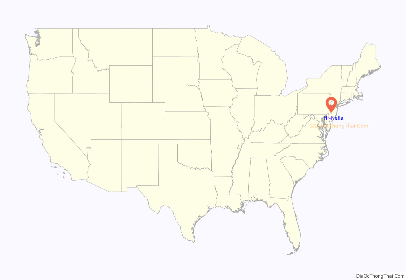
Hi-Nella location map. Where is Hi-Nella borough?
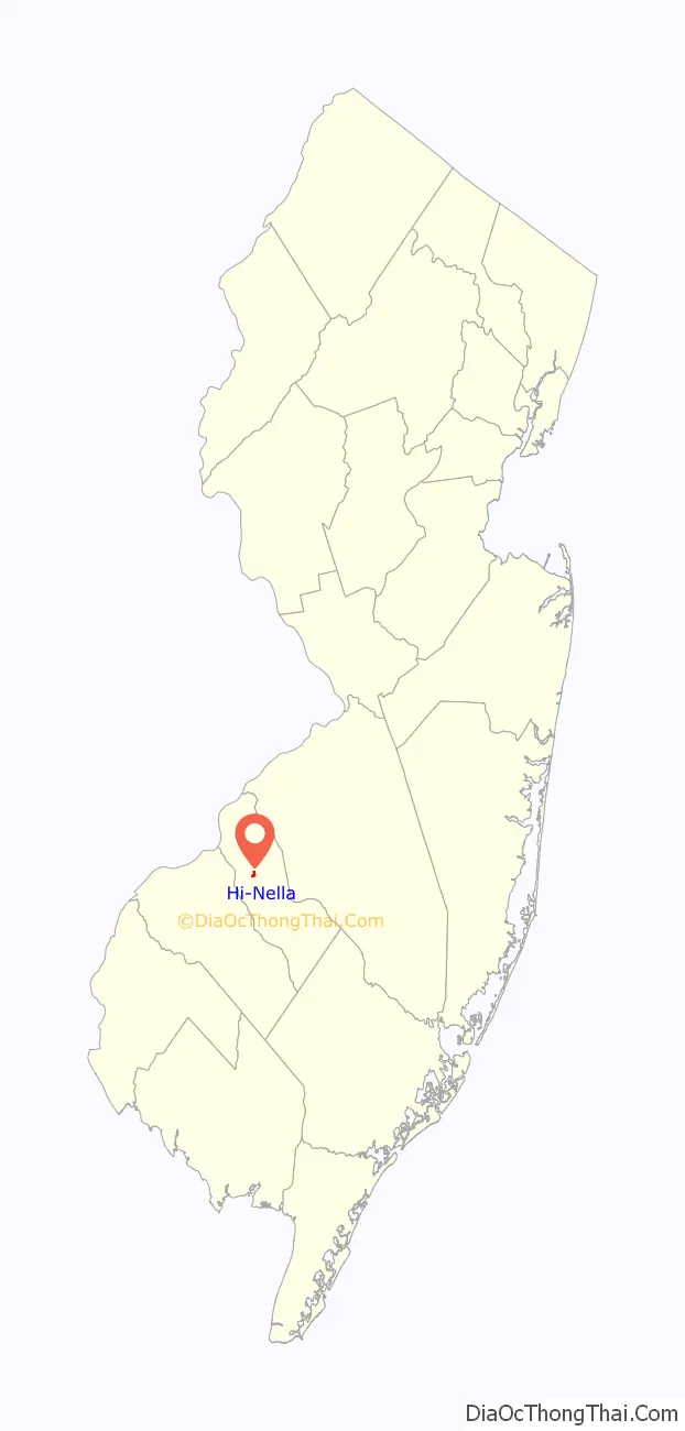
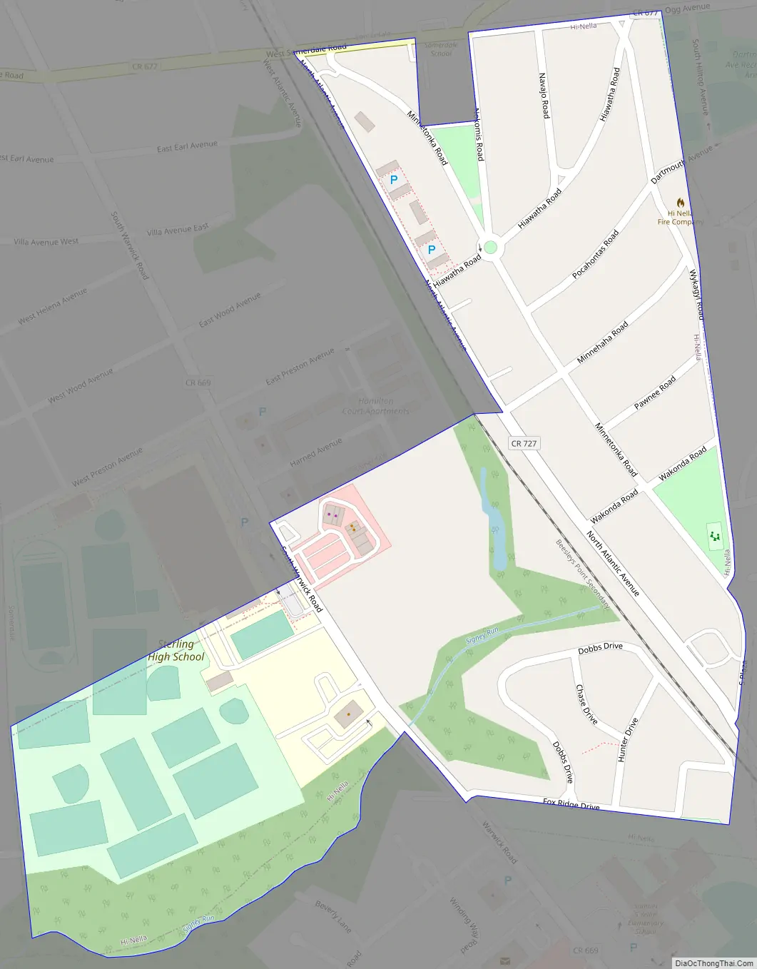
Hi-Nella Road Map
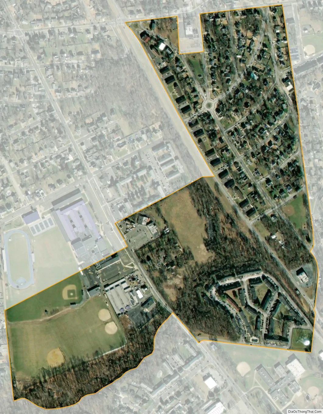
Hi-Nella city Satellite Map
Geography
According to the United States Census Bureau, the borough had a total area of 0.22 square miles (0.58 km), all of which was land.
Hi-Nella borders the Camden County municipalities of Gloucester Township, Somerdale and Stratford.
See also
Map of New Jersey State and its subdivision: Map of other states:- Alabama
- Alaska
- Arizona
- Arkansas
- California
- Colorado
- Connecticut
- Delaware
- District of Columbia
- Florida
- Georgia
- Hawaii
- Idaho
- Illinois
- Indiana
- Iowa
- Kansas
- Kentucky
- Louisiana
- Maine
- Maryland
- Massachusetts
- Michigan
- Minnesota
- Mississippi
- Missouri
- Montana
- Nebraska
- Nevada
- New Hampshire
- New Jersey
- New Mexico
- New York
- North Carolina
- North Dakota
- Ohio
- Oklahoma
- Oregon
- Pennsylvania
- Rhode Island
- South Carolina
- South Dakota
- Tennessee
- Texas
- Utah
- Vermont
- Virginia
- Washington
- West Virginia
- Wisconsin
- Wyoming


