Hopatcong (/hoʊˈpætkɒŋ/ hoh-PAT-kong) is a borough in Sussex County, in the U.S. state of New Jersey. As of the 2020 United States census, the borough’s population was 14,362, a decrease of 785 (−5.2%) from the 2010 census count of 15,147, which in turn reflected a decline of 741 (−4.7%) from the 15,888 counted in the 2000 Census.
| Name: | Hopatcong borough |
|---|---|
| LSAD Code: | 21 |
| LSAD Description: | borough (suffix) |
| State: | New Jersey |
| County: | Sussex County |
| Incorporated: | April 2, 1898 as Brooklyn |
| Elevation: | 997 ft (304 m) |
| Total Area: | 12.41 sq mi (32.16 km²) |
| Land Area: | 10.88 sq mi (28.19 km²) |
| Water Area: | 1.53 sq mi (3.97 km²) 11.83% |
| Total Population: | 14,362 |
| Population Density: | 1,318.9/sq mi (509.2/km²) |
| ZIP code: | 07843 |
| Area code: | 973 |
| FIPS code: | 3432910 |
| GNISfeature ID: | 0885259 |
| Website: | www.hopatcong.org |
Online Interactive Map
Click on ![]() to view map in "full screen" mode.
to view map in "full screen" mode.
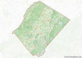
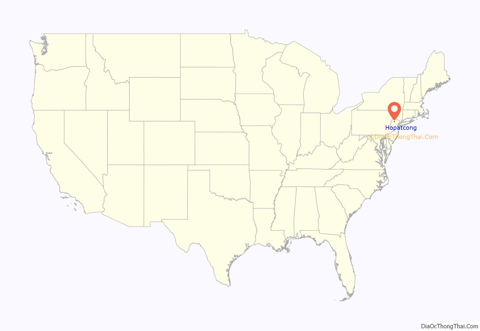
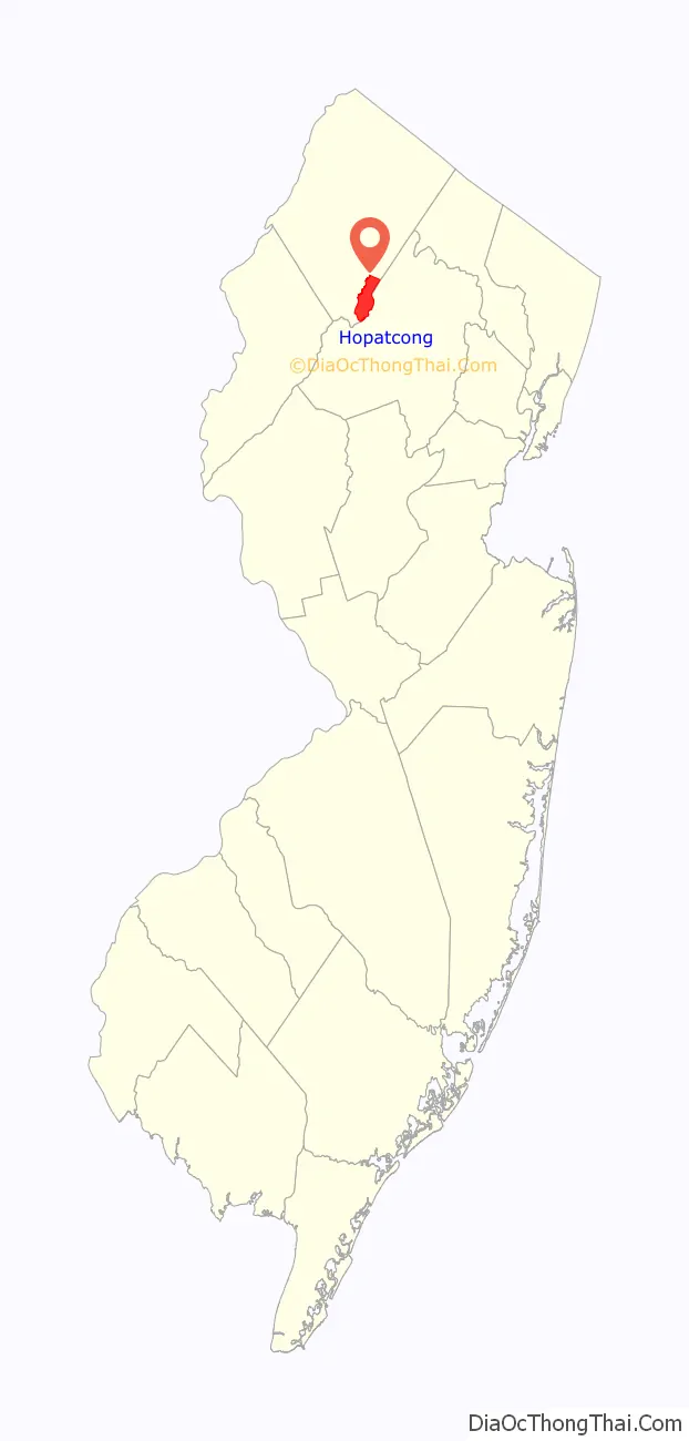
Hopatcong location map. Where is Hopatcong borough?
History
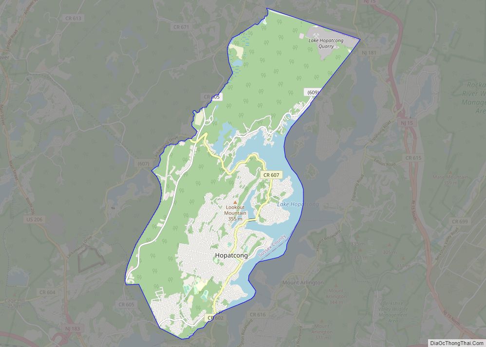
The town of Hopatcong has a rich history, given its relationship with New York City. It borders Lake Hopatcong, a partially man-made lake that is now a source of much recreation and desirable real estate, and is the biggest lake in New Jersey. The community, 40 miles (64 km) west of New York City, began as a summer getaway for the wealthy in NYC who primarily sought access to the lake. An amusement park, called “Bertrand’s Island”, sprang up and was accessible via the lake, trolley or by car through Mount Arlington. The construction of Interstate 80, a highway that stretches from Teaneck, New Jersey, all the way across the country to San Francisco, California, triggered rapid growth in New York City’s suburbs and led to Hopatcong becoming a permanent residential community. The area had been called “Brookland” in the 19th century and the lake that was expanded to become Lake Hopatcong had been known as “Great Pond” or “Brookland Pond”. During the 1830s, the name of the community had been modified to “Brooklyn”, to match the spelling of the city on New York‘s Long Island. Hopatcong was originally established as the Town of Brooklyn on April 2, 1898, from portions of Byram Township. On March 22, 1901, the Borough of Hopatcong replaced Brooklyn. In 1922, residents of Byram Cove, Northwood, and other areas to the west of the original land area of the borough, voted to leave Byram Township and join Hopatcong, leaving the Borough with its current borders.
While the origin of the borough’s name is unclear, it is said to derive from Native American phrases variously meaning “stone over water” or “pipestone”, among other variations.
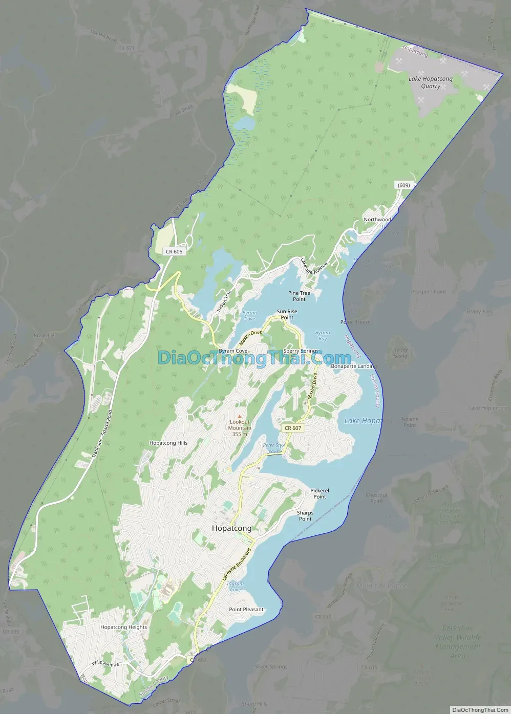
Hopatcong Road Map
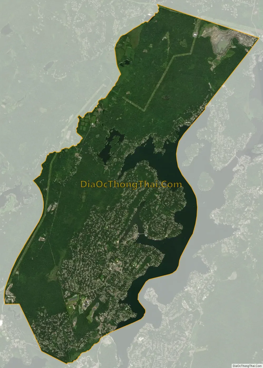
Hopatcong city Satellite Map
Geography
According to the United States Census Bureau, the borough had a total area of 12.35 square miles (31.99 km), including 10.89 square miles (28.21 km) of land and 1.46 square miles (3.78 km) of water (11.83%).
Unincorporated communities, localities and place names located partially or completely within the borough include Bear Pond, Byram Cove, Cow Tongue Point, Davis Cove, Glasser, Hendersons Cove, Roseville, Sharps Rock and Sperry Springs.
Hopatcong borders Byram Township, Sparta Township and Stanhope in Sussex County; and Jefferson Township, Mount Arlington and Roxbury Township in Morris County.
See also
Map of New Jersey State and its subdivision: Map of other states:- Alabama
- Alaska
- Arizona
- Arkansas
- California
- Colorado
- Connecticut
- Delaware
- District of Columbia
- Florida
- Georgia
- Hawaii
- Idaho
- Illinois
- Indiana
- Iowa
- Kansas
- Kentucky
- Louisiana
- Maine
- Maryland
- Massachusetts
- Michigan
- Minnesota
- Mississippi
- Missouri
- Montana
- Nebraska
- Nevada
- New Hampshire
- New Jersey
- New Mexico
- New York
- North Carolina
- North Dakota
- Ohio
- Oklahoma
- Oregon
- Pennsylvania
- Rhode Island
- South Carolina
- South Dakota
- Tennessee
- Texas
- Utah
- Vermont
- Virginia
- Washington
- West Virginia
- Wisconsin
- Wyoming