Lindenwold is a borough in Camden County, in the U.S. state of New Jersey. As of the 2020 United States census, the borough’s population was 21,641, an increase of 4,028 (+22.9%) from the 2010 census count of 17,613, which in turn reflected an increase of 199 (+1.1%) from the 17,414 counted in the 2000 census.
As of 2020, Lindenwold had the 10th-highest property tax rate in New Jersey with an equalized rate of 4.810% compared to 3.470% in the county as a whole and a statewide average of 2.279%. The borough is part of the South Jersey region of the state.
| Name: | Lindenwold borough |
|---|---|
| LSAD Code: | 21 |
| LSAD Description: | borough (suffix) |
| State: | New Jersey |
| County: | Camden County |
| Incorporated: | April 23, 1929 |
| Elevation: | 56 ft (17 m) |
| Total Area: | 3.94 sq mi (10.21 km²) |
| Land Area: | 3.90 sq mi (10.11 km²) |
| Water Area: | 0.04 sq mi (0.11 km²) 1.07% |
| Total Population: | 21,641 |
| Population Density: | 5,546.1/sq mi (2,141.4/km²) |
| ZIP code: | 08021 |
| Area code: | 856 |
| FIPS code: | 3440440 |
| GNISfeature ID: | 0885279 |
| Website: | www.lindenwoldnj.gov |
Online Interactive Map
Click on ![]() to view map in "full screen" mode.
to view map in "full screen" mode.
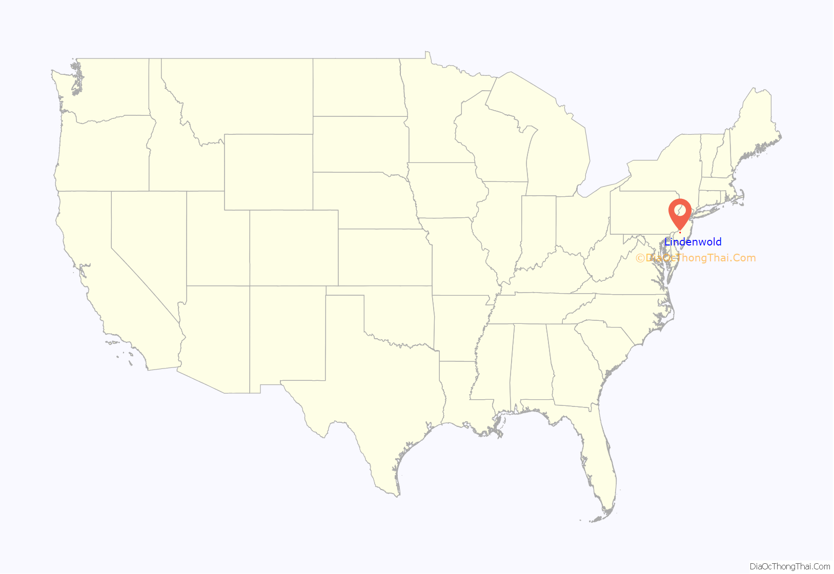
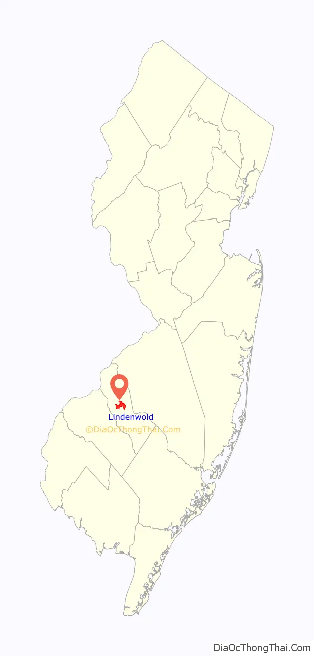
Lindenwold location map. Where is Lindenwold borough?
History
Lindenwold was created on April 23, 1929, from Clementon Township, one of seven municipalities created from the now-defunct township, and one of five new municipalities created on that same date: Hi-Nella, Pine Hill, Pine Valley (since merged with Pine Hill), and Somerdale. The borough’s first official meeting was held on the following May 31 in the old Fire Hall at Linden Avenue and Berlin Road. The name “Lindenwold” (German for “linden forest”) was suggested by Wimer Bedford, a local resident who had been reading a German book that included the word. Bedford sought to have linden trees planted along the borough’s streets, but local officials chose cheaper trees as an alternative.
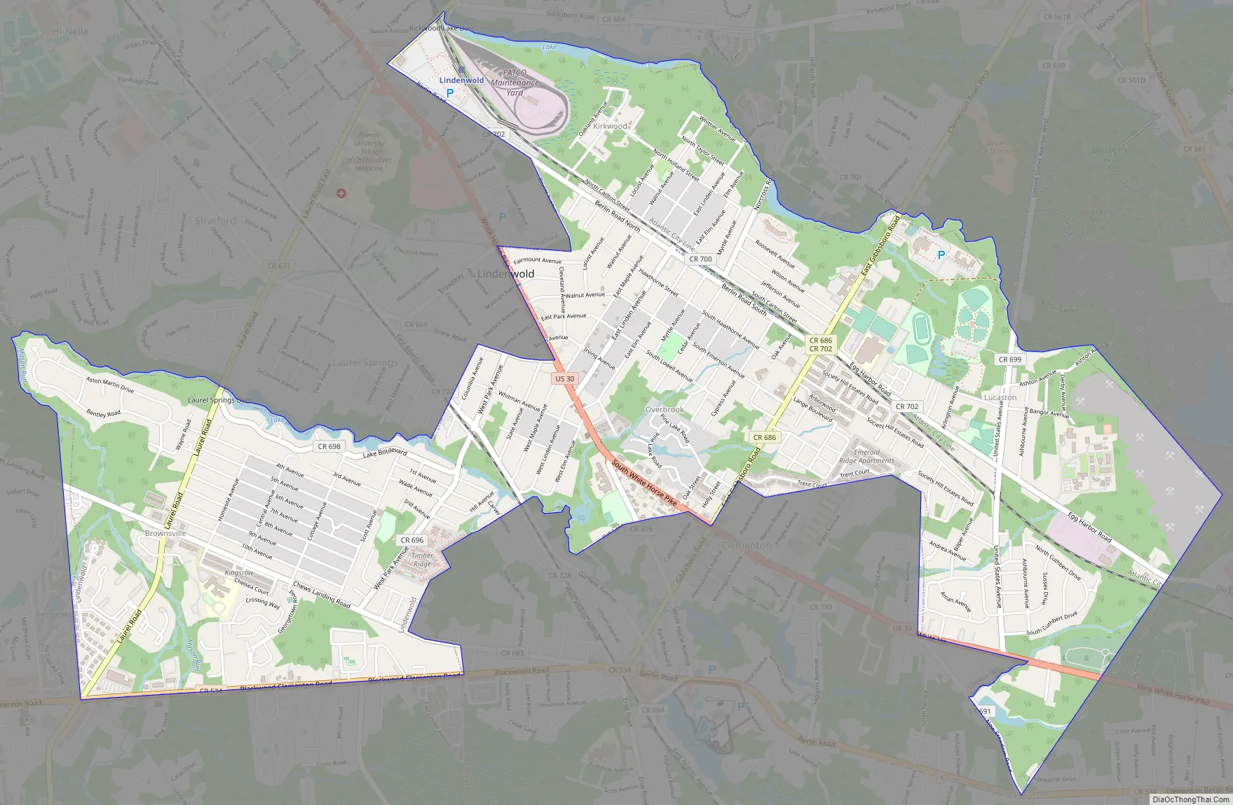
Lindenwold Road Map
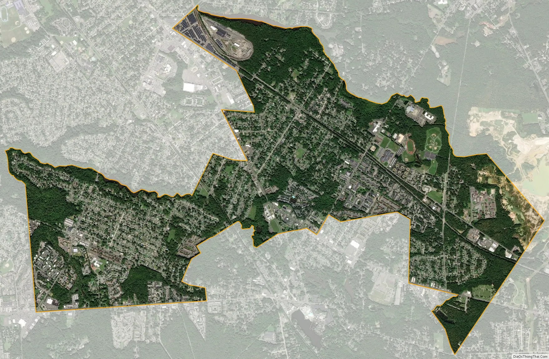
Lindenwold city Satellite Map
Geography
According to the U.S. Census Bureau, the borough had a total area of 3.94 square miles (10.21 km), including 3.90 square miles (10.11 km) of land and 0.04 square miles (0.11 km) of water (1.07%). Unincorporated communities, localities and place names located partially or completely within the township include Kirkwood and Lucastown.
Lindenwold borders the Camden County municipalities of Berlin Borough, Berlin Township, Clementon Borough, Gibbsboro, Gloucester Township, Laurel Springs, Pine Hill, Somerdale, Stratford, and Voorhees Township.
See also
Map of New Jersey State and its subdivision: Map of other states:- Alabama
- Alaska
- Arizona
- Arkansas
- California
- Colorado
- Connecticut
- Delaware
- District of Columbia
- Florida
- Georgia
- Hawaii
- Idaho
- Illinois
- Indiana
- Iowa
- Kansas
- Kentucky
- Louisiana
- Maine
- Maryland
- Massachusetts
- Michigan
- Minnesota
- Mississippi
- Missouri
- Montana
- Nebraska
- Nevada
- New Hampshire
- New Jersey
- New Mexico
- New York
- North Carolina
- North Dakota
- Ohio
- Oklahoma
- Oregon
- Pennsylvania
- Rhode Island
- South Carolina
- South Dakota
- Tennessee
- Texas
- Utah
- Vermont
- Virginia
- Washington
- West Virginia
- Wisconsin
- Wyoming


