Madison Park is an unincorporated community and census-designated place (CDP) located within Old Bridge Township, in Middlesex County, New Jersey, United States. As of the 2010 United States Census, the CDP’s population was 7,144. The name “Madison Park” reflects Old Bridge’s original name of “Madison Township” which it had when it was formed on March 2, 1869 from portions of South Amboy Township, until November 5, 1975, when voters approved a referendum changing the township’s name to Old Bridge Township.
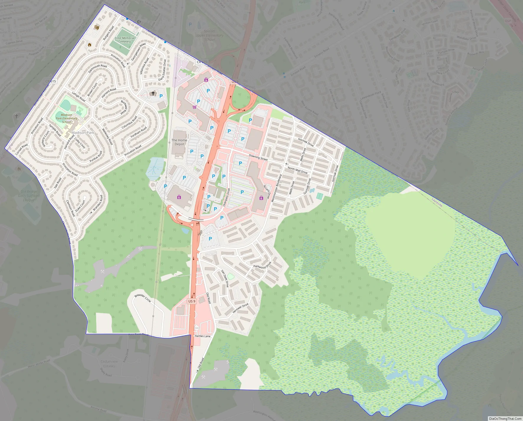
Madison Park is the name of a residential development constructed in 1955-1956 by Herbert J. Kendall. It is located west of U.S. Route 9 bounded by Bordentown Avenue, Cheesequake Road, and Ernston Road. Portions of Madison Park are served by ZIP Code 08859 for Parlin, New Jersey. Madison Park has a fire department (District 4 Old Bridge Township), a volunteer first aid squad, and a school all located within the development. All of the streets in the development are named after prominent universities, with Princeton Road as an oval interior road connecting to the entire development.
| Name: | Madison Park CDP |
|---|---|
| LSAD Code: | 57 |
| LSAD Description: | CDP (suffix) |
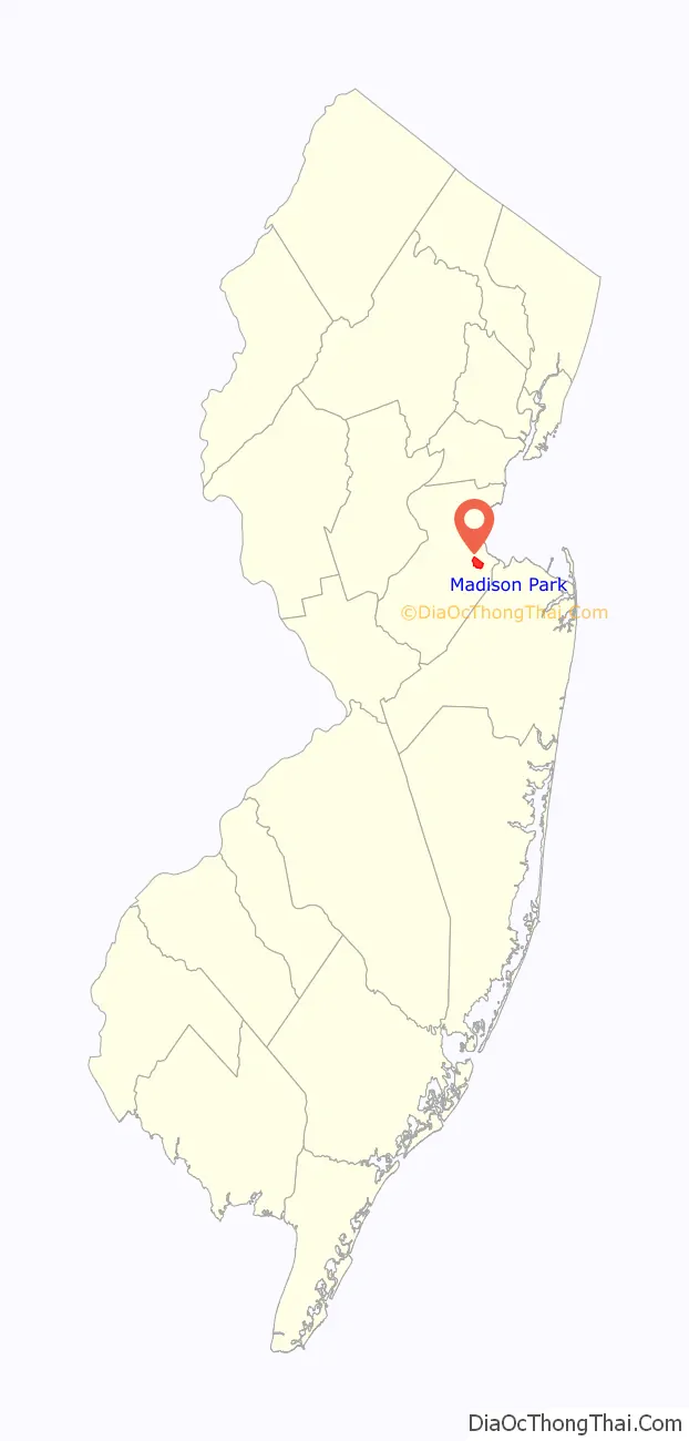
| State: | New Jersey |
| County: | Middlesex County |
| Elevation: | 118 ft (36 m) |
| Total Area: | 1.85 sq mi (4.78 km²) |
| Land Area: | 1.82 sq mi (4.71 km²) |
| Water Area: | 0.03 sq mi (0.07 km²) 1.64% |
| Total Population: | 8,050 |
| Population Density: | 4,427.94/sq mi (1,709.37/km²) |
| Area code: | 732/848 |
| FIPS code: | 3442540 |
| GNISfeature ID: | 02390107 |
Online Interactive Map
Click on ![]() to view map in "full screen" mode.
to view map in "full screen" mode.
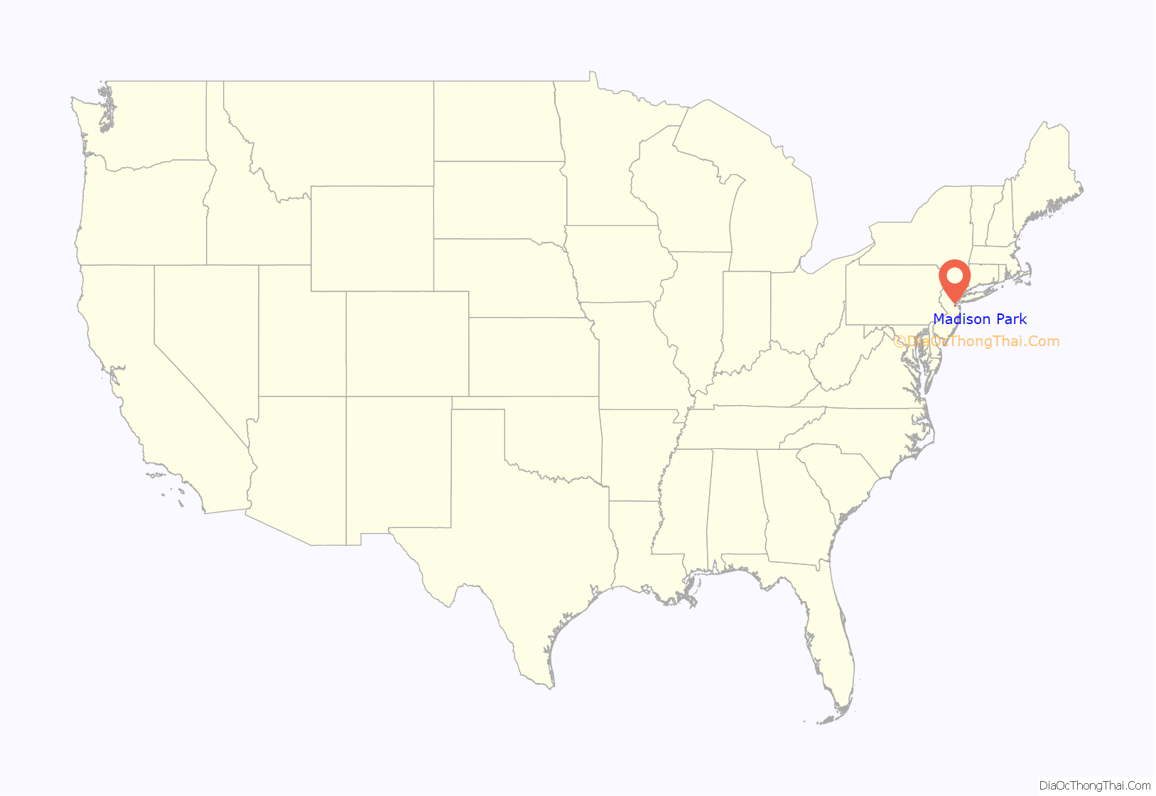
Madison Park location map. Where is Madison Park CDP?
Madison Park Road Map
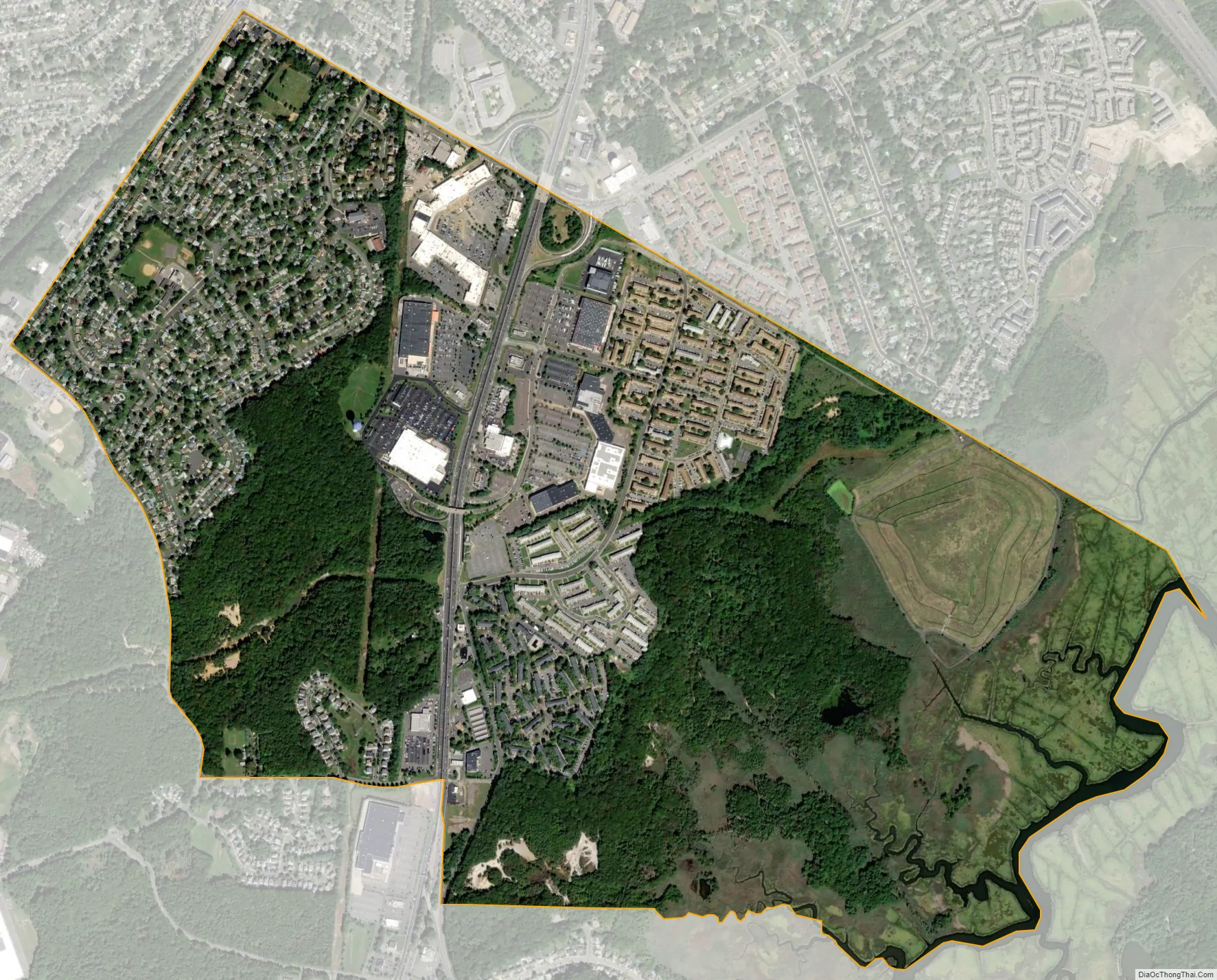
Madison Park city Satellite Map
Geography
According to the United States Census Bureau, the CDP had a total area of 1.687 square miles (4.368 km), including 1.659 square miles (4.296 km) of land and 0.028 square miles (0.071 km) of water (1.64%).
See also
Map of New Jersey State and its subdivision: Map of other states:- Alabama
- Alaska
- Arizona
- Arkansas
- California
- Colorado
- Connecticut
- Delaware
- District of Columbia
- Florida
- Georgia
- Hawaii
- Idaho
- Illinois
- Indiana
- Iowa
- Kansas
- Kentucky
- Louisiana
- Maine
- Maryland
- Massachusetts
- Michigan
- Minnesota
- Mississippi
- Missouri
- Montana
- Nebraska
- Nevada
- New Hampshire
- New Jersey
- New Mexico
- New York
- North Carolina
- North Dakota
- Ohio
- Oklahoma
- Oregon
- Pennsylvania
- Rhode Island
- South Carolina
- South Dakota
- Tennessee
- Texas
- Utah
- Vermont
- Virginia
- Washington
- West Virginia
- Wisconsin
- Wyoming


