Mount Arlington is a borough in Morris County, in the U.S. state of New Jersey. As of the 2020 United States census, the borough’s population was 5,909, an increase of 859 (+17.0%) from the 2010 census count of 5,050, which in turn reflected an increase of 387 (+8.3%) from the 4,663 counted in the 2000 census.
The borough is located on the southeast shore of Lake Hopatcong, New Jersey’s largest lake and a major recreational resource.
| Name: | Mount Arlington borough |
|---|---|
| LSAD Code: | 21 |
| LSAD Description: | borough (suffix) |
| State: | New Jersey |
| County: | Morris County |
| Incorporated: | November 3, 1890 |
| Elevation: | 1,079 ft (329 m) |
| Total Area: | 2.80 sq mi (7.25 km²) |
| Land Area: | 2.14 sq mi (5.55 km²) |
| Water Area: | 0.66 sq mi (1.70 km²) 23.30% |
| Total Population: | 5,909 |
| Population Density: | 2,761.2/sq mi (1,066.1/km²) |
| ZIP code: | 07856 |
| Area code: | 973 |
| FIPS code: | 3448690 |
| GNISfeature ID: | 0885312 |
| Website: | www.mountarlingtonnj.org |
Online Interactive Map
Click on ![]() to view map in "full screen" mode.
to view map in "full screen" mode.
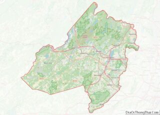
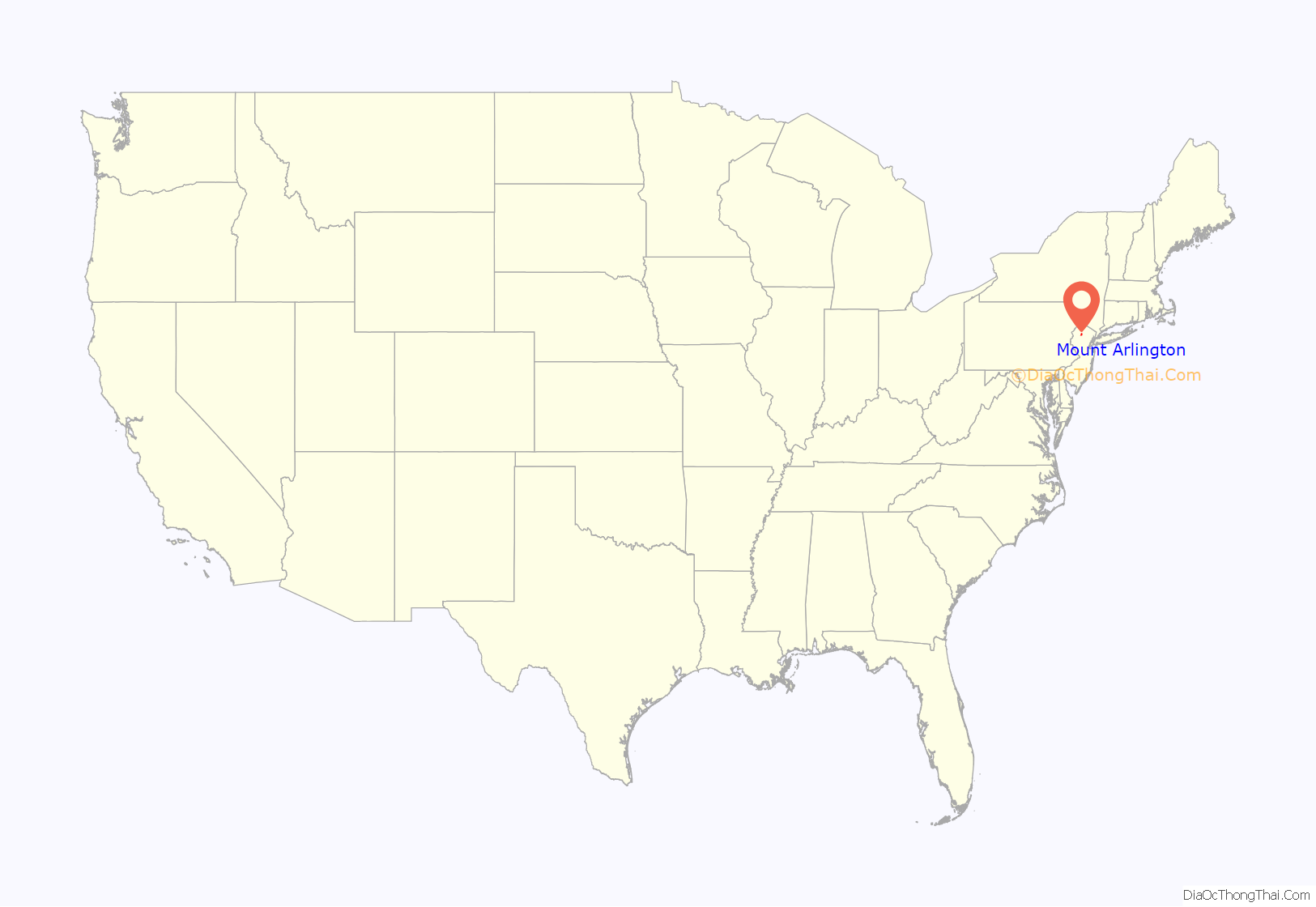
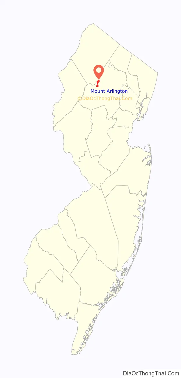
Mount Arlington location map. Where is Mount Arlington borough?
History
While Mount Arlington is now mostly a suburban residential community, it was once a thriving resort community. In the era before the world wars and the advent of air travel, it was a welcome respite for the residents of nearby New York City and Newark.
Every summer, thousands would arrive by train at Landing Station, and then travel by water taxi across Lake Hopatcong to the area’s many large resort hotels to escape the city heat and enjoy the famous “Mount Arlington breeze” which always cooled the summer evenings. There was also a major amusement park, Bertrand Island, which featured a world-famous carousel and roller coaster, which operated until the park was closed in 1983.
Mount Arlington was incorporated as a borough by an act of the New Jersey Legislature on November 3, 1890, from portions of Roxbury Township, based on the results of a referendum held two days earlier. Additional territory was acquired from Roxbury Township on July 25, 1891, on May 31, 1893, and on May 31, 1894. The borough is named for Henry Bennet, 1st Earl of Arlington.
In March 2014, members of the public petitioned the New Jersey Department of Community Affairs to form the Roxbury Mount Arlington Study Commission to consider a possible consolidation of Mount Arlington and the neighboring municipality of Roxbury Township. In March 2015, the commission was formed with five members and two alternates from each municipality. If the commission votes to recommend a merger, the decision would have to be ratified by a referendum of the voters in each community.
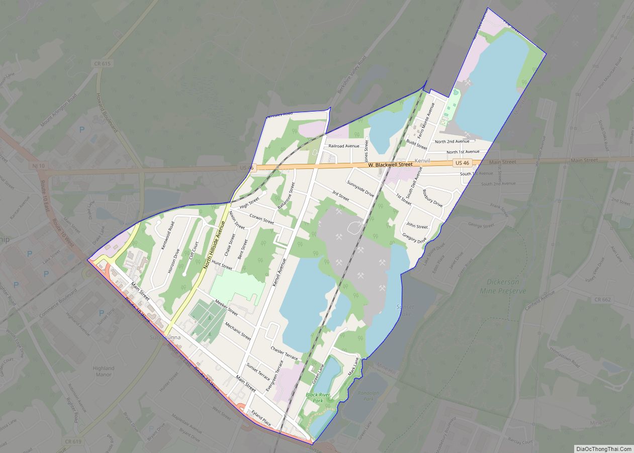
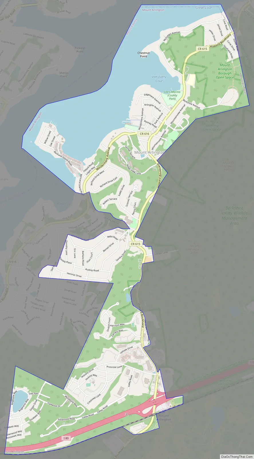
Mount Arlington Road Map
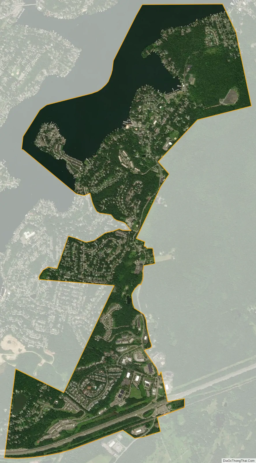
Mount Arlington city Satellite Map
Geography
According to the United States Census Bureau, the borough had a total area of 2.79 square miles (7.23 km), including 2.14 square miles (5.54 km) of land and 0.65 square miles (1.68 km) of water (23.30%).
The borough borders the municipalities of Jefferson Township, New Jersey, and Roxbury Township in Morris County; and Hopatcong in Sussex County.
See also
Map of New Jersey State and its subdivision: Map of other states:- Alabama
- Alaska
- Arizona
- Arkansas
- California
- Colorado
- Connecticut
- Delaware
- District of Columbia
- Florida
- Georgia
- Hawaii
- Idaho
- Illinois
- Indiana
- Iowa
- Kansas
- Kentucky
- Louisiana
- Maine
- Maryland
- Massachusetts
- Michigan
- Minnesota
- Mississippi
- Missouri
- Montana
- Nebraska
- Nevada
- New Hampshire
- New Jersey
- New Mexico
- New York
- North Carolina
- North Dakota
- Ohio
- Oklahoma
- Oregon
- Pennsylvania
- Rhode Island
- South Carolina
- South Dakota
- Tennessee
- Texas
- Utah
- Vermont
- Virginia
- Washington
- West Virginia
- Wisconsin
- Wyoming