Mount Ephraim is a borough in Camden County, in the U.S. state of New Jersey. As of the 2020 United States census, the borough’s population was 4,651, a decrease of 25 (−0.5%) from the 2010 census count of 4,676, which in turn reflected an increase of 181 (+4.0%) from the 4,495 counted in the 2000 census.
The borough had the 20th-highest property tax rate in New Jersey with an equalized rate of 4.442% in 2020, compared to 3.470% in the county as a whole and a statewide average of 2.279%.
| Name: | Mount Ephraim borough |
|---|---|
| LSAD Code: | 21 |
| LSAD Description: | borough (suffix) |
| State: | New Jersey |
| County: | Camden County |
| Incorporated: | March 23, 1926 |
| Elevation: | 30 ft (9 m) |
| Total Area: | 0.91 sq mi (2.34 km²) |
| Land Area: | 0.88 sq mi (2.29 km²) |
| Water Area: | 0.02 sq mi (0.05 km²) 2.31% |
| Total Population: | 4,651 |
| Population Density: | 5,261.3/sq mi (2,031.4/km²) |
| ZIP code: | 08059 |
| Area code: | 856 exchanges: 456, 742, 931, 933 |
| FIPS code: | 3448750 |
| GNISfeature ID: | 0885313 |
| Website: | www.mountephraim-nj.com |
Online Interactive Map
Click on ![]() to view map in "full screen" mode.
to view map in "full screen" mode.
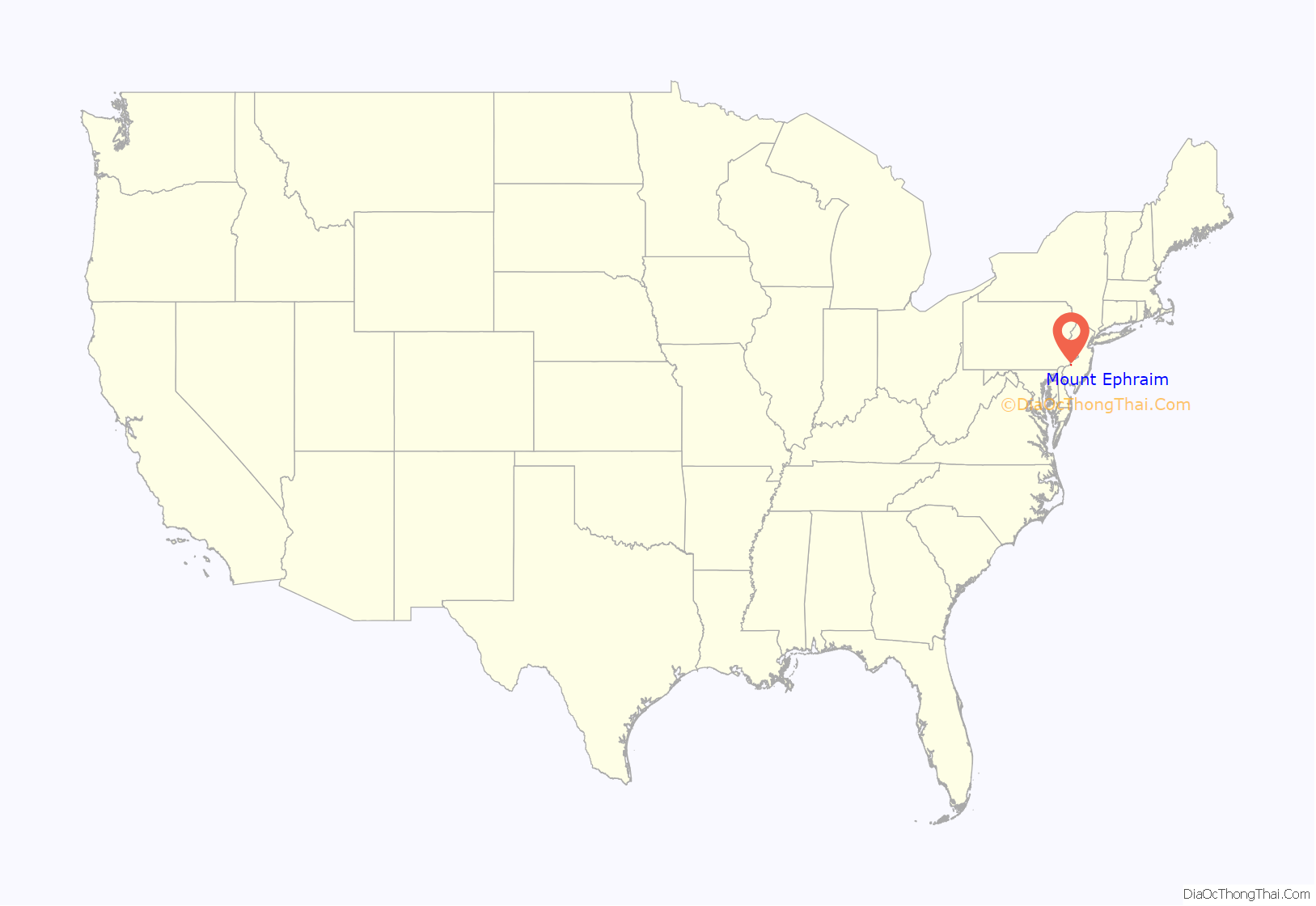
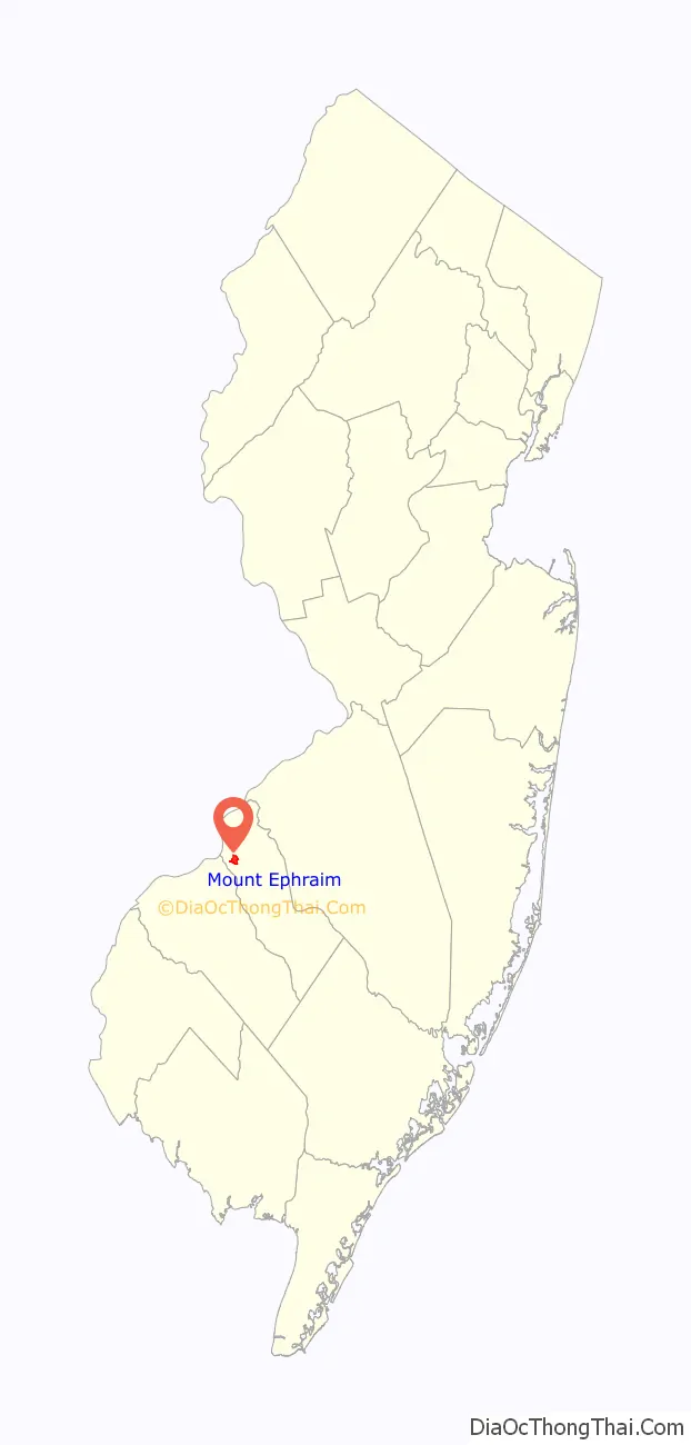
Mount Ephraim location map. Where is Mount Ephraim borough?
History
Mount Ephraim was incorporated as a borough by an act of the New Jersey Legislature on March 23, 1926, from portions of the now-defunct Centre Township. The boroughs of Bellmawr, Runnemede and Lawnside were simultaneously created during the same two-day period. The borough was named for Ephraim Albertson, who owned a tavern in the area in the early 1800s.
In a 1981 decision in Schad v. Mount Ephraim, the U.S. Supreme Court, in a decision authored for the majority by Associate Justice Byron White, the court decided by a 7–2 margin to overturn the convictions of the two owners of a bookstore where there was nude dancing, despite a prohibition against all forms of live entertainment in the borough’s zoning ordinance. The decision cited the First Amendment rights of the storeowners.
In January 2014, New Jersey State Senate President Stephen M. Sweeney put forward a proposal which was intended to lower real estate taxes in the state and cut state expenses by merging many of the states 566 municipalities. Mount Ephraim was then the 29th largest town in Camden County, so it is very likely that the town would have been merged with neighboring municipalities to cut costs, share expenses, reduce bureaucracy, share resources, and reduce the burden in the taxpayers and the state itself. Mount Ephraim was formerly part of Centre Township, which included all of the neighboring communities, and it is possible that the name may be used again in the future if the merger proposal goes forward.
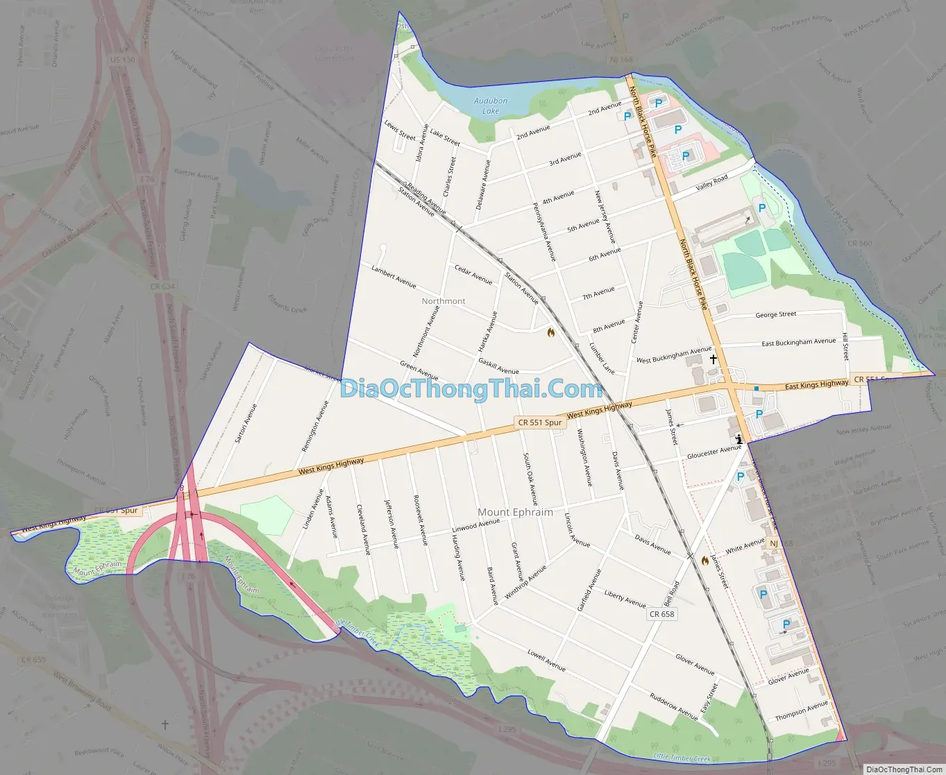
Mount Ephraim Road Map
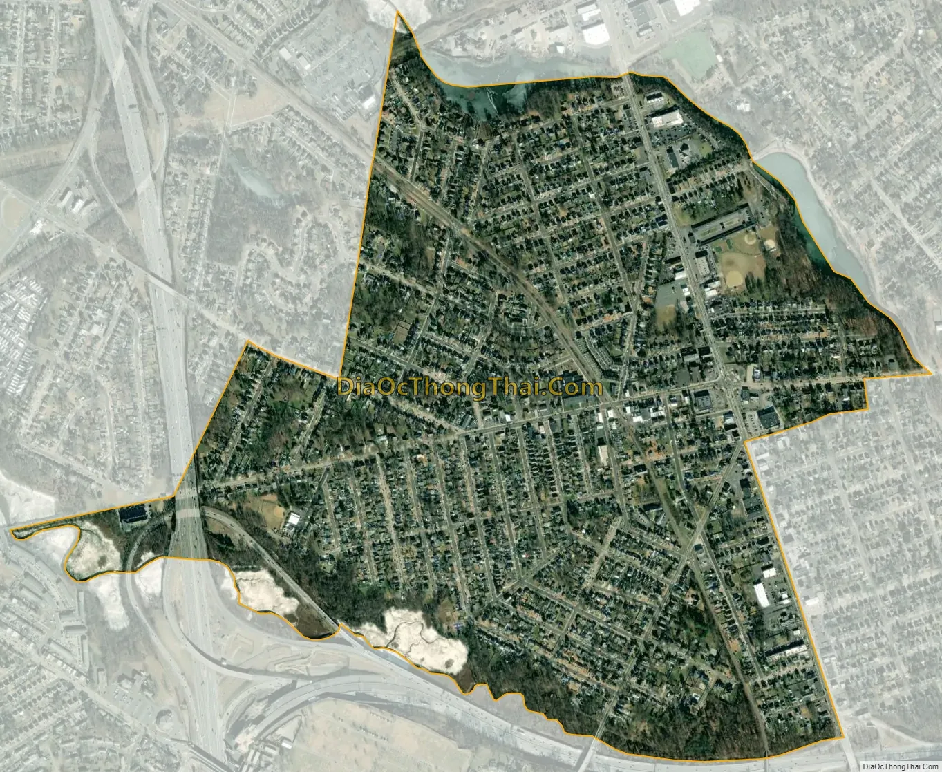
Mount Ephraim city Satellite Map
Geography
According to the U.S. Census Bureau, the borough had a total area of 0.91 square miles (2.34 km), including 0.88 square miles (2.29 km) of land and 0.02 square miles (0.05 km) of water (2.31%).
Mount Ephraim borders Audubon, Bellmawr, Brooklawn, Gloucester City and Haddon Heights.
Weather
On September 4, 2012, at 6:31 p.m., a tornado touched down in Mount Ephraim, causing damage to trees and homes in the immediate vicinity. It was categorized as F-0 by the National Weather Service, with winds topping out at 70 mph, making it the first tornado recorded in the state in more than a year.
See also
Map of New Jersey State and its subdivision: Map of other states:- Alabama
- Alaska
- Arizona
- Arkansas
- California
- Colorado
- Connecticut
- Delaware
- District of Columbia
- Florida
- Georgia
- Hawaii
- Idaho
- Illinois
- Indiana
- Iowa
- Kansas
- Kentucky
- Louisiana
- Maine
- Maryland
- Massachusetts
- Michigan
- Minnesota
- Mississippi
- Missouri
- Montana
- Nebraska
- Nevada
- New Hampshire
- New Jersey
- New Mexico
- New York
- North Carolina
- North Dakota
- Ohio
- Oklahoma
- Oregon
- Pennsylvania
- Rhode Island
- South Carolina
- South Dakota
- Tennessee
- Texas
- Utah
- Vermont
- Virginia
- Washington
- West Virginia
- Wisconsin
- Wyoming


