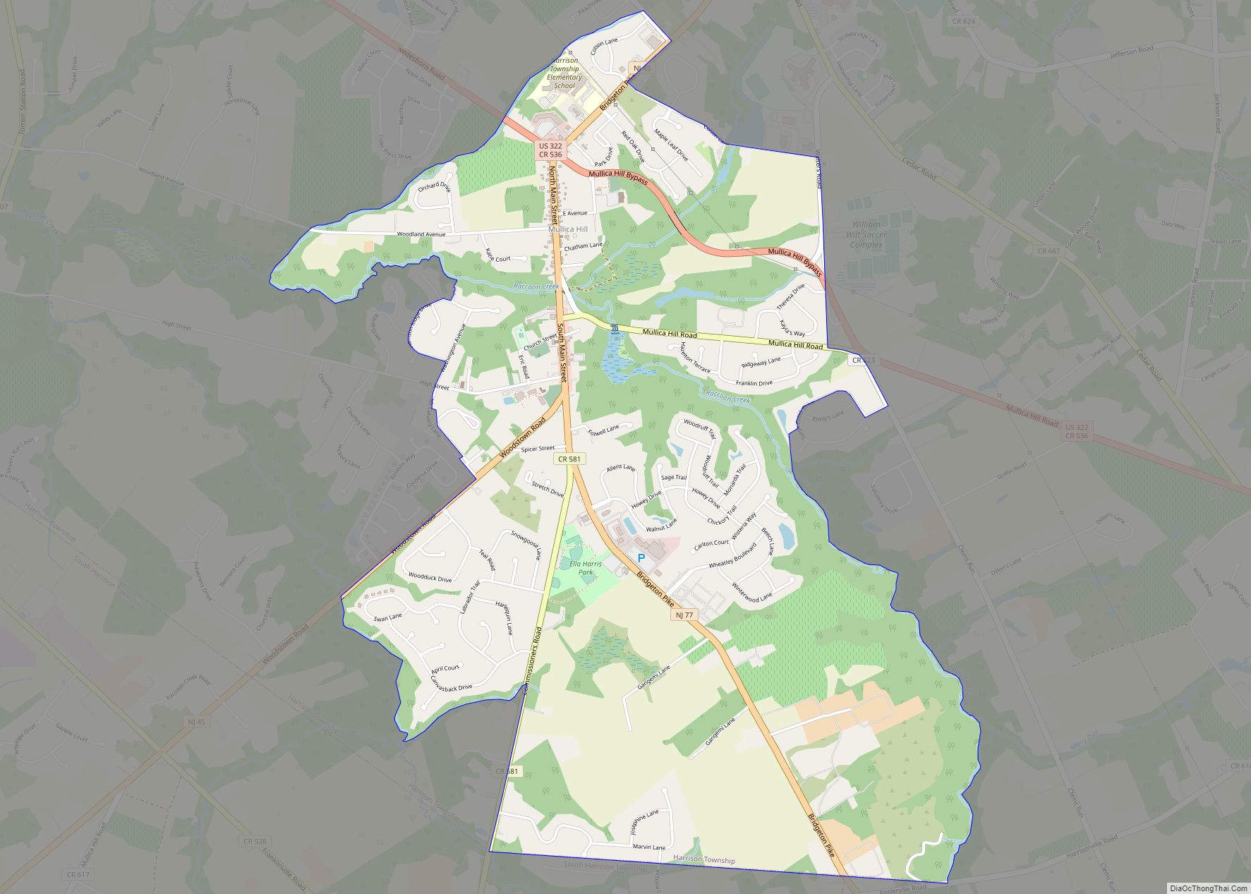
Mullica Hill is a census-designated place (CDP) and unincorporated community within Harrison Township, Gloucester County, New Jersey. As of the 2020 United States census, the CDP’s population was 4,698, an increase of 716 (+18.0%) from the 3,982 counted at the 2010 U.S. census, which in turn reflected an increase of 2,324 (+140.2%) from the 1,658 enumerated at the 2000 census.
| Name: | Mullica Hill CDP |
|---|---|
| LSAD Code: | 57 |
| LSAD Description: | CDP (suffix) |
| State: | New Jersey |
| County: | Gloucester County |
| Founded: | 1701 |
| Elevation: | 30 ft (9 m) |
| Total Area: | 3.77 sq mi (9.77 km²) |
| Land Area: | 3.75 sq mi (9.71 km²) |
| Water Area: | 0.02 sq mi (0.06 km²) 0.63% |
| Total Population: | 4,698 |
| Population Density: | 1,252.80/sq mi (483.71/km²) |
| ZIP code: | 08062 |
| Area code: | 856 |
| FIPS code: | 3449440 |
| GNISfeature ID: | 2389522 |
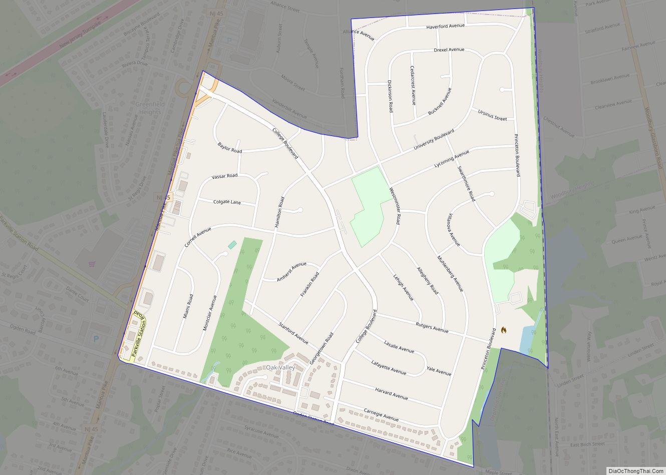
Online Interactive Map
Click on ![]() to view map in "full screen" mode.
to view map in "full screen" mode.
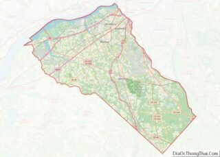
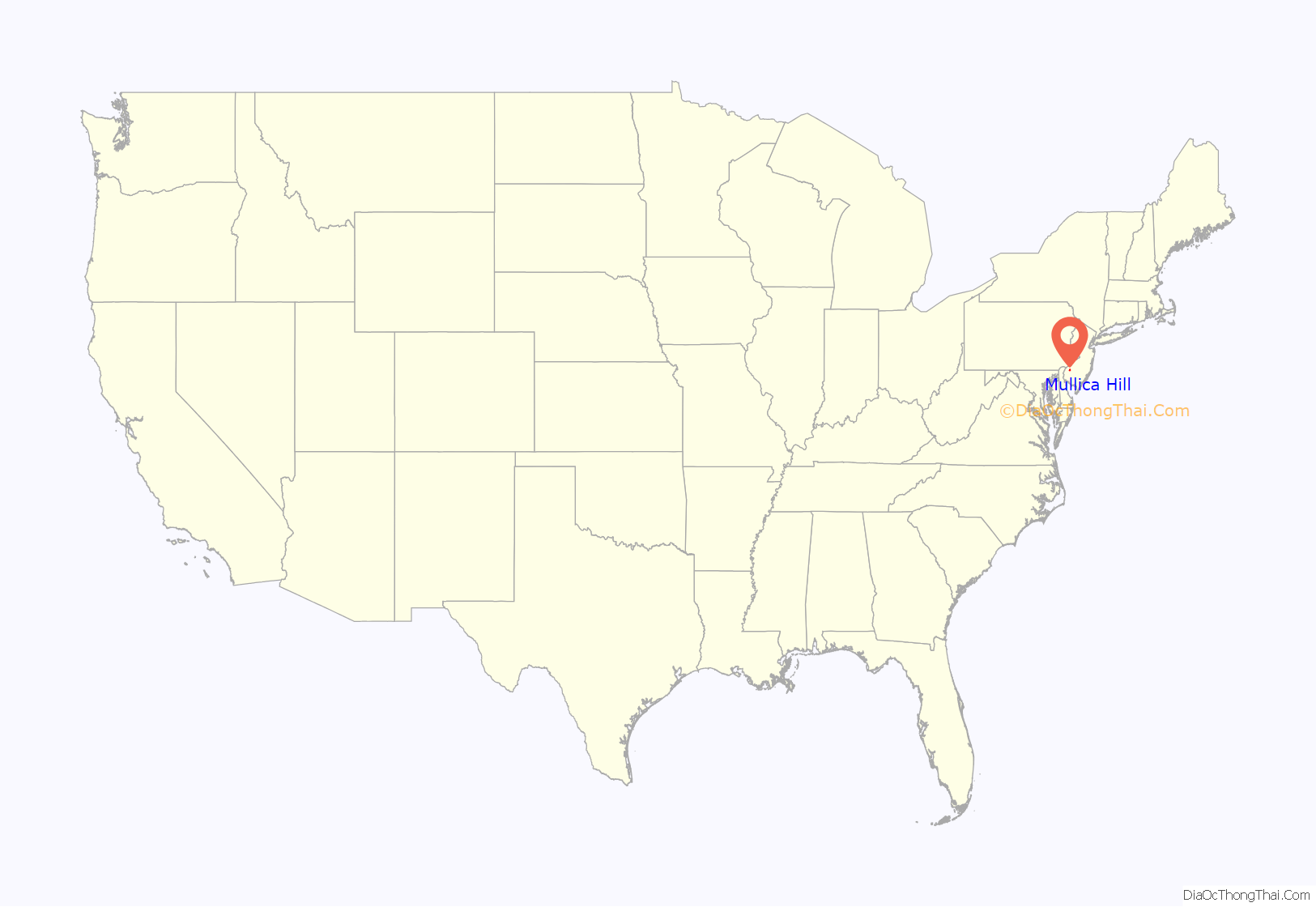
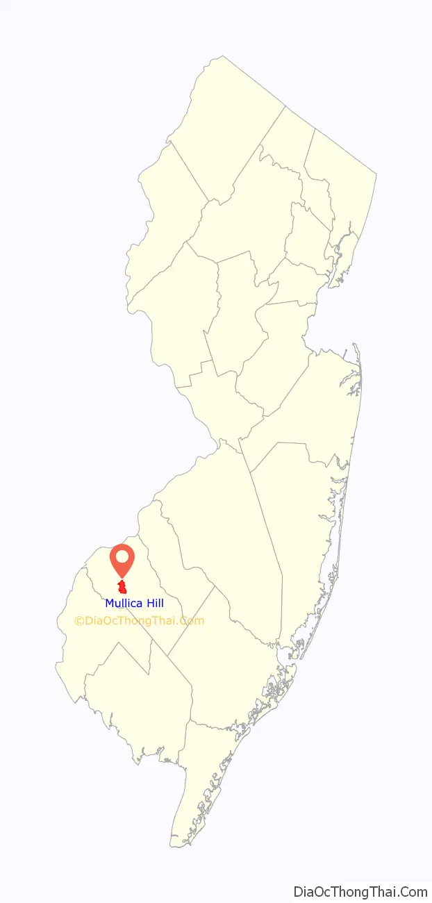
Mullica Hill location map. Where is Mullica Hill CDP?
History
Spicerville was the name of a community on the south bank of Raccoon Creek, named after prominent landowner Jacob Spicer. Mullica Hill originally referred to the settlement on the north bank of Raccoon Creek, named after the sons of Eric Pålsson Mullica, whose sons William, Eric, Olag, and John Mullica began purchasing land here in 1704. Eventually, both communities became known as just Mullica Hill as the original name of Eric’s grandfather’s house in Central Finland: “Mullikkamäki” (mullikka meaning bull calf and mäki meaning hill). Some of Mullica Hill’s historic buildings were built following the Civil War, notably the town hall that still stands today. The period of industrial and agricultural growth during and after the Civil War is commemorated by a reenactment every fall.
The area was hit by a strong EF3 tornado on September 1, 2021, with winds of up to 150 miles per hour (240 km/h), produced by the remnants of Hurricane Ida, with multiple homes and farms destroyed.
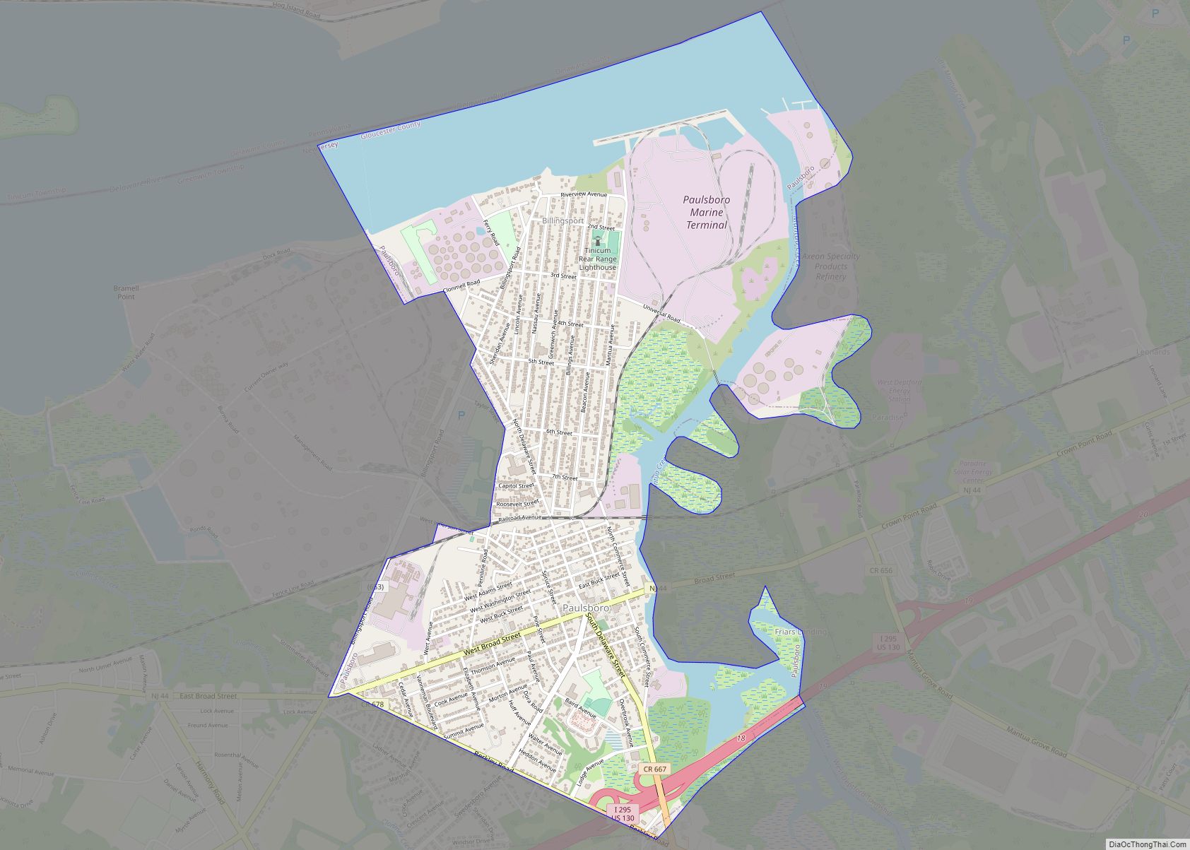
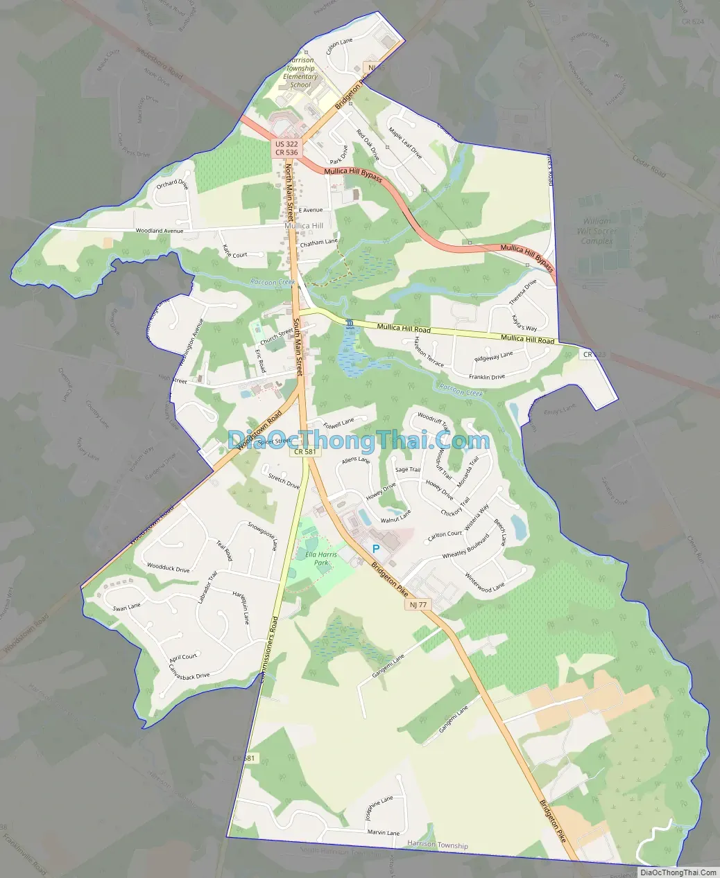
Mullica Hill Road Map
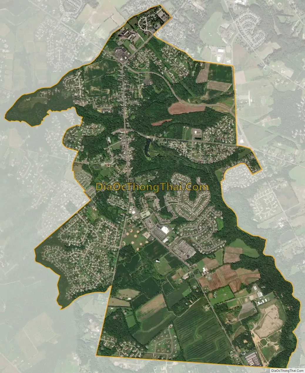
Mullica Hill city Satellite Map
Geography
According to the United States Census Bureau, the CDP had a total area of 3.626 square miles (9.392 km), including 3.603 square miles (9.333 km) of land and 0.023 square miles (0.059 km) of water (0.63%).
See also
Map of New Jersey State and its subdivision: Map of other states:- Alabama
- Alaska
- Arizona
- Arkansas
- California
- Colorado
- Connecticut
- Delaware
- District of Columbia
- Florida
- Georgia
- Hawaii
- Idaho
- Illinois
- Indiana
- Iowa
- Kansas
- Kentucky
- Louisiana
- Maine
- Maryland
- Massachusetts
- Michigan
- Minnesota
- Mississippi
- Missouri
- Montana
- Nebraska
- Nevada
- New Hampshire
- New Jersey
- New Mexico
- New York
- North Carolina
- North Dakota
- Ohio
- Oklahoma
- Oregon
- Pennsylvania
- Rhode Island
- South Carolina
- South Dakota
- Tennessee
- Texas
- Utah
- Vermont
- Virginia
- Washington
- West Virginia
- Wisconsin
- Wyoming