Paulsboro is a borough in Gloucester County, in the U.S. state of New Jersey. As of the 2020 United States census, the borough’s population was 6,196, an increase of 99 (+1.6%) from the 2010 census count of 6,097, which in turn reflected a decline of 63 (−1.0%) from the 6,160 counted in the 2000 census.
Paulsboro was formed as a borough by an act of the New Jersey Legislature on March 2, 1904, from portions of Greenwich Township. It was named for Samuel Phillip Paul, son of a settler.
| Name: | Paulsboro borough |
|---|---|
| LSAD Code: | 21 |
| LSAD Description: | borough (suffix) |
| State: | New Jersey |
| County: | Gloucester County |
| Incorporated: | March 2, 1904 |
| Elevation: | 20 ft (6 m) |
| Total Area: | 2.63 sq mi (6.81 km²) |
| Land Area: | 1.92 sq mi (4.98 km²) |
| Water Area: | 0.70 sq mi (1.83 km²) 26.81% |
| Total Population: | 6,196 |
| Population Density: | 3,220.4/sq mi (1,243.4/km²) |
| ZIP code: | 08066 |
| Area code: | 856 exchanges: 224, 423, 467, 599 |
| FIPS code: | 3457150 |
| GNISfeature ID: | 0885344 |
| Website: | www.paulsboronj.org |
Online Interactive Map
Click on ![]() to view map in "full screen" mode.
to view map in "full screen" mode.
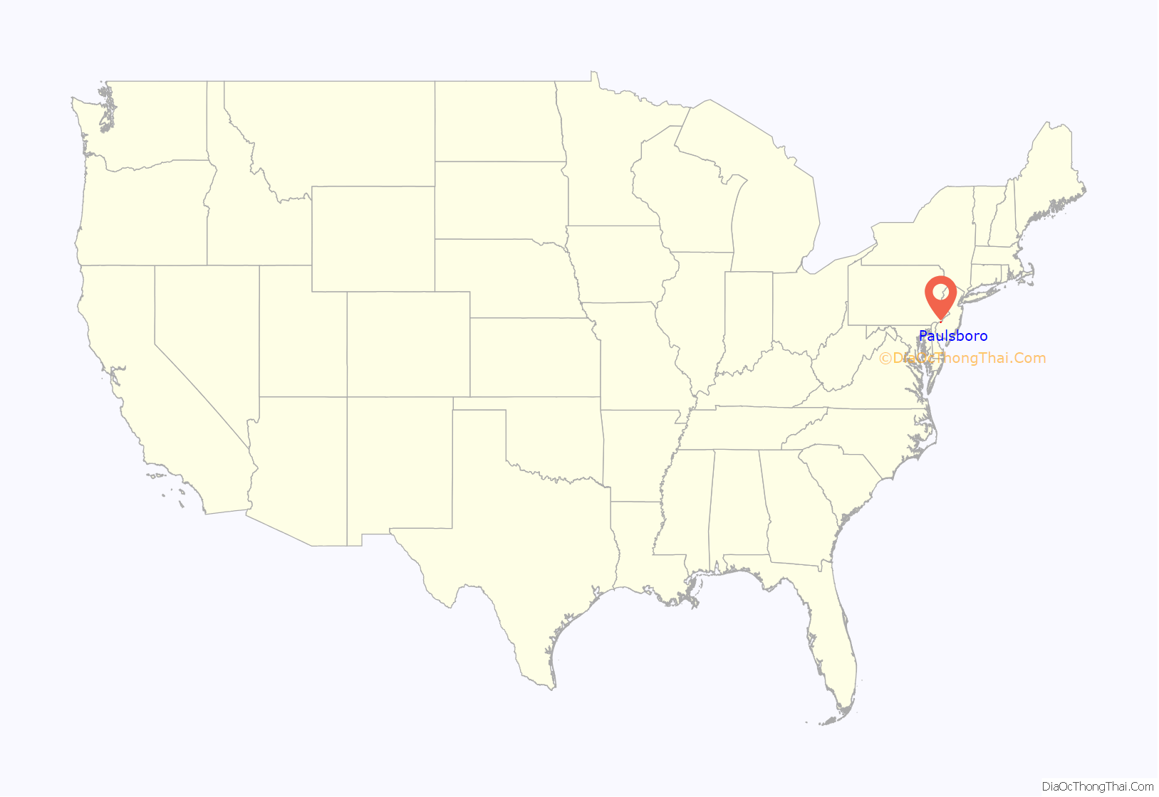
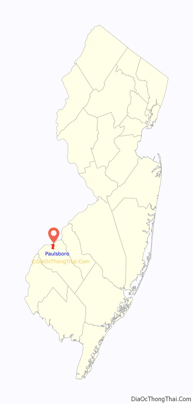
Paulsboro location map. Where is Paulsboro borough?
History
18th century
Paulsboro is the home of Fort Billingsport, the first land purchase made by the United States, acquired on July 5, 1776, the day after the signing of the Declaration of Independence.
19th century
Paulsboro is the location of the Tinicum Island Rear Range Light house, first lit on the night of December 31, 1880.
20th century
In 1997, a local citizens’ group was established with the purpose of providing tours and public access to the structure. The lighthouse is one of New Jersey’s few publicly accessible aids to navigation and is the centerpiece of Paulsboro’s cultural revitalization.
The East Jefferson Street Railroad Bridge over Mantua Creek was built in 1917 and rebuilt in 1940 for the Pennsylvania-Reading Seashore Lines (PRSL). It is now part of Conrail’s Penns Grove Secondary.
21st century
On November 30, 2012, the East Jefferson Street Railroad Bridge buckled, causing seven cars of a freight train to derail. One of the four tanker cars that fell into the creek was punctured, leaking thousands of gallons of vinyl chloride. Homes in the borough had to be evacuated and dozens of people went to hospitals as a precautionary measure due to exposure to the chemicals. Some residents in the area have filed suit against Conrail and CSX in Pennsylvania State Court having “complained about respiratory and bronchial related illnesses, headaches, eye and skin irritations and multiple other symptoms.”
In March 2013, Conrail announced that the bridge would be replaced with an expected September 2014 operational date. Normally, between March 1 and November 30 the bridge is left in the open position for maritime traffic and closed when trains approach. It will remain locked in the closed position until the bridge is replaced. In September 2013, another less serious derailment took place along the border of Gibbstown (in Greenwich Township) and Paulsboro, with one car leaving the tracks on a train consisting mostly of empty tanker cars.
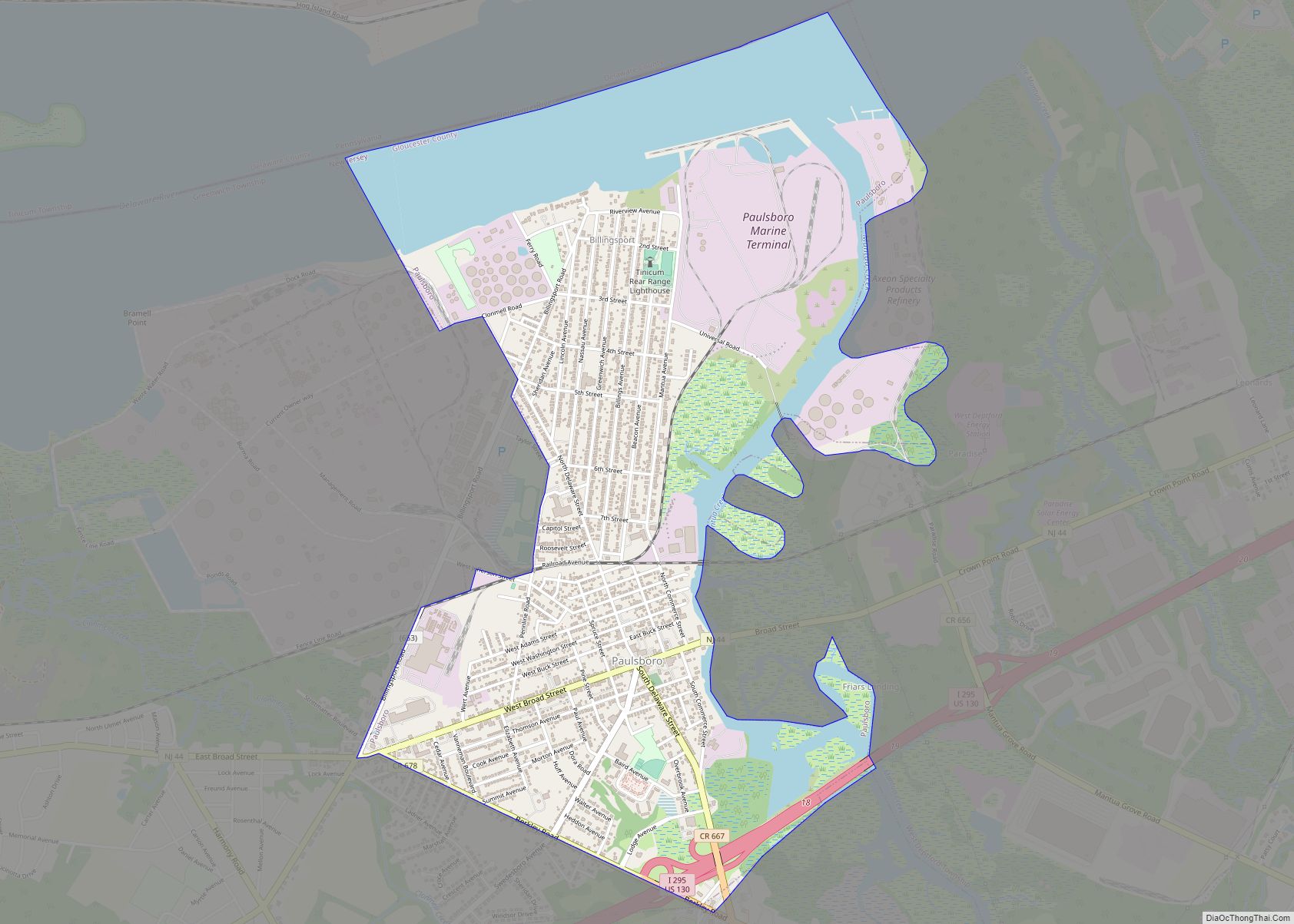
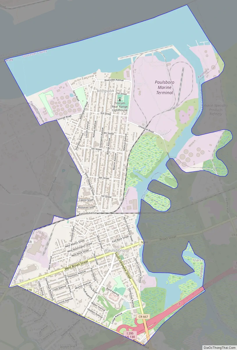
Paulsboro Road Map
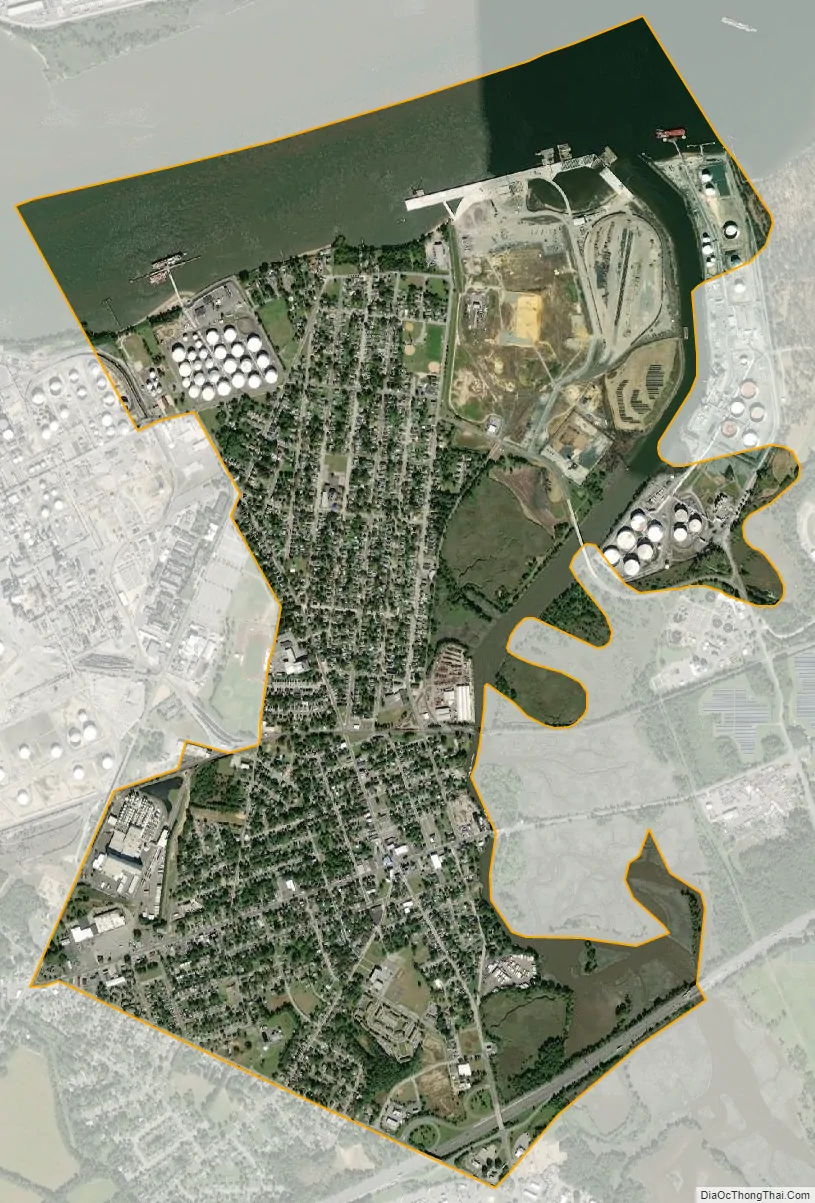
Paulsboro city Satellite Map
Geography
According to the U.S. Census Bureau, the borough had a total area of 2.63 square miles (6.81 km), including 1.92 square miles (4.98 km) of land and 0.71 square miles (1.83 km) of water (26.81%).
Unincorporated communities, localities and place names located partially or completely within the borough include Billingsport.
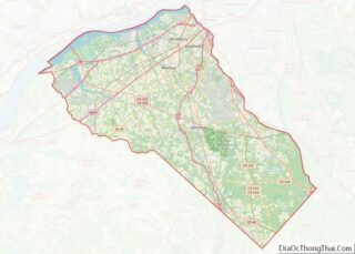
Paulsboro borders the Gloucester County municipalities of East Greenwich Township, Greenwich Township, and West Deptford Township. It also borders the Delaware River.
See also
Map of New Jersey State and its subdivision: Map of other states:- Alabama
- Alaska
- Arizona
- Arkansas
- California
- Colorado
- Connecticut
- Delaware
- District of Columbia
- Florida
- Georgia
- Hawaii
- Idaho
- Illinois
- Indiana
- Iowa
- Kansas
- Kentucky
- Louisiana
- Maine
- Maryland
- Massachusetts
- Michigan
- Minnesota
- Mississippi
- Missouri
- Montana
- Nebraska
- Nevada
- New Hampshire
- New Jersey
- New Mexico
- New York
- North Carolina
- North Dakota
- Ohio
- Oklahoma
- Oregon
- Pennsylvania
- Rhode Island
- South Carolina
- South Dakota
- Tennessee
- Texas
- Utah
- Vermont
- Virginia
- Washington
- West Virginia
- Wisconsin
- Wyoming