South Bound Brook is a borough in Somerset County, in the U.S. state of New Jersey. As of the 2020 United States census, the borough’s population was 4,863, an increase of 300 (+6.6%) from the 2010 census count of 4,563, which in turn reflected an increase of 71 (+1.6%) from the 4,492 counted in the 2000 census.
What is now South Bound Brook was originally formed as a town within Franklin Township. On March 16, 1869, the name of the community was changed to Bloomington, which lasted until May 29, 1891, when the name reverted to South Bound Brook town. South Bound Brook was incorporated as an independent borough by an act of the New Jersey Legislature on April 11, 1907, based on the results of a referendum held on May 1, 1907.
| Name: | South Bound Brook borough |
|---|---|
| LSAD Code: | 21 |
| LSAD Description: | borough (suffix) |
| State: | New Jersey |
| County: | Somerset County |
| Incorporated: | May 1, 1907 |
| Elevation: | 46 ft (14 m) |
| Total Area: | 0.74 sq mi (1.92 km²) |
| Land Area: | 0.65 sq mi (1.67 km²) |
| Water Area: | 0.10 sq mi (0.25 km²) 12.84% |
| Population Density: | 7,543.4/sq mi (2,912.5/km²) |
| ZIP code: | 08880 |
| Area code: | 732 |
| FIPS code: | 3468730 |
| GNISfeature ID: | 885401 |
| Website: | www.sbbnj.com |
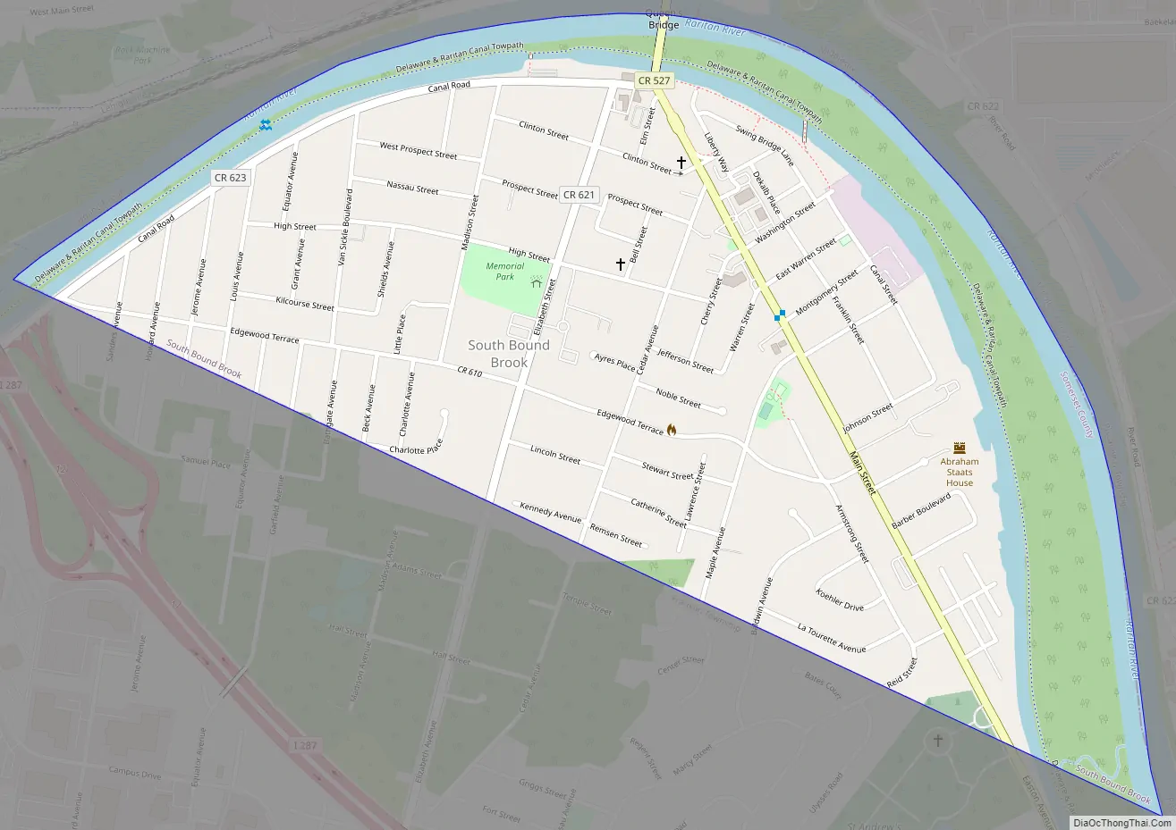
Online Interactive Map
Click on ![]() to view map in "full screen" mode.
to view map in "full screen" mode.
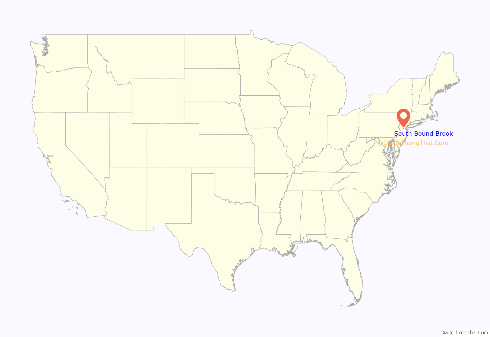
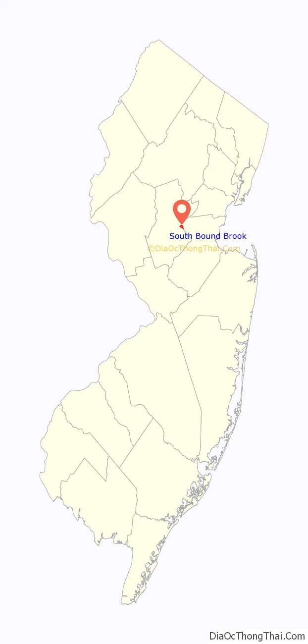
South Bound Brook location map. Where is South Bound Brook borough?
History
The area had historically been occupied by the Lenape Native Americans. The first European settlement was in 1681 and a community was established near the Bound Brook stream of the same name, which flows into the Raritan River via the Green Brook on the eastern side of the borough. The brook, which was mentioned as a boundary in a Native American deed, provides the source of the borough’s name.
The area was originally a Dutch community with apple orchards and just west peach orchards. The Abraham Staats House (c. 1740), located on the south side of Main Street, served as the headquarters of Baron Von Steuben during the American Revolutionary War. The house remained a private home until it was acquired by the Borough of South Bound Brook in 1999. It was placed on the New Jersey and National Registers in 2002. It is currently the headquarters for the Friends of Abraham Staats House, Inc. https://www.staatshouse.org, who maintain it as a museum.
A wooden bridge over the Raritan River was erected as early as 1761 and named Queen’s Bridge in 1767. Later, it became a covered bridge. During the Revolutionary War, the bridge was used repeatedly by both sides including during the Battle of Bound Brook in 1777. In 1875, the wooden bridge was replaced by a steel pipe truss bridge. More than 100 years later, that bridge was itself replaced by a steel girder bridge in 1984, still using the old pillars. The bridge was renovated and paved in 2007.
At this spot on January 4, 1777, General Washington decided to move his troops to Morristown for the winter, thus ending the victorious Trenton-Princeton campaign, rather than attack New Brunswick.
The Battle of Bound Brook, one of the battles in the New York and New Jersey campaign during the American Revolutionary War, occurred on April 13, 1777, and resulted in a defeat for the Continental Army, who were routed by about 4,000 troops under British command.
At dawn on April 13, 1777, Hessian Captain Ewald’s assault over the Queens Bridge spanning the Raritan River between South Bound Brook and Bound Brook was pinned down by “murderous fire” from the American soldiers stationed at half moon battery. Advancing North along present day Easton Avenue, Hessian Colonel Donop pushed aside American outposts and arrived 15 minutes after Ewald’s attack had faltered. Advancing over the Queens Bridge, Donop’s troops engaged the Americans causing them to retreat from the battery. Donop, Ewald’s, and General Grant’s troops pursued the American troops as they fought through the streets of Bound Brook.
The Reformed Church, also on Main Street (near borough hall) was built in 1848 and has been declared a local historical site by the borough council. Originally called the Dutch Reformed Church of Bound Brook, it has gone through very few changes over the years. A pipe organ received from Andrew Carnegie has been removed, and the stained glass windows, which had been added well after the original construction. The Reverend Thomas DeWitt Talmadge was a member and preached at the church.
Originally part of Franklin Township and named Bloomington, South Bound Brook was incorporated as a borough by the New Jersey Legislature in 1907.
In the mid-1970s a teen from the town created a plan for an environmental commission and presented it to the council. James Manley got his commission and the first order of business was to find out what the white piles of waste on the tow path between the Delaware and Raritan Canal and Raritan River consisted of. It turned out to be 17% crystal asbestos by volume. Since there was no New Jersey state regulation for the disposal, this became a landmark case. The waste was hauled in dump trucks through Bound Brook to the floodplain south of West Main Street and dumped. A trail of asbestos dust led from the old dump site to the new dump location.
Redevelopment
The main downtown street in South Bound Brook, known as Main Street, has been refurbished with new sidewalks, lighting, signage and a number of newly renovated stores.
A roofing material manufacturing facility known as GAF Manufacturing was located in South Bound Brook for over a century along Main Street. The site was dormant for about two decades and sat as an eyesore and reminder of the town’s industrial past. New townhomes have been built on the GAF Manufacturing site, along the Delaware and Raritan Canal, which provide the downtown area a new modern look and many new residents.
Part of the redevelopment is being held up by a lawsuit by John Fanaro of Fanaro Carpeting over the right of eminent domain, as the borough tried to seize property along Main Street that is in front of the new townhomes. The redevelopment plan called for the older stores to be razed and replaced with new stores that had parking in back and a dozen rental apartments on the second floor.
A new condominium development along Elizabeth Street in the central part of town was finished in 2010.
South Bound Brook Road Map
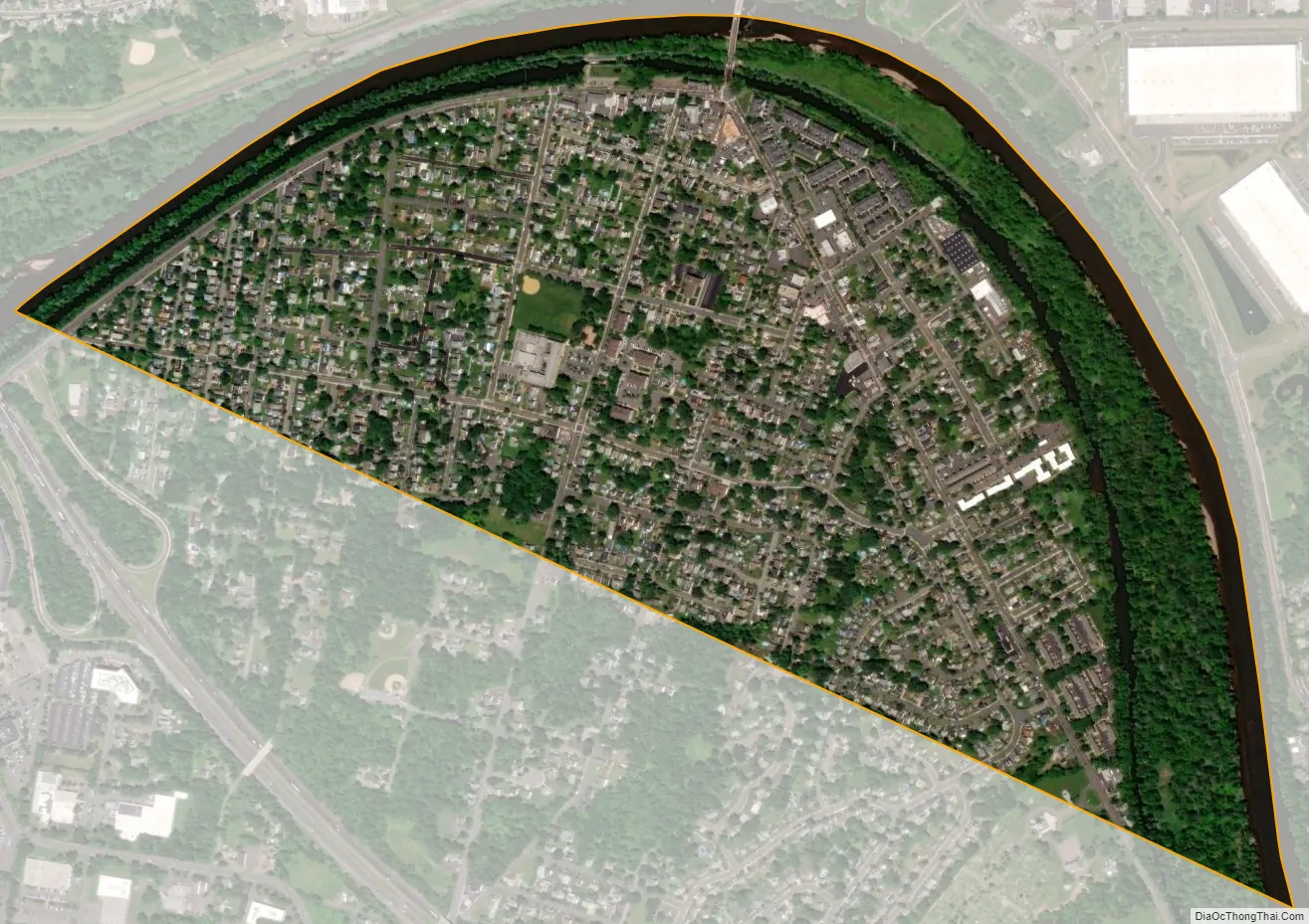
South Bound Brook city Satellite Map
Geography
According to the United States Census Bureau, the borough had a total area of 0.74 square miles (1.92 km), including 0.65 square miles (1.67 km) of land and 0.10 square miles (0.25 km) of water (12.84%).
The borough borders the municipalities of Bound Brook, Bridgewater Township and Franklin Township in Somerset County; and both Middlesex Borough and Piscataway in Middlesex County.
See also
Map of New Jersey State and its subdivision: Map of other states:- Alabama
- Alaska
- Arizona
- Arkansas
- California
- Colorado
- Connecticut
- Delaware
- District of Columbia
- Florida
- Georgia
- Hawaii
- Idaho
- Illinois
- Indiana
- Iowa
- Kansas
- Kentucky
- Louisiana
- Maine
- Maryland
- Massachusetts
- Michigan
- Minnesota
- Mississippi
- Missouri
- Montana
- Nebraska
- Nevada
- New Hampshire
- New Jersey
- New Mexico
- New York
- North Carolina
- North Dakota
- Ohio
- Oklahoma
- Oregon
- Pennsylvania
- Rhode Island
- South Carolina
- South Dakota
- Tennessee
- Texas
- Utah
- Vermont
- Virginia
- Washington
- West Virginia
- Wisconsin
- Wyoming


