Williamstown is an unincorporated community and census-designated place (CDP) located in Monroe Township in Gloucester County, New Jersey. As of the 2010 U.S. census, Williamstown’s population was 15,567.
| Name: | Williamstown CDP |
|---|---|
| LSAD Code: | 57 |
| LSAD Description: | CDP (suffix) |
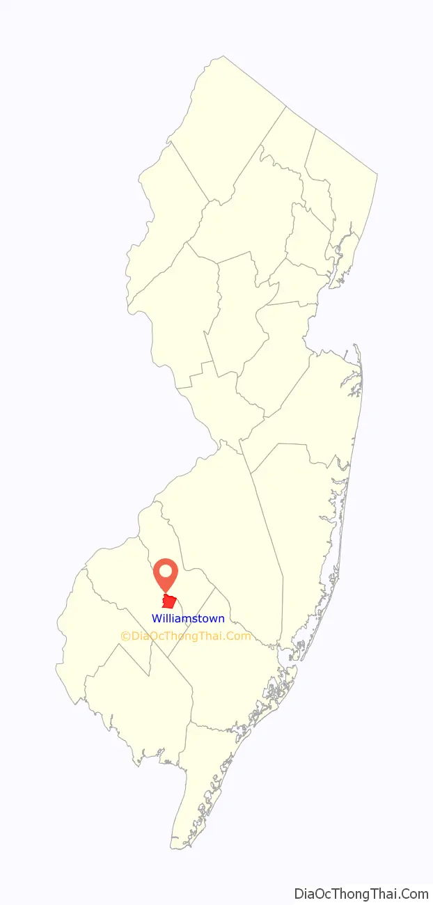
| State: | New Jersey |
| County: | Gloucester County |
| Elevation: | 141 ft (43 m) |
| Total Area: | 7.42 sq mi (19.23 km²) |
| Land Area: | 7.42 sq mi (19.22 km²) |
| Water Area: | 0.00 sq mi (0.01 km²) 0.05% |
| Total Population: | 15,082 |
| Population Density: | 2,032.34/sq mi (784.67/km²) |
| ZIP code: | 08094 |
| Area code: | 856 |
| FIPS code: | 3481380 |
| GNISfeature ID: | 02390518 |
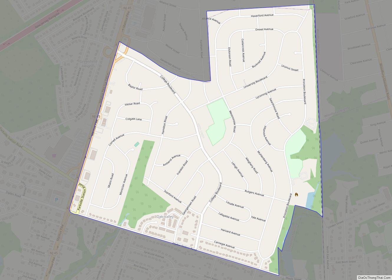
Online Interactive Map
Click on ![]() to view map in "full screen" mode.
to view map in "full screen" mode.
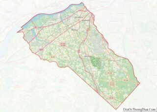
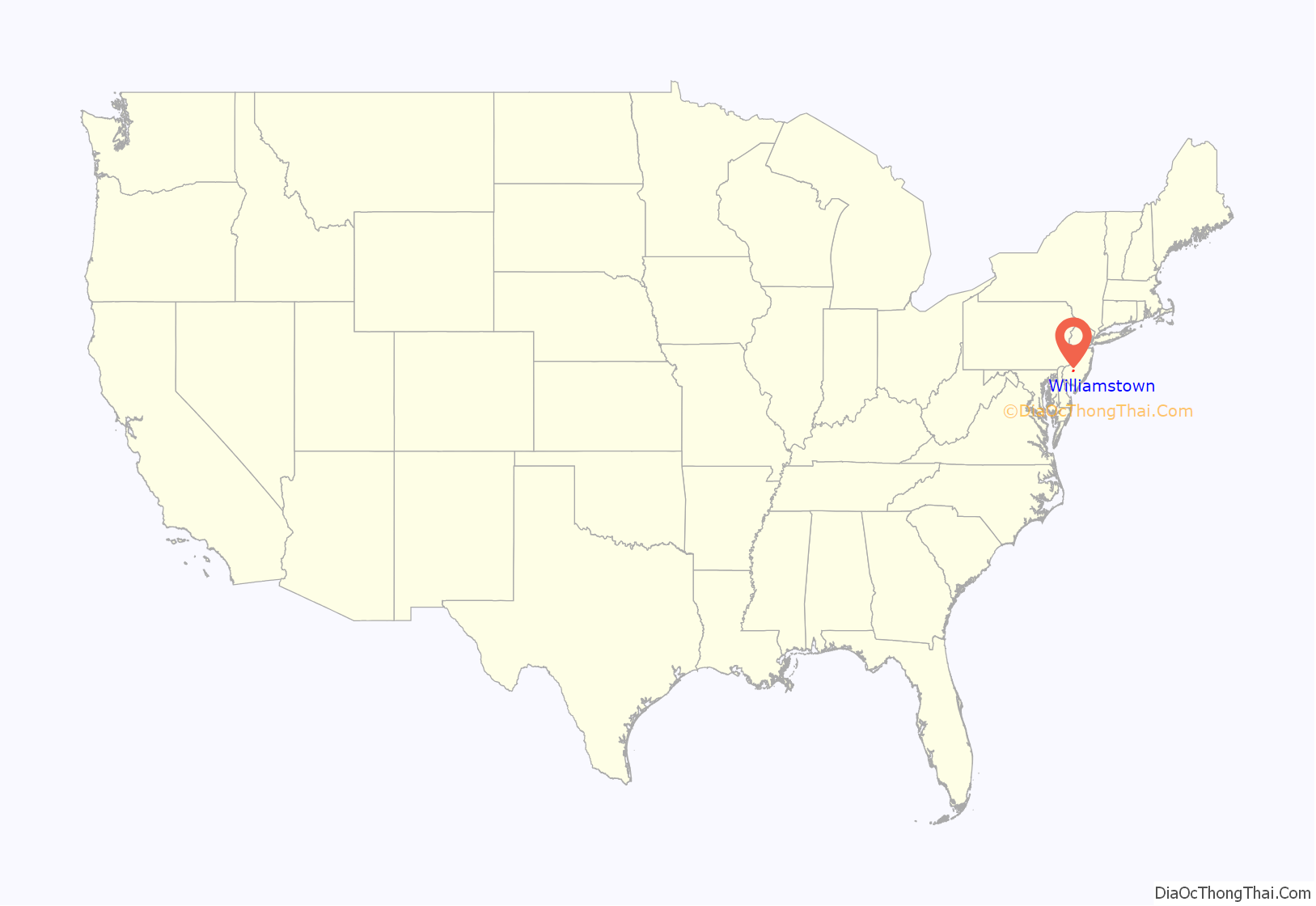
Williamstown location map. Where is Williamstown CDP?
History
Before the community’s settlement in 1737, Williamstown was inhabited by the Lenni-Lenape tribe of Native Americans, from whom the town derived its original name, “Squankum.” The name (Lenape for ‘place where evil spirits dwell’) was changed to Williamstown when the town’s first post office was established, due to postal regulations that prohibited two towns from having the same name and there was an older Squankum located 60 miles (97 km) northeast. It is generally thought that ‘evil spirits’ referred to the abundance of mosquitoes in the area, a by-product of the low-lying swamps that characterized the area during that time period. In the early eighteenth century, Richard Penn sold what eventually became Williamstown to his grandson, John Williams, who divided and resold the land in lots to settlers and for whom the town was eventually renamed. The town was officially incorporated as Monroe Township in March 1859, with Williamstown as meeting place to vote and have town discussions. A municipal court was established in the Township of Monroe, in accordance with the provisions of Chapter 264 of the Laws of 1948. The first school was built in 1750 and stood where the Washington Hotel now stands. The local schools operated on a pay-as-you-go basis until the 1850s and were predominantly church-run. The area built its first high school in 1958.
The population of the town remained small until the early 1830s when the glass industry sprung up (Glassboro, a neighboring town, still bears the name borne of that commercial boom). The first company to form was called Free Will Glass Manufacturing and caused a population surge. The industry thrived until the early 1900s when agricultural businesses began to flourish in the face of the waning glass industry. One notable company, The John Sharp Canning Co., still operates today as Blue Ribbon. The Monroe Township Historical Society was formed as a volunteer organization on October 16, 1974, by Mayor John W. Sharp (of the Canning Company Sharps), dedicated to the preservation of items that reflect the history of Monroe Township.
In 2014, the community had a death rate from heroin that was 25 times the national average, with about five people per year dying of overdoses and other complications in the previous decade.
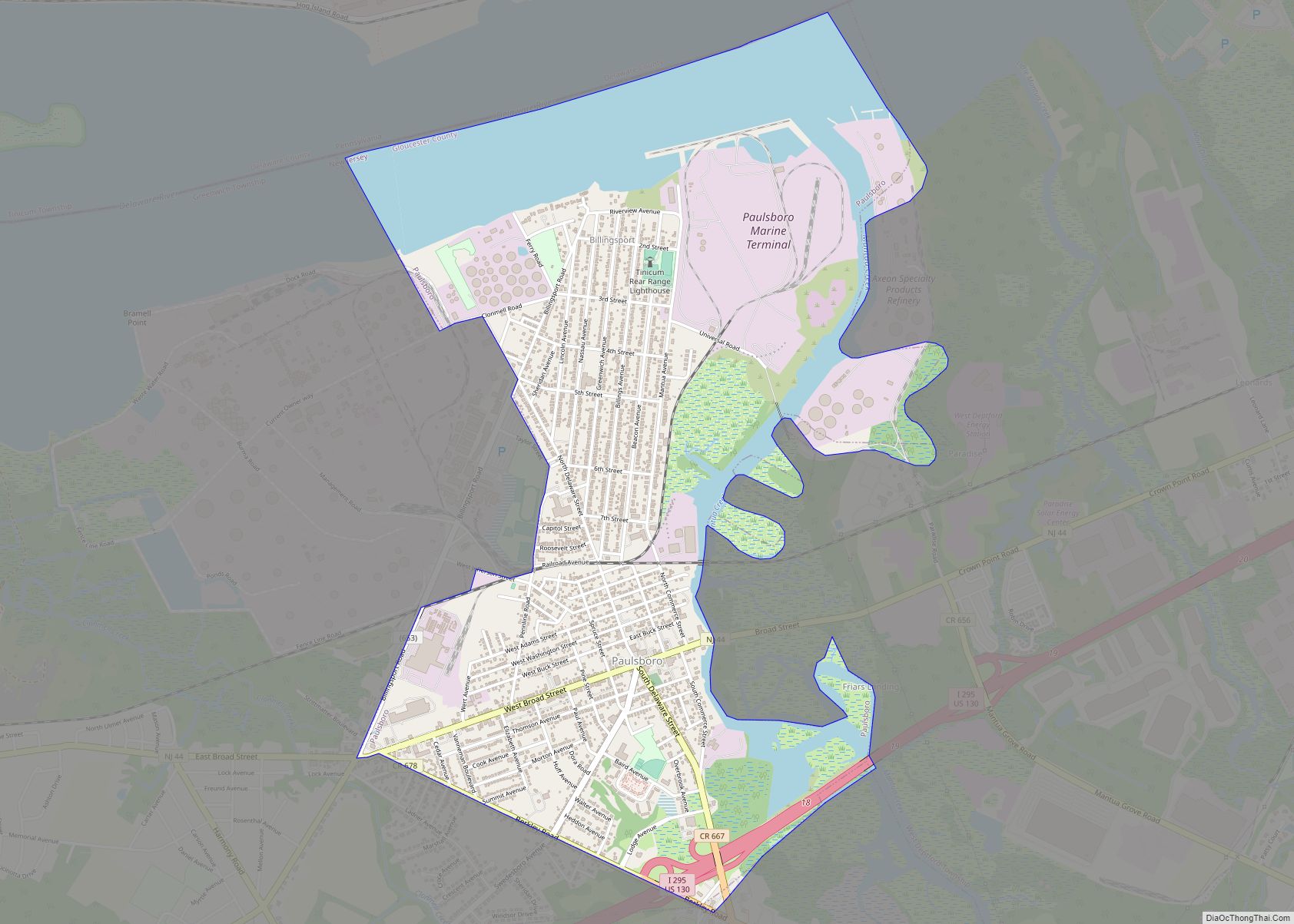
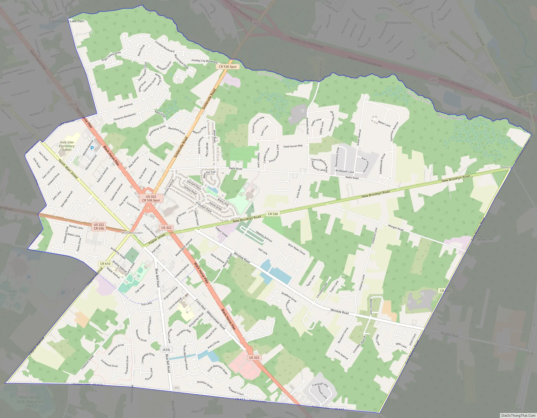
Williamstown Road Map
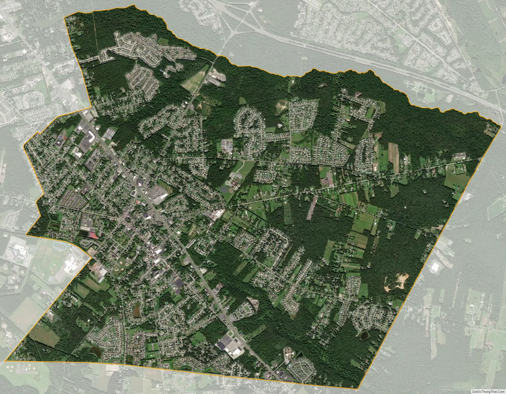
Williamstown city Satellite Map
Geography
According to the U.S. Census Bureau, Williamstown had a total area of 7.423 square miles (19.225 km), including 7.419 square miles (19.216 km) of land and 0.004 square miles (0.010 km) of water (0.05%). It has a humid subtropical climate (Cfa) and average monthly temperatures range from 33.2° in January to 76.7 °F in July. The hardiness zone is 7a.
See also
Map of New Jersey State and its subdivision: Map of other states:- Alabama
- Alaska
- Arizona
- Arkansas
- California
- Colorado
- Connecticut
- Delaware
- District of Columbia
- Florida
- Georgia
- Hawaii
- Idaho
- Illinois
- Indiana
- Iowa
- Kansas
- Kentucky
- Louisiana
- Maine
- Maryland
- Massachusetts
- Michigan
- Minnesota
- Mississippi
- Missouri
- Montana
- Nebraska
- Nevada
- New Hampshire
- New Jersey
- New Mexico
- New York
- North Carolina
- North Dakota
- Ohio
- Oklahoma
- Oregon
- Pennsylvania
- Rhode Island
- South Carolina
- South Dakota
- Tennessee
- Texas
- Utah
- Vermont
- Virginia
- Washington
- West Virginia
- Wisconsin
- Wyoming