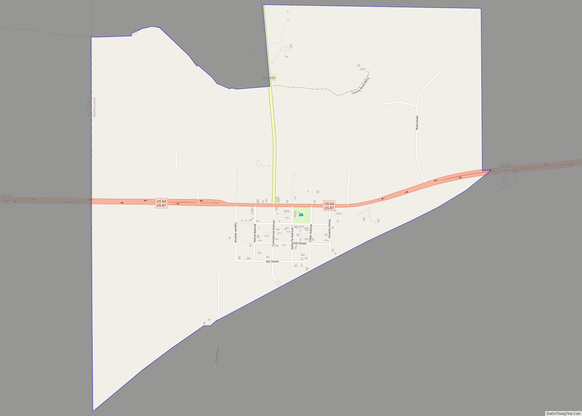
Capulin is a census-designated place and unincorporated community in Union County, New Mexico, United States. Its population was 66 as of the 2010 census. Capulin had a post office until August 13, 2011; it still has its own ZIP code, 88414. U.S. routes 64 and 87 pass through the community. Capulin Volcano National Monument is located 5 kilometres (3.1 mi) north of Capulin. The town was named after the volcano by Hispanic settlers after the Civil War. It was known as Dedman from 1909 to 1922, after railroad superintendent E.J. Dedman.
| Name: | Capulin CDP |
|---|---|
| LSAD Code: | 57 |
| LSAD Description: | CDP (suffix) |
| State: | New Mexico |
| County: | Union County |
| Elevation: | 6,844 ft (2,086 m) |
| Total Area: | 1.48 sq mi (3.84 km²) |
| Land Area: | 1.48 sq mi (3.84 km²) |
| Water Area: | 0.00 sq mi (0.00 km²) |
| Total Population: | 61 |
| Population Density: | 41.11/sq mi (15.87/km²) |
| ZIP code: | 88414 |
| Area code: | 575 |
| FIPS code: | 3512010 |
| GNISfeature ID: | 902195 |
Online Interactive Map
Click on ![]() to view map in "full screen" mode.
to view map in "full screen" mode.
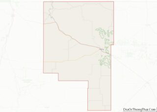
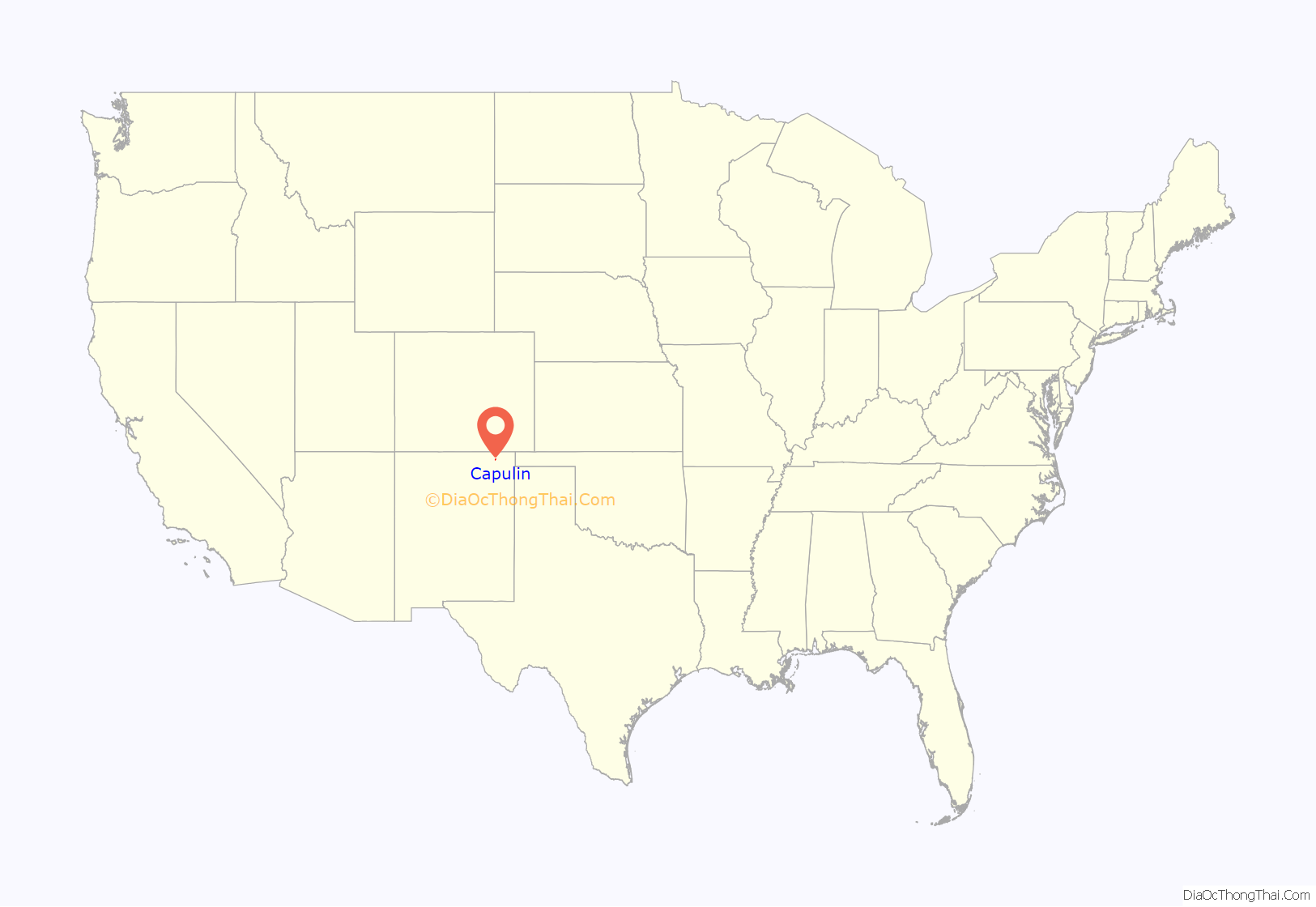
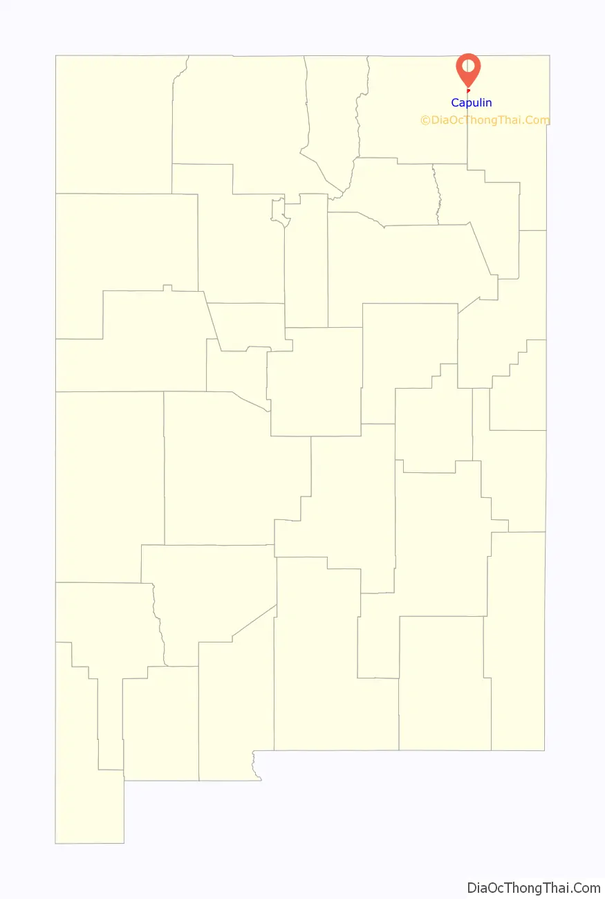
Capulin location map. Where is Capulin CDP?
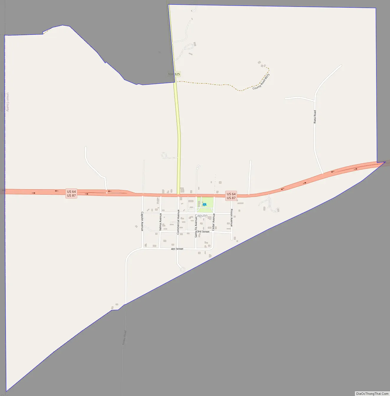
Capulin Road Map
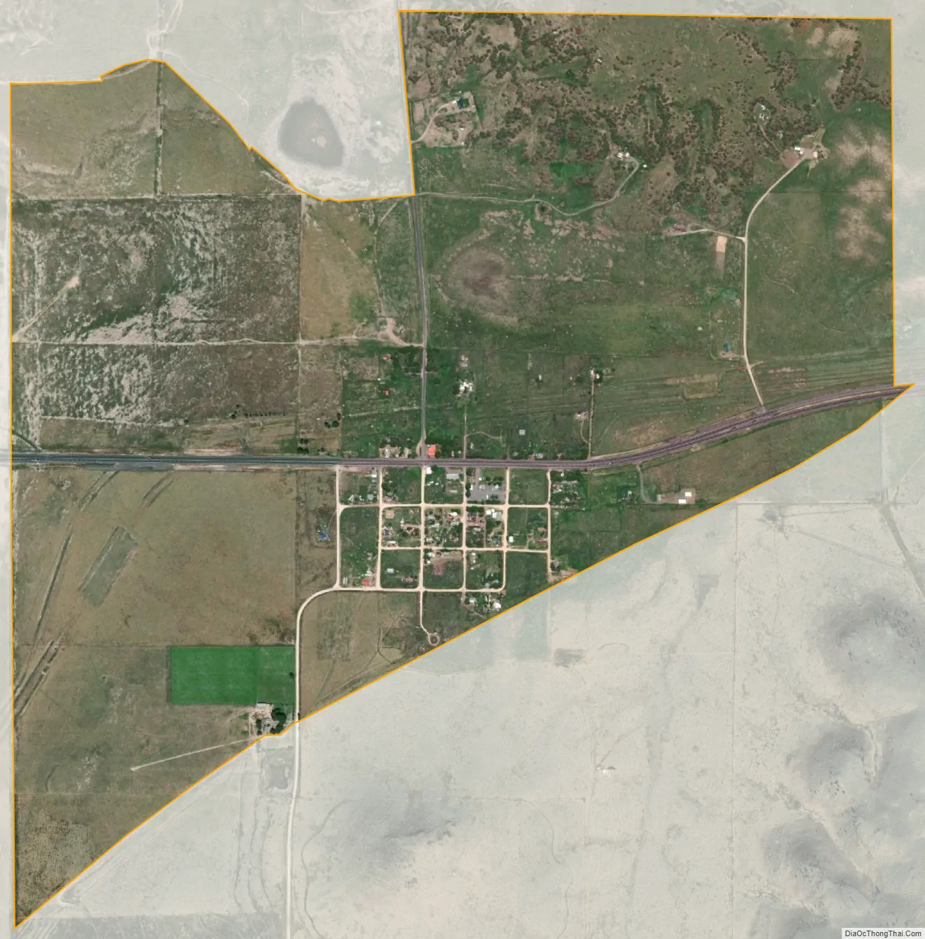
Capulin city Satellite Map
Geography
Climate
See also
Map of New Mexico State and its subdivision: Map of other states:- Alabama
- Alaska
- Arizona
- Arkansas
- California
- Colorado
- Connecticut
- Delaware
- District of Columbia
- Florida
- Georgia
- Hawaii
- Idaho
- Illinois
- Indiana
- Iowa
- Kansas
- Kentucky
- Louisiana
- Maine
- Maryland
- Massachusetts
- Michigan
- Minnesota
- Mississippi
- Missouri
- Montana
- Nebraska
- Nevada
- New Hampshire
- New Jersey
- New Mexico
- New York
- North Carolina
- North Dakota
- Ohio
- Oklahoma
- Oregon
- Pennsylvania
- Rhode Island
- South Carolina
- South Dakota
- Tennessee
- Texas
- Utah
- Vermont
- Virginia
- Washington
- West Virginia
- Wisconsin
- Wyoming