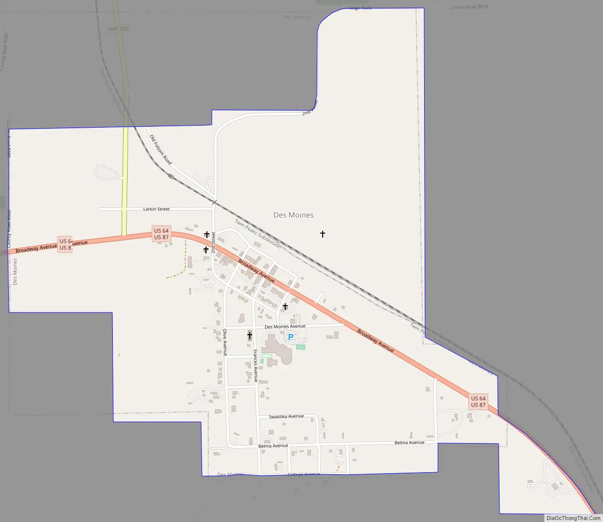
Des Moines is a village in Union County, New Mexico, United States. The population was 143 at the 2010 census. Des Moines is a small village surrounded by large cattle ranches. The summit of Sierra Grande, the largest shield volcano in the Raton-Clayton Volcanic Field, is 5 kilometres (3.1 mi) southwest of the village. The population in 2018 was 20% lower than it was in 2000. Des Moines is known for its educational services, construction, and agriculture. The general cost of living index for Des Moines is 84.9.
| Name: | Des Moines village |
|---|---|
| LSAD Code: | 47 |
| LSAD Description: | village (suffix) |
| State: | New Mexico |
| County: | Union County |
| Elevation: | 6,647 ft (2,026 m) |
| Total Area: | 0.87 sq mi (2.25 km²) |
| Land Area: | 0.87 sq mi (2.25 km²) |
| Water Area: | 0.00 sq mi (0.00 km²) |
| Total Population: | 117 |
| Population Density: | 134.48/sq mi (51.92/km²) |
| ZIP code: | 88418 |
| Area code: | 575 |
| FIPS code: | 3520480 |
| GNISfeature ID: | 0899607 |
Online Interactive Map
Click on ![]() to view map in "full screen" mode.
to view map in "full screen" mode.
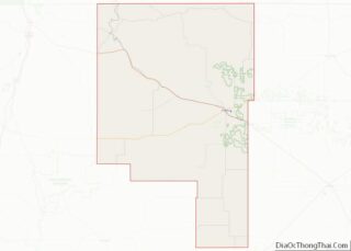
Des Moines location map. Where is Des Moines village?


History
A post office called Des Moines has been in operation since 1906. The village took its name after Des Moines, Iowa.
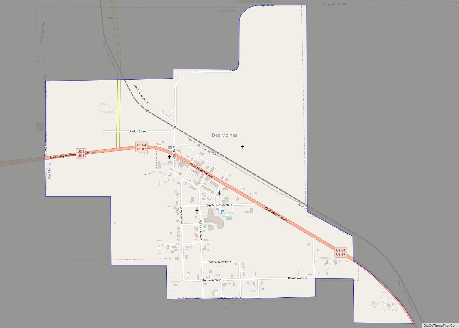
Des Moines Road Map
Des Moines city Satellite Map

Geography
Des Moines is located at 36°45′37″N 103°50′7″W / 36.76028°N 103.83528°W / 36.76028; -103.83528 (36.760167, -103.835317).
According to the United States Census Bureau, the village has a total area of 1.1 square miles (2.8 km), all land.
See also
Map of New Mexico State and its subdivision: Map of other states:- Alabama
- Alaska
- Arizona
- Arkansas
- California
- Colorado
- Connecticut
- Delaware
- District of Columbia
- Florida
- Georgia
- Hawaii
- Idaho
- Illinois
- Indiana
- Iowa
- Kansas
- Kentucky
- Louisiana
- Maine
- Maryland
- Massachusetts
- Michigan
- Minnesota
- Mississippi
- Missouri
- Montana
- Nebraska
- Nevada
- New Hampshire
- New Jersey
- New Mexico
- New York
- North Carolina
- North Dakota
- Ohio
- Oklahoma
- Oregon
- Pennsylvania
- Rhode Island
- South Carolina
- South Dakota
- Tennessee
- Texas
- Utah
- Vermont
- Virginia
- Washington
- West Virginia
- Wisconsin
- Wyoming