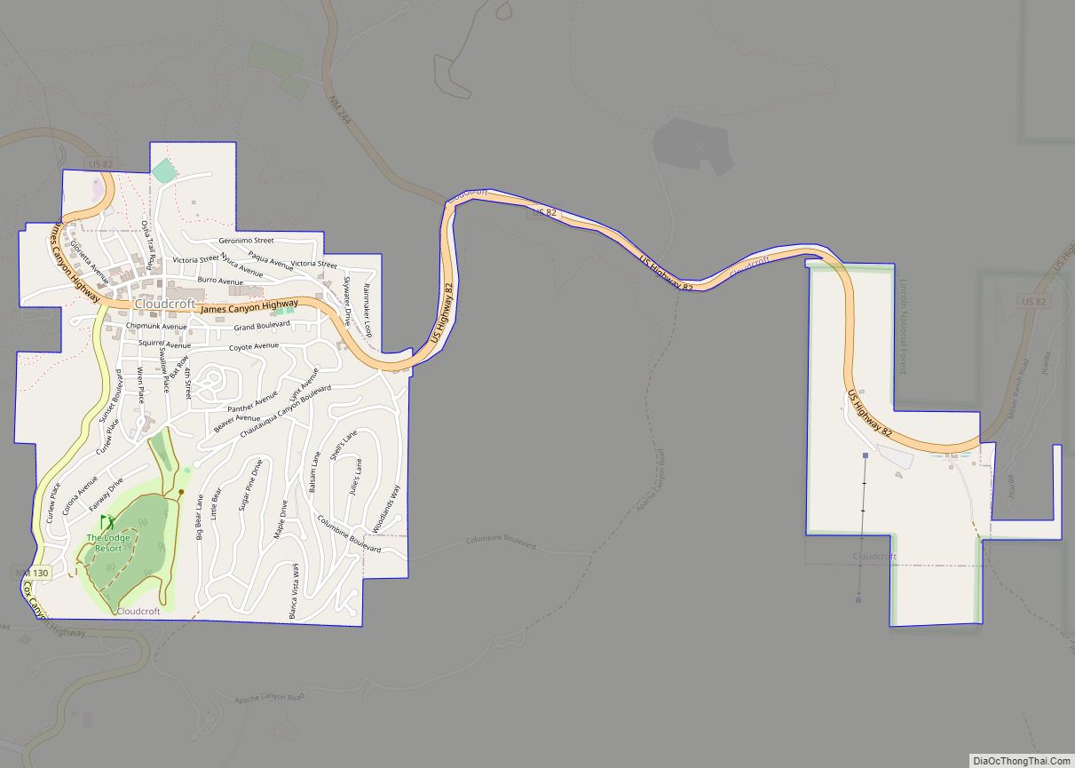
Cloudcroft is a village in Otero County, New Mexico, United States, and is located within the Lincoln National Forest. The population was 674 at the 2010 census. Despite being located in an otherwise arid region, its high elevation (8,676 feet (2,644 m) allows for a mild summer and forested surroundings that makes it a popular tourist attraction in west Texas and southern New Mexico. It was named by Fodor’s in 2002 as the Number 3 “Most Overlooked and Underrated Destination Spot.” Tourism remains the primary economic driver of the village.
| Name: | Cloudcroft village |
|---|---|
| LSAD Code: | 47 |
| LSAD Description: | village (suffix) |
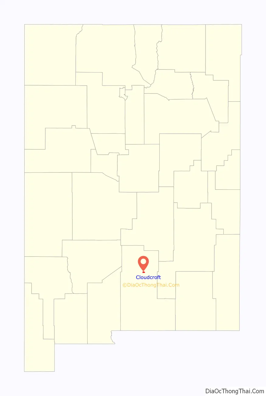
| State: | New Mexico |
| County: | Otero County |
| Elevation: | 8,676 ft (2,644 m) |
| Total Area: | 1.64 sq mi (4.24 km²) |
| Land Area: | 1.64 sq mi (4.24 km²) |
| Water Area: | 0.00 sq mi (0.00 km²) |
| Total Population: | 750 |
| Population Density: | 458.44/sq mi (177.00/km²) |
| ZIP code: | 88317, 88350 |
| Area code: | 575 |
| FIPS code: | 3516280 |
| GNISfeature ID: | 2413541 |
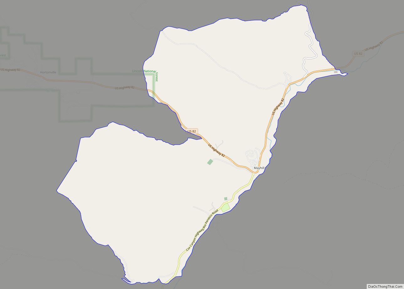
Online Interactive Map
Click on ![]() to view map in "full screen" mode.
to view map in "full screen" mode.
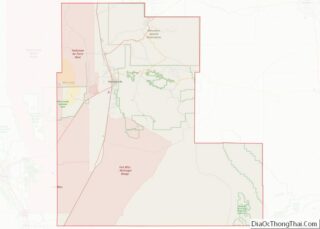
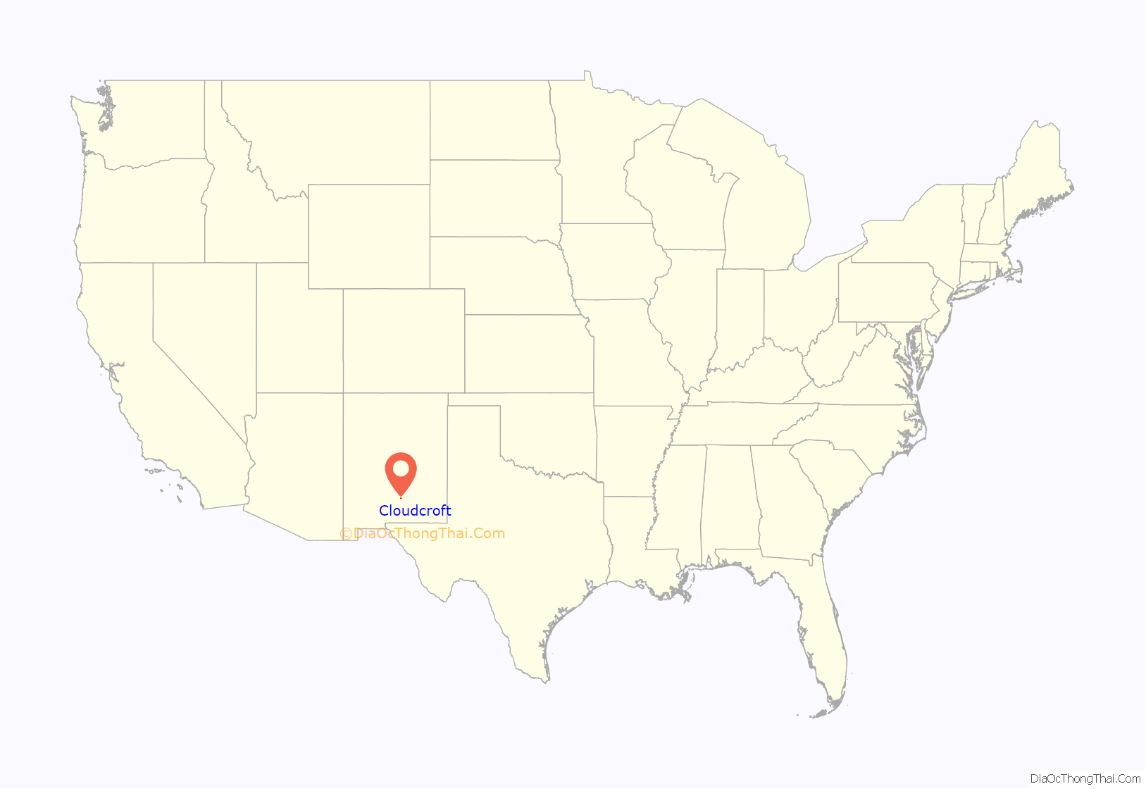
Cloudcroft location map. Where is Cloudcroft village?
History
In the 1890s, the El Paso and Northeastern Railroad, organized by brothers Charles Bishop Eddy and John Arthur Eddy, arrived in the newly founded town of Alamogordo intending to continue the rail line north to the mining town of White Oaks and beyond. This required a steady supply of timber. In 1898 the Eddy brothers sent a survey crew into the Sacramento Mountains to determine the feasibility of extending a line up the summit to harvest the forests. The crew reported that not only was it possible, but the area could attract visitors. The name of Cloudcroft – a pasture for the clouds – was suggested and work on the line soon began.
By the end of the year, the rail line had been extended as far as Toboggan Canyon, and construction was started on a pavilion at the summit to provide accommodations for the anticipated tourists. It consisted of a dining room, kitchen, parlor, entertainment hall, and 40 tents set on wooden platforms. In May 1899 the railroad reached Cox Canyon and in June 1899, “The Pavilion” was formally opened by John Eddy. The first visitors rode the train as far as Toboggan and finished the journey by stagecoach. Favorable reports in newspapers quickly made Cloudcroft a popular destination. An additional resort, The Lodge, was built as a more upscale alternative to The Pavilion. The rail line arrived in Cloudcroft in early 1900, and in June 1900 the train depot was finished, located just west of The Pavilion. Meeting the trains became a daily activity in the village, with three arriving each day, bringing lumber, mail, and passengers.
In 1909, The Lodge burned down; it was rebuilt at its present location in 1911. The Pavilion also burned twice in the 1920s, but was rebuilt each time to conform to the original plans.
The Lodge at Cloudcroft hosted numerous famous guests, including Judy Garland, Gilbert Roland, Clark Gable, and Pancho Villa. In the 1930s the resort was managed by Conrad Hilton, who was born and raised in San Antonio, New Mexico. Hilton was familiar with The Lodge and wanted to be closer to his family as his own hotel chain slowly began its climb to prominence.
As automobiles grew in popularity, the rail line began to lose money. Passenger service ended in 1938, and the last freight train ran in 1947. Since then, tourism in Cloudcroft has grown beyond The Lodge and Pavilion to Burro Street near Highway 82, where many small shops and restaurants are located.
The Mexican Canyon Trestle is a surviving example of the now defunct rail line that once ran up the mountain from Alamogordo to Cloudcroft. It is located off Highway 82 just under one mile west of Cloudcroft.
Cloudcroft Road Map
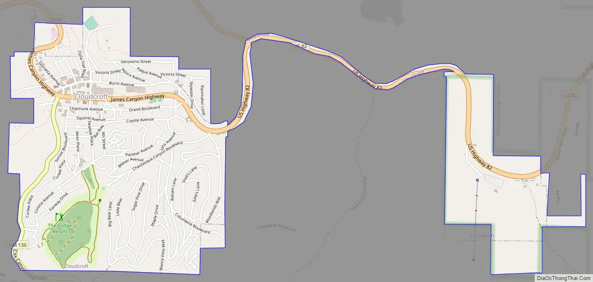
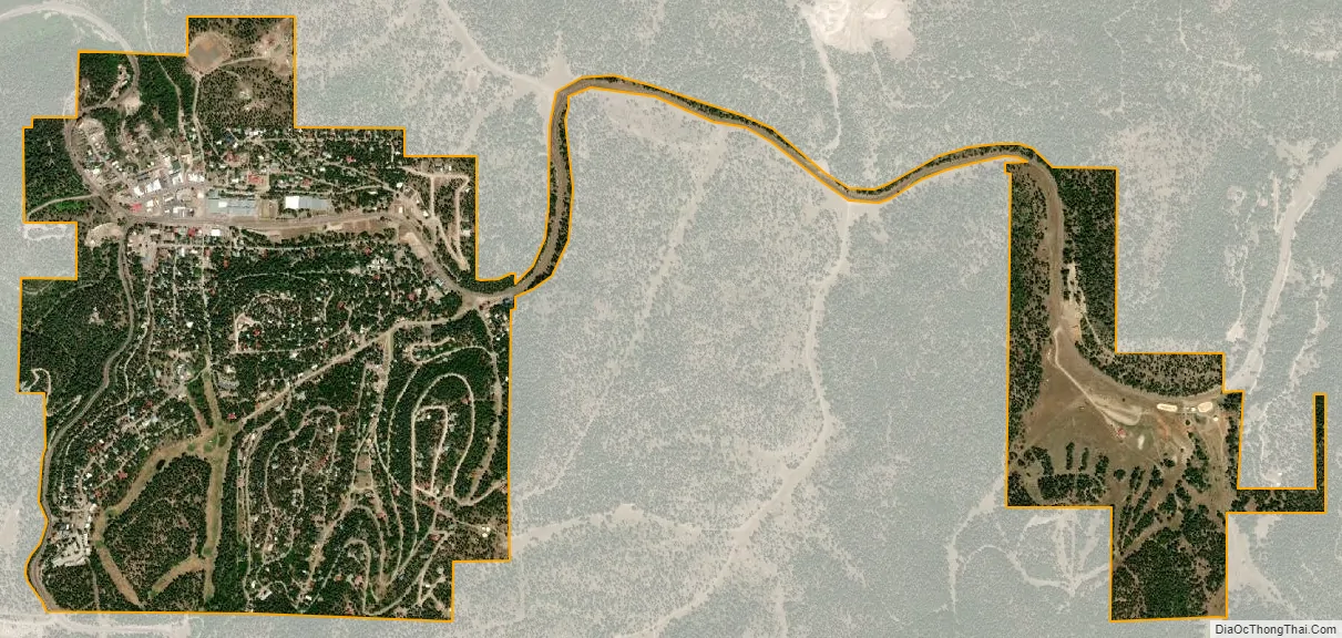
Cloudcroft city Satellite Map
Geography
Cloudcroft is located along US Route 82 approximately 15 miles east of Alamogordo. Elevation is about 8,676 feet (2,644 m).
According to the United States Census Bureau, the village has a total area of 1.63 square miles (4.2 km), all land.
Climate
The climate of Cloudcroft and the Sacramento Mountains is cooler and receives more precipitation and snowfall than the surrounding areas in West Texas and southern New Mexico.
Cloudcroft meets the criteria of a humid continental climate (Köppen: Dfb), if the 32 °F or 0 °C coldest-month isotherm is used. It is the southernmost urban area on the North American continent with such a climatic subtype.
See also
Map of New Mexico State and its subdivision: Map of other states:- Alabama
- Alaska
- Arizona
- Arkansas
- California
- Colorado
- Connecticut
- Delaware
- District of Columbia
- Florida
- Georgia
- Hawaii
- Idaho
- Illinois
- Indiana
- Iowa
- Kansas
- Kentucky
- Louisiana
- Maine
- Maryland
- Massachusetts
- Michigan
- Minnesota
- Mississippi
- Missouri
- Montana
- Nebraska
- Nevada
- New Hampshire
- New Jersey
- New Mexico
- New York
- North Carolina
- North Dakota
- Ohio
- Oklahoma
- Oregon
- Pennsylvania
- Rhode Island
- South Carolina
- South Dakota
- Tennessee
- Texas
- Utah
- Vermont
- Virginia
- Washington
- West Virginia
- Wisconsin
- Wyoming