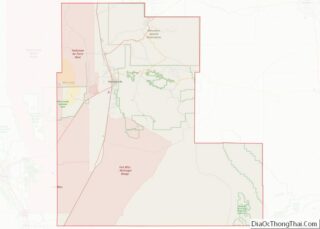
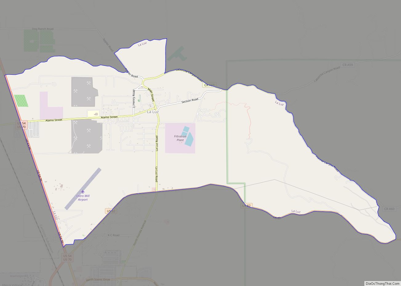
La Luz is a census-designated place (CDP) in Otero County, New Mexico, United States. The population was 1,615 at the 2000 census. It is located immediately north of Alamogordo and lies in the eastern edge of the Tularosa Basin and on the western flank of the Sacramento Mountains. Until 1848, La Luz was a part of Mexico. The CDP gets its name from the Spanish word for “light.”
| Name: | La Luz CDP |
|---|---|
| LSAD Code: | 57 |
| LSAD Description: | CDP (suffix) |
| State: | New Mexico |
| County: | Otero County |
| Elevation: | 4,721 ft (1,439 m) |
| Total Area: | 10.71 sq mi (27.74 km²) |
| Land Area: | 10.68 sq mi (27.67 km²) |
| Water Area: | 0.03 sq mi (0.07 km²) |
| Total Population: | 1,578 |
| Population Density: | 147.70/sq mi (57.02/km²) |
| ZIP code: | 88337 |
| Area code: | Area code 575 |
| FIPS code: | 3538330 |
| GNISfeature ID: | 2408506 |
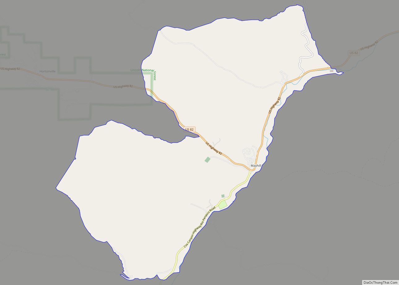
Online Interactive Map
Click on ![]() to view map in "full screen" mode.
to view map in "full screen" mode.
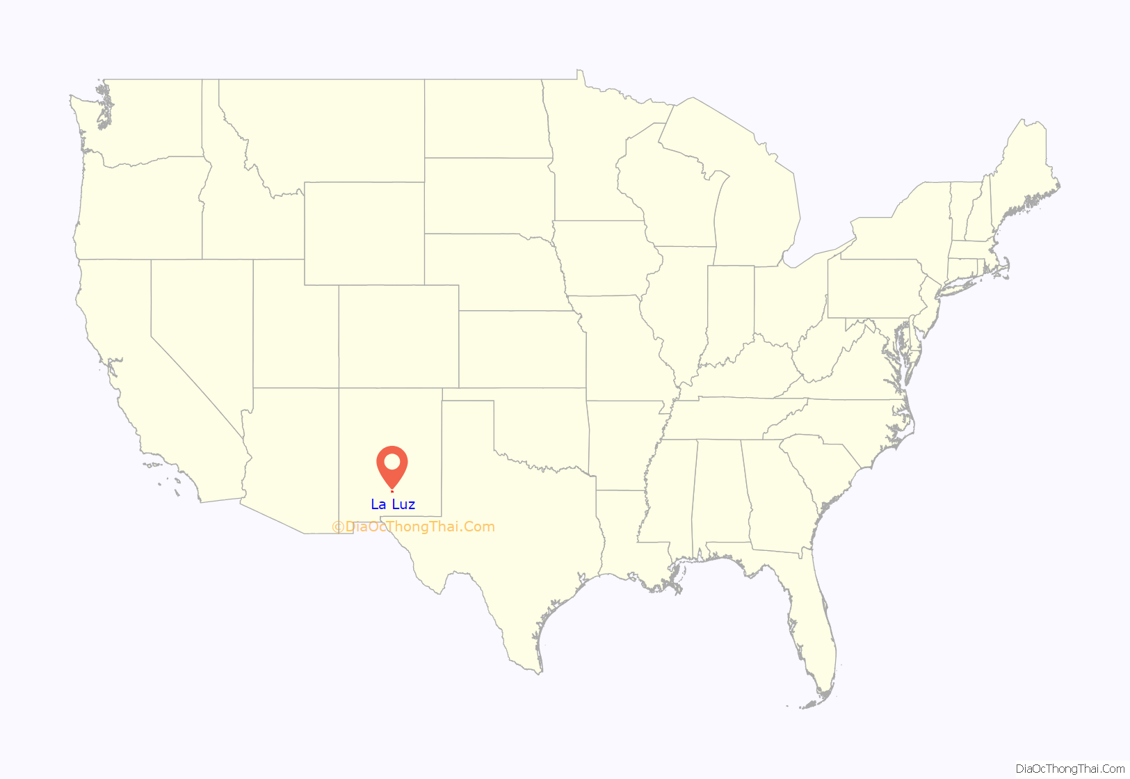
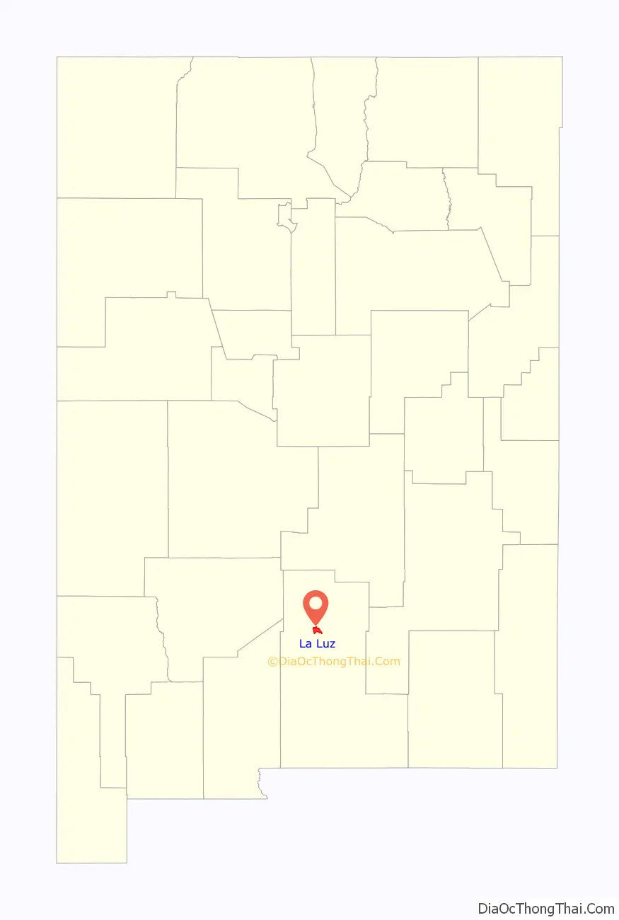
La Luz location map. Where is La Luz CDP?
History
Native Americans lived in the area for thousands of years prior to the arrival of the Spanish in the late 16th Century. The Mescalero Apache homelands covered an area of south-central New Mexico including the Sacramento Mountains and the Tularosa Basin. Today, the ancestral homelands of the Apache have been reduced to those lands contained in the Mescalero Apache Reservation, approximately 30 miles northeast of La Luz. There is some dispute over the founding of La Luz. By some accounts, it was founded by Franciscan friars as early as the 18th Century and called Nuestra Señora De La Luz (Our Lady of the Light). Early maps of the area include this notation and La Luz Canyon may have served as an early pass over the Sacramento Mountains connecting with the Peñasco river, which eventually flows into the Pecos River near present-day Artesia, New Mexico. The Sacramento Mountains reach a height of 9,000 feet.
It is well documented that a large group of Hispanic settlers came to the area around 1864 leaving villages along the Rio Grande in the vicinity of present-day Socorro, New Mexico, after devastating floods had occurred. These settlers founded the Village of Tularosa along the banks of Tularosa Creek and established a large acequia system and agricultural area.
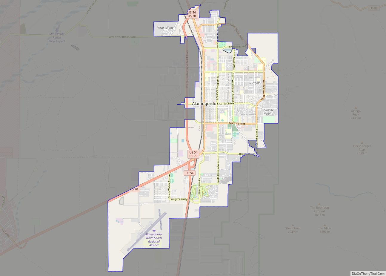
Anglo settlers arrived in increasing numbers in the area especially after the Civil War with some establishing large ranches in the Tularosa Basin and nearby areas to supply beef to nearby Fort Stanton. Increasing rivalries between various competing factions would result in the Lincoln County War. The arrival of the railroad in the area brought rapid change to the area. The railroad reached El Paso, ninety miles to the south, in 1882. Charles B. Eddy and partners constructed a branch line from El Paso northward to exploit the timber resources of the Sacramento Mountains and coal deposits further north near present-day White Oaks, New Mexico. The establishment of the railroad resulted in the founding of Alamogordo in 1898 just a few miles south of La Luz. Eddy then constructed a branch into the Sacramento Mountains that went through La Luz and climbed to approximately 9,000 feet within the span of a few miles. Often referred to as the “Cloud Climbing Railroad” it was an engineering marvel. The mountain section of the railroad was dismantled in the early 1940s. The Village of Cloudcroft was established in the Sacramento Mountains and offered residents of El Paso an escape from the heat during the summer. Eddy’s partner and lawyer for the railroad, William Ashton Hawkins, established a farm and large home which still stands in La Luz.
In the early Twentieth Century, Rowland Hazard III (1882–1945), the heir of an industrial fortune from Rhode Island, came to the area and established a large ranch and farm in the canyon areas above La Luz. He had the Coronado Lodge constructed as a hunting lodge in Cottonwood Canyon out of native stone in the early 1920s. Hazzard also established the La Luz Pottery Works after discovery of rich clay deposits in La Luz Canyon. The pottery works were well known for the manufacture of clay roof tiles and other architectural components such as chimney pots as well as extremely large pottery vessels. The pottery works supplied contractors nationwide at a time when the Spanish Colonial Revival architectural style was at its height. Both the Coronado Lodge and the pottery works remain as fine examples of this type of architecture.
La Luz Road Map

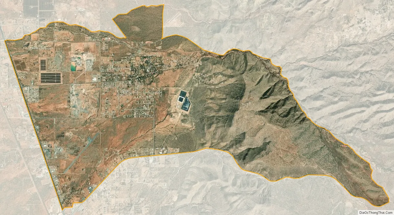
La Luz city Satellite Map
Geography
According to the United States Census Bureau, the CDP has a total area of 10.7 square miles (28 km), all land.
La Luz sits at the opening of La Luz Canyon Creek, whose headwaters are high in the Sacramento Mountains. The waters of La Luz and Fresnal creeks are used by both the much larger city of Alamogordo, just to the south of La Luz and by La Luz in a ditch or acequia system. The City of Alamogordo has constructed a large reservoir to the south of La Luz to impound these waters.
See also
Map of New Mexico State and its subdivision: Map of other states:- Alabama
- Alaska
- Arizona
- Arkansas
- California
- Colorado
- Connecticut
- Delaware
- District of Columbia
- Florida
- Georgia
- Hawaii
- Idaho
- Illinois
- Indiana
- Iowa
- Kansas
- Kentucky
- Louisiana
- Maine
- Maryland
- Massachusetts
- Michigan
- Minnesota
- Mississippi
- Missouri
- Montana
- Nebraska
- Nevada
- New Hampshire
- New Jersey
- New Mexico
- New York
- North Carolina
- North Dakota
- Ohio
- Oklahoma
- Oregon
- Pennsylvania
- Rhode Island
- South Carolina
- South Dakota
- Tennessee
- Texas
- Utah
- Vermont
- Virginia
- Washington
- West Virginia
- Wisconsin
- Wyoming