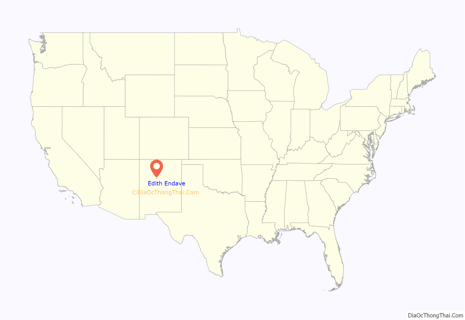
Edith Endave is a census-designated place (CDP) in Bernalillo County, New Mexico, United States. The population was 211 at the 2010 census. It is part of the Albuquerque Metropolitan Statistical Area.
| Name: | Edith Endave CDP |
|---|---|
| LSAD Code: | 57 |
| LSAD Description: | CDP (suffix) |
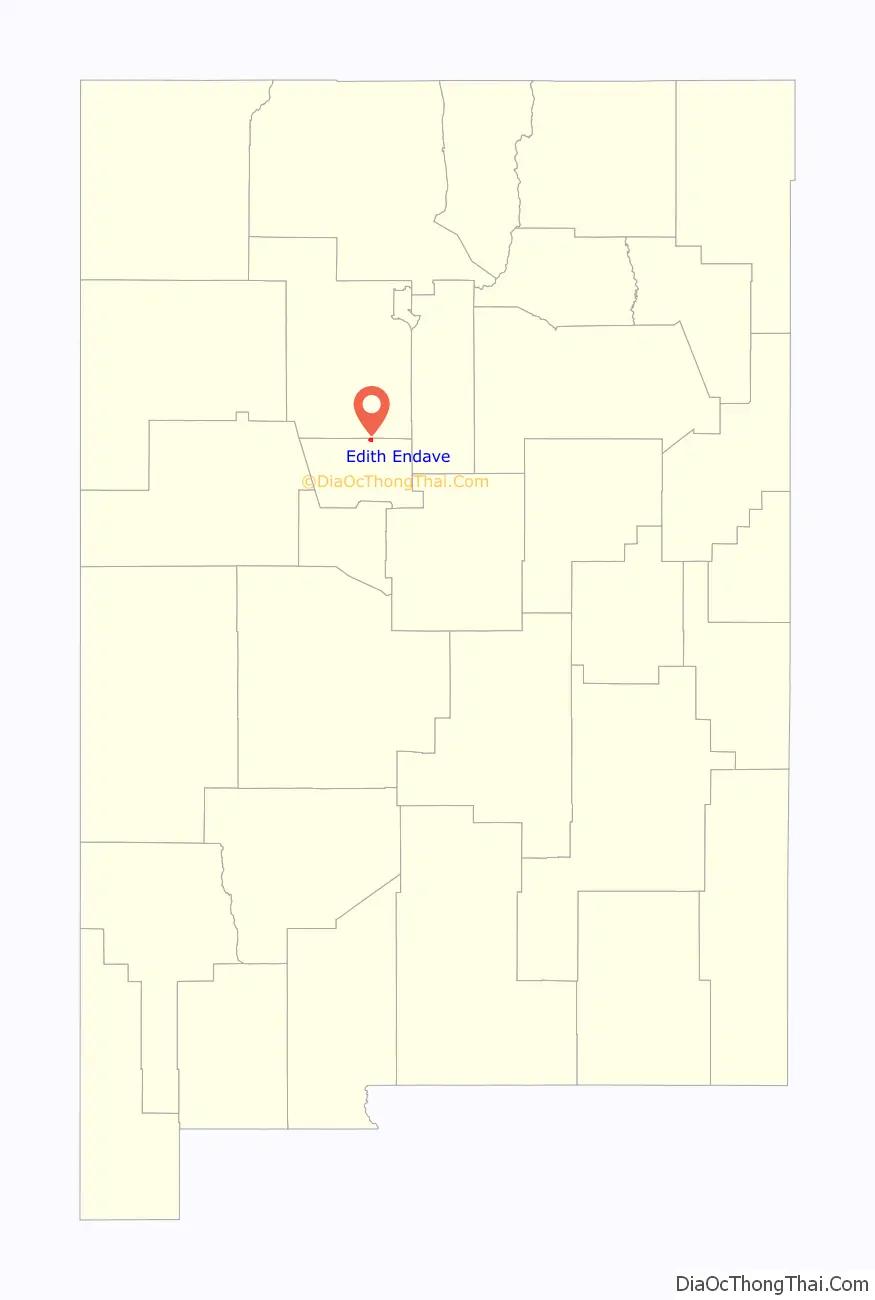
| State: | New Mexico |
| County: | Bernalillo County |
| Elevation: | 5,015 ft (1,529 m) |
| Total Area: | 1.5 sq mi (4.0 km²) |
| Land Area: | 1.5 sq mi (3.9 km²) |
| Water Area: | 0.04 sq mi (0.1 km²) |
| Total Population: | 211 |
| Population Density: | 140/sq mi (53.9/km²) |
| Area code: | 505 |
| FIPS code: | 3522390 |
| GNISfeature ID: | 2584091 |
Online Interactive Map
Click on ![]() to view map in "full screen" mode.
to view map in "full screen" mode.
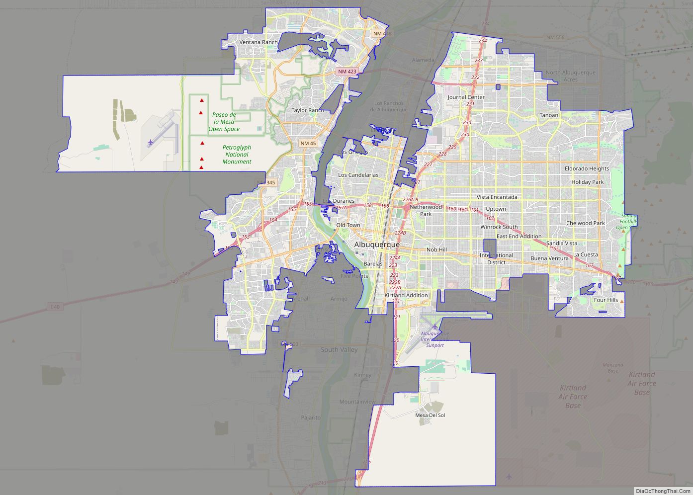
Edith Endave location map. Where is Edith Endave CDP?
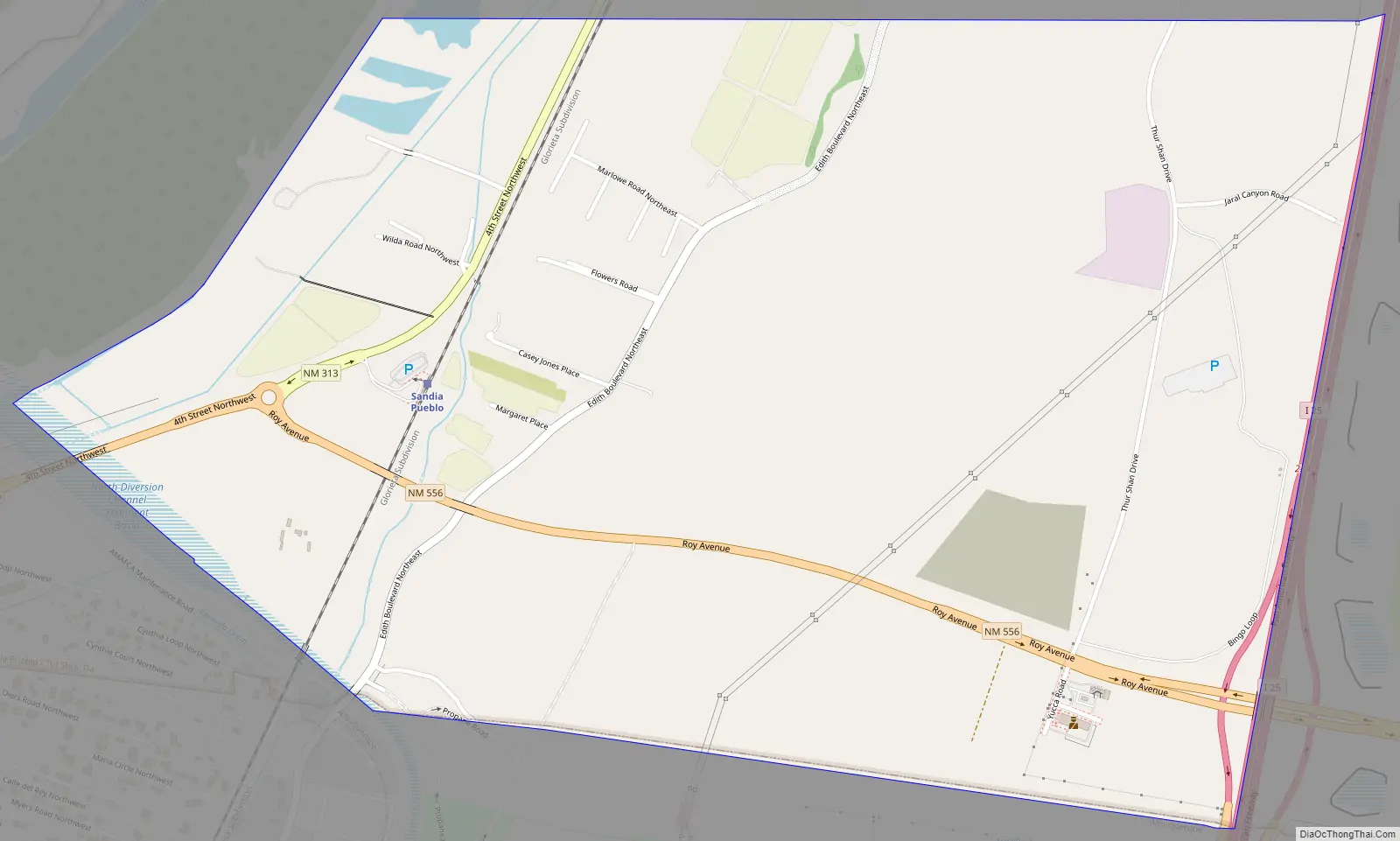
Edith Endave Road Map
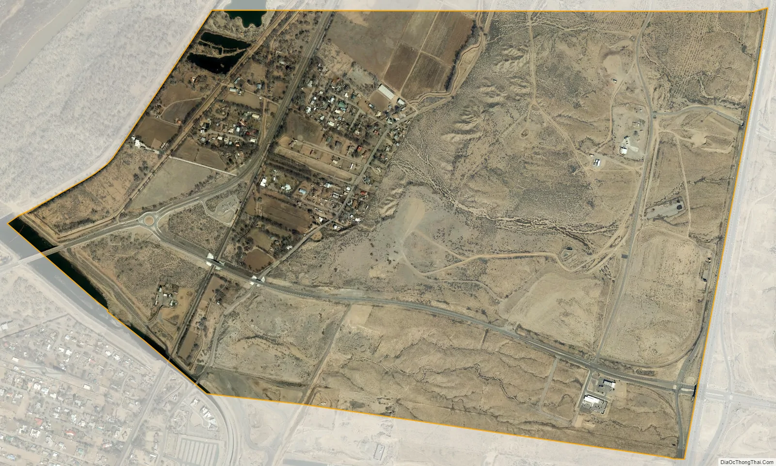
Edith Endave city Satellite Map
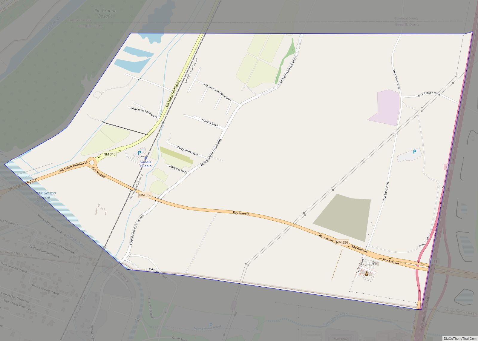
Geography
The CDP is located in northern Bernalillo County; it is bordered by the city of Albuquerque to the south, Interstate 25 to the east, the Sandoval County boundary to the north, and a levee along the Rio Grande to the west. The main road through the CDP is the north-south New Mexico State Road 313 (4th Street NW). New Mexico State Road 556 (Roy Avenue) leads east to I-25’s Exit 234. Downtown Albuquerque is 10 miles (16 km) south of the center of the CDP.
According to the United States Census Bureau, the CDP has a total area of 1.5 square miles (4.0 km), of which 1.5 square miles (3.9 km) is land and 0.04 square miles (0.1 km), or 2.99%, is water.
See also
Map of New Mexico State and its subdivision: Map of other states:- Alabama
- Alaska
- Arizona
- Arkansas
- California
- Colorado
- Connecticut
- Delaware
- District of Columbia
- Florida
- Georgia
- Hawaii
- Idaho
- Illinois
- Indiana
- Iowa
- Kansas
- Kentucky
- Louisiana
- Maine
- Maryland
- Massachusetts
- Michigan
- Minnesota
- Mississippi
- Missouri
- Montana
- Nebraska
- Nevada
- New Hampshire
- New Jersey
- New Mexico
- New York
- North Carolina
- North Dakota
- Ohio
- Oklahoma
- Oregon
- Pennsylvania
- Rhode Island
- South Carolina
- South Dakota
- Tennessee
- Texas
- Utah
- Vermont
- Virginia
- Washington
- West Virginia
- Wisconsin
- Wyoming