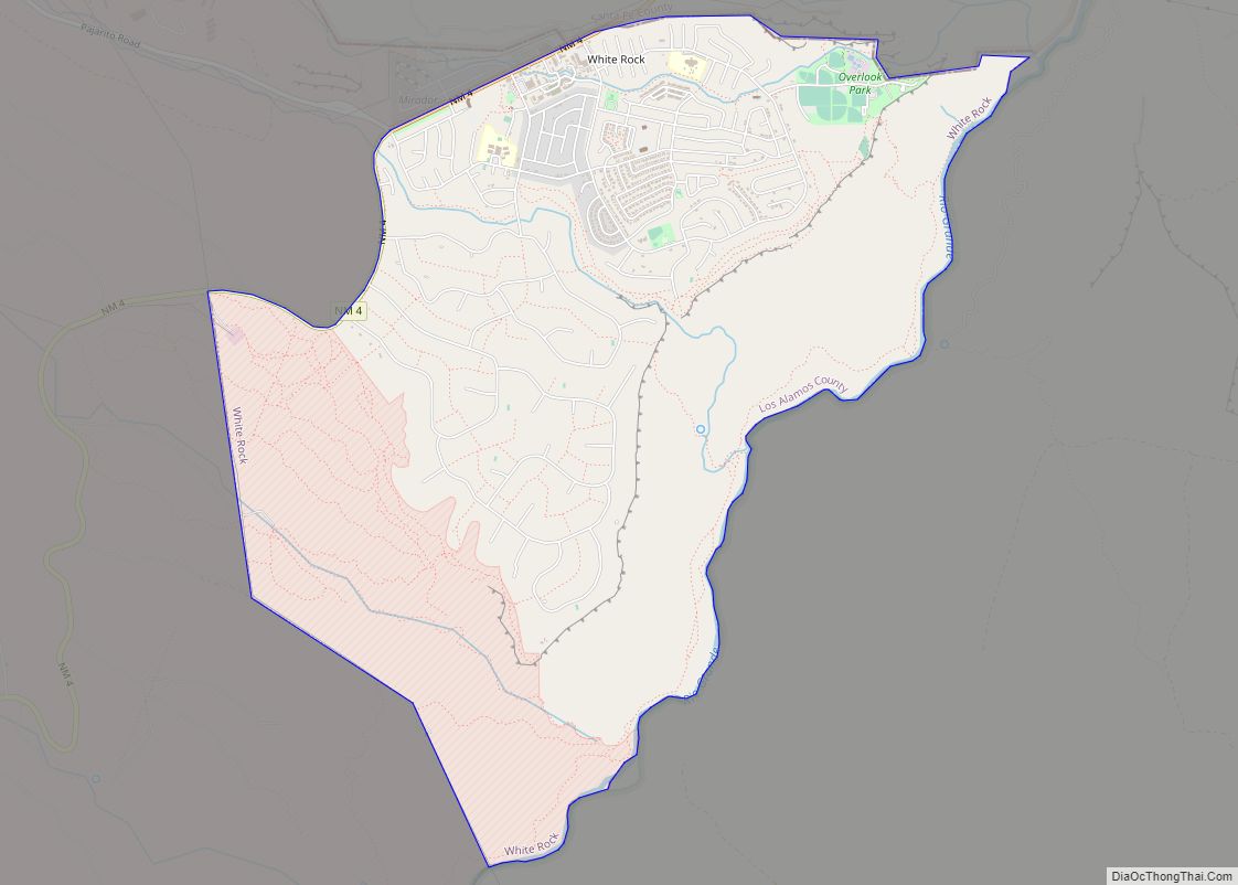
Los Alamos (Spanish: Los Álamos) is a census-designated place in Los Alamos County, New Mexico, United States, that is recognized as the development and creation place of the atomic bomb—the primary objective of the Manhattan Project by Los Alamos National Laboratory during World War II. The town is located on four mesas of the Pajarito Plateau, and had a population of about 13,200 as of 2020. It is the county seat and one of two population centers in the county known as census-designated places (CDPs); the other is White Rock.
| Name: | Los Alamos CDP |
|---|---|
| LSAD Code: | 57 |
| LSAD Description: | CDP (suffix) |
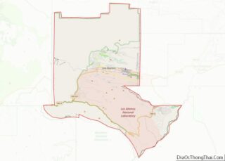
| State: | New Mexico |
| County: | Los Alamos County |
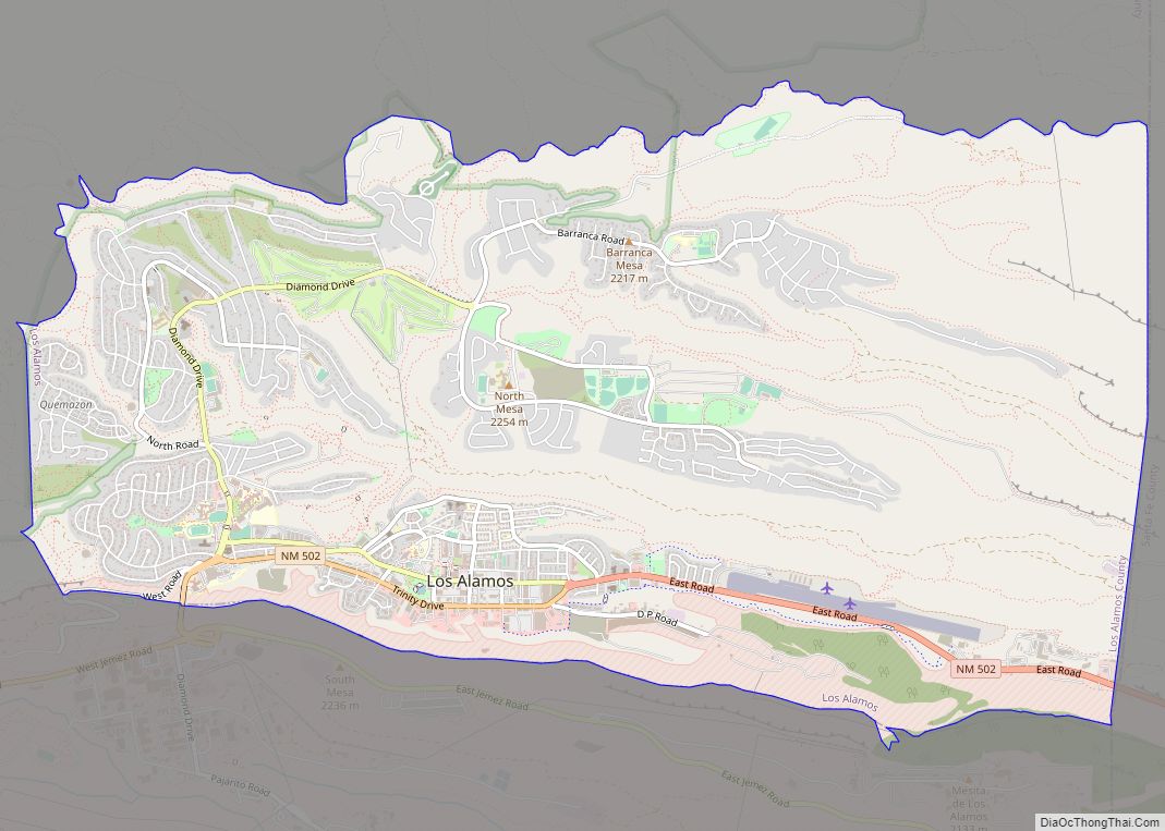
| Elevation: | 7,320 ft (2,231 m) |
| Total Area: | 11.11 sq mi (28.77 km²) |
| Land Area: | 11.11 sq mi (28.77 km²) |
| Water Area: | 0.00 sq mi (0.00 km²) |
| Total Population: | 13,179 |
| Population Density: | 1,186.44/sq mi (458.09/km²) |
| ZIP code: | 87544, 87547 |
| Area code: | 505 |
| FIPS code: | 3542320 |
| GNISfeature ID: | 0901357 |
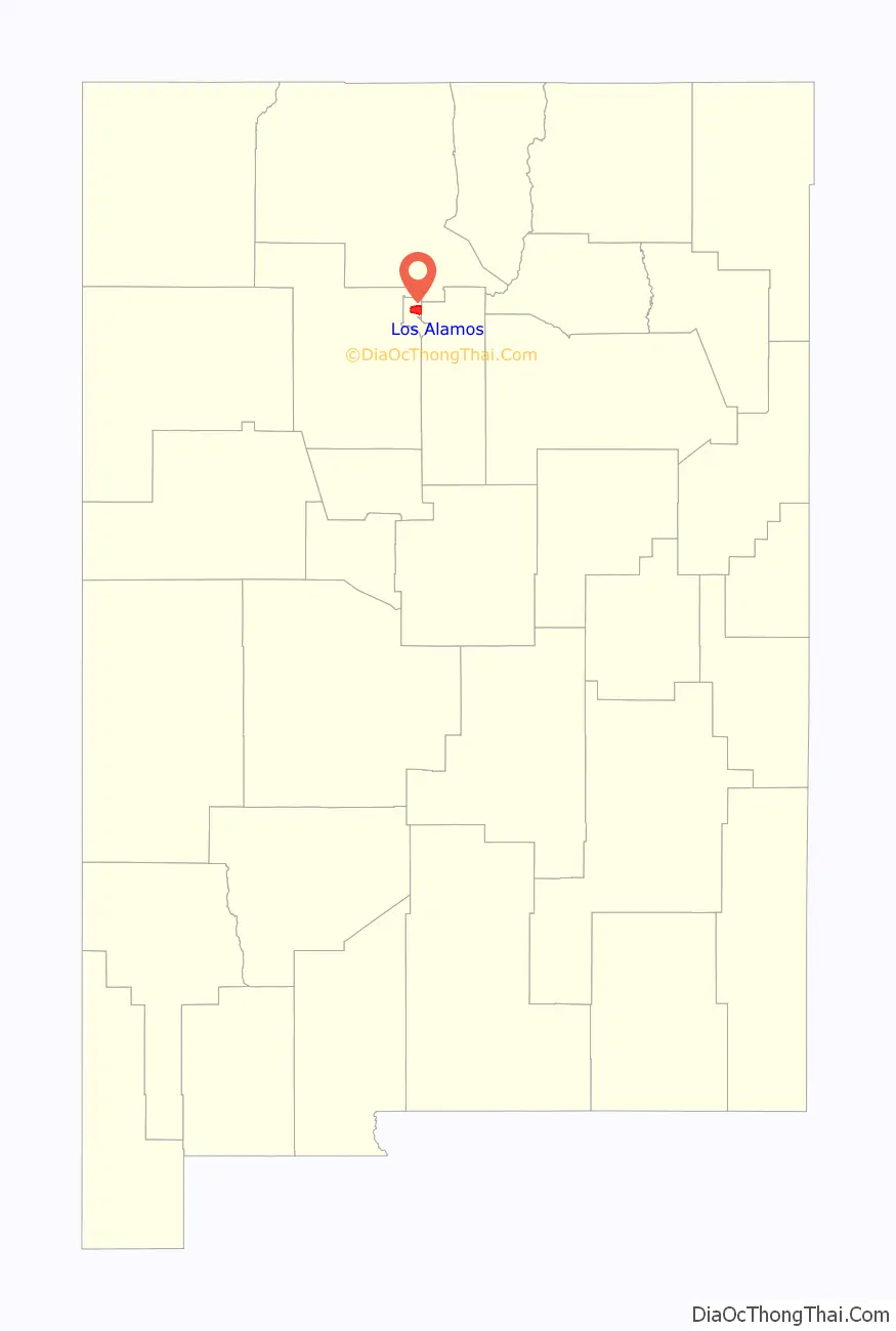
Online Interactive Map
Click on ![]() to view map in "full screen" mode.
to view map in "full screen" mode.
Los Alamos location map. Where is Los Alamos CDP?
History
The ruins of permanent Puebloan settlements, such as those located in nearby Bandelier National Monument and Tsankawi, and numerous other sites such as cliff dwellings indicate that the area has been inhabited during various eras since around 1150 AD. The first settlers on the plateau are thought to be Keres speaking Native Americans around the 10th century. Around 1300, Tewa settlers immigrated from the Four Corners Region and built large cities but were driven out within 50 years by Navajo and Apache raids and by drought.
In the late 19th century, homesteaders utilized the land for ranching. Most homesteaders built simple log cabins that they only lived in during warm weather to feed livestock. Many of the homesteaders later moved down to the warmer Rio Grande Valley. In 1917, homesteader Harold H. Brook sold part of his land and buildings to Ashley Pond II, a businessman from Detroit who founded the Los Alamos Ranch School. The area was used to teach young men basic ranching and other outdoor survival skills.
In 1943, during World War II, the United States Department of War exercised eminent domain over the Ranch School and all remaining homesteads in the area so that the relatively isolated location could be used for the secretive Manhattan Project, which ultimately developed the world’s first nuclear weapons. Facilities for research and development were quickly built and scientists and engineers from all over the world were assigned to the project, however all information about the town and project was held secretively away from public awareness. Los Alamos was referred to under the code name “Site Y” by military personnel, and was known only as “The Hill” by many in nearby Santa Fe. The specific location of the project and all of its residents was also concealed by designating its mailing address as PO Box 1663, Santa Fe, NM. All incoming truckloads were falsely labeled as common items in order to conceal the true nature of their contents, and any outbound correspondence by those working and living in Los Alamos was censored by military officials. Not until after the bombing of Hiroshima was information about the purpose of the Manhattan Project released to the public.
In the years after World War II, the laboratory was established as a research government facility under the Department of Energy, and is now known as Los Alamos National Laboratory.
Etymology
Los Alamos is a Spanish place name that typically refers to poplar or cottonwood trees. Alternatively, Los Alamos could refer to the large groves of aspen trees (alamo temblon) that intersperse the coniferous forest on the mountainsides above the townsite, where they are distinctly visible during the autumn months due to their spectacular autumn colors.
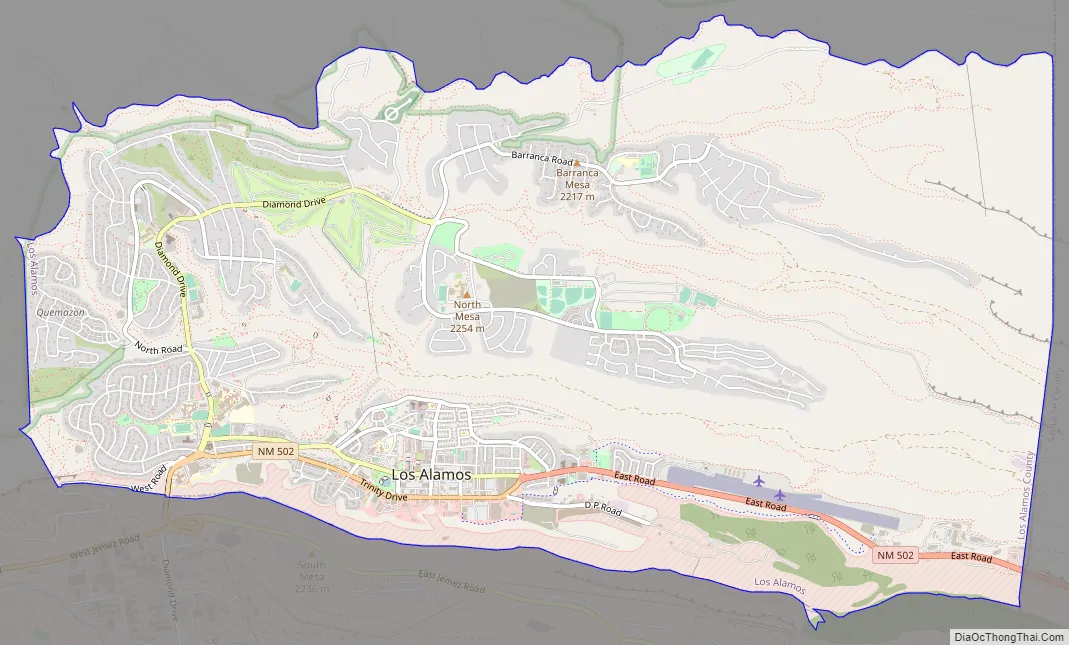
Los Alamos Road Map
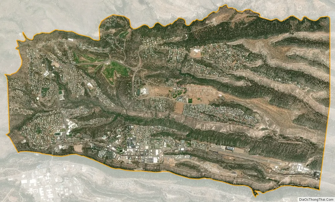
Los Alamos city Satellite Map
Geography
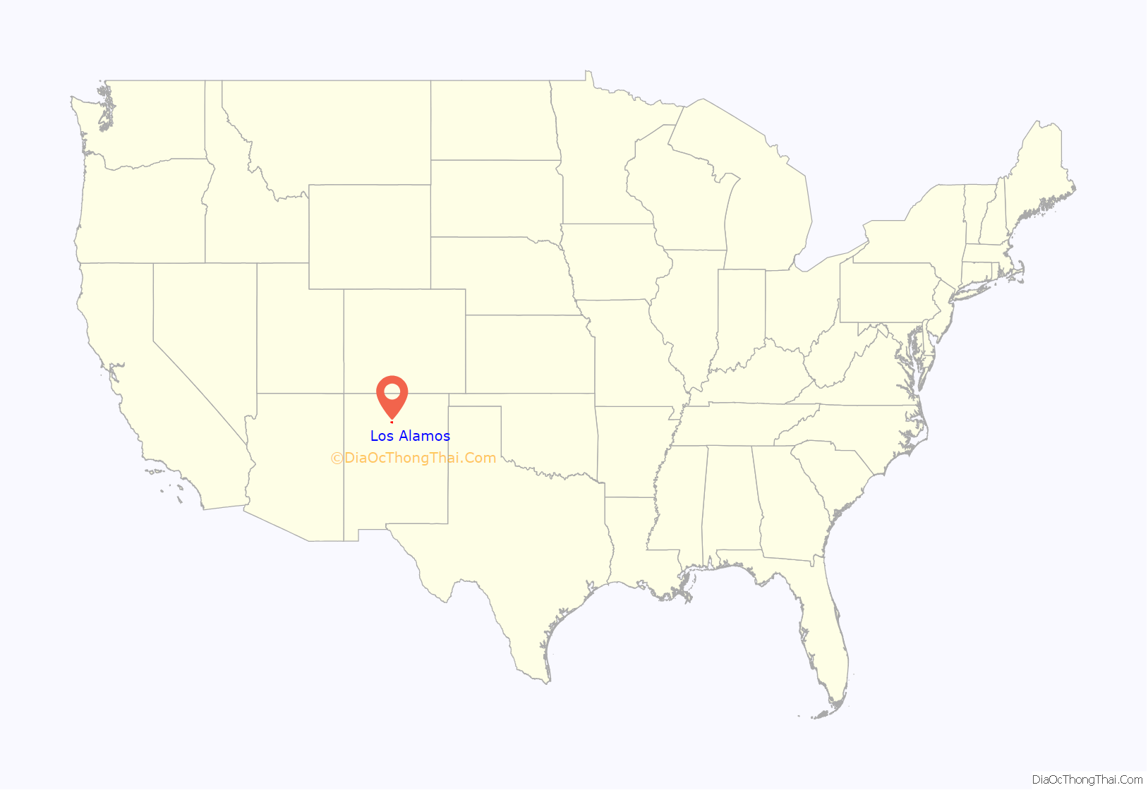
Los Alamos is located in northern New Mexico between the Rio Grande and the eastern rim of the Valles Caldera on the Pajarito Plateau, approximately 35 mi (56 km) to the northwest of Santa Fe. The elevation at the post office is 7,320 feet (2,230 m) and total land area is 11.14 square miles (28.9 km).
The Los Alamos Townsite and White Rock are located on flat mesa tops separated by steep canyons. This location was chosen for its relative inaccessibility to help protect the secret activities of the Manhattan Project.
The town of Los Alamos was built on four mesas—Barranca Mesa, North Mesa, Los Alamos Mesa and South Mesa—along with the connecting communities at the base of the mountain. Los Alamos National Laboratory occupies half of South Mesa, Two Mile Mesa, Frijoles Mesa, Mesita de Buey and several nearby areas in the region (in the valleys and at the base of the mountain). White Rock lies at the top of White Rock Canyon.
Much of Los Alamos County is within the Española Ranger District of the Santa Fe National Forest.
Climate
Los Alamos has a humid continental climate (Dfb) with four distinct seasons. Summer days are moderately warm in the 70s and 80s, but reach 90 on only 5 days per year on average.
Wildlife and vegetation
Los Alamos’ geographical location causes its wildlife and vegetation to be diverse compared to surrounding areas in the state. “The variation in elevation creates precipitation and temperature gradients that support a wide diversity of plant communities…” There are six different plant communities within the county; each is home to unique flora and fauna. Ponderosa pine trees are the most common trees at the elevation of Los Alamos (7,000 and 8,000 feet (2,100 and 2,400 m)). Common shrubs in the area include sagebrush, Gambel oak, and wild rose.
Black bears (brown-color variation), elk, mule deer, bobcats, gray foxes, skunks and chipmunks are examples of mammals living in the area. “Over 200 species of birds have been reported” in the Pajarito Ornithological Survey conducted by LANL. Among these are broad-tailed hummingbirds, hairy woodpeckers, zone-tailed hawks, common ravens, western bluebirds, and great horned owls.
Wildfires have affected the county, but the most destructive to the townsite was the Cerro Grande Fire of May 2000, which caused an estimated $1 billion in damages and destroyed more than 400 homes. The town was evacuated for eight days. The Federal Emergency Management Agency (FEMA) built temporary housing on North Mesa for those who were displaced by the fire. Though there was no loss of life, other effects include damage to LANL facilities (nuclear material was not affected), flash-flooding, and erosion.
The Las Conchas Fire of June 26, 2011 burned about three times as many acres and also prompted evacuation of Los Alamos, but there was no damage to property in Los Alamos. It was the biggest wildfire New Mexico had endured.
Wildfires have altered plant communities in the area. Plant species are migrating to cover burn areas.
Environmental remediation
Over two thousand sites in the area have been determined to have been impacted as a result of past activities at LANL. The location of these sites have been identified throughout the county, and are primarily (but not exclusively) on DOE property. Contaminated sites vary widely in significance. Corrective action and environmental restoration has been deemed necessary for certain areas; LANL takes part in this process. Some residents have voiced concern about a lack of public participation and opportunity to comment on the cleanup schedule and funding.
See also
Map of New Mexico State and its subdivision: Map of other states:- Alabama
- Alaska
- Arizona
- Arkansas
- California
- Colorado
- Connecticut
- Delaware
- District of Columbia
- Florida
- Georgia
- Hawaii
- Idaho
- Illinois
- Indiana
- Iowa
- Kansas
- Kentucky
- Louisiana
- Maine
- Maryland
- Massachusetts
- Michigan
- Minnesota
- Mississippi
- Missouri
- Montana
- Nebraska
- Nevada
- New Hampshire
- New Jersey
- New Mexico
- New York
- North Carolina
- North Dakota
- Ohio
- Oklahoma
- Oregon
- Pennsylvania
- Rhode Island
- South Carolina
- South Dakota
- Tennessee
- Texas
- Utah
- Vermont
- Virginia
- Washington
- West Virginia
- Wisconsin
- Wyoming