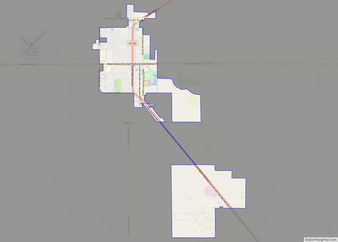
Lovington is a city in, and the county seat of, Lea County, New Mexico, United States. The population was 11,009 at the 2010 census, up from 9,471 in 2000.
| Name: | Lovington city |
|---|---|
| LSAD Code: | 25 |
| LSAD Description: | city (suffix) |
| State: | New Mexico |
| County: | Lea County |
| Elevation: | 3,918 ft (1,194 m) |
| Total Area: | 11.23 sq mi (29.10 km²) |
| Land Area: | 11.21 sq mi (29.03 km²) |
| Water Area: | 0.03 sq mi (0.07 km²) |
| Total Population: | 11,668 |
| Population Density: | 1,040.95/sq mi (401.90/km²) |
| ZIP code: | 88260 |
| Area code: | 575 |
| FIPS code: | 3544490 |
| GNISfeature ID: | 2410888 |
| Website: | lovington.org |
Online Interactive Map
Click on ![]() to view map in "full screen" mode.
to view map in "full screen" mode.
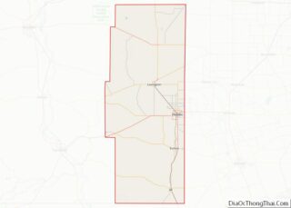
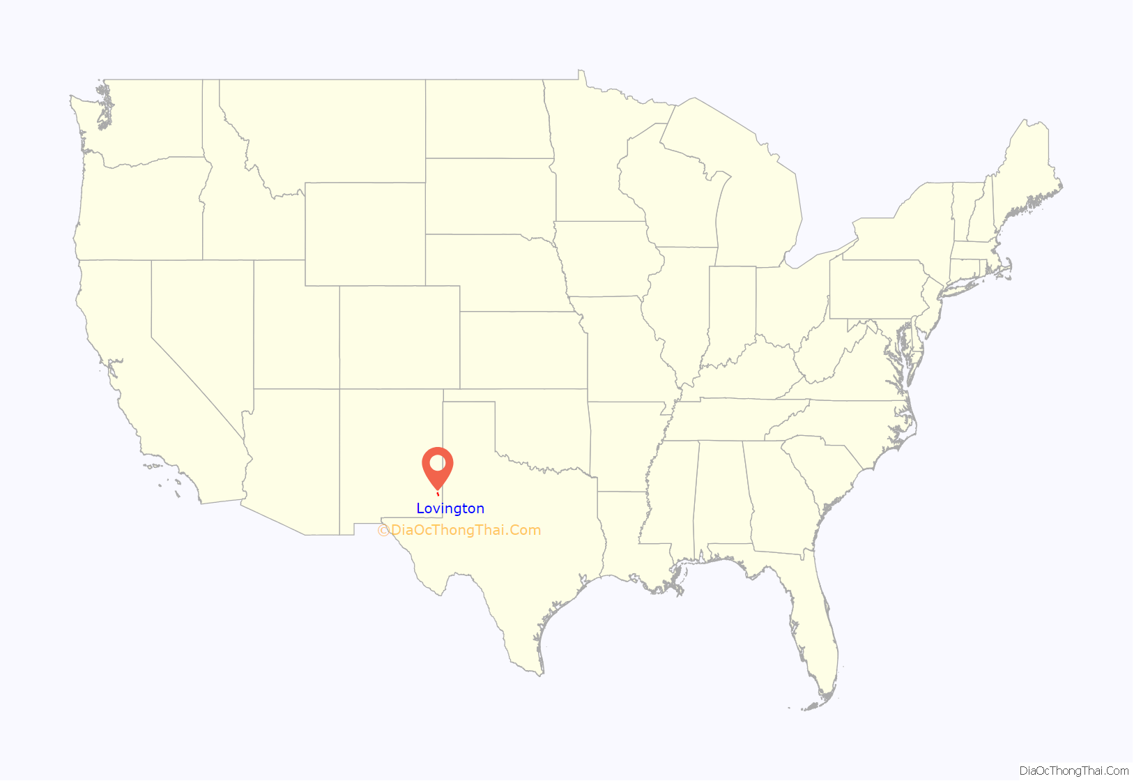
Lovington location map. Where is Lovington city?
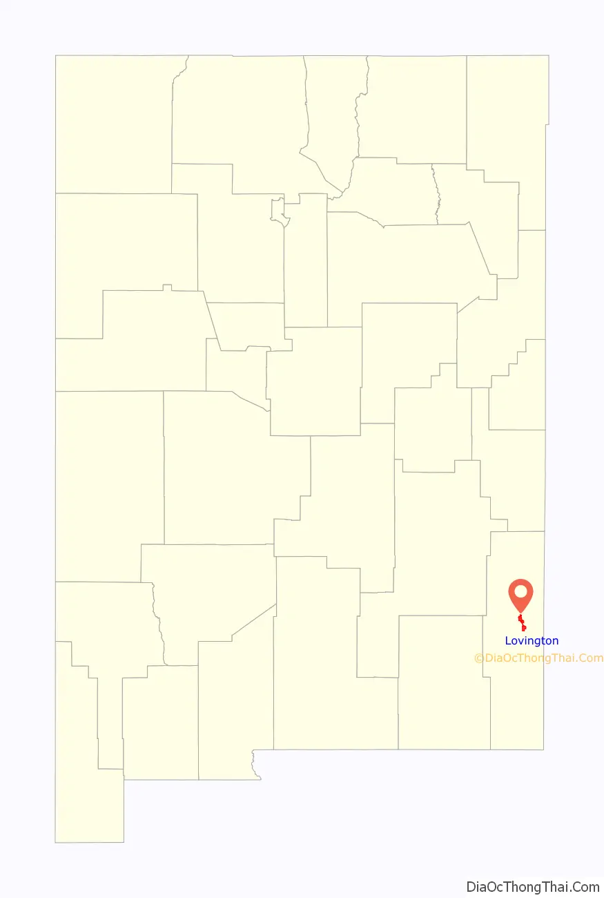
Lovington Road Map
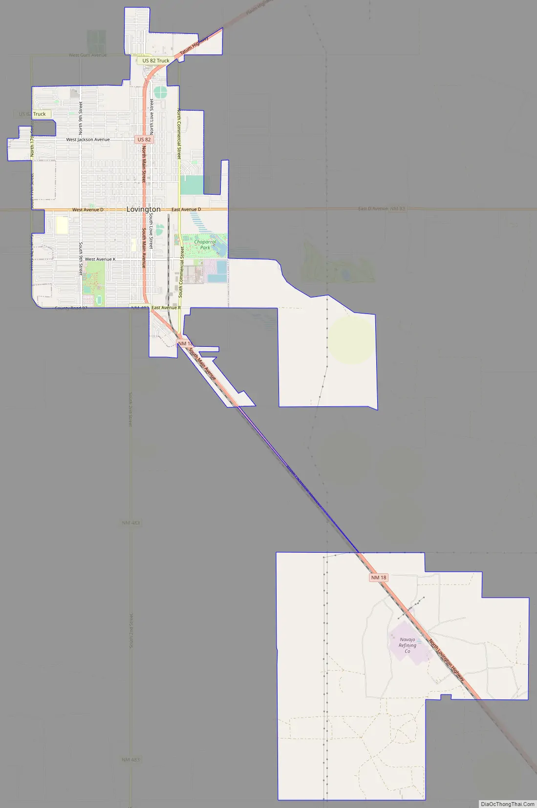
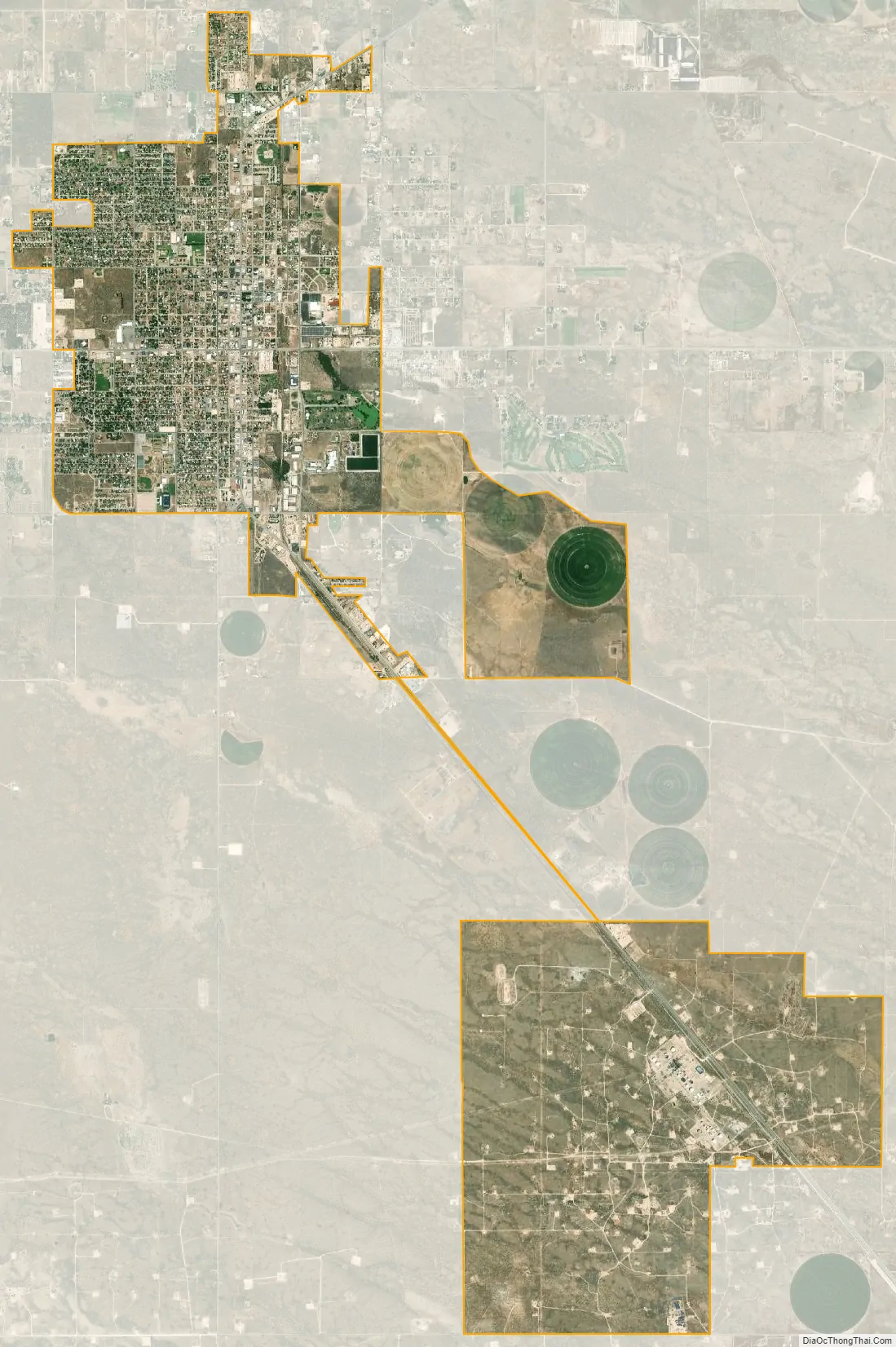
Lovington city Satellite Map
Geography
Lovington is located slightly north of the center of Lea County. U.S. Route 82 passes through the center of town, leading west 64 miles (103 km) to Artesia and northeast 35 miles (56 km) to Plains, Texas. New Mexico State Road 18 leads southeast from Lovington 21 miles (34 km) to Hobbs, the largest city in Lea County. State Road 83 leads east 18 miles (29 km) to the Texas border, where Texas State Highway 83 continues east 14 miles (23 km) to Denver City, Texas.
According to the United States Census Bureau, Lovington has a total area of 11.4 square miles (29.5 km), of which 0.03 square miles (0.08 km), or 0.26%, are water.
See also
Map of New Mexico State and its subdivision: Map of other states:- Alabama
- Alaska
- Arizona
- Arkansas
- California
- Colorado
- Connecticut
- Delaware
- District of Columbia
- Florida
- Georgia
- Hawaii
- Idaho
- Illinois
- Indiana
- Iowa
- Kansas
- Kentucky
- Louisiana
- Maine
- Maryland
- Massachusetts
- Michigan
- Minnesota
- Mississippi
- Missouri
- Montana
- Nebraska
- Nevada
- New Hampshire
- New Jersey
- New Mexico
- New York
- North Carolina
- North Dakota
- Ohio
- Oklahoma
- Oregon
- Pennsylvania
- Rhode Island
- South Carolina
- South Dakota
- Tennessee
- Texas
- Utah
- Vermont
- Virginia
- Washington
- West Virginia
- Wisconsin
- Wyoming