Mesquite is an unincorporated community and census-designated place (CDP) in Doña Ana County, New Mexico, United States. The population was 1,112 at the 2010 census, up from 948 at the 2000 census. It is part of the Las Cruces Metropolitan Statistical Area.
| Name: | Mesquite CDP |
|---|---|
| LSAD Code: | 57 |
| LSAD Description: | CDP (suffix) |
| State: | New Mexico |
| County: | Doña Ana County |
| Elevation: | 3,839 ft (1,170 m) |
| Total Area: | 0.82 sq mi (2.12 km²) |
| Land Area: | 0.82 sq mi (2.12 km²) |
| Water Area: | 0.00 sq mi (0.00 km²) |
| Total Population: | 984 |
| Population Density: | 1,201.47/sq mi (463.96/km²) |
| ZIP code: | 88048 |
| Area code: | 575 |
| FIPS code: | 3548270 |
| GNISfeature ID: | 0899792 |
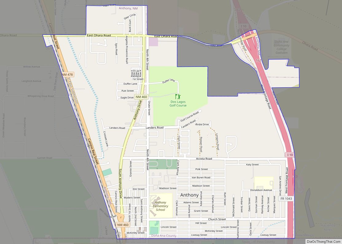
Online Interactive Map
Click on ![]() to view map in "full screen" mode.
to view map in "full screen" mode.
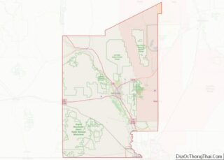
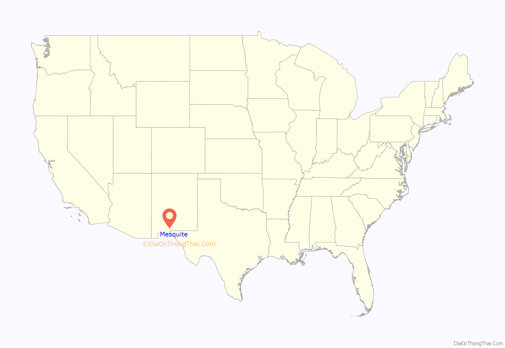
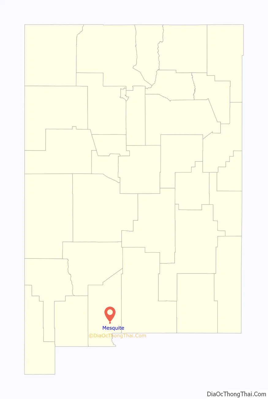
Mesquite location map. Where is Mesquite CDP?
History
Mesquite was established and named by executives of the Santa Fe Railroad after brush which grew profusely along the tracks. The persistent desert shrub had long been a feature of the landscape. In 1847 a military detachment left El Paso, Texas, on an expedition against the Apaches. Before leaving the saloon of El Paso, where “Pass Whiskey” was plentiful, they armed themselves with a supply. By the second day out, a portion of the party where so befuddled that they got lost in the jungle of mesquite that grew in the area. When they finally found their way back to the main body of troops, their Commander ordered them to make camp, confiscating the rest of their whiskey, and gave them the remainder of the day to sober up.
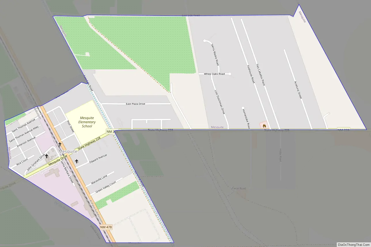
Mesquite Road Map
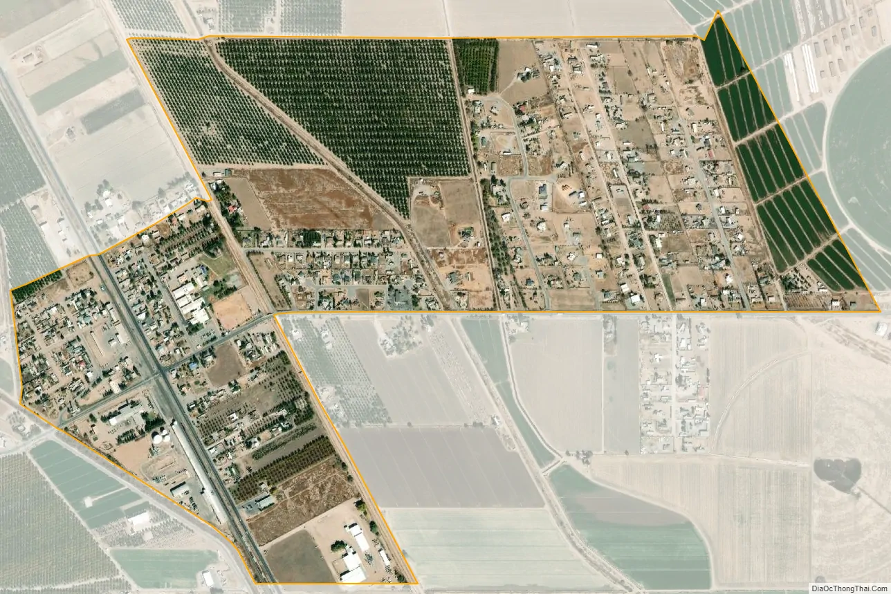
Mesquite city Satellite Map
Geography
Mesquite is located in southeastern Doña Ana County at 32°9′47″N 106°41′36″W / 32.16306°N 106.69333°W / 32.16306; -106.69333 (32.162976, -106.693434). It is in the Mesilla Valley, on the east side of the Rio Grande. Interstate 10 passes just east of the CDP, with access from Exit 151. I-10 leads northwest 13 miles (21 km) to Las Cruces, the county seat, and southeast 35 miles (56 km) to El Paso, Texas.
According to the United States Census Bureau, the Mesquite CDP has a total area of 0.81 square miles (2.1 km), all land.
See also
Map of New Mexico State and its subdivision: Map of other states:- Alabama
- Alaska
- Arizona
- Arkansas
- California
- Colorado
- Connecticut
- Delaware
- District of Columbia
- Florida
- Georgia
- Hawaii
- Idaho
- Illinois
- Indiana
- Iowa
- Kansas
- Kentucky
- Louisiana
- Maine
- Maryland
- Massachusetts
- Michigan
- Minnesota
- Mississippi
- Missouri
- Montana
- Nebraska
- Nevada
- New Hampshire
- New Jersey
- New Mexico
- New York
- North Carolina
- North Dakota
- Ohio
- Oklahoma
- Oregon
- Pennsylvania
- Rhode Island
- South Carolina
- South Dakota
- Tennessee
- Texas
- Utah
- Vermont
- Virginia
- Washington
- West Virginia
- Wisconsin
- Wyoming