Midway is an unincorporated community and census-designated place (CDP) in Chaves County, New Mexico. The population was 971 at time of the 2010 census.
| Name: | Midway CDP |
|---|---|
| LSAD Code: | 57 |
| LSAD Description: | CDP (suffix) |
| State: | New Mexico |
| County: | Chaves County |
| Elevation: | 3,573 ft (1,089 m) |
| Total Area: | 2.49 sq mi (6.44 km²) |
| Land Area: | 2.48 sq mi (6.44 km²) |
| Water Area: | 0.00 sq mi (0.01 km²) |
| Total Population: | 818 |
| Population Density: | 329.18/sq mi (127.09/km²) |
| ZIP code: | 88230 |
| Area code: | 575 |
| FIPS code: | 3548480 |
| GNISfeature ID: | 0923629 |
Online Interactive Map
Click on ![]() to view map in "full screen" mode.
to view map in "full screen" mode.
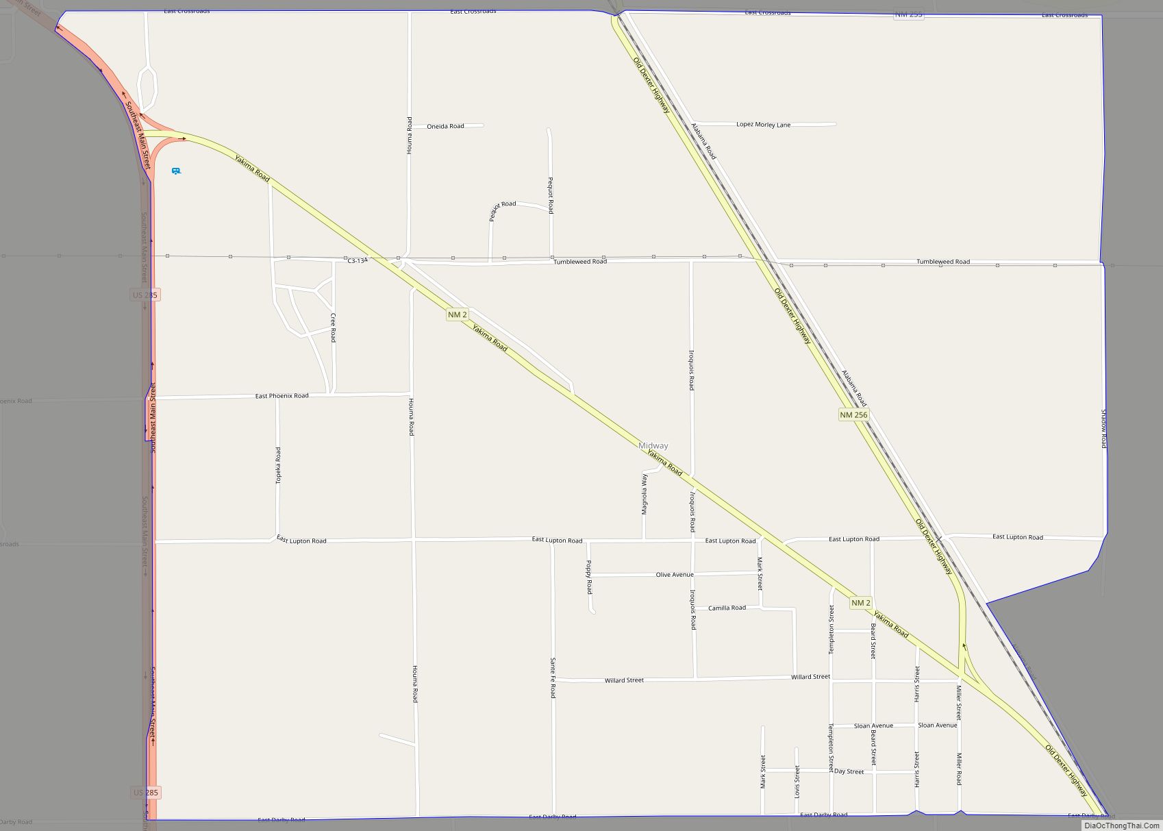
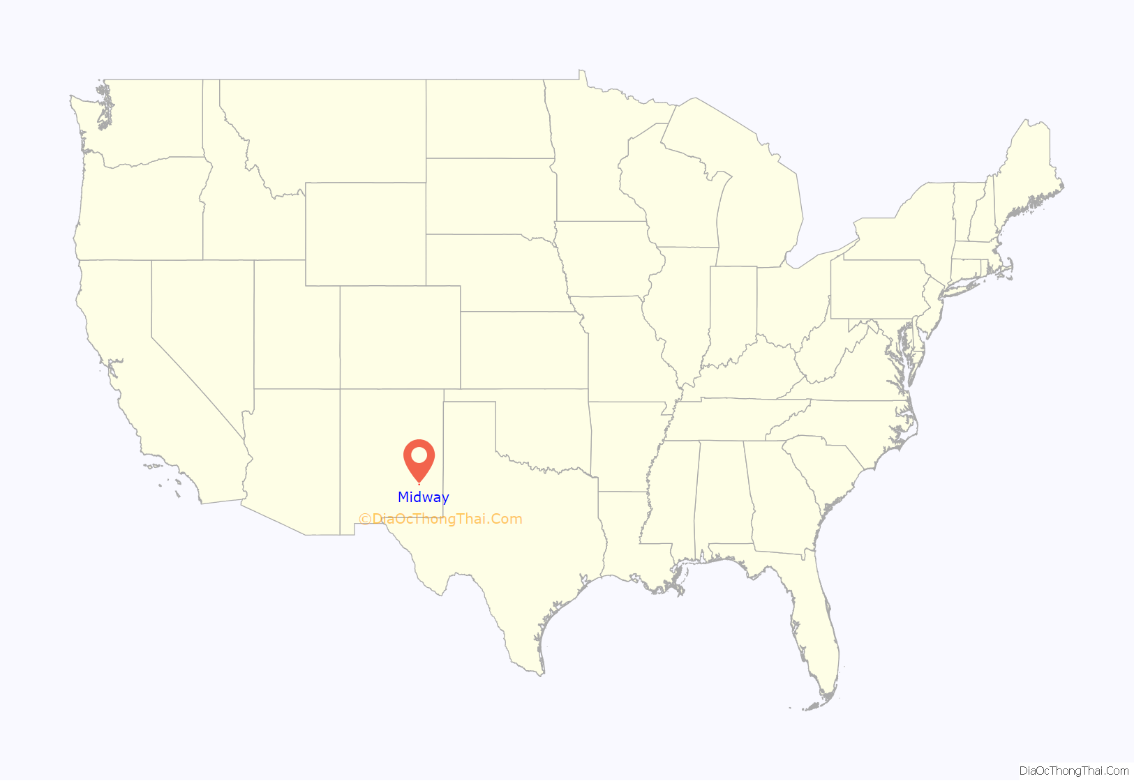
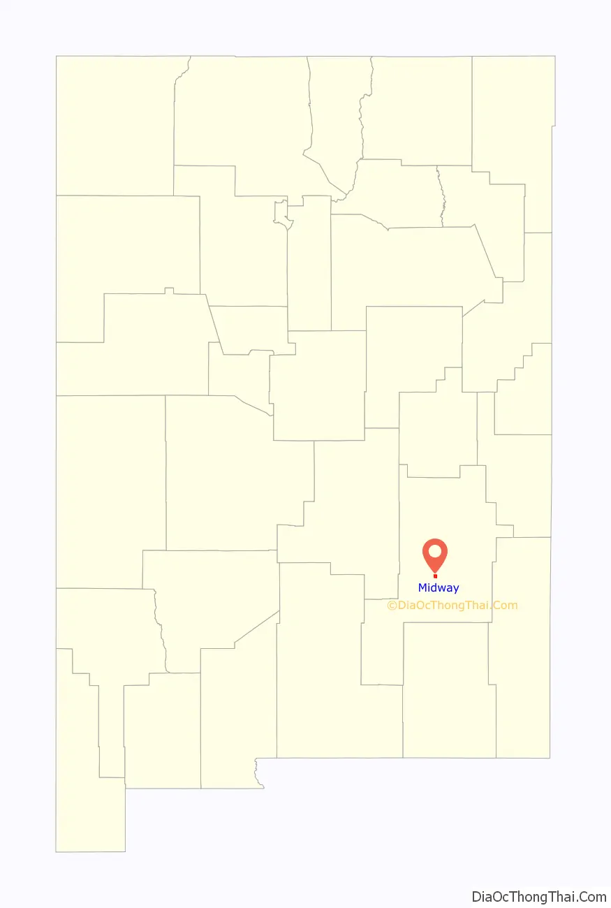
Midway location map. Where is Midway CDP?
Midway Road Map
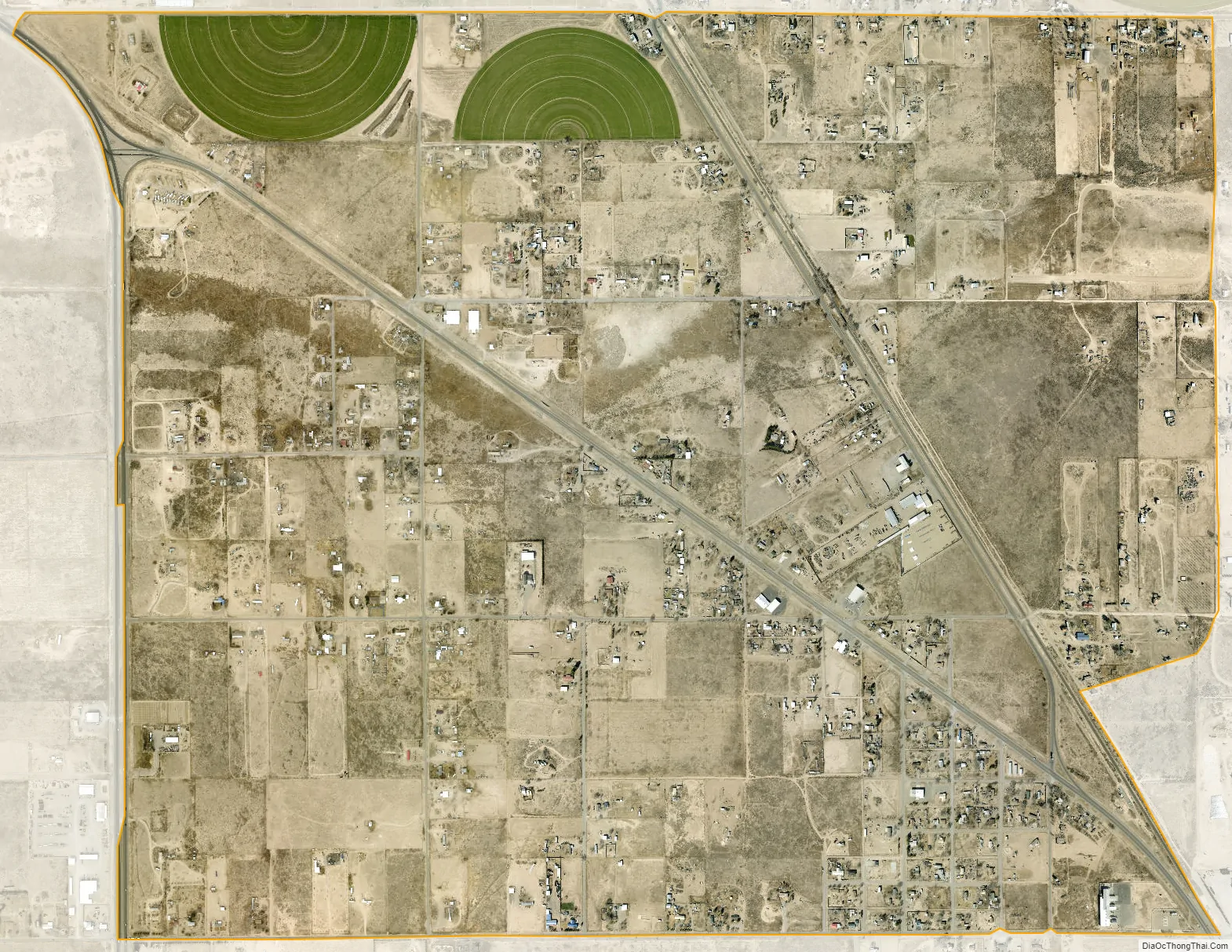
Midway city Satellite Map
Geography
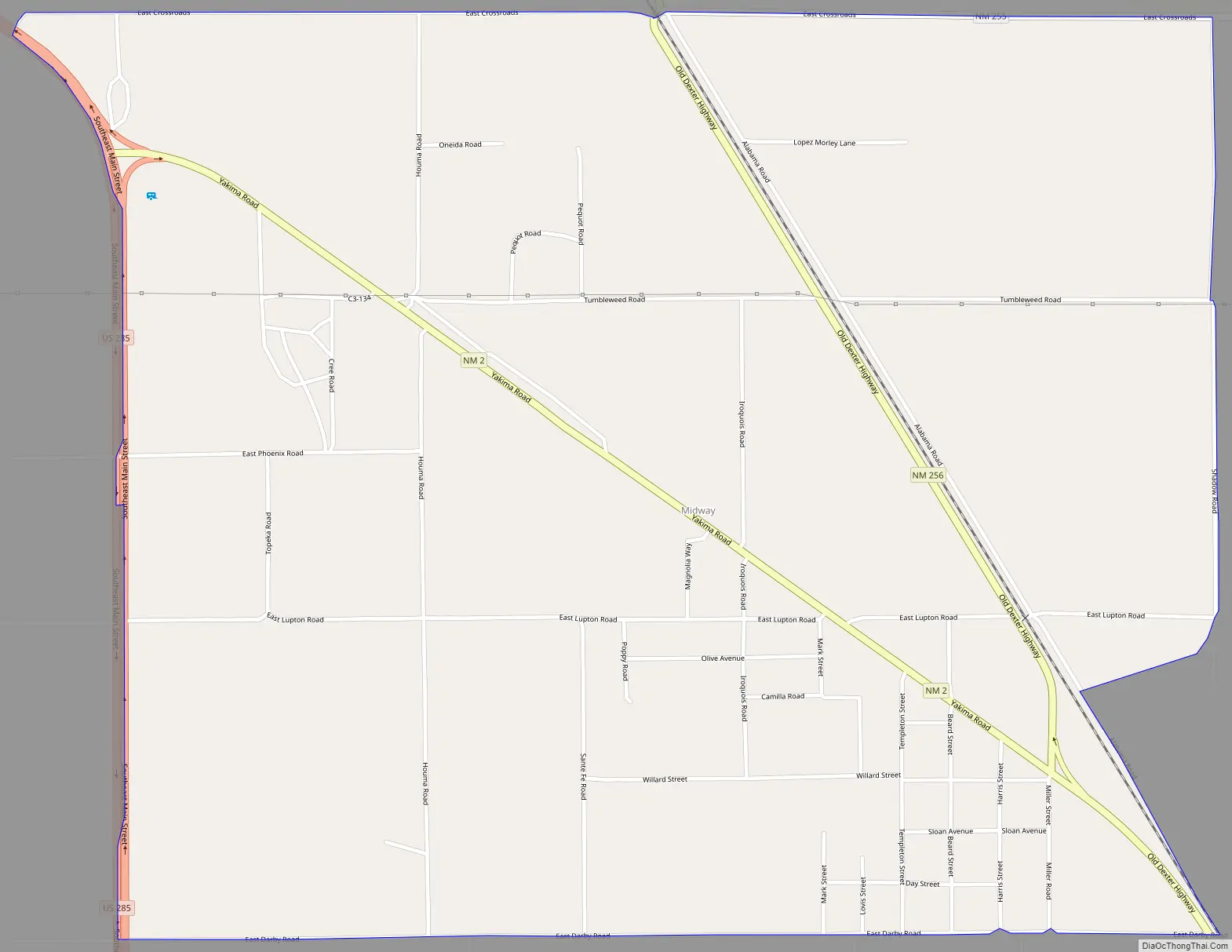
Midway is located in central Chaves County at 33°17′40″N 104°27′0″W / 33.29444°N 104.45000°W / 33.29444; -104.45000, 9 miles (14 km) southeast of the center of Roswell, the county seat. U.S. Route 285 forms the western edge of the CDP, leading northwest to Roswell and south 33 miles (53 km) to Artesia. New Mexico State Road 2 runs through the center of the community, joining US 285 at the CDP’s northwest corner and running southeast 15 miles (24 km) to Hagerman.
According to the United States Census Bureau, the Midway CDP has a total area of 2.5 square miles (6.4 km), all land.
See also
Map of New Mexico State and its subdivision: Map of other states:- Alabama
- Alaska
- Arizona
- Arkansas
- California
- Colorado
- Connecticut
- Delaware
- District of Columbia
- Florida
- Georgia
- Hawaii
- Idaho
- Illinois
- Indiana
- Iowa
- Kansas
- Kentucky
- Louisiana
- Maine
- Maryland
- Massachusetts
- Michigan
- Minnesota
- Mississippi
- Missouri
- Montana
- Nebraska
- Nevada
- New Hampshire
- New Jersey
- New Mexico
- New York
- North Carolina
- North Dakota
- Ohio
- Oklahoma
- Oregon
- Pennsylvania
- Rhode Island
- South Carolina
- South Dakota
- Tennessee
- Texas
- Utah
- Vermont
- Virginia
- Washington
- West Virginia
- Wisconsin
- Wyoming