Pinehill or Pine Hill is a census-designated place in Cibola County, New Mexico, United States. It is located on the Ramah Navajo Indian Reservation. The population was 88 at the 2010 census. The location of the CDP in 2010 had become the location of the Mountain View CDP as of the 2020 census, while a new CDP named “Pinehill” was listed 8 miles (13 km) further south, at a point 4 miles (6 km) southeast of Candy Kitchen.
| Name: | Pinehill CDP |
|---|---|
| LSAD Code: | 57 |
| LSAD Description: | CDP (suffix) |
| State: | New Mexico |
| County: | Cibola County |
| Elevation: | 7,119 ft (2,170 m) |
| Total Area: | 3.54 sq mi (9.15 km²) |
| Land Area: | 3.54 sq mi (9.15 km²) |
| Water Area: | 0.00 sq mi (0.00 km²) |
| Total Population: | 586 |
| Population Density: | 165.77/sq mi (64.01/km²) |
| ZIP code: | 87357 |
| Area code: | 505 |
| FIPS code: | 3557190 |
| GNISfeature ID: | 1852631 |
Online Interactive Map
Click on ![]() to view map in "full screen" mode.
to view map in "full screen" mode.
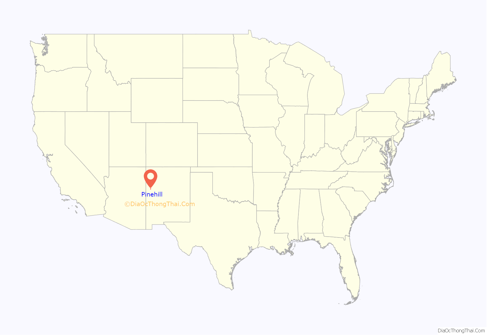
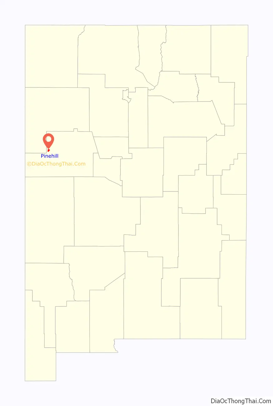
Pinehill location map. Where is Pinehill CDP?
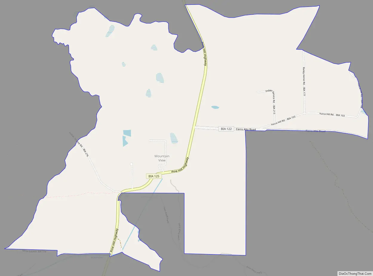
Pinehill Road Map
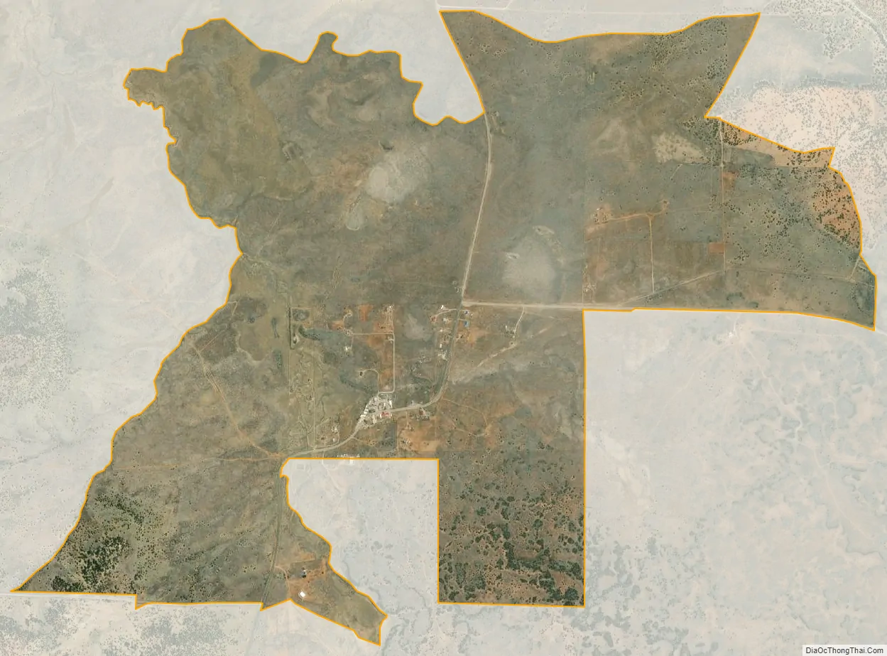
Pinehill city Satellite Map
Geography
Pinehill is located in western Cibola County, 12 miles (19 km) south of New Mexico State Road 53 and 62 miles (100 km) southeast of Gallup. Grants, the Cibola County seat, is 58 miles (93 km) to the northeast. In 2010, the Pinehill CDP was 8 miles (13 km) to the north, encompassing the area known as Mountain View, the central location for many of the Ramah Navajo government offices.
According to the United States Census Bureau, in 2010 the CDP had a total area of 3.4 square miles (8.7 km), all land.
See also
Map of New Mexico State and its subdivision: Map of other states:- Alabama
- Alaska
- Arizona
- Arkansas
- California
- Colorado
- Connecticut
- Delaware
- District of Columbia
- Florida
- Georgia
- Hawaii
- Idaho
- Illinois
- Indiana
- Iowa
- Kansas
- Kentucky
- Louisiana
- Maine
- Maryland
- Massachusetts
- Michigan
- Minnesota
- Mississippi
- Missouri
- Montana
- Nebraska
- Nevada
- New Hampshire
- New Jersey
- New Mexico
- New York
- North Carolina
- North Dakota
- Ohio
- Oklahoma
- Oregon
- Pennsylvania
- Rhode Island
- South Carolina
- South Dakota
- Tennessee
- Texas
- Utah
- Vermont
- Virginia
- Washington
- West Virginia
- Wisconsin
- Wyoming