Ranchos de Taos is a census-designated place (CDP) in Taos County, New Mexico. The population was 2,390 at the time of the 2000 census.
The historic district is the Ranchos de Taos Plaza, which includes the San Francisco de Asis Mission Church.
| Name: | Ranchos de Taos CDP |
|---|---|
| LSAD Code: | 57 |
| LSAD Description: | CDP (suffix) |
| State: | New Mexico |
| County: | Taos County |
| Elevation: | 6,906 ft (2,105 m) |
| Total Area: | 3.53 sq mi (9.14 km²) |
| Land Area: | 3.53 sq mi (9.14 km²) |
| Water Area: | 0.00 sq mi (0.00 km²) |
| Total Population: | 2,707 |
| Population Density: | 767.51/sq mi (296.32/km²) |
| ZIP code: | 87557 |
| Area code: | 575 |
| FIPS code: | 3561710 |
| GNISfeature ID: | 0928779 |
Online Interactive Map
Click on ![]() to view map in "full screen" mode.
to view map in "full screen" mode.
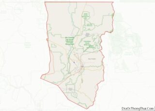
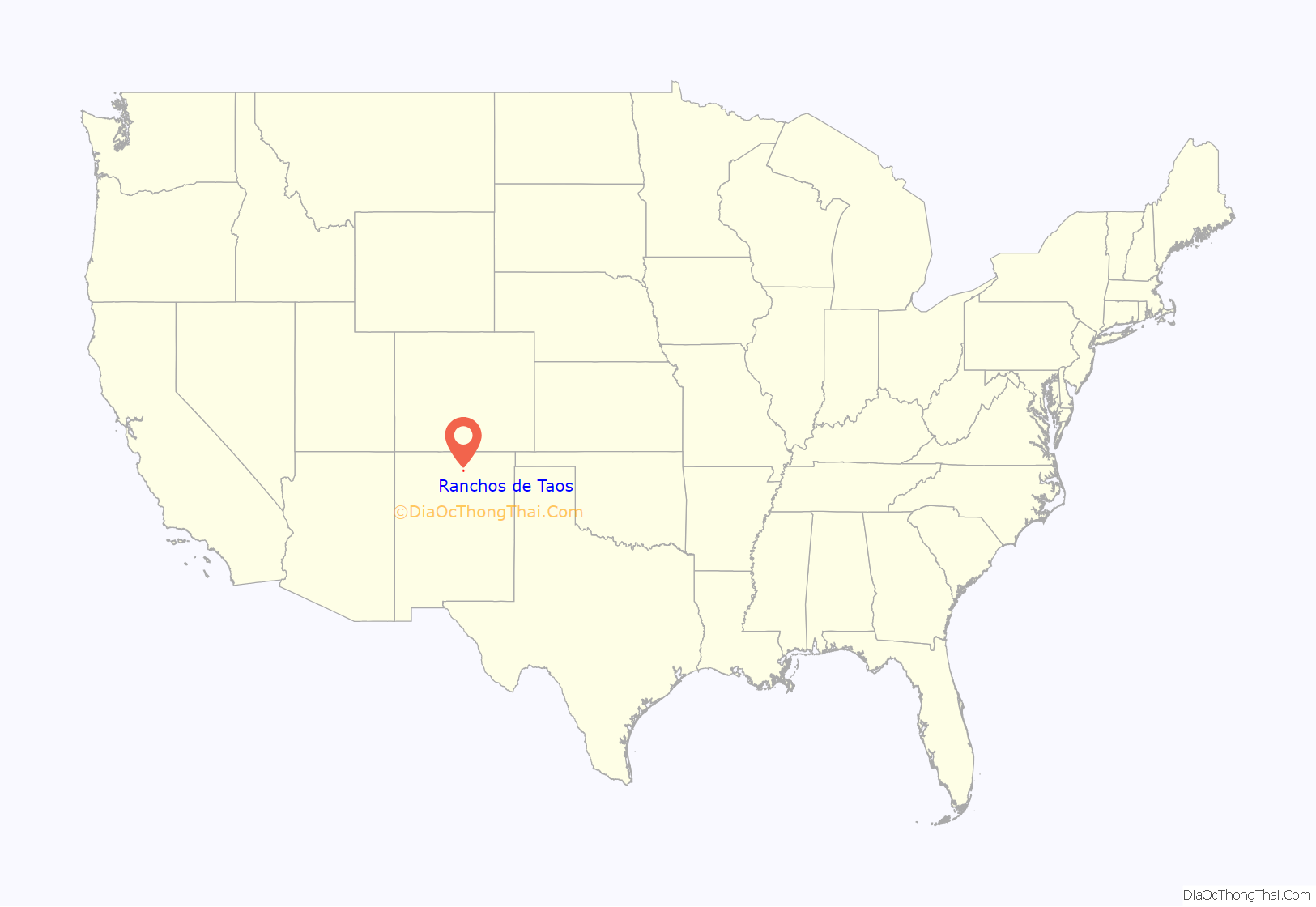
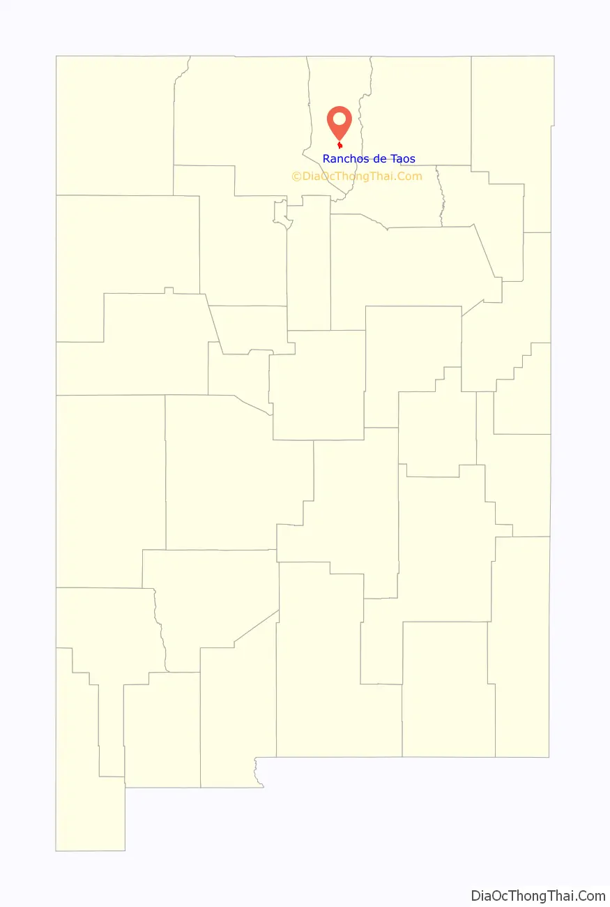
Ranchos de Taos location map. Where is Ranchos de Taos CDP?
History
In 1725, the settlement that was originally called Las Trampas de Taos became the permanent Spanish settlement called Ranchos de Taos. In 1760 Ranchos de Taos, also called Taos “Old Town”, was attacked by Comanche Native Americans who took 50 women from a fortified house, the home of the Vidalpando family, and killed the men of the settlement.
Spanish settlers of the Taos Valley moved into the Taos Pueblo for safety from attacks from Plains Indians. In 1772 a mission church was begun. Between 1796 and 1797, land from the Don Fernando de Taos Land Grant was given to 63 Spanish families. In 1815 the San Francisco de Asis Mission Church was completed. The Taos region population grew as the result of land grants made by Mexico between 1821 and 1846.
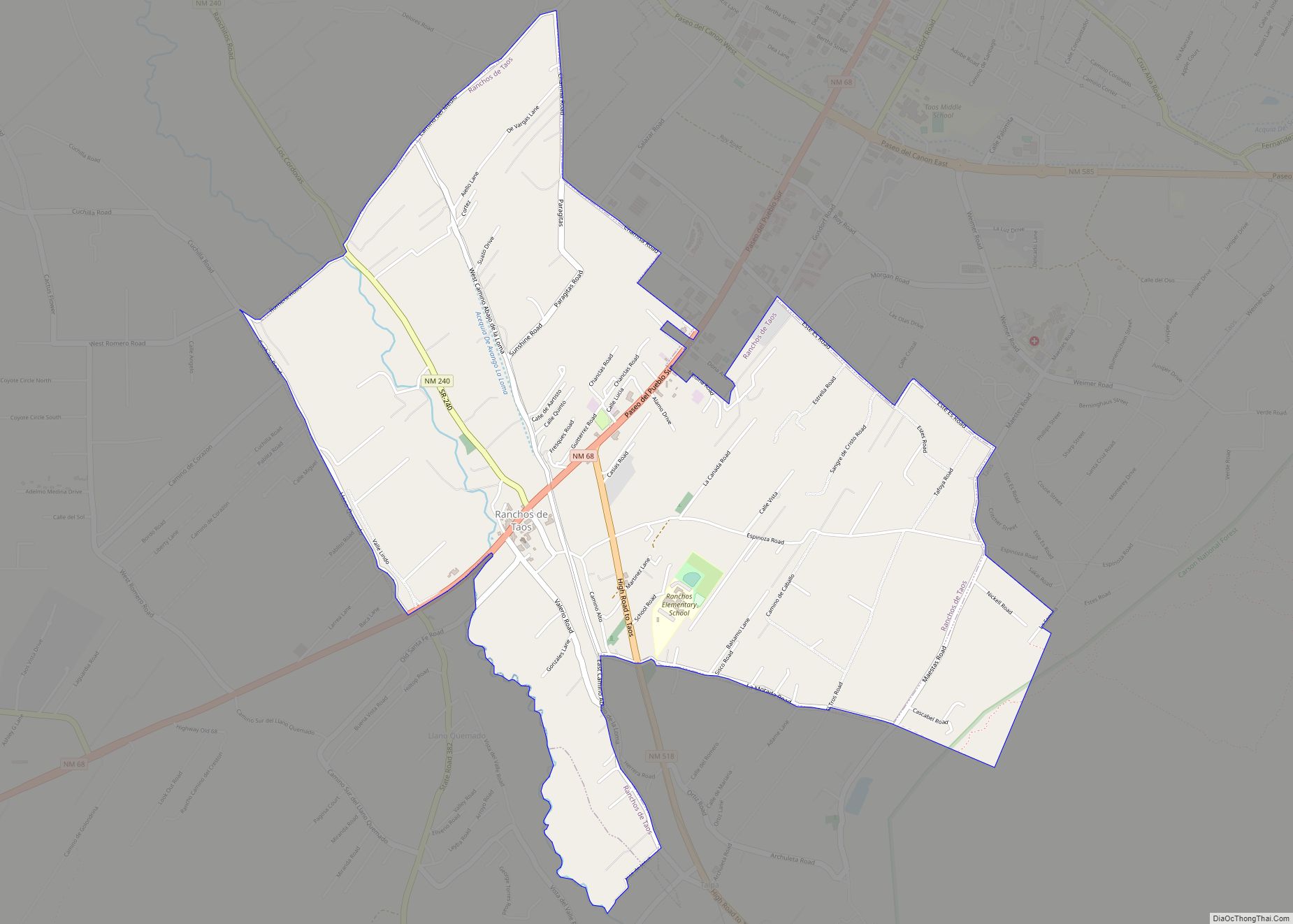
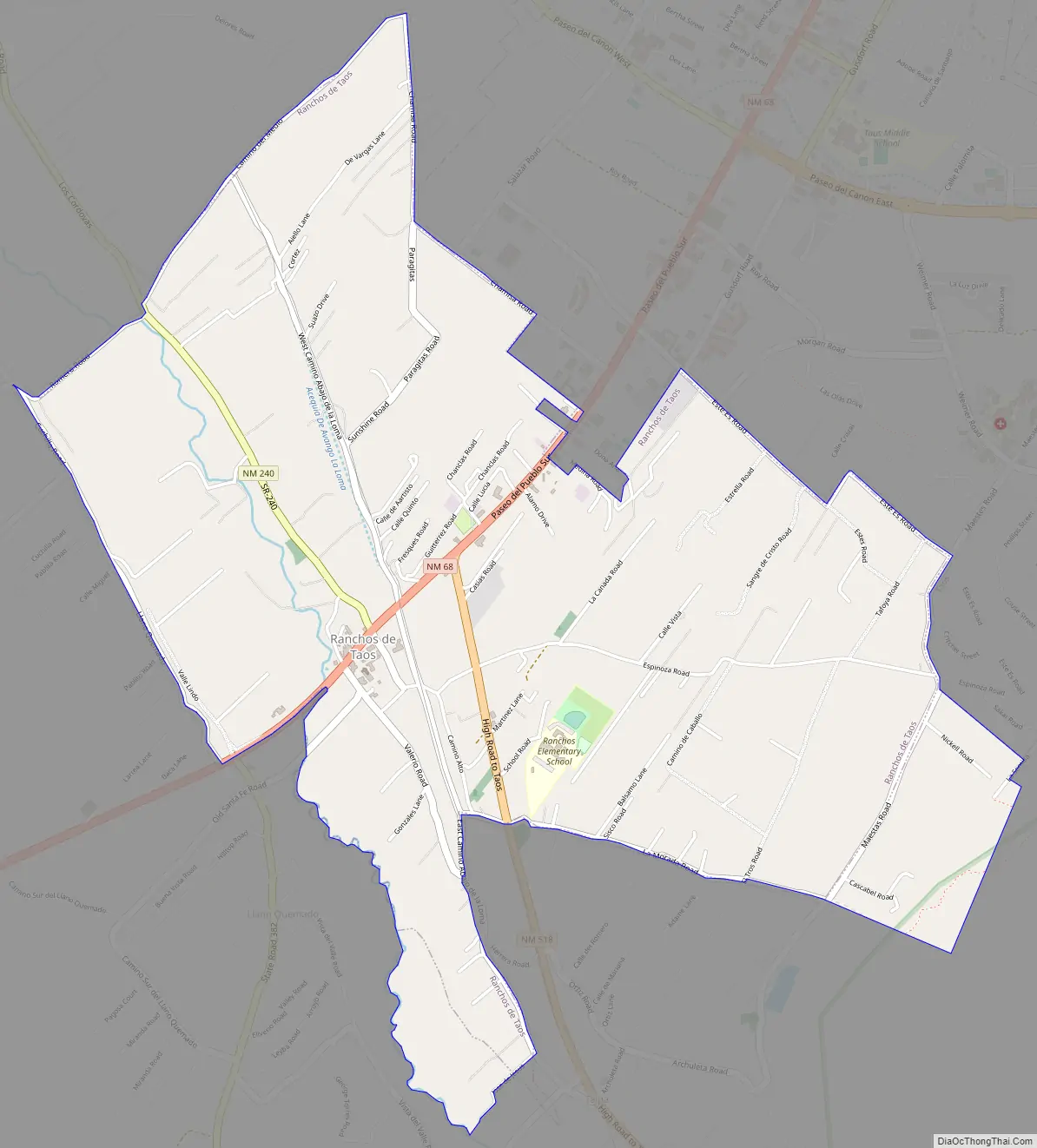
Ranchos de Taos Road Map
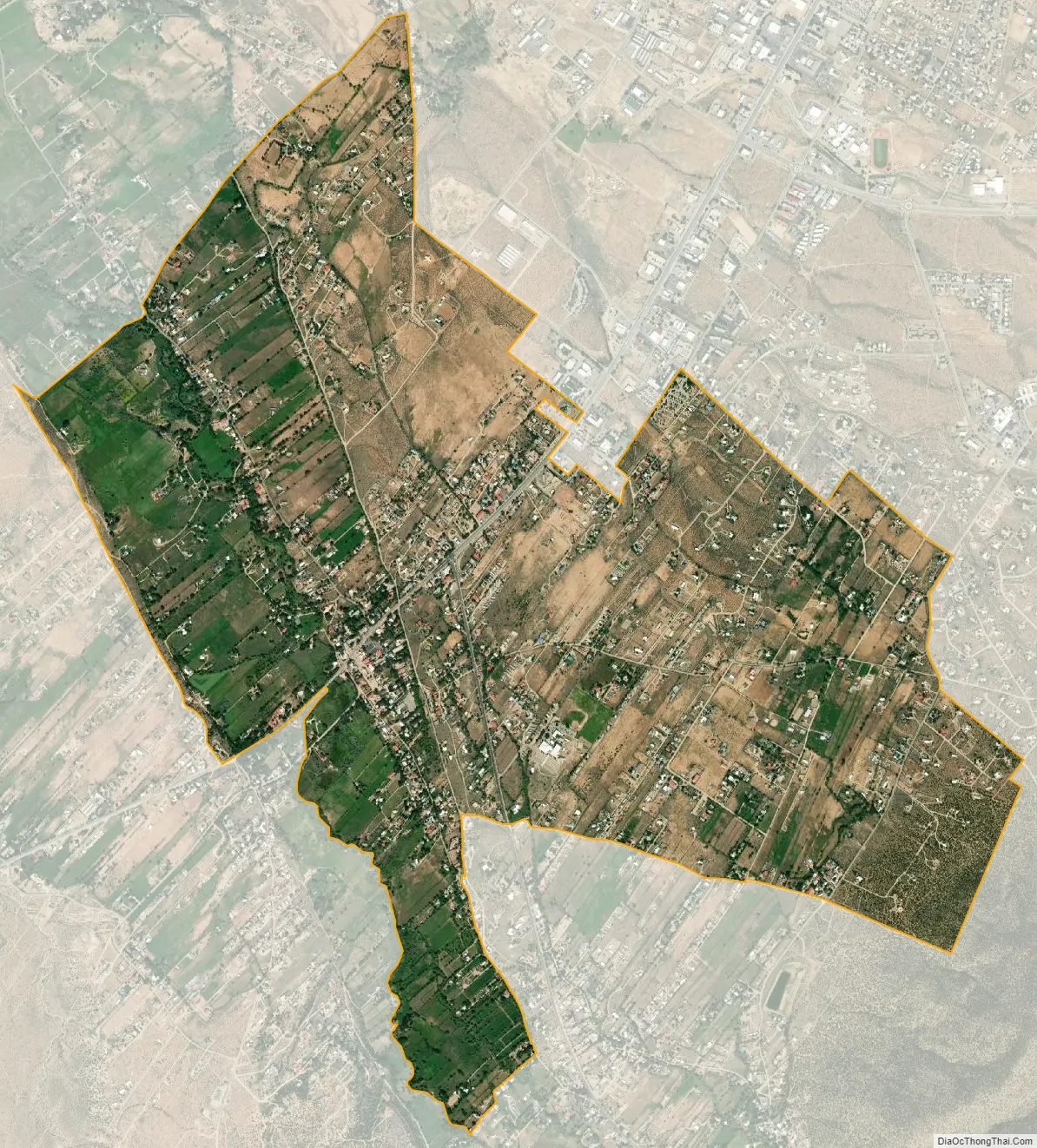
Ranchos de Taos city Satellite Map
Geography
Ranchos de Taos is located approximately four miles southwest of Taos.
According to the United States Census Bureau, the CDP has a total area of 3.4 square miles (8.8 km), all land.
See also
Map of New Mexico State and its subdivision: Map of other states:- Alabama
- Alaska
- Arizona
- Arkansas
- California
- Colorado
- Connecticut
- Delaware
- District of Columbia
- Florida
- Georgia
- Hawaii
- Idaho
- Illinois
- Indiana
- Iowa
- Kansas
- Kentucky
- Louisiana
- Maine
- Maryland
- Massachusetts
- Michigan
- Minnesota
- Mississippi
- Missouri
- Montana
- Nebraska
- Nevada
- New Hampshire
- New Jersey
- New Mexico
- New York
- North Carolina
- North Dakota
- Ohio
- Oklahoma
- Oregon
- Pennsylvania
- Rhode Island
- South Carolina
- South Dakota
- Tennessee
- Texas
- Utah
- Vermont
- Virginia
- Washington
- West Virginia
- Wisconsin
- Wyoming