South Valley is a census-designated place (CDP) and town in Bernalillo County, New Mexico, United States. The population was 40,976 at the 2010 Census. It is part of the Albuquerque Metropolitan Statistical Area. The U.S. Postal Service uses “Albuquerque” for all South Valley addresses (ZIP code 87105).
| Name: | South Valley CDP |
|---|---|
| LSAD Code: | 57 |
| LSAD Description: | CDP (suffix) |
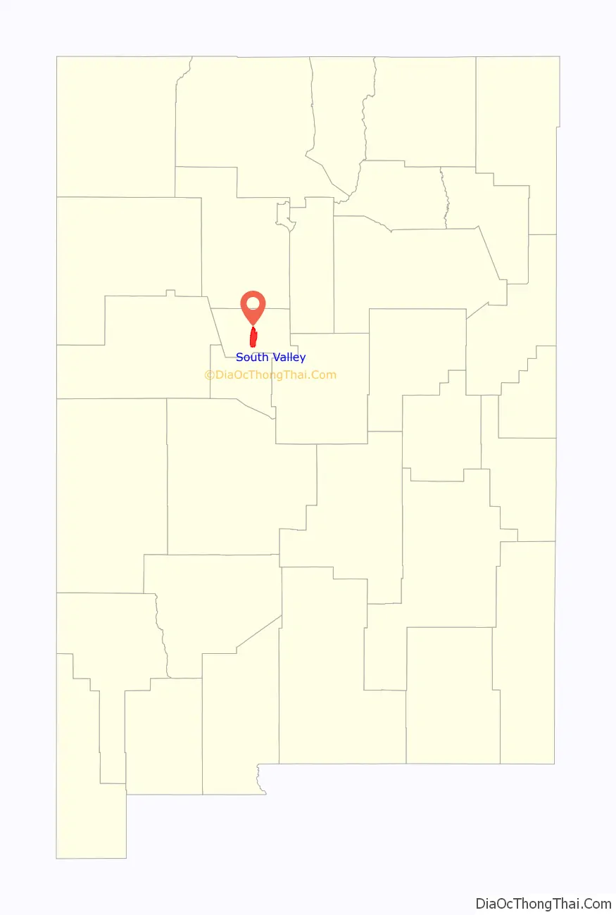
| State: | New Mexico |
| County: | Bernalillo County |
| Elevation: | 4,925 ft (1,501 m) |
| Total Area: | 30.30 sq mi (78.47 km²) |
| Land Area: | 29.02 sq mi (75.16 km²) |
| Water Area: | 1.28 sq mi (3.31 km²) |
| Total Population: | 38,338 |
| Population Density: | 1,321.13/sq mi (510.09/km²) |
| Area code: | 505 |
| FIPS code: | 3574520 |
| GNISfeature ID: | 1867390 |
Online Interactive Map
Click on ![]() to view map in "full screen" mode.
to view map in "full screen" mode.
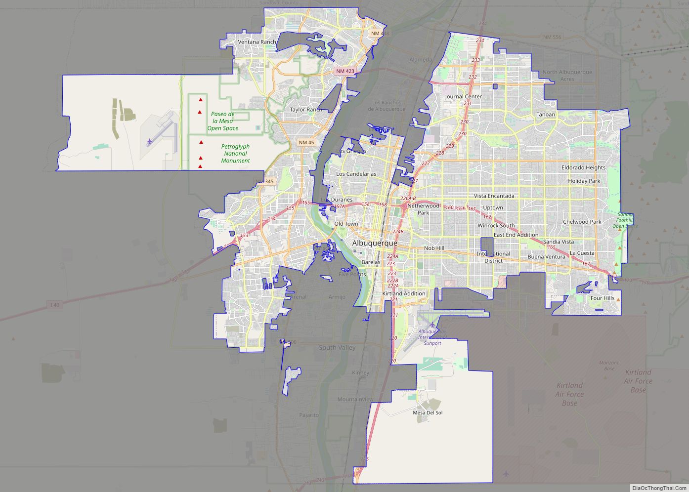
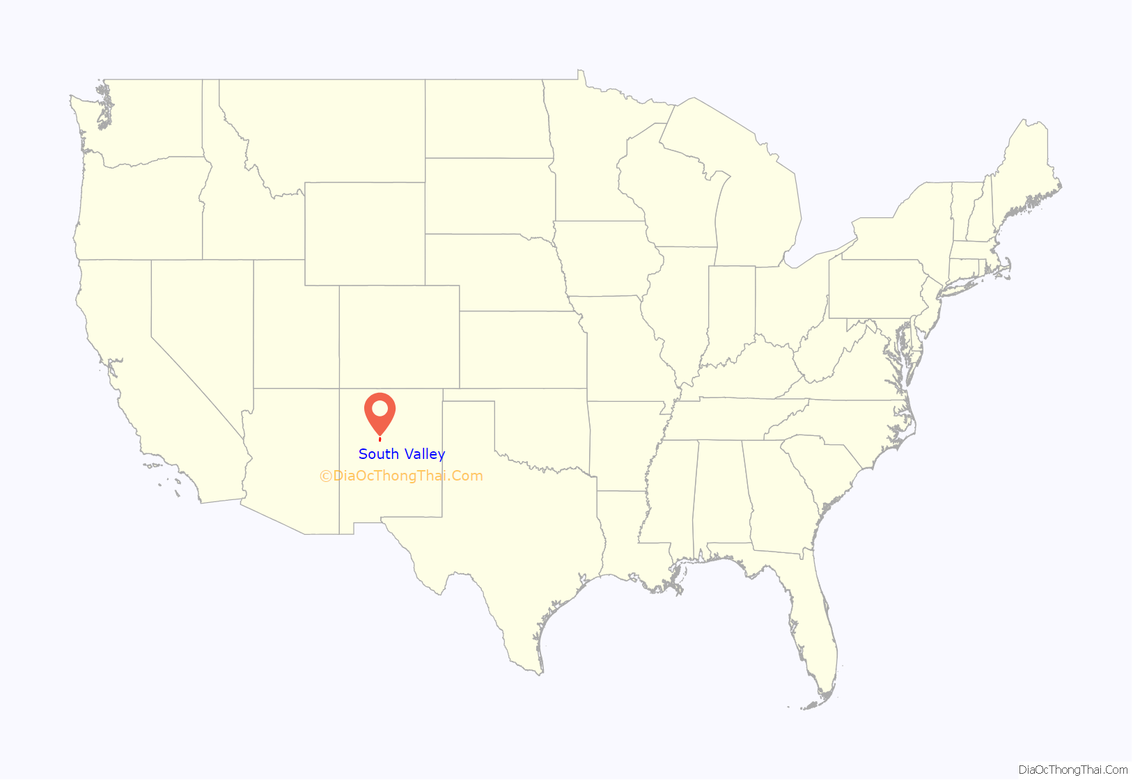
South Valley location map. Where is South Valley CDP?
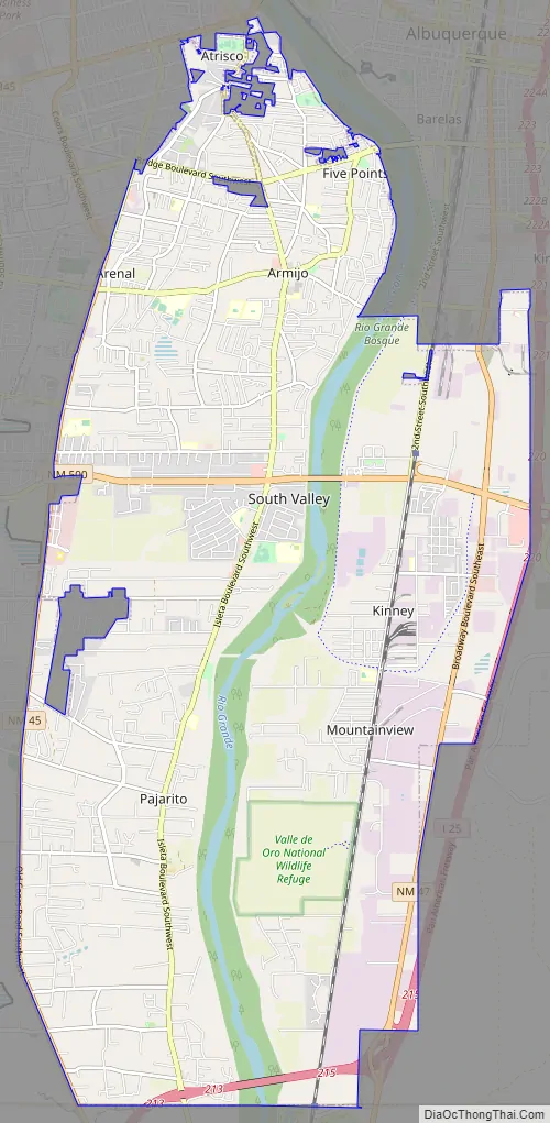
South Valley Road Map
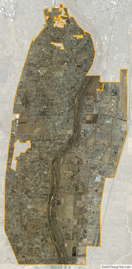
South Valley city Satellite Map
Geography
South Valley is located in central Bernalillo County at 35°1′N 106°41′W / 35.017°N 106.683°W / 35.017; -106.683. It is bordered on the north, east, and half of its west side by the city of Albuquerque. The Rio Grande runs north to south through the center of the CDP.
According to the United States Census Bureau, the CDP has a total area of 30.1 square miles (77.9 km), of which 28.8 square miles (74.6 km) is land and 1.3 square miles (3.3 km), or 4.23%, is water.
Municipal wells San Jose number 3 and San Jose number 6 were decommissioned in 1981 due to contamination with low levels of organic solvents, halocarbons and aromatics. These wells were plugged and abandoned in September 1994. The site remains on the Superfund site list with on-going remedial actions to contain, capture and reduce the concentration of the contaminant plume within the ground water.
See also
Map of New Mexico State and its subdivision: Map of other states:- Alabama
- Alaska
- Arizona
- Arkansas
- California
- Colorado
- Connecticut
- Delaware
- District of Columbia
- Florida
- Georgia
- Hawaii
- Idaho
- Illinois
- Indiana
- Iowa
- Kansas
- Kentucky
- Louisiana
- Maine
- Maryland
- Massachusetts
- Michigan
- Minnesota
- Mississippi
- Missouri
- Montana
- Nebraska
- Nevada
- New Hampshire
- New Jersey
- New Mexico
- New York
- North Carolina
- North Dakota
- Ohio
- Oklahoma
- Oregon
- Pennsylvania
- Rhode Island
- South Carolina
- South Dakota
- Tennessee
- Texas
- Utah
- Vermont
- Virginia
- Washington
- West Virginia
- Wisconsin
- Wyoming