Tucumcari (/ˈtuːkəmˌkæriː/; TOO-cum-carry) is a city in and the county seat of Quay County, New Mexico, United States. The population was 5,278 at the 2020 census. Tucumcari was founded in 1901, two years before Quay County was established.
| Name: | Tucumcari city |
|---|---|
| LSAD Code: | 25 |
| LSAD Description: | city (suffix) |
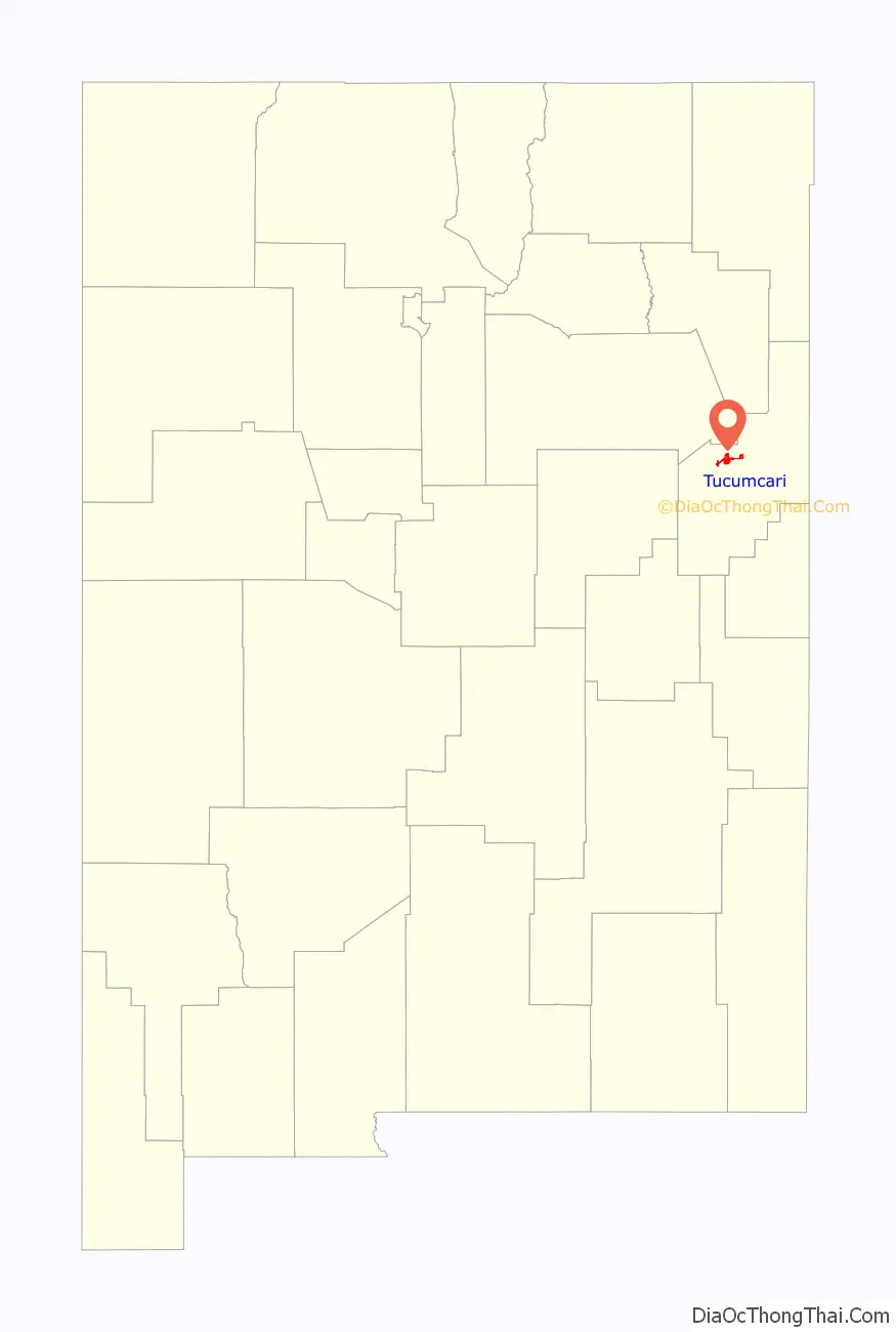
| State: | New Mexico |
| County: | Quay County |
| Founded: | 1901 |
| Elevation: | 4,091 ft (1,247 m) |
| Total Area: | 9.51 sq mi (24.63 km²) |
| Land Area: | 9.51 sq mi (24.62 km²) |
| Water Area: | 0.00 sq mi (0.00 km²) |
| Total Population: | 5,278 |
| Population Density: | 555.17/sq mi (214.34/km²) |
| ZIP code: | 88401 |
| Area code: | 575 |
| FIPS code: | 3579910 |
| GNISfeature ID: | 0915909 |
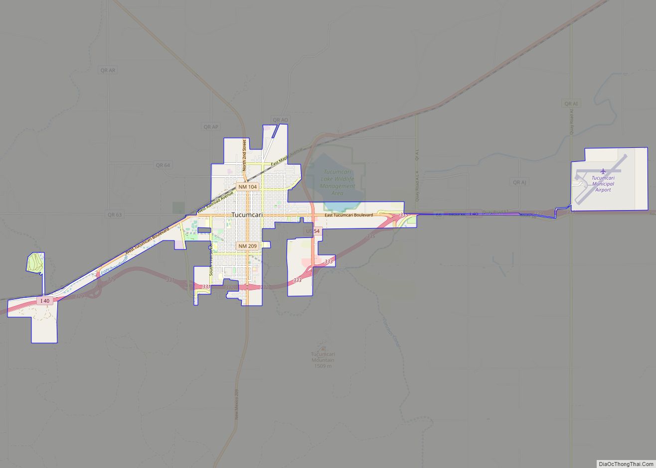
Online Interactive Map
Click on ![]() to view map in "full screen" mode.
to view map in "full screen" mode.
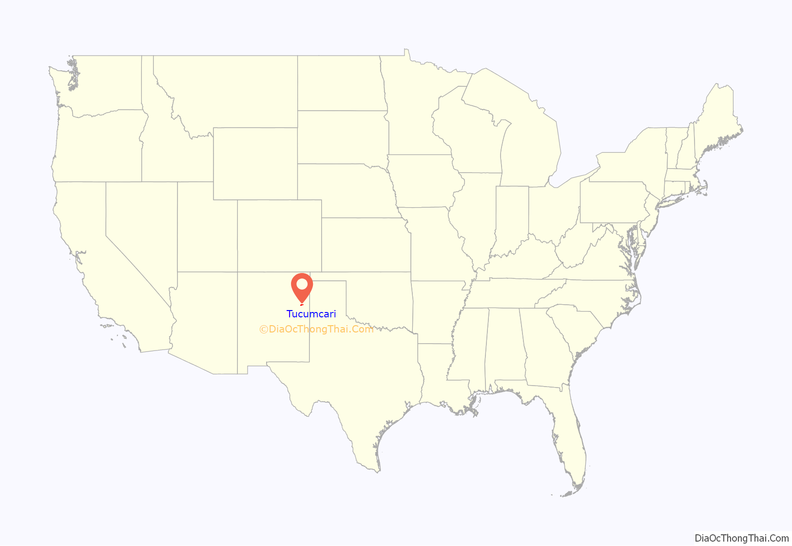
Tucumcari location map. Where is Tucumcari city?
History
In 1901, the Chicago, Rock Island and Pacific Railroad built a construction camp in the western portion of modern-day Quay County. Originally called Ragtown, the camp became known as “Six Shooter Siding”, due to numerous gunfights. Its first formal name, Douglas, was used only for a short time. After it grew into a permanent settlement, it was renamed Tucumcari in 1908. The name was taken from Tucumcari Mountain, which is situated near the community. The origin of the mountain’s name is uncertain; it may have been derived from the Comanche word tʉkamʉkarʉ, which means ‘ambush’. A 1777 burial record mentions a Comanche woman and her child captured in a battle at Cuchuncari, which is believed to be an early version of the name Tucumcari.
In December 1951, a water storage tank collapsed in the city. Four were killed and numerous buildings were destroyed.
Former railroad transit point
Tucumcari until the mid-twentieth century was a junction for transcontinental train service. The Rock Island Railroad ran pool train operations with the Southern Pacific, with transfers at the station (for the Tucumcari-Los Angeles leg of the trip). The Choctaw Rocket (Memphis-Little Rock-Tucumcari-El Paso-Los Angeles) made the switch there (for the coach cars). The Golden State (Chicago-Kansas City-Topeka-Tucumcari-El Paso-Los Angeles) ran continuously through the town.
Cattle ranches
- Bell Ranch – created from a land grant in 1824 and now one of the very largest ranches in the United States
- T4 Cattle Company – founded in 1902 and continues to be a family run enterprise, one of the country’s largest ranches
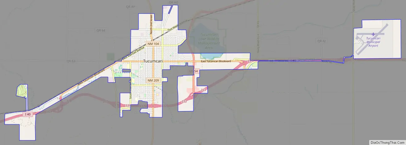
Tucumcari Road Map
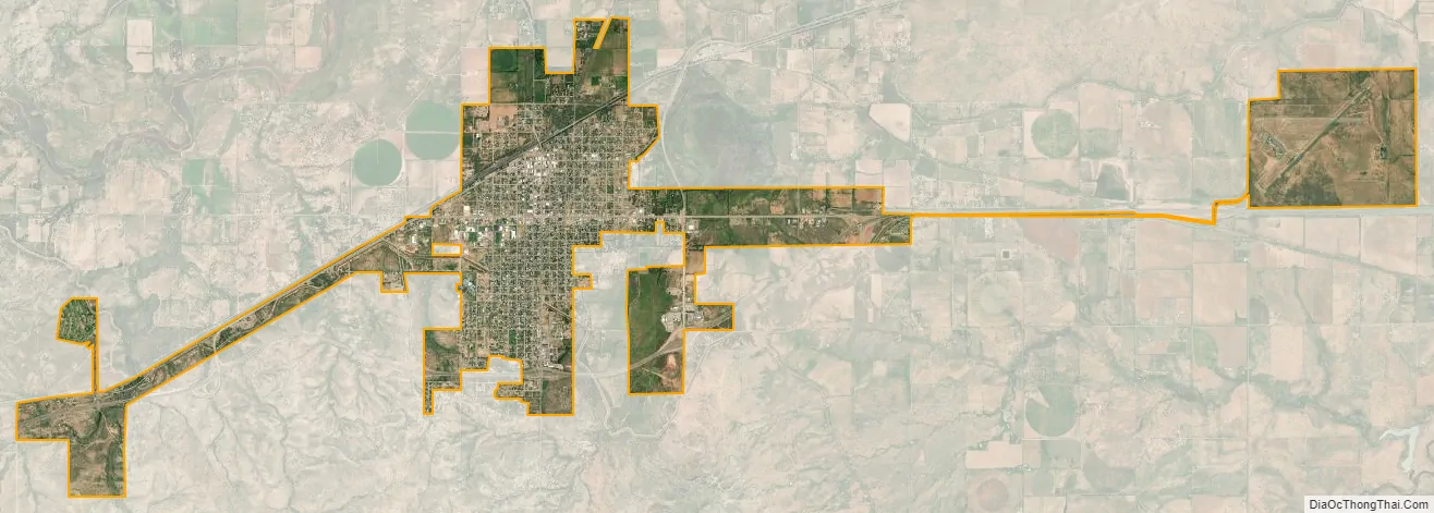
Tucumcari city Satellite Map
Geography
According to the United States Census Bureau, the city has a total area of 7.6 sq mi (19.6 km), of which 7.5 sq mi (19.5 km) is land and 0.13% is water.
Climate
Tucumcari has a cool semi-arid climate (Köppen BSk), characterized by cool winters and hot summers. Rainfall is relatively low except during the summer months, when thunderstorms associated with the North American monsoon can bring locally heavy downpours. Snowfall is generally light, with an average of 14.9 inches (0.38 m). Due to the frequency of low humidity, wide daily temperature variations are normal.
The record high temperature at Tucumcari was 111 °F (44 °C) on June 11, 2022, and the record low temperature −22 °F (−30 °C) on January 13, 1963. The hottest monthly mean maximum has been 100.5 °F (38.1 °C) in July 2011 and the coldest mean minimum 12.4 °F (−10.9 °C) in January 1963, although the coldest month by mean maximum was January 1949, with a mean high of 38.6 °F or 3.7 °C.
The wettest calendar year has been 1941, with 34.94 inches (887.5 mm) and the driest, 1934, with 6.13 inches (155.7 mm). The most rainfall in one month was 11.19 inches (284.2 mm) in July 1950. The most rainfall in 24 hours was 4.41 inches (112.0 mm) on June 21, 1971. The most snowfall in one year was 51.2 inches (1.30 m), from July 1911 to June 1912. The most snowfall in one month was 30.0 inches (0.76 m), in February 1912.
See also
Map of New Mexico State and its subdivision: Map of other states:- Alabama
- Alaska
- Arizona
- Arkansas
- California
- Colorado
- Connecticut
- Delaware
- District of Columbia
- Florida
- Georgia
- Hawaii
- Idaho
- Illinois
- Indiana
- Iowa
- Kansas
- Kentucky
- Louisiana
- Maine
- Maryland
- Massachusetts
- Michigan
- Minnesota
- Mississippi
- Missouri
- Montana
- Nebraska
- Nevada
- New Hampshire
- New Jersey
- New Mexico
- New York
- North Carolina
- North Dakota
- Ohio
- Oklahoma
- Oregon
- Pennsylvania
- Rhode Island
- South Carolina
- South Dakota
- Tennessee
- Texas
- Utah
- Vermont
- Virginia
- Washington
- West Virginia
- Wisconsin
- Wyoming